Aegean Sea/imagemap
From CruisersWiki
(Difference between revisions)
Istioploos (Talk | contribs) m (Protected "Aegean Sea/imagemap": Image map ([edit=sysop] (indefinite) [move=sysop] (indefinite))) |
Istioploos (Talk | contribs) (Port of entry) |
||
| (One intermediate revision not shown) | |||
| Line 1: | Line 1: | ||
| + | <center>{{infobox coordblock | ||
| + | | lat= 38.08269|lon=25.56519|zoom=7 | ||
| + | | type=waypoint | ||
| + | }}{{PEntry there}}</center> | ||
| + | |||
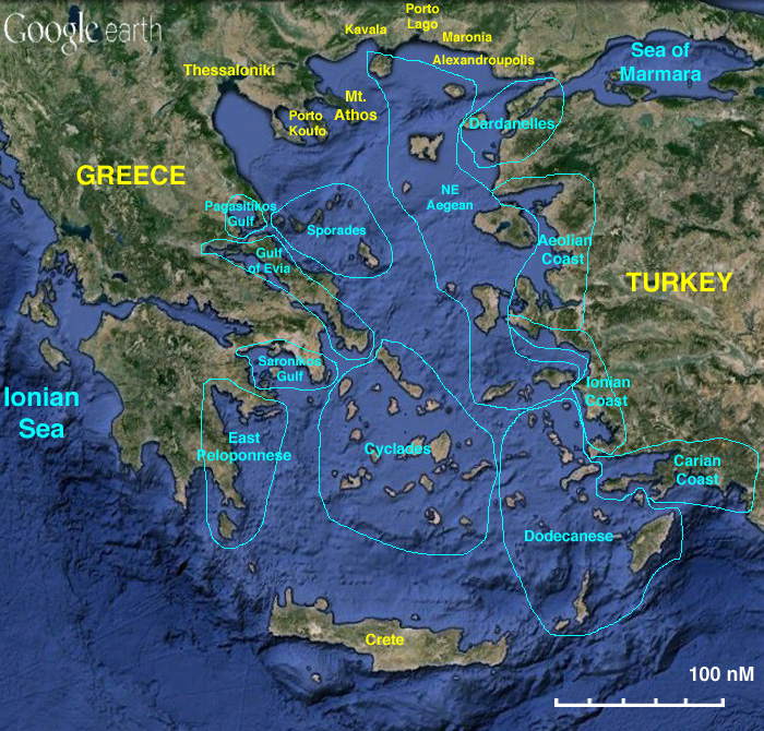
<imagemap> | <imagemap> | ||
Image:AegeanMap.jpg|frame|center|Map of the Aegean Sea - <em>For details click on a name or an area</em> | Image:AegeanMap.jpg|frame|center|Map of the Aegean Sea - <em>For details click on a name or an area</em> | ||
Latest revision as of 02:39, 25 February 2017

Map of the Aegean Sea - For details click on a name or an area