Baie de St Vincent
From CruisersWiki
Baie De St Vincent, New Caledonia
| | |
| | DD°M.M′N/S, DD°M.M′E/W |
|---|---|
| | Photo gallery |
| | Local chartlet |
Overview
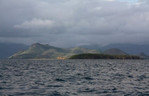
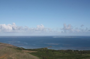
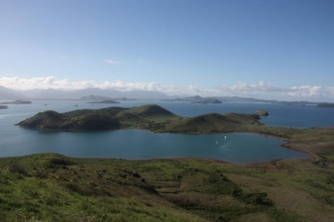
Baie De St Vincent is a huge island studded bay about 22 nm NW of Noumea. While there are a number of good anchorages scattered around the bay, large sections of the area are too shallow to be accessible by most boats. Considerable caution is required in the bay as there are numerous shoals and reefs, all charted and most marked, but all requiring that you pay attention to where you are.
Cruising the region
Baie de Saint Vincent can be easily reached from Noumea in a brisk day sail (returning into the SE Trades can be harder!). The distance is around 22 nm. There is no need to go outside the barrier reef and the track through to the bay is clearly marked, even though there are a few reefs to be avoided. There are number of good anchorages along the way, most notably, Baie Maa.
Once you leave Baie De St Vincent, there is about 16 nm of sailing inside the reef, with a few suitable anchorages along the way. The final anchorage is at Ile Lebris, after which it is necessary to exit Passe D'Ouarai to the open sea in order to travel any further north.
There are a number of islands outside the bay which are worth a visit, in particular, Ile Tenia.
Charts
Submit the chart details that are required for safe navigation.
- Chart Source
- Chart No
- Chart No
Weather
Local weather conditions?
Sources for Weather forecasts:
Local forecasts are, of course, in French, but non-French speakers should find them relatively easy to understand. A very useful vocabulary can be found at How to Understand French Weather Forecasts for Sailors.
The main source of weather information for the area around New Caledonia is Meteo France Nouvelle-Calédonie. The marine section provides a 6 day forecast for the whole region, with details for each of the passes through the barrier reef.
Nouméa radio broadcasts the weather report in French on VHF 16, everyday at 6:30, 9:30, 15:15, 18:30.
There is a set of repeater channels allowing receipt of weather info anywhere in the country:
- Nouméa area: VHF 26
- Southern portion of the Grande Terre: VHF 28
- Isle of Pines and the Southern Lagoon: VHF 25
- Grande Terre North West coast: VHF 25
- Northern portion of Grande Terre: VHF 24
- Ouvea: VHF 23
- Lifou: VHF 26
- Maré: VHF 87
Passages
Popular passages/routes, timing, etc.
Islands
List Islands
- Ile Tenia.This island lies on the outer reef, forming the northern side of Passe St Vincent.The main attractions here are the white sand beaches and the good scuba diving and snorkelling. The water is very clear and there is a choice of dive sites, ranging from swimming around the boat to diving on the drop off on the outside of the main barrier reef. Anchorage here is a bit exposed, but in trade conditions you should be able to find shelter to the west of the sand spit that extends off the north of the island. If you decide to day visit Tenia, consider a very early start so that you can be there before the trades start to really kick in the middle of the morning.
Communication
Also see World Cruiser's Nets
Approach from the open sea can be via Passe De Uitoe or Passe Saint Vincent. Both Passes are wide and free of dangers.
To enter Baie De St Vincent from the south, you should use Passe Du Cap Ka. Based on the chart, it may be tempting to use the channel between Ile Mathieu and the mainland, but this route should only be used with great care and in perfect visibility. The Passe is only a mile further west and is much safer to use.
Approaching from the north, you can enter through the wide and accessible Canal Ducos or through the narrow and relatively shallow Canal Lepredour. If Lepredour is the more convenient approach, then it should present no problems provided you follow the chart depths very carefully. It provides you with very close up views of Ile Lepredour.
Entrance
Submit details about facilities for checking in - where to dock, location of immigration & customs, etc.
Marinas & Yacht Clubs
- None
Anchorages
- Baie Des Moustiques. Despite its name, the mosquitoes seem to be absent from this deep bay on the north side of Ile Ducos. It offers good shelter from all but northerly winds. There is a hill about 120 metres high on the western side of this bay and a scramble to the top of this is rewarded with stunning views of Baie De St Vincent and the outer reef. Approaching this anchorage from the east, note that there is a reef about a 350 metres off the NE corner of Ile Ducos. Approaching from the west, do not attempt to pass inside Ile Marceau and beware of the shoals about 400 metres to the NNW of this island. Anchor in sand and mud towards the head of the bay.
- Ile Lepredour. Note that the island is a Reserve and landing on it is forbidden. Heading north, anchorage can be found just west of the narrowest section of Canal Lepredour on the mainland side (northern) of the channel. There is a small settlement on the shore of the mainland.
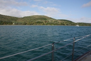
- Uitoe. There are a number of obvious anchorages in this area, depending on wind direction. If you enter Baie de St Vincent by Passe du Cap Ka, then anchorage can be found off the beach on the west side of Presquile Uitoe. This anchorage is very protected in easterly conditions. There is a white sand beach and a walk onto the nearby hills provides good views of the Baie de St Vincent area. Baie de Uitoe, on the east side of Presqu'ile de Uitoe, is a good anchorage in northerly through to westerly conditions.
Yacht Repairs and Services
Marine Stores
Submit addresses and contact details of marine related businesses that are of interest to cruisers.
- None
Repairs/Yards
- none
Fuel, Water, & Electricity
- Fuel
- Not available
- Water
- Not available
- Electricity
- None
Things to do Ashore
Tourism
List places of interest, tours, etc.
- Explore the shorelines in most of the anchorages.
Grocery & Supply Stores
- None
Eateries
- None
Internet/WiFi
Available?
Laundry
- None
Motorbike & Car Rentals
- No
Garbage Disposal
No
Transportation
Transportation (local and/or international)
Friends
Contact details of "Cruiser's Friends" that can be contacted for local information or assistance.
Forums
List links to discussion threads on partnering forums. (see link for requirements)
Links
Links to relevant websites.
References & Publications
Publications, Guides, etc.
Comments
We welcome users' contributions to the Wiki. Please click on Comments to view other users' comments, add your own personal experiences or recommend any changes to this page following your visit. Personal experiences?
Last Visited & Details Checked (and updated here)
- June 2010 - Pedro
| This page has an outline in place but needs completing. Please contribute if you can to help it grow further. Click on Comments to suggest further content or alternatively, if you feel confident to edit this page, click on the edit tab at the top and enter your changes directly. |
| |
|---|
|
Names: Pedro |


