Bol
From CruisersWiki
m (Text replace - "==References & Publications==" to "==References==") |
(refactored) |
||
| Line 1: | Line 1: | ||
{{IsPartOf|Mediterranean|Adriatic Sea|Croatia|Brac}} | {{IsPartOf|Mediterranean|Adriatic Sea|Croatia|Brac}} | ||
{{TOC block}} | {{TOC block}} | ||
| - | {{Infobox |43 | + | {{Infobox |
| - | | zoom= | + | | lat=43.26043|lon=16.65689 |
| + | | zoom= 16 | ||
| + | | chartlet=y | ||
| image= BolAerial.jpg | | image= BolAerial.jpg | ||
| imagetext= Bol harbour from S | | imagetext= Bol harbour from S | ||
| - | | notes= | + | | notes= |
}} | }} | ||
| - | The town and small harbour of Bol are situated on the S coast of the island of [[Brac]] in [[Croatia]], roughly halfway between the harbours of [[Milna]] and [[Sumartin]] at the W and E ends of the island. A three mile channel separates the harbour from the N coast of the neighbouring island of [[Hvar]] to the south. The town is a very popular tourist resort in view of its proximity to the internationally renowned beach of Zlatni Rat (aka Dugi Rat) a mile to the west, which features in just about every tourist brochure for Croatia and the islands. Its harbour is small and cramped and visiting yachts need to squeeze in wherever they can among the boats along its quays. Shelter here is good in winds from NW round to SE but poor in SW and S winds. | + | The town and small harbour of Bol are situated on the S coast of the island of [[Brac]] in [[Croatia]], roughly halfway between the harbours of [[Milna]] and [[Sumartin]] at the W and E ends of the island. A three mile channel separates the harbour from the N coast of the neighbouring island of [[Hvar]] to the south. The town is a very popular tourist resort in view of its proximity to the internationally renowned beach of Zlatni Rat (aka Dugi Rat) a mile to the west, which features in just about every tourist brochure for Croatia and the islands. |
| + | |||
| + | Its harbour is small and cramped and visiting yachts need to squeeze in wherever they can among the boats along its quays. Shelter here is good in winds from NW round to SE but poor in SW and S winds. | ||
==Charts== | ==Charts== | ||
| - | + | {{tlist | |
| - | + | | British Admiralty| 2712 | |
| - | + | | Croatian| MK18, MK19, MK20 | |
| - | + | | Imray| M26 (Split to Dubrovnik) | |
| - | + | }} | |
| - | + | ||
| - | + | ||
| - | + | ||
==Weather== | ==Weather== | ||
| Line 28: | Line 29: | ||
==Passages== | ==Passages== | ||
{{Green|List popular passages/routes, timing, etc.}} | {{Green|List popular passages/routes, timing, etc.}} | ||
| - | |||
* | * | ||
==Communication== | ==Communication== | ||
{{Green|Add here VHF channel for coastguard, harbor masters. etc.}} | {{Green|Add here VHF channel for coastguard, harbor masters. etc.}} | ||
| - | |||
* | * | ||
| Line 45: | Line 44: | ||
==Berthing== | ==Berthing== | ||
| - | |||
{{Image right| BolHarbour.jpg| Bol harbour is often crammed }} | {{Image right| BolHarbour.jpg| Bol harbour is often crammed }} | ||
| - | The harbour is often filled to capacity by late afternoon during the season and a visiting yacht will have to fit in wherever it can along the quays. There are laid moorings along the quays. Depths are mostly about 2.0 metres, increasing to 4.0 - 5.0 metres along the S breakwater (where, unfortunately, the ferries and tripper boats have priority). The best position is there is space is on the N quay in the inner part of the harbour, where there are water and electricity points. Depths here are 2.0 metres. If all else fails, drop anchor and go bows or stern-to the short breakwater on the W side of the harbour, taking long lines ashore. There is rock ballasting here, so it may be a bit of a struggle to get lines ashore and you may need to use your dinghy to get ashore. | + | The harbour is often filled to capacity by late afternoon during the season and a visiting yacht will have to fit in wherever it can along the quays. There are laid moorings along the quays. Depths are mostly about 2.0 metres, increasing to 4.0 - 5.0 metres along the S breakwater (where, unfortunately, the ferries and tripper boats have priority). |
| + | {{poi | ||
| + | | type=berth | ||
| + | | name=Town quay | ||
| + | | lat=43.26127|lon=16.65695 | ||
| + | | url= | ||
| + | | text= | ||
| + | The best position is there is space is on the N quay in the inner part of the harbour, where there are water and electricity points. Depths here are 2.0 metres. If all else fails, drop anchor and go bows or stern-to the short breakwater on the W side of the harbour, taking long lines ashore. There is rock ballasting here, so it may be a bit of a struggle to get lines ashore and you may need to use your dinghy to get ashore. | ||
| + | }} | ||
| - | + | Note that the jetty further W is the fuel berth. | |
| - | + | ||
| - | + | ==Anchorages== | |
| + | {{poi | ||
| + | | type=anchorage | ||
| + | | name=Zlatni Rat | ||
| + | | lat=43.25643|lon=16.63156 | ||
| + | | url= | ||
| + | | text= | ||
During the day it is a very popular pastime to anchor off the beach at Zlatni Rat a mile W of the harbour in 6.0 - 8.0 metres and swim off the boat. Holding is moderate in sand and shingle. However, this position is unsuitable for an overnight stop as it is very exposed to any sudden change in the weather. | During the day it is a very popular pastime to anchor off the beach at Zlatni Rat a mile W of the harbour in 6.0 - 8.0 metres and swim off the boat. Holding is moderate in sand and shingle. However, this position is unsuitable for an overnight stop as it is very exposed to any sudden change in the weather. | ||
| + | }} | ||
| - | == | + | ==Amenities== |
| - | + | {{tlist | |
| - | + | |header|Facilities | |
| - | + | ||
| - | + | ||
| - | + | |Water| on N quay | |
| - | + | |Electricity| see above | |
| - | + | |Toilets| None | |
| - | + | |Showers|None | |
| + | |Laundry| None | ||
| + | |Garbage| Near the waterfront | ||
| - | + | |header|Supplies | |
| - | ==== | + | |Fuel| {{mark |
| - | + | | type = fuel | |
| + | | lat=43.26042|lon=16.65515 | ||
| + | | name= INA | ||
| + | | url= | ||
| + | | text =Fuel berth on jetty to W of harbour (depths of 3.5 metres alongside) | ||
| + | }} | ||
| + | |Bottled gas| None | ||
| + | |Chandlers| None | ||
| - | + | |header|Services | |
| - | + | ||
| - | + | |Repairs| None | |
| - | None | + | |Internet| From internet cafés |
| - | + | |Mobile connectivity| | |
| - | None | + | |Vehicle rentals| None |
| + | |Health| | ||
| + | }} | ||
| - | == | + | ==Provisioning== |
| - | + | Supermarket and other provisions shops in the village. Fruit and vegetable market. | |
| - | == | + | ==Eating out== |
| - | + | Restaurants and café/bars ashore. | |
| - | == | + | ==Transportation== |
* Ferries to [[Split]] and [[Hvar]] | * Ferries to [[Split]] and [[Hvar]] | ||
* Buses to [[Supetar]] and other local destinations | * Buses to [[Supetar]] and other local destinations | ||
| - | == | + | ==Tourism== |
| - | + | {{Image right| BracZlatniRat.jpg| The promontory of Zlatni Rat (out of season!) }} | |
| - | + | {{Image right| BolWaterfront.jpg| Waterfront of Bol }} | |
| - | + | Most visitors to Bol come for the unusual natural feature of Zlatni Rat, a 500-metre long promontory of white sand and shingle extending S from the coast a mile or so west of the town. The promontory has a backbone of pine trees for shade and during the season it is crawling with sun-worshipping tourists. In a yacht, however, one can anchor off in (reasonable) solitude and dive down into some of the clearest waters in Croatia. Note, however, that tidal currents can be significant. | |
| - | + | ||
| - | + | The town itself is not short of attractions, with a pleasant stroll eastwards to the 15th Dominican monastery and Church of Our Lady of Mercy. For the energetic, there is a good walk up to the summit of Vidova Gora, the mountain that dominates the town from the NW, which is rewarded with superb views over [[Hvar]] and [[Korcula]] islands to the south. | |
| - | + | ||
==Links== | ==Links== | ||
| Line 115: | Line 134: | ||
{{Verified by}} | {{Verified by}} | ||
| - | * August 2005 --[[User:Atheneoflymington|Athene of Lymington]] | + | * August 2005 --[[User:Atheneoflymington|Athene of Lymington]] |
| - | + | ||
| - | + | ||
{{Page useable}} | {{Page useable}} | ||
Revision as of 15:56, 15 August 2018
| Bol
| |
| |
 Bol harbour from S |
The town and small harbour of Bol are situated on the S coast of the island of Brac in Croatia, roughly halfway between the harbours of Milna and Sumartin at the W and E ends of the island. A three mile channel separates the harbour from the N coast of the neighbouring island of Hvar to the south. The town is a very popular tourist resort in view of its proximity to the internationally renowned beach of Zlatni Rat (aka Dugi Rat) a mile to the west, which features in just about every tourist brochure for Croatia and the islands.
Its harbour is small and cramped and visiting yachts need to squeeze in wherever they can among the boats along its quays. Shelter here is good in winds from NW round to SE but poor in SW and S winds.
Charts
| British Admiralty | 2712 |
|---|---|
| Croatian | MK18, MK19, MK20 |
| Imray | M26 (Split to Dubrovnik) |
Weather
Diurnal winds among the islands are mostly moderate during the summer months, predominantly from NW and rarely exceeding force 4/5, although gusting is common in narrow channels between islands and on the lee side of headlands. At night, katabatic winds off the mountains affect some of the islands close to the mainland coast. During early spring and (especially) autumn conditions can be more unsettled, occasionally accompanied by violent thunderstorms - luckily of short duration - with winds of 30-35 knots or more and vicious, steep seas. In the winter the sudden, violent N wind off the mountains, the bora, is much to be feared, especially along the coast from Rijeka down to Zadar, although its effects can be felt as far south as Split.
Equally prevalent in winter - although not uncommon in summer - is the scirocco, a S/SE wind that blows up from North Africa, usually in advance of a depression moving E across the Mediterranean. Unlike the bora, the scirocco only occasionally exceeds gale force, but is still a phenomenon to be wary of, especially if on a lee coast.
For sources of weather forecasting, see Croatia.
Passages
List popular passages/routes, timing, etc.
Communication
Add here VHF channel for coastguard, harbor masters. etc.
Also see World Cruiser's Nets
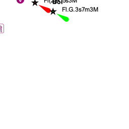
The immediate approach to Bol has no dangers. In the approach from W, past the sandy spit of Zlatna Rat, note that the shoal water extends for nearly 400 metres from the end of the spit. A yellow buoy is usually in position marking the end of the shoals. Depths in the harbour entrance are 6.0 - 7.0 metres and on the quays mostly around 2.0 metres.
Entrance
Split is the nearest all-year round port of entry. During the summer, Hvar, Vis and, if arriving from N, Primosten on the mainland are also ports of entry.
Berthing

The harbour is often filled to capacity by late afternoon during the season and a visiting yacht will have to fit in wherever it can along the quays. There are laid moorings along the quays. Depths are mostly about 2.0 metres, increasing to 4.0 - 5.0 metres along the S breakwater (where, unfortunately, the ferries and tripper boats have priority).
Town quay
Note that the jetty further W is the fuel berth.
Anchorages
Zlatni Rat
Amenities
| Facilities | |
|---|---|
| Water | on N quay |
| Electricity | see above |
| Toilets | None |
| Showers | None |
| Laundry | None |
| Garbage | Near the waterfront |
| Supplies | |
| Fuel | |
| Bottled gas | None |
| Chandlers | None |
| Services | |
| Repairs | None |
| Internet | From internet cafés |
| Mobile connectivity | |
| Vehicle rentals | None |
| Health | |
Provisioning
Supermarket and other provisions shops in the village. Fruit and vegetable market.
Eating out
Restaurants and café/bars ashore.
Transportation
Tourism


Most visitors to Bol come for the unusual natural feature of Zlatni Rat, a 500-metre long promontory of white sand and shingle extending S from the coast a mile or so west of the town. The promontory has a backbone of pine trees for shade and during the season it is crawling with sun-worshipping tourists. In a yacht, however, one can anchor off in (reasonable) solitude and dive down into some of the clearest waters in Croatia. Note, however, that tidal currents can be significant.
The town itself is not short of attractions, with a pleasant stroll eastwards to the 15th Dominican monastery and Church of Our Lady of Mercy. For the energetic, there is a good walk up to the summit of Vidova Gora, the mountain that dominates the town from the NW, which is rewarded with superb views over Hvar and Korcula islands to the south.
Links
- Bol at the Wikipedia
- Brac Tourism
For other useful websites, see Croatia.
References
See Croatia.
Comments
We welcome users' contributions to the Wiki. Please click on Comments to view other users' comments, add your own personal experiences or recommend any changes to this page following your visit.
Verified by
Date of member's last visit to Bol and this page's details validated:
- August 2005 --Athene of Lymington
| This is a usable page of the cruising guide. However, please contribute if you can to help it grow further. Click on Comments to add your personal notes on this page or to discuss its contents. Alternatively, if you feel confident to edit the page, click on the edit tab at the top and enter your changes directly. |
| |
|---|
|
Names: Lighthouse, Athene of Lymington |