Croatia
From CruisersWiki
| Croatia
| |
| Capital | Zagreb |
|---|---|
| Language | Croatian |
| Currency | Kuna (HRK) |
| Time zone | CET (UTC + 1) , DST: CEST (UTC+2) |
| Calling code | +385 |
| | |
| Legislation has now been passed (2013) by the Croatian government to forbid anchoring within 150 metres of mooring buoys in those bays or harbours where concessions are in force Map of mooring concessions. This effectively forces yachts to use (often expensive) mooring buoys rather than their own anchors in hundreds of locations throughout Croatia. --Athene of Lymington 10:00, 24 December 2013 (GMT)
From 1 January 2014 Croatia has introduced a new Navigation, safety and pollution prevention fee to replace the former vignette (existing vignettes will be honoured until their expiry date). This and the existing 'Sojourn tax' are payable by all yachts, whether foreign, EU-registered or Croatian, --Athene of Lymington 14:37, 28 December 2013 (GMT) | |
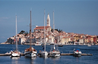
The coast of Croatia and its numerous offshore islands are one of the most beautiful (and expensive) cruising grounds in the Western Mediterranean.
Lying between the coast of Slovenia, which ends at Piran to the north, and that of Montenegro, which starts at Herceg Novi to the south, Croatia also shares additional inland borders with Bosnia-Hercegovina, Serbia and Hungary.
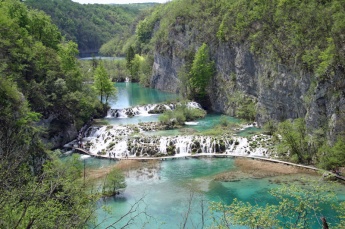
The country has a deeply indented coastline of nearly 1800 kilometers as well as over 1,200 offshore islands and its mostly mountainous interior is dotted with spectacular national parks, picturesque mediaeval villages and numerous reminders of Roman, Byzantine and Venetian rule.
Since the setback of the 1995 conflict that led to the country’s hard-won independence from the former Republic of Yugoslavia, tourism has boomed again and the beaches, hotels and harbours along the coast are filled to the brim with tourists from all over the world.
For cruising yachtsmen the country’s popularity is a mixed blessing, since Croatia is now exceptionally well organized for them, with over 50 marinas and even more harbours supplying their every need. However, it is not a cheap place to visit, with cruising and sojourn taxes to be paid on entry and substantial daily berthing charges, sometimes even when anchored.
At its closest, Croatia is barely 60 miles from the Italian coast - a day’s sail for a yacht and a morning spin for a motor boat - so it is no surprise that harbours and anchorages are packed with holidaying Italian cruisers in July and August.
However, like a meal at a Michelin-starred restaurant, one cannot but acknowledge the quality of the offering even while one baulks a little at the price.
Charts
The charts produced by the National Hydrographic Institute of the Croatian Republic are accurate and reliable. The Italian authorities also cover the area as does the British Admiralty, which offers a different slicing up of the country; this may be useful in some cases. For instance, to approach Vis from the north (Primosten), the Admiralty chart enables the whole passage to be planned on a single chart, while with the Croatian charts, two would be required.
Also see Adriatic Sea.
Weather
Northern Croatia has a temperate continental climate whereas central, semi-mountainous and mountainous regions have a mountainous climate. The entire Adriatic coast has a pleasant Mediterranean climate. Spring and autumn are mild along the coast, while winter is cold and snowy in central and northern regions. The average temperature in the inland in January ranges from 0 to 2°C, August 19 to 23°C. The average temperature at the seaside is higher: January 6 to 11°C, August 21 to 27°C.
Main winds in the Adriatic
The Maestral is a NW wind that appears in periods of high air pressure, usually around 11.00, and brings good weather. It can reach up to force 5 and causes rough seas. It dies down in the late afternoon, and the following day - after a calm night - starts blowing at a similar force to the previous day.
Burin is a wind that blows from the opposite direction of the Maestral. It usually blows at night, mostly from NNE in the northern Adriatic and from E or SE in the southern Adriatic. It is strongest before dawn and soon dies down afterwards.
Bora is a strong NE wind that appears in periods of high air pressure, it blows from the mainland towards the sea in powerful gusts. It is hardly predictable in spite of early warning: the coastal mountain peaks are covered by small clouds and the sea surface in the northeastern part spumes. The greater the distance from the coast, the weaker the force of the gusts. In summer the bora usually blows only a few hours, but sometimes it can last up to a day or two. It can be extremely strong in the Kvarner area, along the Velebit Channel, and around Šibenik, Split, Pelješac and Dubrovnik.
Jugo (scirocco) is a warm and humid SE wind that from October to the end of January brings a lot of rain. Calm sea and a heavy cloud cover in the south are signs of the jugo slowly approaching and raising high waves. The jugo often blows for several days (in summer up to 3 days, in winter up to 3 weeks), while rough seas can last even longer. From time to time this wind also brings reddish-brown sand from Africa. It should be remembered that the jugo can change its direction in just a few minutes and turn into a very strong Bora (NE wind). The jugo is a typical wind of the Southern Adriatic where it lasts longer than in the north.
Nevera is a very strong "W" wind that brings bad weather. It mostly blows in summer. It strikes suddenly, causing rough seas, but is mostly of short duration. It is usually accompanied by thunder. When it stops blowing the air is fresh and pleasant. It is most common in the Northern Adriatic.
Other winds in the Adriatic are: Lebić - SW; Levant - strong SE; Tramontana - cold N.
High and stable air pressure usually brings nocturnal winds blowing from the mainland, and diurnal winds blowing from the sea.
Sources of weather forecasts: Broadcast:
Rijeka Radio VHF channel 04, 20, 24, 81 at: 05.35, 14.35, 19.35
Split Radio VHF channel 21, 07, 81, 23 at: 05.45, 12.45, 19.45
Dubrovnik Radio VHF channel 07, 04at : 06.25, 13.20, 21.20
Navtex: 518kHz "Q" from Split Radio at: 0545, 1445, 1945
Continuous weather forecasts for the Croatian coastal region are provided in Croatian, English, Italian and German every 15 minutes, and are updated at 7:00, 13:00 and 19:00 (local time). The forecast is for the next 24 hours and includes information on barometric. Broadcast frequencies:
- VHF ch. 73 for northern Adriatic/ western coast of Istria
- VHF ch. 69 for northern Adriatic/ eastern part
- VHF ch. 67 for central Adriatic / eastern part
- VHF ch. 73 for southern Adriatic / eastern part
Internet weather sites:
- At the site of Croatian Meteorological and Hydrological Service:
- Weather forecast for the Adriatic 24h text-based, from the Meteorological Center in Split.
- ALADIN/HR 72h charts with wind, pressure and precipitation forecast (the country overall and the coastal regions).
- Marine forecast 72h graphical wave, wind, pressure and precipitation forecasts for a number of selected spots.
- For 72 hr Euroweather forecast for Northern, Central and Southern Adriatic or Meteomed (both rather heavy on graphics).
- Also try harbour masters’ offices (+24 and +48 hours) and the reception desk in nearly all marinas (+24 and +96 hours), albeit the information from the latter is usually based on the information from Windfinder or Windguru.
- Observations are published on Eurometeo's website.
Passages
List popular passages/routes, timing, etc.
Communication
Add here VHF channel for coastguard, harbor masters. etc.
Also see World Cruiser's Nets
See individual islands, ports. & anchorages.
Restricted Areas
Warning: See up to date nautical charts for restrictions. Heavy fines are levied for infringements.
Currents and tidal streams
Currents along the Croatian coast of the Adriatic circulate mainly anti-clockwise. Tidal streams tend to be weaker, although they can be strong in narrow channels, especially between islands. The length of the tides in the Adriatic is around 12 hours, and tidal heights range from 25 cm at the Strait of Otranto to 80 cm in the Northern Adriatic. There are many deviations through the islands, but the main direction is NW with variable W currents in the central regions. There can be strong flows in narrow channels following the cessation of periods of strong winds.
Entrance
Arrival
All yachts entering Croatia should do so at the handiest designated port of entry (see below). A yacht should fly the "Q" flag only if it is a non-EU yacht, and in this case the skipper should then report to the local port police with all crew passports for passport control before visiting the harbour master to pay the required navigation fees and sojourn tax. A non-EU crew should not leave the customs quay area until the formalities are completed. EU yachts need only report in to the harbourmaster at their first port of entry to pay the necessary fees. When departing the country from a designated port of entry, a yacht must leave Croatian waters as quickly as possible.
Customs and Immigration
Immigration
Clearing in
Visiting foreign yachts can clear in at the following harbours (as per Uredba o graničnim prijelazima Republike Hrvatske):
- Permanent maritime border crossings: Rijeka, Ploče, Zadar, Šibenik, Split, Dubrovnik, Raša-Bršica, Umag, Poreč, Rovinj, Pula, Mali Lošinj, Korčula, Ubli.
- Seasonal (Apr–Oct) maritime border crossings: Umag – ACI Marina, Novigrad, Sali, Božava, Primošten, Komiža, Hvar, Vis, Stari Grad (Hvar), Vela Luka, Cavtat.
Visas
Nationals of most countries do not require a visa for visits under 90 days. For full details of current visa requirements, see the following website: Ministry of Foreign Affairs. If a visa is required, it is advisable to obtain it in advance.
Customs
Firearms and ammunition MUST be declared on arrival. These will be officially sealed and re-checked when checking out. Full details of firearms and ammunition must be included on the cruising permit. All radio transceivers must be declared and an operator's permit produced.
Pets
Dogs and cats require a veterinary certificate showing that the animal has been inoculated against rabies between 15 days and six months previously. All animals need a general health certificate and to have had all the necessary vaccinations. More information and updates can be found at Croatian National Tourist Board.
Documentation Required
For the latest requirements click on the link to the Official Croatian Ministry website.
Fees and Charges
Following accession to the EU on 1 July 2013, the taxes charged on local and visiting yachts have changed. From 1 January 2014 Croatia is imposing a new Navigation, safety and pollution prevention fee, which replaces the former (and much more expensive) 'Vignette', as well as continuing to charge the existing Sojourn tax on both local and visiting yachts. In addition to these charges, mooring costs are very expensive in most marinas and some of the most popular harbours, sometimes exceeding Euros 100 a night for a 13-15 metre yacht. Many of the most popular anchorages convenient for going ashore to civilization are also subject to a hefty mooring charge. This charge is typically 50 per cent of the charge for berthing at the quays in the nearby harbours.
The main charges for a cruising yacht on entry to Croatia are (from 1 January 2014) as follows:
All yachts, whether foreign, EU-registered or Croatian flagged, are required to pay this new fee. Foreign and EU-registered yachts pay on arrival at their first port of entry and the fee payment is valid for the calendar year. The so-called 'Vignette' formerly required is no longer issued; the payment receipt is all that is needed. Once the fee is paid, the vessel is permitted to cruise the entire Croatian coast, including the previously prohibited islands like Vis, but excluding the Brioni islands off Pula and the national parks of Kornati and Telascica, which make substantial additional charges. When paying the fee, you need to produce the crew list, boat registration details, third party insurance certificate and (sometimes) a certificate of competence for the skipper. Proof of ownership of the vessel (or documented permission to use the vessel) and (for EU-registered yachts) proof of payment of VAT may also be asked for. Payment is usually in local currency (HRK: Kunas) and the harbourmaster will direct you to the nearest ATM if necessary.
The new fee is calculated in Croatian Kuna (HRK) according to the formula (20 x L) + (2 x P) (where L = overall length of vessel in metres and P = engine power in kW). Vessels over 40 metres overall length or with engine power over 3000 kW (around 4000 HP), pay a flat fee of HRK 7,500. Thus fees are around HRK275 for a typical 11 metre yacht; around HRK330 for a 13 metre yacht; around HRK390 for a 15 metre yacht, etc - all, of course, depending on engine power. For yachts remaining in Croatia, the fee is reduced by 10 per cent for each subsequent year up to a maximum of 50 per cent.
Sojourn Tax
For several years all visitors to Croatia have been required to pay a daily tourist or ‘sojourn’ tax. For yachts - foreign, EU-registered or locally owned - this is charged as a lump sum advance payment based on the size of the yacht and the proposed duration of stay in Croatian waters. Unlike the Navigation, safety and pollution prevention fee, this can be paid for periods of 8, 15, 30 or 90 days or for the whole year. For a typical yacht of 12-15 metres this costs from HRK300 for 8 days up to HRK1300 for a full year. Yachts can be heavily fined if this is not paid on entry, fines ranging from HRK1,000 up to HRK5,000. See New Croatian regulations for full details.
Restrictions
Health & Security
Standards of health care in Croatia are at least equal to those of most Western European countries and no special measures of immunizations are required (although Hepatitis A and B vaccinations are often recommended for travel to most Mediterranean countries). Like many areas of the Mediterranean, mosquitoes can be a problem during the summer, especially in lake areas and coastal marshes. The usual precautions are recommended of plenty of insect repellent and covering up whenever possible in the evenings. Food standards (at least in terms of hygiene) are good and the tap water is safe to drink. Most EU countries have reciprocal agreements for medical treatment with Croatia, and visitors from EU countries should be able to receive treatment on production of their E111 card. Currently (2014) E111 card holders pay a nominal HRK 10 for a consultation with a doctor and a similar amount for a prescription from a pharmacy. Visitors from other countries should not visit Croatia without appropriate insurance. If spending long periods of time in forested areas, immunisation against tick-borne encephalitis is advised and precautions should be taken against tick bites. For further advice see Croatia health care and vaccinations.
Regions
Istria
Istria (Croatian: Istra), is the largest peninsula in the Adriatic Sea.
The western coastline of it extends from Umag just south of the Slovenian border as far as the major port of Pula. Mostly low-lying and green, the coastline here is well-equipped with marinas and harbours, several of them among the finest examples of mediaeval Venetian towns in Croatia.
The eastern coastline, from Pula towards Opatija, by contrast, is less populous, more mountainous and deeply indented in places, with fewer harbours and anchorages.
| Mainland | ||
|
Marina Cervar-Porat |
Marina Parentium |
|
Marina Funtana |
Marina Veruda |
|
Zaljev Rasa |
Plomin Luka |
|
| Islands | ||
Kvarner Gulf
The stretch from Rijeka to Zadar offers more challenging sailing, much of it in the lee of the Velebit mountain range where the effects of the bora are most keenly felt.
Nevertheless, the mainland coast here is majestic, rising steeply from sea level to peaks which are often snow-clad into late spring. The islands along the coast here also tend to be more mountainous and bare than those further south and navigating between them can be exciting in gusty conditions. Still, both mainland and islands are well supplied with sheltered ports and marinas for when conditions become too taxing.
| Mainland | ||
|
Kraljevica |
Crikvenica |
Senj |
|
Karlobag |
Starigrad-Paklenica |
| |
| Islands | ||
|
Skarda |
Vir |
| ||
North Dalmatia
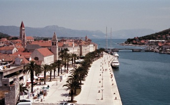
Cruising between Zadar and Split a yacht is in the most popular and busy part of the Croatian coast, especially for charter yachts. In addition to remarkable inland cruising grounds such as the river Krka up to Sibenik and Skradin and the historic World Heritage-listed town of Trogir, there are the extraordinary and protected Kornati Islands to explore, with their dazzling white lunar landscape that gleams in the sun. There are more mainland harbours along this stretch but fewer on the islands, where a yacht is more likely to be at anchor or on a mooring buoy.
| Mainland | ||
|
Morinje |
| ||
| Archipelagos | ||
| Zadar | Kornati | Šibenik |
|
Zverinac |
Sestrunj |
Lavdara |
|
Kornat |
Lavsa |
Levrnaka |
Vela Smokvica |
Ravni Žakan |
Kameni Žakan |
Piškera |
Sit |
|
Kakan |
Zmajan |
Tijat |
Krapanj |
|
South Dalmatia
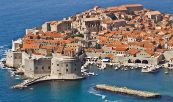
From Split to Dubrovnik, the coast and the offshore islands become progressively greener, until the vegetation on islands such as Mljet and the small islands off Dubrovnik is almost sub-tropical in appearance. Marinas are scarcer along this coast, although it is amply supplied with small harbours, especially on the mainland and the Peljesac Peninsula, where a yacht can tie up on a stone quay or anchor off a world away from the bustle of the charter yacht ‘hot spots’. Of course, no visit to Croatia would be complete without a visit to the World Heritage-listed town of Dubrovnik, the 'Pearl of the Adriatic'.
| Mainland | |||
|
Marina |
Kaštela |
Stobreč |
Brela |
Baska Voda |
|
Krvavica |
Tucepi |
Podgora |
Igrane |
Blace |
|
Mali Ston |
Drace |
Trpanj |
Loviste |
Orebic |
| |
| Islands | |||
|
Šćedro |
|
Jakljan |
Lopud |
Kolocep |
| ||
Transportation
List transportation to other countries, etc.
Friends
Submit details/contacts of cruiser's "friends" that can be contacted in advance or on arrival - who can offer information and assistance to our cruising "family".
Forums
List links to discussion threads on partnering forums. (see link for requirements)
Links
There is quite an amount of useful information is available in English at the "Nautics" page at the site of the Croatian Ministry of Maritime Affairs, Transport and Infrastructure. In particular:
- pamphlet "Information for Vessel Owners Regarding Registration of Vessels with Croatian Vessel Registers"
- information regarding government-licensed mooring facilities
- list of "Recognized certificates for operating boats and yachts"
- list of licensed anchorages
- references to some other relevant documents
- links to the relevant legislation (in Croatian). NB: For infamous 150 m mooring field buffer limit see Ordinance on Safety of Maritime Navigation... paragraph 49.3 (in Croatian).
- List of harbour masters' offices
- Sketches of the majority of licensed anchorages
- List of Croatian marinas
Also Hydrographic Institute of the Republic of Croatia (HHI) provides a number of so-called e-Services (a free registration is required):
- a copy of effective Radio Navigational Warnings
- Notices to Mariners a monthly publication with chart corrections, etc
- Croatian Tides on-line
Generic sites:
- Croatia at the Wikipedia
- Croatia at the Wikivoyage
- Croatian National Tourist Board
- Find Croatia travel guide
Other sites
- Map of (mostly) government-licensed anchorages
- Yet another map of harbours and anchorages
- Vodnik po Jadranu an interactive map (in Slovenian) with nautical facilities along the Eastern Adriatic Coast.
- List of nautical fuel stations in Croatia.
- On-line nautical guide for Adriatic Sea
References & Publications
- Trevor & Dinah Thompson, Adriatic Pilot, Imray Laurie and Wilson (6th edition edition 2012), ISBN 978-1846233333
- Sonia Florian, Dario Silvestro, Piero Magnabosco, 777 Harbours and Anchorages - Croatia, Slovenia, Montenegro and Albania, Edizioni Magnamare (6th edition 2014/15), ISBN 9788862000345
- Jane Cody & John Nash, Croatia Cruising Companion, Wiley Nautical (reprinted 2010), ISBN 978-1904358282
- Hrvatski Hidrografski Institut, Adriatic Sea Pilot Volume 2, Croatian Hydrographic department, ISBN 9536165317
- Hrvatski Hidrografski Institut, Adriatic Sea Pilot Volume 1, Croatian Hydrographic department, ISBN 9536165325
- Zavod Leksikografski, Navigational Guide to the Adriatic, Imray Laurie Norie & Wilson, ISBN 9789536036875
- Radovan Marčić & Braslav Karlić, A Gourmet Cruise; The Adriatic Good Food Pilot, Gustoza đita (3rd Edition 2010), ISBN 9789537131043
Comments
We welcome users' contributions to the Wiki. Please click on Comments to view other users' comments, add your own personal experiences or recommend any changes to this page following your visit.
Verified by
Date of member's last visit to Croatia and this page's details validated:
- October 2016 --Athene of Lymington
| This is a usable page of the cruising guide. However, please contribute if you can to help it grow further. Click on Comments to add your personal notes on this page or to discuss its contents. Alternatively, if you feel confident to edit the page, click on the edit tab at the top and enter your changes directly. |
| |
|---|
|
Names: Lighthouse, Athene of Lymington, Rr7, Gonzo123, Vadp |


