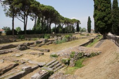
Grado
From CruisersWiki
| Grado
| |
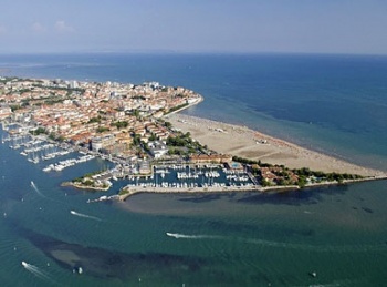
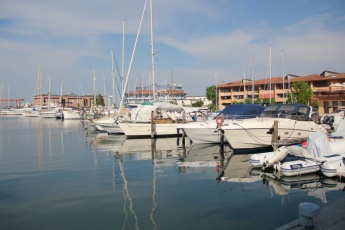
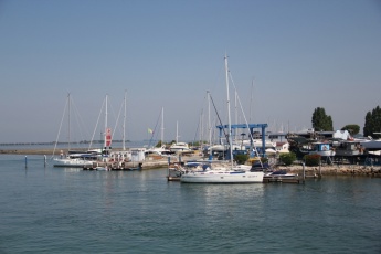
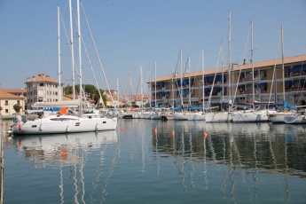
The town of Grado is situated on a low sandy spit at the mouth of the lagoon of the same name, 11 miles E of Lignano and five miles SW of Monfalcone on the northern Adriatic coast of Italy. During the Roman era, the town was an important staging post for the major settlement of Aquileia on the northern coast of the lagoon of Grado. During the decline of the Roman empire in the 5th century AD, there was a major population shift to Grado from the less protected settlements inland. The town was later to become an important naval base for the Byantines and subsequently the Lombards in the 6th century AD. By the 15th century Grado had declined to become a minor outpost of the Venetian empire, a position which was further reinforced by its sacking by English and then French forces in the early 19th century. The area was ceded to Austria in 1815 at the Congress of Vienna following the defeat of Napoleon’s forces and Grado remained part of the Austro-Hungarian empire until the conclusion of hostilities in 1918, when it finally became part of the unified kingdom of Italy. Today there are several traces of the town’s former strategic importance dotted around the lagoon, but its principal tourist attractions are Grado’s beaches and thermal baths. Yachtsmen visiting the town of the lagoon can find berths in the basin of Porto San Vito at the western end of the town, at the pontoons of the Italian Lega Navale, Grado immediately E of Porto San Vito along the northern end of town or the small canal basin of Darsena San Marco at the entrance to the Canale di Belvedere 200 metres N of the town just W of the bridge. Alternatively, a smaller yacht of modest draft can berth at the S end of the Grado canal in the (noisy) Grado town basin in the centre of town or continue four miles NNW from the entrance to Grado along the channel to the Natissa river, where the Marina di Aquileia lies 1.5 miles upstream from the river entrance. As with most harbours along this coast, Grado is best entered on a rising tide close to high water and never with strong onshore winds.
Charts
- British Admiralty
- 204 - Sedmovrace to Trieste and Ravenna to Venezia
- 1471 - Golfo di Trieste and Approaches
- Italian
- 924
- 39
- 235
Weather
During the summer months the prevailing winds in the Adriatic are light to moderate coastal seabreezes. In spring and autumn, northerly winds are more frequent and can quickly rise to near gale force, especially in the northern Adriatic, where the much-feared “bora” is caused by high pressure over the mountains to the NE coupled with low pressure over southern Italy. Fortunately, the fiercest “bora” is normally to be expected in the winter months. Thunderstorms are occasionally experienced in spring and especially autumn and can be accompanied by violent winds of gale force and above. Luckily they are rarely long-lasting. In the southern Adriatic, the “scirocco”, a S/SE wind blowing up from North Africa which can last for several days, is more common. Unlike the “bora”, which can arrive without warning, a “scirocco” tends to build in strength over 24-48 hours, sometimes reaching gale force (especially in winter).
Sources for weather information:
- There is a continuous (computerized voice) weather forecast on VHF 68 - first in Italian and then followed with an English translation
- The same forecast is given in Italian and English on VHF coastal stations following a notification on channel 16
- Navtex weather forecasts covering the Adriatic are broadcast from stations at Roma, Trieste, Kerkyra (Greece) and Split (Croatia)
Passages
List popular passages/routes, timing, etc.
Islands
None offshore, but in the lagoon:
- Isola Barbana
- Isola Marina dei Menzi
- Isola Gorgo
Communication
Add here VHF channel for coastguard, harbor masters. etc.
Also see World Cruiser's Nets
The entrance to the Grado lagoon lies at ![]() 45°39.6′N, 13°20.9′E, where there is a red fairway buoy just under two miles offshore. Dangerous sandbanks extend for almost two miles on both sides of the entrance, so approach is only safe from this buoy, near high water and in settled weather. Approach should be made on a course of 040 degrees. The entrance channel, which is dredged to a depths of just 3.0 metres, is marked by piles on either side. Once inside the entrance, the channel forks. The starboard channel curves E round to Grado town and the moorings of Porto San Vito, Lega Navale and Darsena San Marco. The port channel turns W then N towards the Natissa river and the Marina di Aquileia.
45°39.6′N, 13°20.9′E, where there is a red fairway buoy just under two miles offshore. Dangerous sandbanks extend for almost two miles on both sides of the entrance, so approach is only safe from this buoy, near high water and in settled weather. Approach should be made on a course of 040 degrees. The entrance channel, which is dredged to a depths of just 3.0 metres, is marked by piles on either side. Once inside the entrance, the channel forks. The starboard channel curves E round to Grado town and the moorings of Porto San Vito, Lega Navale and Darsena San Marco. The port channel turns W then N towards the Natissa river and the Marina di Aquileia.
Berthing
There are five berthing options in Grado or the lagoon of Grado, all are marinas.
Marinas & Yacht Clubs
For a map showing the marinas in central Grado, click on this link marinas in central Grado.
Porto San Vito
Darsena San Marco
Grado town basin
Marina di Aquileia
Anchorages
Anchoring is possible anywhere in the lagoon where the depths are suitable and you are not obstructing the channels. Fore and aft anchors may be necessary to stop swinging into the channel.
Yacht Repairs and Services
Marine Stores
Submit addresses and contact details of marine related businesses that are of interest to cruisers.
Repairs/Yards
See marina entries for details.
Fuel, Water, & Electricity
See marina entries for details.
Things to do Ashore
Tourism
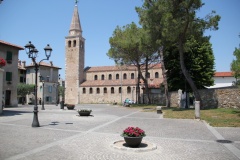
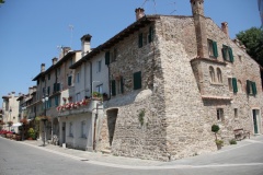
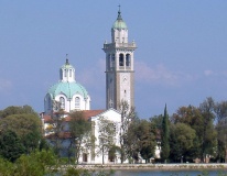
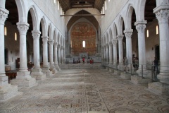
Most tourists come to Grado for its beaches and for spa treatments at the town’s thermal baths. However, the old centre, especially around the inner basin, is attractive to explore. Grado also boasts an imposing Basilica di Sant’Eufemia with a 6th century mosaic floor and an octagonal baptistery. A trip by boat to the island of Barbana at the northern end of the lagoon is also recommended to visit the Sanctuary of Barbana, constructed in 582 AD to house a miraculous image of the Virgin Mary. Grado is also a good base for visiting the World Heritage listed Roman site of Aquileia, one of the most important archaeological sites in N. Italy, which lies near the modern town of Aquileia two miles up the Natissa river on the N coast of the lagoon. In addition to Roman remains, Aquileia contains an impressive Byzantine cathedral and an excellent National Archaeological Museum.
Grocery & Supply Stores
- Good provisions shops in Grado town, within walking distance of the town marinas
- Also in Aquileia, about one kilometer N of Marina di Aquileia
Eateries
- Bar and restaurant in Porto San Vito
- Restaurant/pizzeria at Darsena San Marco.
- Bar and restaurant in Marina di Aquileia.
- Numerous bars and restaurants in Grado old town.
Internet/WiFi
See marina entries.
Laundry
See marina entries.
Motorbike & Car Rentals
Rental outlets in Grado town and Aquileia.
Garbage Disposal
Bins at the marinas.
Transportation
Buses to Aquileia and other destinations from bus station.
Cruiser’s Friends
Contact details of “Cruiser’s Friends” that can be contacted for local information or assistance.
Forums
List links to discussion threads on partnering forums. (see link for requirements)
Links
- Grado at the Wikipedia
- Pagine Azzurre Grado
- Municipal website
- Tourism website
- Bach and thermal baths website
References & Publications
See Italy.
Comments
We welcome users' contributions to the Wiki. Please click on Comments to view other users' comments, add your own personal experiences or recommend any changes to this page following your visit.
Verified by
Date of member's last visit to Grado and this page's details validated:
- June 2015 --Athene of Lymington
| This is a usable page of the cruising guide. However, please contribute if you can to help it grow further. Click on Comments to add your personal notes on this page or to discuss its contents. Alternatively, if you feel confident to edit the page, click on the edit tab at the top and enter your changes directly. |
| |
|---|
|
Names: Athene of Lymington |
