Lopud
From CruisersWiki
Istioploos (Talk | contribs) (Template) |
Istioploos (Talk | contribs) (Template) |
||
| (5 intermediate revisions not shown) | |||
| Line 1: | Line 1: | ||
| - | {{IsPartOf|Mediterranean|Adriatic Sea|Croatia}} | + | {{IsPartOf|Mediterranean|Adriatic Sea|Croatia|Southern Dalmatia}} |
{{TOC block}} | {{TOC block}} | ||
| - | {{Infobox |42 | + | |
| - | | zoom= | + | {{Infobox |
| + | | lat= 42.686|lon=17.94717 | ||
| + | | name= Lopud | ||
| + | | portofentry= | ||
| + | | containsportofentry= | ||
| + | | zoom= 13 | ||
| + | | chartlet = y | ||
| image= LopudJetty.jpg | | image= LopudJetty.jpg | ||
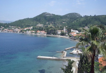
| - | | imagetext= The wide bay of U. Lopud | + | | imagetext= The wide bay of U. Lopud |
| - | | | + | | summary= [[Lopud]] Island is the second southernmost of a chain of small islands lying barely two miles off the coast of [[Croatia]]. Known as the '''Elafiti Islands''' (from the Greek word ''elaphos'', meaning deer, with which the islands were presumably formerly populated), the chain is mostly heavily forested and unspoilt. Several of the islands are popular day trip destinations for holidaymakers staying in Dubrovnik, but visiting yachts using the various anchorages around the islands can usually escape the worst of the crowds (especially outside the peak months of July and August) and even the busier anchorages quieten down at night when the tripper boats go home. Lopud Island is around four miles WNW of the port of [[Dubrovnik]] and is a popular summer beach destination for day trippers. It offers two attractive anchorages in settled weather on its NW and SE sides, U. Lopud and U. Sunj. |
| + | | notes= | ||
| news= | | news= | ||
| - | + | }} | |
| - | + | ||
| - | + | ||
==Charts== | ==Charts== | ||
| - | + | ''See [[Southern Dalmatia#Charts|Southern Dalmatia]]''. | |
| - | + | ||
| - | + | ||
| - | + | ||
| - | + | ||
| - | + | ||
| - | + | ||
| - | + | ||
==Weather== | ==Weather== | ||
| - | + | ''See [[Croatia#Weather|Croatia]]''. | |
| - | + | ||
| - | + | ||
| - | + | ||
| - | + | ||
==Passages== | ==Passages== | ||
| Line 32: | Line 26: | ||
==Islands== | ==Islands== | ||
| - | * [[ | + | * [[Koločep]] |
| - | * [[ | + | * [[Šipan]] |
==Communication== | ==Communication== | ||
| Line 43: | Line 37: | ||
==Navigation== | ==Navigation== | ||
| - | {{Green|Add any navigation notes such approaches, dangers etc here. If this section does not apply remove it.}} | + | {{Green|Add any navigation notes such approaches, dangers etc here. If this section does not apply, remove it.}} |
==Entrance== | ==Entrance== | ||
| Line 49: | Line 43: | ||
==Berthing== | ==Berthing== | ||
| - | There are two principal berthing options on the island, the anchorages of [[#U. Lopud|U. Lopud]] on the NW coast of the island and [[#U. Sunj|U. Sunj]] on the SE coast. | + | There are two principal berthing options on the island, the anchorages of [[#U. Lopud|U. Lopud]], on the NW coast of the island, and [[#U. Sunj|U. Sunj]], on the SE coast. |
===Ports=== | ===Ports=== | ||
| Line 57: | Line 51: | ||
None. | None. | ||
| - | + | ==Anchorages== | |
{{Poi | lat= 42.68844 | lon= 17.93982 | type= anchorage | name= U. Lopud| zoom= 15 | {{Poi | lat= 42.68844 | lon= 17.93982 | type= anchorage | name= U. Lopud| zoom= 15 | ||
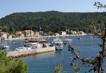
| image= LopudBay.jpg | imagetext= Tripper boats use the jetty at U. Lopud | imagewidth= | | image= LopudBay.jpg | imagetext= Tripper boats use the jetty at U. Lopud | imagewidth= | ||
| - | | text= The village and wide bay of U. Lopud are situated on the NW coast of the island, protected from SW by a long, wooded peninsula. | + | | text= The village and wide bay of U. Lopud are situated on the NW coast of the island, protected from SW by a long, wooded peninsula. There are no dangers in the immediate approach, although note if approaching from N that there is a reef around 200 metres off the headland at the N end of Lopud island. The village and associated tourist infrastructure are spread along the E side of the bay, together with several stone jetties used by ferries and small leisure craft. Anchor anywhere along the shore in 6.0 - 8.0 metres, clear of the jetties at the N and S ends used by the ferries and tripper boats. The holding is good in sand, mud and weed. Shelter in the bay is good in winds from E and S but poor in winds from W round to N. Restaurants, café/bars and some provisions shops ashore.}} |
{{hold vertical}} | {{hold vertical}} | ||
| Line 66: | Line 60: | ||
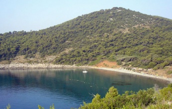
| image= LopudSunjApproach.jpg| | imagetext= Rocks fringe the approach to U. Sunj | imagewidth= | | image= LopudSunjApproach.jpg| | imagetext= Rocks fringe the approach to U. Sunj | imagewidth= | ||
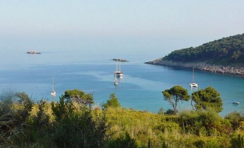
| text= {{Image right| LopudSunj.jpg| Yacht anchored in U. Sunj }} | | text= {{Image right| LopudSunj.jpg| Yacht anchored in U. Sunj }} | ||
| - | U. Sunje lies on the SE coast of the island, facing the nearby island of [[Kolocep]] a mile to the E. | + | U. Sunje lies on the SE coast of the island, facing the nearby island of [[Kolocep]] a mile to the E. There is little ashore but a café open during the season and a good sandy beach. Attention is needed in the approach to the string of rocky {{mark|type=danger|name=islets|lat=42.67515|lon=17.95741|zoom=17}} extending for 60 metres SE from the southern headland of the bay and a {{mark|type=danger|name=shoal patch|lat=42.67672|lon=17.98314|zoom=17}} 200 metres off the W end of [[Koločep]] island. Anchor in 6.0 - 8.0 metres at the head of the bay, staying clear of the N side, where there are rocks close inshore. Holding is good in sand. During the summer, the beach at the head is popular and buoyed off for swimming. Shelter in the anchorage is adequate in settled weather, but the bay is exposed in winds from S round to E.}} |
| - | == | + | ==Amenities== |
| - | + | ||
| - | + | ||
| - | + | ||
| - | + | ||
| - | + | ||
| - | + | ||
| - | + | ||
| - | + | ||
| - | + | ||
| - | + | ||
| - | + | ||
| - | + | ||
| - | + | ||
None. | None. | ||
| - | == | + | ==Provisioning== |
| - | {{ | + | {{mark | type= provisions |name= [[#U. Lopud|U. Lopud]] |text= some provisions shops ashore.}} |
| - | |||
| - | |||
| - | |||
| - | == | + | ==Eating out== |
| - | + | * [[#U. Lopud|U. Lopud]] | |
| - | + | : {{mark |name= | type= eatingout |text=Restaurants and café/bars ashore.}} | |
| - | + | ||
| - | + | ||
| - | + | ||
| - | + | ||
| - | + | ||
| - | + | ||
| - | + | ||
| - | + | ||
| - | + | ||
| - | + | ||
| - | + | ||
| - | {{ | + | |
| - | + | ||
| - | === | + | |
| - | + | ||
| - | + | ||
| - | + | ||
| - | + | ||
==Transportation== | ==Transportation== | ||
Ferries to [[Dubrovnik]] from [[#U. Lopud|U. Lopud]]. | Ferries to [[Dubrovnik]] from [[#U. Lopud|U. Lopud]]. | ||
| - | |||
| - | |||
| - | |||
==Tourism== | ==Tourism== | ||
| Line 141: | Line 98: | ||
For other useful websites, ''see [[Croatia#Links|Croatia]]''. | For other useful websites, ''see [[Croatia#Links|Croatia]]''. | ||
| - | ==References | + | ==References== |
| - | ''See [[Croatia# | + | ''See [[Croatia#References|Croatia]]''. |
{{Comments}} | {{Comments}} | ||
| + | * | ||
* | * | ||
Latest revision as of 23:32, 1 May 2019
| Lopud
| |
| | |
Lopud Island is the second southernmost of a chain of small islands lying barely two miles off the coast of Croatia. Known as the Elafiti Islands (from the Greek word elaphos, meaning deer, with which the islands were presumably formerly populated), the chain is mostly heavily forested and unspoilt. Several of the islands are popular day trip destinations for holidaymakers staying in Dubrovnik, but visiting yachts using the various anchorages around the islands can usually escape the worst of the crowds (especially outside the peak months of July and August) and even the busier anchorages quieten down at night when the tripper boats go home. Lopud Island is around four miles WNW of the port of Dubrovnik and is a popular summer beach destination for day trippers. It offers two attractive anchorages in settled weather on its NW and SE sides, U. Lopud and U. Sunj.
Charts
See Southern Dalmatia.
Weather
See Croatia.
Passages
See Croatia.
Islands
Communication
Add here VHF channel for coastguard, harbor masters. etc.
Also see World Cruiser's Nets
Add any navigation notes such approaches, dangers etc here. If this section does not apply, remove it.
Entrance
Dubrovnik is the nearest year-round port of entry.
Berthing
There are two principal berthing options on the island, the anchorages of U. Lopud, on the NW coast of the island, and U. Sunj, on the SE coast.
Ports
None.
Marinas & Yacht Clubs
None.
Anchorages
U. Lopud
U. Sunj
Amenities
None.
Provisioning
![]() U. Lopud [[Lopud#U. Lopud|U. Lopud]] some provisions shops ashore.
U. Lopud [[Lopud#U. Lopud|U. Lopud]] some provisions shops ashore.
Eating out
-
 [[Lopud# | ]] Restaurants and café/bars ashore.
Transportation
Ferries to Dubrovnik from U. Lopud.
Tourism
History
Give a short history of the island.
Places to Visit
There are a few fortifications around the island which remain from the days of piracy in the 16th century and some villas formerly owned by wealthy Dubrovnik families, but little else.
Friends
Contact details of "Cruiser's Friends" that can be contacted for local information or assistance.
Forums
List links to discussion threads on partnering forums. (see link for requirements)
Links
- Lopud at the Wikipedia
For other useful websites, see Croatia.
References
See Croatia.
Comments
We welcome users' contributions to the Wiki. Please click on Comments to view other users' comments, add your own personal experiences or recommend any changes to this page following your visit.
Verified by
Date of member's last visit to Lopud and this page's details validated:
- June 2004 --Athene of Lymington 16:20, 15 November 2012 (GMT)
| This is a usable page of the cruising guide. However, please contribute if you can to help it grow further. Click on Comments to add your personal notes on this page or to discuss its contents. Alternatively, if you feel confident to edit the page, click on the edit tab at the top and enter your changes directly. |
| |
|---|
|
Names: Lighthouse, Athene of Lymington |


