Pagasitikos Gulf
From CruisersWiki
m (Changed Volos Yacht Club reference to describe it more accurately. Removed non-operational website link.) |
(Added detail for Volos. Need to split Volos to a separate page to reduce size of this page.) |
||
| Line 1: | Line 1: | ||
| - | ==Pagasitikos Gulf (Gulf of Volos)== | + | == Pagasitikos Gulf (Gulf of Volos) == |
| - | [[Image: | + | [[Image:Pagasitikos m.jpg|thumb|right|350px|Pagasitikos m.jpg]] |
| - | [http://en.wikipedia.org/wiki/Pagasetic_Gulf Pagasitikos Gulf] (Παγασιτικός Κόλπος) or the Gulf of Volos and the Trikeri Peninsula at the foot of [http://en.wikipedia.org/wiki/Pelio Mt. Pelion] is the enchanted region where the centaur [http://www.maicar.com/GML/Chiron.html Chiron] taught so many mythological heroes including [http://www.maicar.com/GML/Jason.html Jason] the leader of the [http://en.wikipedia.org/wiki/Argonauts Argonauts]. This is the place where that mythical journey to the [[Black Sea]] began. | + | [http://en.wikipedia.org/wiki/Pagasetic_Gulf Pagasitikos Gulf] (Παγασιτικός Κόλπος) or the Gulf of Volos and the Trikeri Peninsula at the foot of [http://en.wikipedia.org/wiki/Pelio Mt. Pelion] is the enchanted region where the centaur [http://www.maicar.com/GML/Chiron.html Chiron] taught so many mythological heroes including [http://www.maicar.com/GML/Jason.html Jason] the leader of the [http://en.wikipedia.org/wiki/Argonauts Argonauts]. This is the place where that mythical journey to the [[Black Sea]] began. |
| - | [[Image: | + | [[Image:Pagasitikos Lefteris2.jpg|thumb|left|200px|Pagasitikos Lefteris2.jpg]] |
| - | The Trikeri Channel that separates [[Skiathos]] from [[ | + | The Trikeri Channel that separates [[Skiathos]] from [[Gulf of Evia|Evia]] and the mainland. In the middle of the channel there is the infamous reef ''Lefteris'', this reef covers a very small area and it is very treacherous. The channel is very busy with traffic and many ships have found their doom on ''Lefteris''. The list includes many of the ships from the [http://en.wikipedia.org/wiki/Battle_of_Artemisium Persian fleet] of [http://en.wikipedia.org/wiki/Xerxes_I Xerxes] on their way to conquer Greece in 480 BC. The reef then was called ''Myrmes''. In ''Lefteris'' also the heroic Greek submarine [http://en.wikipedia.org/wiki/Greek_submarine_Katsonis_(Υ-1) Lambros Katsonis] was sank with all hands except three crewmen who after swimming for 9 hours made it to [[Skiathos]]. |
| - | Inside the gulf, is a good sailing ground because there are relatively flat seas while the wind, channeled by the mountains can be quite strong. | + | Inside the gulf, is a good sailing ground because there are relatively flat seas while the wind, channeled by the mountains can be quite strong. |
| - | ==Charts== | + | == Charts == |
| - | + | ||
| - | + | [[Image:Pagasitikos Pelio1.jpg|thumb|right|200px|Pagasitikos Pelio1.jpg]] | |
| - | : | + | |
| - | + | ||
| - | + | ||
| - | + | ||
| - | + | ||
| - | + | ||
| - | + | ||
| - | + | ||
| - | + | ||
| - | + | ||
| - | + | ;BA | |
| - | + | :1085 Kólpos Petalión to Srimonikos kólpos including Thermaikos kólpos | |
| - | + | :1556 Vórios Evoïkós Kólpos and approaches to Vólos | |
| - | + | ;Imray-Tetra | |
| - | + | :G25 Eastern Sporades and North Evvoia | |
| - | + | ;NIMA | |
| + | :54349 Maliakos Kolpos | ||
| + | :54351 Approaches to Volos | ||
| + | ;Greek | ||
| + | :31 North Evoikos to Kavala Gulf | ||
| + | :74 Corinth to Skopelos Island | ||
| - | + | {{TOCleft}} | |
| - | + | ||
| - | == | + | == Radio Nets == |
| - | + | ||
| - | ==Check-in facilities== | + | ''Also see [[HF Radio|Cruiser's Nets]]'' |
| - | The major harbor in the area is Volos but there are many good anchorages in this region. | + | |
| + | *Goast Guard - VHF channel 12 | ||
| + | *Olympia Radio - VHF channels 03 and 60 | ||
| + | *Cellular Phone(GSM/GPRS) - Weak signal in Paleo Trikeri | ||
| + | |||
| + | == Local Weather == | ||
| + | |||
| + | ''See [[Aegean Sea#Weather_and_Winds|Aegean Sea]]''. | ||
| + | |||
| + | == Approach and Navigation == | ||
| + | |||
| + | Approached to the gulf are straightforward, but inside the gulf there can be rather strong and gusty winds. | ||
| + | |||
| + | == Check-in facilities == | ||
| + | |||
| + | The major harbor in the area is Volos but there are many good anchorages in this region. | ||
| + | |||
| + | == Ports and Popular Stops == | ||
| + | |||
| + | === Ports === | ||
| + | |||
| + | ==== Volos (Port of Entry) ==== | ||
| - | |||
| - | |||
| - | |||
{| class="infobox bordered" style="width: 28em; text-align: left; font-size: 90%;" | {| class="infobox bordered" style="width: 28em; text-align: left; font-size: 90%;" | ||
|- | |- | ||
| colspan="2" style="text-align:center; font-size: smaller;" | {{Small info}} (''Click links for more information'') | | colspan="2" style="text-align:center; font-size: smaller;" | {{Small info}} (''Click links for more information'') | ||
|- | |- | ||
| - | ! <center>[[ | + | ! <center>[[Image:World icon.png]]</center> |
| {{Coord|39|21.5|N|22|56.5|E|}} | | {{Coord|39|21.5|N|22|56.5|E|}} | ||
|- | |- | ||
| - | ! <center>[[ | + | ! <center>[[Image:Photo icon.png]]</center> |
| [http://www.panoramio.com/map/#lt=39.353281&ln=22.943487&z=3&k=0&a=1&tab=2 Photo gallery] | | [http://www.panoramio.com/map/#lt=39.353281&ln=22.943487&z=3&k=0&a=1&tab=2 Photo gallery] | ||
|- | |- | ||
| - | ! <center>[[ | + | ! <center>[[Image:Chart icon.png]]</center> |
| [http://mapserver.maptech.com/homepage/index.cfm?lat=39.358333&lon=22.941667&scale=24000&zoom=50&type=1 Local chartlet] | | [http://mapserver.maptech.com/homepage/index.cfm?lat=39.358333&lon=22.941667&scale=24000&zoom=50&type=1 Local chartlet] | ||
| - | |} | + | |} |
| - | + | ||
| - | + | Located at the north of the gulf, Volos is a major regional centre with a population of more than 100,000 people. The city is the marine transport hub for Thessaly, Greece’s largest agricultural region, and a key ferry port for the holiday islands of the Northern Sporades. Cruise ships use the port as a base for visiting the Meteora monasteries and other local attractions.<br> | |
| - | + | ||
| - | + | ||
| - | [[Image: | + | ===== Local Weather ===== |
| + | |||
| + | In summer a southerly breeze blows onto Volos nearly every afternoon, unless it is overridden by a strong regional or local airflow (e.g. a passing cold front or thunderstorm). This breeze varies in strength but is typically 10 to 15 knots. The afternoon southerly will blow even when prevailing north-easterlies of 10 to 15 knots are blowing at the south of the gulf and in the adjacent Evia Island channel. | ||
| + | |||
| + | ===== Check-in facilities (for Customs and Immigration and mooring formalities) ===== | ||
| + | |||
| + | The Port Police (Coast Guard) are in the building at the southern end of the ferry quay ([[Image:World icon.png]] {{Coord|39|21.4616|N|22|56.6296|E|}}). The main office is on the first floor entered through the eastern door. It may also be necessary to go to the records office on the ground floor entered through the door on the western side of the building. | ||
| + | |||
| + | Mooring charges: In August 2011 the fee for a non-EU private boat mooring in Volos harbour was calculated as: <br>Length (m) x days x 0.23 plus 20% plus another 23% (Tax). <br>So a 13m yacht was charged EUR4.41 per day. It appears that an overnight stay is charged as two days as the boat will be present on two different days of the week. <br>In addition a departure fee of EUR0.88 was charged.<br>Generally the Port Police will not approach yachts. It is the responsibility of the skipper to approach them | ||
| + | |||
| + | A Hellenic Police office is located on the ferry quay, near the north-western corner ([[Image:World icon.png]] {{Coord|39|21.5422|N|22|56.6834|E|}}). | ||
| + | |||
| + | ===== Mooring ===== | ||
| + | |||
| + | There are a number of alternative mooring locations, each with its complications. <br> | ||
| + | |||
| + | 1. Moored stern or bows to the breakwater, or alongside the floating pontoon in the south-east of the harbour ([[Image:World icon.png]] {{Coord|39|21.3300|N|22|56.9297|E|}}). Issues here include: | ||
| + | |||
| + | **Avoid mooring stern or bows to the breakwater within 20m of the floating pontoon. Mooring chains and anchors have been laid to secure the pontoon. They extend an unknown distance out either side of the pontoon. | ||
| + | **This is a favourite place for the residents of Volos – families and groups of friends - to socialize on summer evenings. This makes for a busy, vital atmosphere into the late evening. Often some of the younger groups stay on until much later, with the pontoon being a favourite – and usually very noisy - location. As with any population a small minority can cause problems. Boats have been boarded without permission and on at least one occasion a burning cigarette butt was flicked onto a boat. | ||
| + | **North-east of the ‘dogleg’ in the breakwater local boats have established ‘their’ spaces. It may be possible to moor here, but it is best to check beforehand (see note below on ‘Unofficial harbourmaster’. | ||
| + | **The footbridge joining the breakwater to the main quay is difficult to negotiate with heavy loads or for anyone with mobility problems. | ||
| + | **There is no electricity on the breakwater or pontoon and water can only be obtained at the north-eastern end of the breakwater through arrangement with the ‘owners’ of the spaces (or the unofficial harbourmaster). | ||
| + | **The breakwater to the south-west of the floating pontoon has mooring rings in place and does not have the problems of claims by local boats or mooring chains. It is further from the town, but is otherwise suitable for mooring. | ||
| + | |||
| + | 2. On the main town quay moor stern or bows to ([[Image:World icon.png]] {{Coord|39|21.4919|N|22|56.8700|E|}}). Most of this quay is reserved. Access can be arranged through contact with the unofficial harbourmaster. | ||
| + | |||
| + | 3. In the inner fishing boat harbour moor stern or bows to ([[Image:World icon.png]] {{Coord|39|21.6817|N|22|56.4871|E|}}). Most of this quay is reserved. Access can be arranged through contact with the unofficial harbourmaster. | ||
| + | |||
| + | ====== Unofficial harbourmaster<br> ====== | ||
| + | |||
| + | There is no port official that takes responsibility for coordinating mooring of pleasure boats in the port. An Irish man (with German and English background) has filled this gap in an unofficial capacity. Carlo is contactable on his mobile phone (6973 076 005). In addition to managing a number of the mooring points on the quay he can arrange general boat repairs and maintenance. This was the position in August 2001. | ||
| + | |||
| + | ===== Anchoring<br> ===== | ||
| + | |||
| + | Inside the harbour, in an emergency, it is possible to anchor off in the eastern corner ([[Image:World icon.png]] {{Coord|39|21.3843|N|22|56.9413|E|}}). Ensure plenty of room is left for boats manoeuvring onto moorings.<br>Boats have anchored in the south-west corner (about [[Image:World icon.png]] {{Coord|39|20.8948|N|22|56.0798|E|}}) and inside the outer breakwater (about [[Image:World icon.png]] {{Coord|39|20.8673|N|22|56.5015|E|}}). Ensure depths are suitable and that there is plenty of room left for boats entering and leaving the port.<br> | ||
| + | |||
| + | ===== Last Visited & Details Checked (and updated here) ===== | ||
| + | |||
| + | ''Date of member's visit to this Port/Stop & this page's details validated'': | ||
| + | |||
| + | *August 2011 -- [[User:Yachtbillabong|Yachtbillabong]] [[Image:Australia Icon.png]] | ||
| + | |||
| + | [[Image:Pagasitikos Volos harbor.jpg|thumb|center|200px|Pagasitikos Volos harbor.jpg]] | ||
| + | |||
| + | ==== Orei ==== | ||
| - | |||
{| class="infobox bordered" style="width: 28em; text-align: left; font-size: 90%;" | {| class="infobox bordered" style="width: 28em; text-align: left; font-size: 90%;" | ||
|- | |- | ||
| colspan="2" style="text-align:center; font-size: smaller;" | {{Small info}} (''Click links for more information'') | | colspan="2" style="text-align:center; font-size: smaller;" | {{Small info}} (''Click links for more information'') | ||
|- | |- | ||
| - | ! <center>[[ | + | ! <center>[[Image:World icon.png]]</center> |
| {{Coord|38|57|N|23|05|E|}} | | {{Coord|38|57|N|23|05|E|}} | ||
|- | |- | ||
| - | ! <center>[[ | + | ! <center>[[Image:Photo icon.png]]</center> |
| [http://www.panoramio.com/map/#lt=38.945459&ln=23.077898&z=3&k=0&a=1&tab=2 Photo gallery] | | [http://www.panoramio.com/map/#lt=38.945459&ln=23.077898&z=3&k=0&a=1&tab=2 Photo gallery] | ||
|- | |- | ||
| - | ! <center>[[ | + | ! <center>[[Image:Chart icon.png]]</center> |
| [http://mapserver.mytopo.com/homepage/index.cfm?lat=38.95&lon=23.083333&scale=300000&zoom=100&type=0&icon=0&searchscope=dom&CFID=17583484&CFTOKEN=79232580&scriptfile=http://mapserver.mytopo.com/homepage/index.cfm&latlontype=DMS Local chartlet] | | [http://mapserver.mytopo.com/homepage/index.cfm?lat=38.95&lon=23.083333&scale=300000&zoom=100&type=0&icon=0&searchscope=dom&CFID=17583484&CFTOKEN=79232580&scriptfile=http://mapserver.mytopo.com/homepage/index.cfm&latlontype=DMS Local chartlet] | ||
|} | |} | ||
| - | [http://en.wikipedia.org/wiki/Oreoi Orei] (Ορεοί) or Oreios is a pleasant little harbor on the N of the large island of [[ | + | [http://en.wikipedia.org/wiki/Oreoi Orei] (Ορεοί) or Oreios is a pleasant little harbor on the N of the large island of [[Gulf of Evia|Evia]]. Moor stern-to the mole or to the iron wharf. It is also possible to anchor off. The harbor provides good protection from the meltemi but it is open to the W-NW. |
| - | =====Last Visited & Details Checked (and updated here)===== | + | ===== Last Visited & Details Checked (and updated here) ===== |
| - | + | ||
| - | + | ||
| - | + | ||
| + | ''Date of member's visit to this Port/Stop & this page's details validated'': | ||
| + | |||
| + | *1986 --[[User:Istioploos|Istioploos]] [[Image:Greece Icon.png]] | ||
| + | *<br> | ||
<center> | <center> | ||
{| | {| | ||
| - | |valign="top"|[[Image: | + | |- |
| - | |[[Image: | + | | valign="top" | [[Image:Pagasitikos Orei1.jpg|thumb|center|200px|Pagasitikos Orei1.jpg]] |
| - | |}</center> | + | | [[Image:Greece Pagasitikos Orei h.jpg|thumb|right|300px|Greece Pagasitikos Orei h.jpg]] |
| + | |} | ||
| + | </center> | ||
| + | <br> | ||
| + | === Anchorages === | ||
| + | ==== Andriami Bay ==== | ||
| - | + | [[Image:World icon.png]] {{Coord|39|05.2|N|23|07|E|}}<br> This is a large deserted bay about 3 M E of Trikeri Point, it is open to the S. It provides some protection from the ''meltemi''. | |
| - | + | ||
| - | [[ | + | |
| - | This is a large deserted bay about 3 M E of Trikeri Point, it is open to the S. It provides some protection from the ''meltemi''. | + | |
| - | Anchor on the N side in 5-8 m. | + | Anchor on the N side in 5-8 m. |
| - | =====Last Visited & Details Checked (and updated here)===== | + | ===== Last Visited & Details Checked (and updated here) ===== |
| - | ''Date of member's visit to this Port/Stop & this page's details validated'': | + | |
| - | * September 2000 --[[User:Istioploos|Istioploos]] [[Image: | + | ''Date of member's visit to this Port/Stop & this page's details validated'': |
| - | * | + | |
| + | *September 2000 --[[User:Istioploos|Istioploos]] [[Image:Greece Icon.png]] | ||
| + | *<br> | ||
| + | |||
| + | ==== Ayia Kiriaki ==== | ||
| - | |||
{| | {| | ||
| - | |valign="top"|[[ | + | |- |
| - | Ayia Kiriaki (Αγία Κυριακή) is a fishing port and a traditional boat shipyard. | + | | valign="top" | [[Image:World icon.png]] {{Coord|39|05.4|N|23|03.9|E|}} |
| + | Ayia Kiriaki (Αγία Κυριακή) is a fishing port and a traditional boat shipyard. | ||
| + | |||
| + | ===== Last Visited & Details Checked (and updated here) ===== | ||
| + | |||
| + | ''Date of member's visit to this Port/Stop & this page's details validated'': | ||
| - | + | *September 2000 [[Image:World icon.png]] | |
| - | + | *<br> | |
| - | * September 2000 [[ | + | |
| - | * | + | |
| - | |align="right"|[[Image: | + | | align="right" | [[Image:Pagasitikos AyKiriaki.jpg|thumb|right|200px|Pagasitikos AyKiriaki.jpg]] |
|} | |} | ||
| - | ====Port Trikeri==== | + | ==== Port Trikeri ==== |
| - | + | ||
| - | + | ||
| - | + | [[Image:World icon.png]] {{Coord|39|06.3|N|23|06.2|E|}}<br> This is an isolated deep bay that has spectacular scenery. | |
| - | + | ||
| - | + | ||
| - | + | ||
| - | ==== | + | ===== Last Visited & Details Checked (and updated here) ===== |
| - | + | ||
| - | + | ||
| - | + | ''Date of member's visit to this Port/Stop & this page's details validated'': | |
| - | ''Date of member's visit to this Port/Stop & this page's details validated'': | + | |
| - | + | ||
| - | + | ||
| - | + | ||
| - | + | ||
| - | + | ||
| - | + | ||
| - | + | *September 2000 --[[User:Istioploos|Istioploos]] [[Image:Greece Icon.png]] | |
| + | *<br> | ||
| - | ===== | + | ==== Avra ==== |
| - | + | ||
| - | + | ||
| - | + | ||
| - | + | [[Image:World icon.png]] {{Coord|39|08|N|23|10.1|E|}}<br> A small anchorage E of Cape Marathea. It is very pleasant. | |
| - | [[ | + | |
| - | + | ||
| - | ==== | + | ===== Last Visited & Details Checked (and updated here) ===== |
| - | + | ||
| - | + | ||
| - | + | ''Date of member's visit to this Port/Stop & this page's details validated'': | |
| - | + | ||
| - | + | ||
| - | + | *September 2000 --[[User:Istioploos|Istioploos]] [[Image:Greece Icon.png]] | |
| - | + | *<br> | |
| - | * | + | |
| - | * | + | |
| - | ==== | + | ==== Vathudi Bay ==== |
| - | + | ||
| - | + | ||
| - | + | [[Image:Greece Pagasitikos Vathudi m.jpg|thumb|right|300px|Greece Pagasitikos Vathudi m.jpg]] [[Image:World icon.png]] {{Coord|39|09|N|23|12.2|E|}}<br> This bay on the SE corner of the Pagasitikos Gulf is protected by the island of Alatas and has several good anchorages such as Petraki, Milina, and E and S of Alatas. The bay is a popular spot with local sailboats and windsurfs. | |
| - | + | ||
| - | + | ||
| - | + | ||
| - | + | There is no problem crossing the narrow channel between the mainland and S of Alatas. The depth is 3.5-4 m in the middle of the channel. | |
| - | + | ||
| - | + | ||
| - | + | ||
| - | == | + | ===== Last Visited & Details Checked (and updated here) ===== |
| - | ==== | + | |
| - | + | ||
| - | + | ''Date of member's visit to this Port/Stop & this page's details validated'': | |
| - | + | ||
| - | ====Fuel, Water, & Electricity==== | + | *September 2000 --[[User:Istioploos|Istioploos]] [[Image:Greece Icon.png]] |
| - | + | *<br> | |
| - | + | ||
| - | : In [[#Orei|Orei]], near the harbor (have | + | ==== Amalioupolis & Soupis Bay ==== |
| - | + | ||
| - | : In [[#Orei|Orei]] | + | [[Image:World icon.png]] {{Coord|39|11.9|N|22|53.3|E|}} - [http://mapserver.maptech.com/homepage/index.cfm?lat=39.17238382922573&lon=22.88512887167203&scale=300000&zoom=100&type=0&icon=0&width=498&height=498&searchscope=dom&CFID=1509264&CFTOKEN=22608242&scriptfile=http://mapserver.maptech.com/homepage/index.cfm&latlontype=DMS Chartlet]<br> There are a number of anchorages here. |
| - | + | ||
| - | + | ==== Pigadhi ==== | |
| - | + | ||
| - | + | [[Image:World icon.png]] {{Coord|39|02|N|23|0.4|E|}} - [http://mapserver.maptech.com/homepage/index.cfm?lat=39.033333&lon=23.006667&scale=300000&zoom=100&type=0&icon=0&searchscope=dom&CFID=1509264&CFTOKEN=22608242&scriptfile=http://mapserver.maptech.com/homepage/index.cfm&latlontype=DMS Chartlet]<br> Pigadhi (Πηγάδι) is the place that [http://www.maicar.com/GML/Achilles.html Achilles] sailed for the expedition to [http://en.wikipedia.org/wiki/Troy Troy]. | |
| + | |||
| + | ==== Glyfa ==== | ||
| + | |||
| + | [[Image:World icon.png]] {{Coord|38|56.9|N|22|58.1|E|}}<br> Glyfa (Γλύφα) or Glifa is a ferry terminal to [[Gulf of Evia|Evia]]. Several tavernas. It is sheltered from the ''meltemi'' but there is some swell. Anchor off. | ||
| + | |||
| + | ===== Last Visited & Details Checked (and updated here) ===== | ||
| + | |||
| + | ''Date of member's visit to this Port/Stop & this page's details validated'': | ||
| + | |||
| + | *1991 --[[User:Istioploos|Istioploos]] 13:53, 3 July 2008 (MDT) | ||
| + | *<br> | ||
| + | |||
| + | ==== Vathikelo ==== | ||
| + | |||
| + | [[Image:World icon.png]] {{Coord|38|56.4|N|22|56.3|E|}}<br> Vathikelo (Βαθύκελο) is about 1.5 M W of Glifa. It is a deep landlocked bay. It is a good all around shelter. | ||
| + | |||
| + | ===== Last Visited & Details Checked (and updated here) ===== | ||
| + | |||
| + | ''Date of member's visit to this Port/Stop & this page's details validated'': | ||
| + | |||
| + | *1991 --[[User:Istioploos|Istioploos]] [[Image:Greece Icon.png]] | ||
| + | *<br> | ||
| + | |||
| + | == Marinas & Yacht Clubs == | ||
| + | |||
| + | *None. There is an association of commercial yacht charter operators that apparently call themselves the ''Volos Yacht Club'' (http://www.argotrade.com/services/volos/) but their website is not operational.<br> | ||
| + | |||
| + | == Yacht Services and Repairs == | ||
| + | |||
| + | ==== Marine Stores ==== | ||
| + | |||
| + | In [[#Volos|Volos]] chandleries can be found: <br> | ||
| + | |||
| + | *Facing and immediately north-west of the Port Authority building ([[Image:World icon.png]] {{Coord|39|21.6528|N|22|56.5996|E|}})<br> | ||
| + | *At the west end of the next street back from the quay (Iasonos) ([[Image:World icon.png]] {{Coord|39|21.6869|N|22|56.5630|E|}}<br> | ||
| + | *Opposite Lidl supermarket ([[Image:World icon.png]] {{Coord|39|21.9941|N|22|56.0594|E|}}) | ||
| + | |||
| + | ==== Yacht Services/Repairs/Yards[[#Volos|<br>]] ==== | ||
| + | |||
| + | In Volos there is Pefkakia Boatyard. Contact Gregory Kartapanis (Tel +30 24210 88612; mob: +30 6945 618 847; email: [email protected]). | ||
| + | |||
| + | ==== Fuel, Water, & Electricity ==== | ||
| + | |||
| + | ===== Fuel<br> ===== | ||
| + | |||
| + | In [[#Volos|Volos]]: | ||
| + | |||
| + | *An Elin fuelling jetty is on the south western corner of the fishing boat harbour, on the southern side of the quay ([[Image:World icon.png]] {{Coord|39|21.6517|N|39|21.6517|E|}}). | ||
| + | *BP and Shell fuel stations are about 100m before the eastern end of Iasonos Street (the first street behind the waterfront street) ([[Image:World icon.png]] {{Coord|39|21.4868|N|22|57.0061|E|}}) | ||
| + | |||
| + | In [[#Orei|Orei]], near the harbor (have to carry jerry cans)<br> | ||
| + | |||
| + | ===== Water ===== | ||
| + | |||
| + | In [[#Volos|Volos]]: | ||
| + | |||
| + | *On the main town quay water is available for a charge through units that are operated using smartcards. Enquire with the unofficial harbourmaster. | ||
| + | *Some waterfront restaurants have outdoor taps and in the past have been willing to water cans to be filled from them. Ask before taking any water.<br> | ||
| + | |||
| + | In [[#Orei|Orei]] near the harbor (can use hose) | ||
| + | |||
| + | ===== Electricity ===== | ||
| + | |||
| + | In [[#Volos|Volos]] on the main town quay electricity is available for a charge through units that are operated using smartcards. Enquire with the unofficial harbourmaster.<br> | ||
| + | |||
| + | In [[#Orei|Orei]] N/A (Not Available) <br> | ||
| + | |||
| + | == Offshore Islands == | ||
| + | |||
| + | ==== Paleo Trikeri ==== | ||
| - | |||
| - | |||
{| | {| | ||
| - | |valign="top"|[[ | + | |- |
| - | Paleo Trikeri (Παλαιό Τρίκερι) is a small island with a delightful little harbor. If there is room, you can either moor side-to, stern-to, or anchor off. | + | | valign="top" | [[Image:World icon.png]] {{Coord|39|09.2|N|23|04.6|E|}} |
| + | Paleo Trikeri (Παλαιό Τρίκερι) is a small island with a delightful little harbor. If there is room, you can either moor side-to, stern-to, or anchor off. | ||
| + | |||
| + | <font color="red">Warning:</font> Be aware that you may have to move when either the ferry boat or the hydrofoil arrives. Ask when they are due. | ||
| + | |||
| + | There are three restaurants. | ||
| + | |||
| + | ===== Last Visited & Details Checked (and updated here) ===== | ||
| - | + | ''Date of member's visit to this Port/Stop & this page's details validated'': | |
| - | + | *September 2000 --[[User:Istioploos|Istioploos]] [[Image:Greece Icon.png]] | |
| + | *<br> | ||
| - | + | [[Image:Pagasitikos PalTrekeri5.jpg|thumb|center|200px|Pagasitikos PalTrekeri5.jpg]] | |
| - | + | ||
| - | + | ||
| - | + | ||
| - | + | ||
| - | |valign="top"|[[Image: | + | | valign="top" | [[Image:Greece Pagasitikos PalaioTrikeri h.jpg|thumb|right|300px|Greece Pagasitikos PalaioTrikeri h.jpg]] |
|} | |} | ||
| - | ====Cape Artemision==== | + | ==== Cape Artemision ==== |
| - | + | ||
| - | + | ||
| - | + | [[Image:World icon.png]] {{Coord|39|02.6|N|23|20.1|E|}}<br> The SW corner of the Pondikonisi island, just across from Cape Artemision gives good shelter from the ''meltemi''. | |
| - | + | ||
| - | + | ||
| - | + | ||
| - | == | + | ===== Last Visited & Details Checked (and updated here) ===== |
| - | + | ||
| - | ==== | + | |
| - | + | ||
| - | + | ''Date of member's visit to this Port/Stop & this page's details validated'': | |
| - | + | ||
| - | + | ||
| - | + | *1986 --[[User:Istioploos|Istioploos]] [[Image:Greece Icon.png]] | |
| - | * | + | *<br> |
| - | + | ||
| - | === | + | == Tourism and Things to do Ashore == |
| - | + | ||
| - | + | ||
| - | + | ||
| - | + | ||
| - | === | + | === Tourism === |
| - | + | ||
| + | ==== Mt. Pelio ==== | ||
| - | + | A land expedition to [http://en.wikipedia.org/wiki/Pelio Mt. Pelio] with its many picturesque villages is highly recommended. | |
| - | + | ||
| - | + | ||
| - | === | + | ==== In Paleo Trikeri ==== |
| - | + | ||
| - | + | [[Image:Pagasitikos PalTrekeri3.jpg|thumb|right|200px|Pagasitikos PalTrekeri3.jpg]] The ''Monastery of Panayia'', built in 1829, is about 15 minute walk up the hill from the harbor. It is a nice walk and the monastery is very pleasant and well maintained. | |
| - | + | ||
| - | === | + | === Grocery & Supply Stores === |
| - | + | ||
| - | + | ||
| - | + | [[#Volos|Volos]]: | |
| - | + | ||
| - | + | *Many motor and motor parts shops can be found along Larisis Street, the main road heading out of Volos towards the north-west (starting about [[Image:World icon.png]] {{Coord|39|21.8300|N|22|55.7721|E|}}). | |
| - | + | *Hardware stores with a good range of supplies can be found at the western end of the two streets immediately back from the quay (e.g. Ianosos: ([[Image:World icon.png]] {{Coord|39|21.6970|N|22|56.5641|E|}} and Dimitriados: ([[Image:World icon.png]] {{Coord|39|21.7136|N|22|56.6137|E|}}). | |
| + | *Camping gas (e.g. 3kg bottles) can be obtained in a store in the alleyway on the west side of the Galaxy supermarket towards the west end of Dimitriados Street ([[Image:World icon.png]] {{Coord|39|21.7054|N|22|56.6929|E|}}) | ||
| + | *Larger supermarkets: | ||
| + | **Galaxy: 200m from the Ferry jetty. Take the road that runs inland from the middle of the Port Authority building ([[Image:World icon.png]] {{Coord|39|21.6902|N|22|56.6923|E|}}). | ||
| + | **AB: Opposite the hospital, about 1km south-east of the breakwater footbridge ([[Image:World icon.png]] {{Coord|39|21.1848|N|22|57.7358|E|}}) | ||
| + | **Spar: 250m north of the Fishing boat harbour, behind the municipality precinct ([[Image:World icon.png]] {{Coord|39|21.8112|N|22|56.3091|E|}}) | ||
| + | **Carrefour (Marinoupolos): 300m north of the fishing boat harbour, along Defteras Noemvriou street ([[Image:World icon.png]] {{Coord|39|21.8662|N|22|56.4017|E|}}) | ||
| + | **AB: another 150m north of Carrefour on the opposite side of the same street ([[Image:World icon.png]] {{Coord|39|21.9392|N|22|56.3747|E|}}) | ||
| + | **Lidl: 800m north-west of the fishing boat harbour. Go west from the fishing boat harbour and after crossing the railway line take the second road to the right. ([[Image:World icon.png]] {{Coord|39|22.0252|N|22|56.0555|E|}}). There is also another Carrefour plus a Praktika in this ‘Old City’ shopping centre. | ||
| + | *There are a large number of small fruit and vegetable stores and minimarkets close to the harbour. Two are: | ||
| + | **250m north of the breakwater footbridge. Go inland from the footbridge and take the third street on the left to the second intersection ([[Image:World icon.png]] {{Coord|39|21.5464|N|22|57.0658|E|}}). | ||
| + | **300m east of the ferry jetty. From the Post Office, go inland one block, then left for 70m – opposite the church ([[Image:World icon.png]] {{Coord|39|21.6227|N|22|56.9204|E|}}). | ||
| + | *Fresh fish can be bought from the fish market 200m west of the fishing boat harbour ([[Image:World icon.png]] {{Coord|39|21.6862|N|22|56.2383|E|}}) or purchased directly from the fishing boats as they return in the morning. The boats tie up on the quay between the fishing boat harbour and the ferry jetty for direct sales. | ||
| + | *Bicycle shops are located: | ||
| + | **Towards the western end of Dimitriados Street (the second street behind the waterfront street) ([[Image:World icon.png]] {{Coord|39|21.6917|N|22|56.6623|E|}}). | ||
| + | **About 200m north-east of the breakwater footbridge, on Polymeri Street, the main road leading out of town to the east ([[Image:World icon.png]] {{Coord|39|21.6917|N|22|56.6623|E|}}). | ||
| + | *Telephone: Stores for three of the main suppliers (Cosmote, Vodafone and Wind) are near each other 200m from the Ferry jetty. Take the road that runs inland from the middle of the Port Authority building. ([[Image:World icon.png]] {{Coord|39|21.6509|N|22|56.7464|E|}}) | ||
| + | *The Post Office is on Dimitriados Street. Go two streets inland from the centre of the main town quay ([[Image:World icon.png]] {{Coord|39|21.5757|N|22|56.9149|E|}}). | ||
| - | + | [[#Orei|Orei]] | |
| - | + | ||
| - | + | ||
| - | + | ||
| - | + | ||
| - | + | *Small store. | |
| - | * | + | |
| - | + | ||
| - | + | ||
| - | == | + | === Eateries === |
| - | + | ||
| - | + | *Many good restaurants in [[#Volos|Volos]] | |
| - | '' | + | *Reasonable food at the ''Diavlos'' in [[#Paleo_Trikeri|Paleo Trikeri]] |
| + | *Modest taverna in [[#Orei|Orei]] | ||
| + | *Several tavernas in [[#Glyfa|Glyfa]] | ||
| - | == | + | === Internet/WiFi === |
| - | + | ||
| - | + | ||
| + | In cafés in [[#Volos|Volos]]. | ||
| - | + | <br> | |
| + | === Laundry === | ||
| - | <br | + | In [[#Volos|Volos]] |
| - | {| | + | |
| - | + | *A coin-operated, self service Laundromat is 400m back from the centre of the main town quay on Gklavani Street ([[Image:World icon.png]] {{Coord|39|21.6779|N|22|57.0356|E|}}). | |
| + | *A conventional laundry is 200m from the breakwater footbridge, continuing to the north-east ([[Image:World icon.png]] {{Coord|39|21.5063|N|22|57.1178|E|}}).<br> | ||
| + | |||
| + | === Motorbike & Car Rentals === | ||
| + | |||
| + | *Several agencies in [[#Volos|Volos]] | ||
| + | |||
| + | === Garbage Disposal === | ||
| + | |||
| + | There are bins around the harbors and in several anchorages. | ||
| + | |||
| + | In Volos there are no liquid waste disposal receptacles for oil, bilge water, etc. If significant quantities are involved the Port Police can arrange for a commercial company to take it. On at least one occasion this in the past there was no charge for this. | ||
| + | |||
| + | === Transportation === | ||
| + | |||
| + | Volos is a transport hub for the region (http://wikitravel.org/en/Volos): | ||
| + | |||
| + | *Ferry: A number of companies operate from the ferry terminal ([[Image:World icon.png]] {{Coord|39|21.5601|N|22|56.6906|E|}}) with ferry and hydrofoil to the nearby Northern Sporades Islands, plus connections to Limnos, Lesvos, Chios and Skyros. | ||
| + | *Bus: Regular services to and from Athens plus other destinations. The railway station is about 600m west from the fishing boat harbour ([[Image:World icon.png]] {{Coord|39|21.6537|N|22|55.9819|E|}}) | ||
| + | *Rail: Regular services to and from Athens plus other destinations. The railway station is about 300m north-west from the fishing boat harbour ([[Image:World icon.png]] {{Coord|39|21.8435|N|22|56.2283|E|}}). | ||
| + | *Air: Nea Anchialos National Airport about 30 km SW of the city, or 45km by road ([[Image:World icon.png]] {{Coord|39|12.9949|N|22|47.5361|E|}}) services limited domestic flights and seasonal international flights (http://en.wikipedia.org/wiki/Nea_Anchialos_National_Airport). | ||
| + | |||
| + | == Routes/Passages To/From == | ||
| + | |||
| + | *[[Cruising the North Sporades Islands]] | ||
| + | |||
| + | == Cruiser's Friends == | ||
| + | |||
| + | Contact details of "Cruiser's Friends" that can be contacted for local information or assistance. | ||
| + | |||
| + | == Forum Discussions == | ||
| + | |||
| + | List links to discussion threads on [[Cruising Forums|partnering forums]]. (see link for requirements) | ||
| + | |||
| + | *<br> | ||
| + | *<br> | ||
| + | *<br> | ||
| + | |||
| + | == External Links == | ||
| + | |||
| + | *[http://en.wikipedia.org/wiki/Pagasetic_Gulf Pagasitikos Gulf] (Wikipedia) | ||
| + | *[http://en.wikipedia.org/wiki/Volos Volos] | ||
| + | *<br> | ||
| + | |||
| + | == References & Publications == | ||
| + | |||
| + | See [[Greece#References_.26_Publications|Greece]]. | ||
| + | |||
| + | == Last Visited & Details Checked (and updated here) == | ||
| + | |||
| + | ''See individual ports in this page''. | ||
| + | |||
| + | == Personal Notes == | ||
| + | |||
| + | Personal experiences? | ||
| + | |||
| + | *<br> | ||
| + | |||
| + | <br> {{Guide2}} | ||
| + | |||
| + | <br> <br> | ||
| + | |||
| + | {| width="100%" cellspacing="1" cellpadding="2" id="mp-right" style="vertical-align:top; background:#fff5ee; border:1px solid #fa8072;" | ||
|- | |- | ||
| - | |style="color:#000;"|<small> | + | ! |
| - | '''Names''': | + | == [[Image:SailorSmiley.gif]]Contributors to this page == |
| - | </small> | + | |
| + | |- | ||
| + | | style="color:#000;" | <small></small> | ||
| + | <small>'''Names''': </small>[[User:Yachtbillabong|Yachtbillabong]] | ||
| + | |||
|} | |} | ||
| - | <br> | + | |
| - | {| | + | <br> |
| - | + | ||
| + | {| width="100%" cellspacing="1" cellpadding="2" id="mp-right" style="vertical-align:top; background:#f5faff; border:1px solid #a3b0bf;" | ||
|- | |- | ||
| - | |style="color:#000;"| | + | ! |
| + | == Cruising Wiki Navigation == | ||
| + | |||
| + | |- | ||
| + | | style="color:#000;" | | [[World_Cruising_and_Sailing_Wiki|HOMEPAGE]] | [[World Cruising Guides|Wiki Contents]] | [[Mediterranean]] | [[Aegean Sea]] | [[Greece]] | [[Pagasitikos Gulf]] | | ||
|} | |} | ||
| - | + | <br> . | |
| - | . | + | |
| - | [[Category: | + | <br> |
| + | |||
| + | <br> | ||
| + | |||
| + | [[Category:Ports_-_Greece]] | ||
Revision as of 17:46, 22 August 2011
Pagasitikos Gulf (Gulf of Volos)
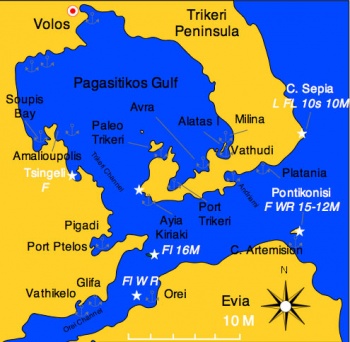
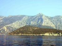
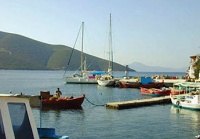
Pagasitikos Gulf (Παγασιτικός Κόλπος) or the Gulf of Volos and the Trikeri Peninsula at the foot of Mt. Pelion is the enchanted region where the centaur Chiron taught so many mythological heroes including Jason the leader of the Argonauts. This is the place where that mythical journey to the Black Sea began.
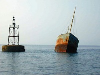
The Trikeri Channel that separates Skiathos from Evia and the mainland. In the middle of the channel there is the infamous reef Lefteris, this reef covers a very small area and it is very treacherous. The channel is very busy with traffic and many ships have found their doom on Lefteris. The list includes many of the ships from the Persian fleet of Xerxes on their way to conquer Greece in 480 BC. The reef then was called Myrmes. In Lefteris also the heroic Greek submarine Lambros Katsonis was sank with all hands except three crewmen who after swimming for 9 hours made it to Skiathos.
Inside the gulf, is a good sailing ground because there are relatively flat seas while the wind, channeled by the mountains can be quite strong.
Charts
- BA
- 1085 Kólpos Petalión to Srimonikos kólpos including Thermaikos kólpos
- 1556 Vórios Evoïkós Kólpos and approaches to Vólos
- Imray-Tetra
- G25 Eastern Sporades and North Evvoia
- NIMA
- 54349 Maliakos Kolpos
- 54351 Approaches to Volos
- Greek
- 31 North Evoikos to Kavala Gulf
- 74 Corinth to Skopelos Island
Radio Nets
Also see Cruiser's Nets
- Goast Guard - VHF channel 12
- Olympia Radio - VHF channels 03 and 60
- Cellular Phone(GSM/GPRS) - Weak signal in Paleo Trikeri
Local Weather
See Aegean Sea.
Approached to the gulf are straightforward, but inside the gulf there can be rather strong and gusty winds.
Check-in facilities
The major harbor in the area is Volos but there are many good anchorages in this region.
Ports and Popular Stops
Ports
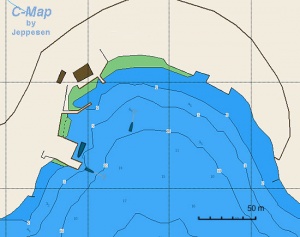
Volos (Port of Entry)
| | |
| | 39°21.5′N, 22°56.5′E |
|---|---|
| | Photo gallery |
| | Local chartlet |
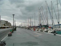
Located at the north of the gulf, Volos is a major regional centre with a population of more than 100,000 people. The city is the marine transport hub for Thessaly, Greece’s largest agricultural region, and a key ferry port for the holiday islands of the Northern Sporades. Cruise ships use the port as a base for visiting the Meteora monasteries and other local attractions.
Local Weather
In summer a southerly breeze blows onto Volos nearly every afternoon, unless it is overridden by a strong regional or local airflow (e.g. a passing cold front or thunderstorm). This breeze varies in strength but is typically 10 to 15 knots. The afternoon southerly will blow even when prevailing north-easterlies of 10 to 15 knots are blowing at the south of the gulf and in the adjacent Evia Island channel.
Check-in facilities (for Customs and Immigration and mooring formalities)
The Port Police (Coast Guard) are in the building at the southern end of the ferry quay (![]() 39°21.4616′N, 22°56.6296′E). The main office is on the first floor entered through the eastern door. It may also be necessary to go to the records office on the ground floor entered through the door on the western side of the building.
39°21.4616′N, 22°56.6296′E). The main office is on the first floor entered through the eastern door. It may also be necessary to go to the records office on the ground floor entered through the door on the western side of the building.
Mooring charges: In August 2011 the fee for a non-EU private boat mooring in Volos harbour was calculated as:
Length (m) x days x 0.23 plus 20% plus another 23% (Tax).
So a 13m yacht was charged EUR4.41 per day. It appears that an overnight stay is charged as two days as the boat will be present on two different days of the week.
In addition a departure fee of EUR0.88 was charged.
Generally the Port Police will not approach yachts. It is the responsibility of the skipper to approach them
A Hellenic Police office is located on the ferry quay, near the north-western corner (![]() 39°21.5422′N, 22°56.6834′E).
39°21.5422′N, 22°56.6834′E).
Mooring
There are a number of alternative mooring locations, each with its complications.
1. Moored stern or bows to the breakwater, or alongside the floating pontoon in the south-east of the harbour (![]() 39°21.3300′N, 22°56.9297′E). Issues here include:
39°21.3300′N, 22°56.9297′E). Issues here include:
- Avoid mooring stern or bows to the breakwater within 20m of the floating pontoon. Mooring chains and anchors have been laid to secure the pontoon. They extend an unknown distance out either side of the pontoon.
- This is a favourite place for the residents of Volos – families and groups of friends - to socialize on summer evenings. This makes for a busy, vital atmosphere into the late evening. Often some of the younger groups stay on until much later, with the pontoon being a favourite – and usually very noisy - location. As with any population a small minority can cause problems. Boats have been boarded without permission and on at least one occasion a burning cigarette butt was flicked onto a boat.
- North-east of the ‘dogleg’ in the breakwater local boats have established ‘their’ spaces. It may be possible to moor here, but it is best to check beforehand (see note below on ‘Unofficial harbourmaster’.
- The footbridge joining the breakwater to the main quay is difficult to negotiate with heavy loads or for anyone with mobility problems.
- There is no electricity on the breakwater or pontoon and water can only be obtained at the north-eastern end of the breakwater through arrangement with the ‘owners’ of the spaces (or the unofficial harbourmaster).
- The breakwater to the south-west of the floating pontoon has mooring rings in place and does not have the problems of claims by local boats or mooring chains. It is further from the town, but is otherwise suitable for mooring.
2. On the main town quay moor stern or bows to (![]() 39°21.4919′N, 22°56.8700′E). Most of this quay is reserved. Access can be arranged through contact with the unofficial harbourmaster.
39°21.4919′N, 22°56.8700′E). Most of this quay is reserved. Access can be arranged through contact with the unofficial harbourmaster.
3. In the inner fishing boat harbour moor stern or bows to (![]() 39°21.6817′N, 22°56.4871′E). Most of this quay is reserved. Access can be arranged through contact with the unofficial harbourmaster.
39°21.6817′N, 22°56.4871′E). Most of this quay is reserved. Access can be arranged through contact with the unofficial harbourmaster.
Unofficial harbourmaster
There is no port official that takes responsibility for coordinating mooring of pleasure boats in the port. An Irish man (with German and English background) has filled this gap in an unofficial capacity. Carlo is contactable on his mobile phone (6973 076 005). In addition to managing a number of the mooring points on the quay he can arrange general boat repairs and maintenance. This was the position in August 2001.
Anchoring
Inside the harbour, in an emergency, it is possible to anchor off in the eastern corner (![]() 39°21.3843′N, 22°56.9413′E). Ensure plenty of room is left for boats manoeuvring onto moorings.
39°21.3843′N, 22°56.9413′E). Ensure plenty of room is left for boats manoeuvring onto moorings.
Boats have anchored in the south-west corner (about ![]() 39°20.8948′N, 22°56.0798′E) and inside the outer breakwater (about
39°20.8948′N, 22°56.0798′E) and inside the outer breakwater (about ![]() 39°20.8673′N, 22°56.5015′E). Ensure depths are suitable and that there is plenty of room left for boats entering and leaving the port.
39°20.8673′N, 22°56.5015′E). Ensure depths are suitable and that there is plenty of room left for boats entering and leaving the port.
Last Visited & Details Checked (and updated here)
Date of member's visit to this Port/Stop & this page's details validated:
- August 2011 -- Yachtbillabong

Orei
| | |
| | 38°57′N, 23°05′E |
|---|---|
| | Photo gallery |
| | Local chartlet |
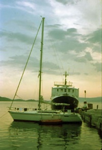
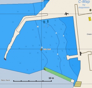
Orei (Ορεοί) or Oreios is a pleasant little harbor on the N of the large island of Evia. Moor stern-to the mole or to the iron wharf. It is also possible to anchor off. The harbor provides good protection from the meltemi but it is open to the W-NW.
Last Visited & Details Checked (and updated here)
Date of member's visit to this Port/Stop & this page's details validated:
- 1986 --Istioploos

Anchorages
Andriami Bay
![]() 39°05.2′N, 23°07′E
39°05.2′N, 23°07′E
This is a large deserted bay about 3 M E of Trikeri Point, it is open to the S. It provides some protection from the meltemi.
Anchor on the N side in 5-8 m.
Last Visited & Details Checked (and updated here)
Date of member's visit to this Port/Stop & this page's details validated:
- September 2000 --Istioploos

Ayia Kiriaki
| Ayia Kiriaki (Αγία Κυριακή) is a fishing port and a traditional boat shipyard. Last Visited & Details Checked (and updated here)Date of member's visit to this Port/Stop & this page's details validated: |
Port Trikeri
![]() 39°06.3′N, 23°06.2′E
39°06.3′N, 23°06.2′E
This is an isolated deep bay that has spectacular scenery.
Last Visited & Details Checked (and updated here)
Date of member's visit to this Port/Stop & this page's details validated:
- September 2000 --Istioploos

Avra
![]() 39°08′N, 23°10.1′E
39°08′N, 23°10.1′E
A small anchorage E of Cape Marathea. It is very pleasant.
Last Visited & Details Checked (and updated here)
Date of member's visit to this Port/Stop & this page's details validated:
- September 2000 --Istioploos

Vathudi Bay
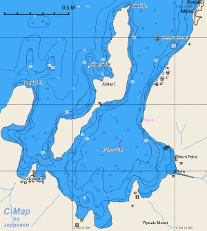
This bay on the SE corner of the Pagasitikos Gulf is protected by the island of Alatas and has several good anchorages such as Petraki, Milina, and E and S of Alatas. The bay is a popular spot with local sailboats and windsurfs.
There is no problem crossing the narrow channel between the mainland and S of Alatas. The depth is 3.5-4 m in the middle of the channel.
Last Visited & Details Checked (and updated here)
Date of member's visit to this Port/Stop & this page's details validated:
- September 2000 --Istioploos

Amalioupolis & Soupis Bay
![]() 39°11.9′N, 22°53.3′E - Chartlet
39°11.9′N, 22°53.3′E - Chartlet
There are a number of anchorages here.
Pigadhi
![]() 39°02′N, 23°0.4′E - Chartlet
39°02′N, 23°0.4′E - Chartlet
Pigadhi (Πηγάδι) is the place that Achilles sailed for the expedition to Troy.
Glyfa
![]() 38°56.9′N, 22°58.1′E
38°56.9′N, 22°58.1′E
Glyfa (Γλύφα) or Glifa is a ferry terminal to Evia. Several tavernas. It is sheltered from the meltemi but there is some swell. Anchor off.
Last Visited & Details Checked (and updated here)
Date of member's visit to this Port/Stop & this page's details validated:
- 1991 --Istioploos 13:53, 3 July 2008 (MDT)
Vathikelo
![]() 38°56.4′N, 22°56.3′E
38°56.4′N, 22°56.3′E
Vathikelo (Βαθύκελο) is about 1.5 M W of Glifa. It is a deep landlocked bay. It is a good all around shelter.
Last Visited & Details Checked (and updated here)
Date of member's visit to this Port/Stop & this page's details validated:
- 1991 --Istioploos

Marinas & Yacht Clubs
- None. There is an association of commercial yacht charter operators that apparently call themselves the Volos Yacht Club (http://www.argotrade.com/services/volos/) but their website is not operational.
Yacht Services and Repairs
Marine Stores
In Volos chandleries can be found:
- Facing and immediately north-west of the Port Authority building (
 39°21.6528′N, 22°56.5996′E)
- At the west end of the next street back from the quay (Iasonos) (
 39°21.6869′N, 22°56.5630′E
- Opposite Lidl supermarket (
 39°21.9941′N, 22°56.0594′E)
Yacht Services/Repairs/Yards
In Volos there is Pefkakia Boatyard. Contact Gregory Kartapanis (Tel +30 24210 88612; mob: +30 6945 618 847; email: [email protected]).
Fuel, Water, & Electricity
Fuel
In Volos:
- An Elin fuelling jetty is on the south western corner of the fishing boat harbour, on the southern side of the quay (
 39°21.6517′N, 39°21.6517′E).
- BP and Shell fuel stations are about 100m before the eastern end of Iasonos Street (the first street behind the waterfront street) (
 39°21.4868′N, 22°57.0061′E)
In Orei, near the harbor (have to carry jerry cans)
Water
In Volos:
- On the main town quay water is available for a charge through units that are operated using smartcards. Enquire with the unofficial harbourmaster.
- Some waterfront restaurants have outdoor taps and in the past have been willing to water cans to be filled from them. Ask before taking any water.
In Orei near the harbor (can use hose)
Electricity
In Volos on the main town quay electricity is available for a charge through units that are operated using smartcards. Enquire with the unofficial harbourmaster.
In Orei N/A (Not Available)
Offshore Islands
Paleo Trikeri
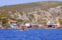
| Paleo Trikeri (Παλαιό Τρίκερι) is a small island with a delightful little harbor. If there is room, you can either moor side-to, stern-to, or anchor off. Warning: Be aware that you may have to move when either the ferry boat or the hydrofoil arrives. Ask when they are due. There are three restaurants. Last Visited & Details Checked (and updated here)Date of member's visit to this Port/Stop & this page's details validated:
|
Cape Artemision
![]() 39°02.6′N, 23°20.1′E
39°02.6′N, 23°20.1′E
The SW corner of the Pondikonisi island, just across from Cape Artemision gives good shelter from the meltemi.
Last Visited & Details Checked (and updated here)
Date of member's visit to this Port/Stop & this page's details validated:
- 1986 --Istioploos

Tourism and Things to do Ashore
Tourism
Mt. Pelio
A land expedition to Mt. Pelio with its many picturesque villages is highly recommended.
In Paleo Trikeri
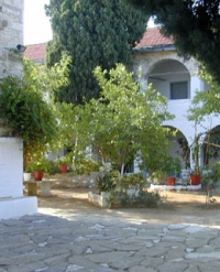
The Monastery of Panayia, built in 1829, is about 15 minute walk up the hill from the harbor. It is a nice walk and the monastery is very pleasant and well maintained.Grocery & Supply Stores
- Many motor and motor parts shops can be found along Larisis Street, the main road heading out of Volos towards the north-west (starting about
 39°21.8300′N, 22°55.7721′E).
- Hardware stores with a good range of supplies can be found at the western end of the two streets immediately back from the quay (e.g. Ianosos: (
 39°21.6970′N, 22°56.5641′E and Dimitriados: (
 39°21.7136′N, 22°56.6137′E).
- Camping gas (e.g. 3kg bottles) can be obtained in a store in the alleyway on the west side of the Galaxy supermarket towards the west end of Dimitriados Street (
 39°21.7054′N, 22°56.6929′E)
- Larger supermarkets:
- Galaxy: 200m from the Ferry jetty. Take the road that runs inland from the middle of the Port Authority building (
 39°21.6902′N, 22°56.6923′E).
- AB: Opposite the hospital, about 1km south-east of the breakwater footbridge (
 39°21.1848′N, 22°57.7358′E)
- Spar: 250m north of the Fishing boat harbour, behind the municipality precinct (
 39°21.8112′N, 22°56.3091′E)
- Carrefour (Marinoupolos): 300m north of the fishing boat harbour, along Defteras Noemvriou street (
 39°21.8662′N, 22°56.4017′E)
- AB: another 150m north of Carrefour on the opposite side of the same street (
 39°21.9392′N, 22°56.3747′E)
- Lidl: 800m north-west of the fishing boat harbour. Go west from the fishing boat harbour and after crossing the railway line take the second road to the right. (
 39°22.0252′N, 22°56.0555′E). There is also another Carrefour plus a Praktika in this ‘Old City’ shopping centre.
- Galaxy: 200m from the Ferry jetty. Take the road that runs inland from the middle of the Port Authority building (
- There are a large number of small fruit and vegetable stores and minimarkets close to the harbour. Two are:
- 250m north of the breakwater footbridge. Go inland from the footbridge and take the third street on the left to the second intersection (
 39°21.5464′N, 22°57.0658′E).
- 300m east of the ferry jetty. From the Post Office, go inland one block, then left for 70m – opposite the church (
 39°21.6227′N, 22°56.9204′E).
- 250m north of the breakwater footbridge. Go inland from the footbridge and take the third street on the left to the second intersection (
- Fresh fish can be bought from the fish market 200m west of the fishing boat harbour (
 39°21.6862′N, 22°56.2383′E) or purchased directly from the fishing boats as they return in the morning. The boats tie up on the quay between the fishing boat harbour and the ferry jetty for direct sales.
- Bicycle shops are located:
- Towards the western end of Dimitriados Street (the second street behind the waterfront street) (
 39°21.6917′N, 22°56.6623′E).
- About 200m north-east of the breakwater footbridge, on Polymeri Street, the main road leading out of town to the east (
 39°21.6917′N, 22°56.6623′E).
- Towards the western end of Dimitriados Street (the second street behind the waterfront street) (
- Telephone: Stores for three of the main suppliers (Cosmote, Vodafone and Wind) are near each other 200m from the Ferry jetty. Take the road that runs inland from the middle of the Port Authority building. (
 39°21.6509′N, 22°56.7464′E)
- The Post Office is on Dimitriados Street. Go two streets inland from the centre of the main town quay (
 39°21.5757′N, 22°56.9149′E).
- Small store.
Eateries
- Many good restaurants in Volos
- Reasonable food at the Diavlos in Paleo Trikeri
- Modest taverna in Orei
- Several tavernas in Glyfa
Internet/WiFi
In cafés in Volos.
Laundry
In Volos
- A coin-operated, self service Laundromat is 400m back from the centre of the main town quay on Gklavani Street (
 39°21.6779′N, 22°57.0356′E).
- A conventional laundry is 200m from the breakwater footbridge, continuing to the north-east (
 39°21.5063′N, 22°57.1178′E).
Motorbike & Car Rentals
- Several agencies in Volos
Garbage Disposal
There are bins around the harbors and in several anchorages.
In Volos there are no liquid waste disposal receptacles for oil, bilge water, etc. If significant quantities are involved the Port Police can arrange for a commercial company to take it. On at least one occasion this in the past there was no charge for this.
Transportation
Volos is a transport hub for the region (http://wikitravel.org/en/Volos):
- Ferry: A number of companies operate from the ferry terminal (
 39°21.5601′N, 22°56.6906′E) with ferry and hydrofoil to the nearby Northern Sporades Islands, plus connections to Limnos, Lesvos, Chios and Skyros.
- Bus: Regular services to and from Athens plus other destinations. The railway station is about 600m west from the fishing boat harbour (
 39°21.6537′N, 22°55.9819′E)
- Rail: Regular services to and from Athens plus other destinations. The railway station is about 300m north-west from the fishing boat harbour (
 39°21.8435′N, 22°56.2283′E).
- Air: Nea Anchialos National Airport about 30 km SW of the city, or 45km by road (
 39°12.9949′N, 22°47.5361′E) services limited domestic flights and seasonal international flights (http://en.wikipedia.org/wiki/Nea_Anchialos_National_Airport).
Routes/Passages To/From
Cruiser's Friends
Contact details of "Cruiser's Friends" that can be contacted for local information or assistance.
Forum Discussions
List links to discussion threads on partnering forums. (see link for requirements)
External Links
- Pagasitikos Gulf (Wikipedia)
- Volos
References & Publications
See Greece.
Last Visited & Details Checked (and updated here)
See individual ports in this page.
Personal Notes
Personal experiences?
|
|---|
|
Names: Yachtbillabong |
|
|
|---|
| | HOMEPAGE | Wiki Contents | Mediterranean | Aegean Sea | Greece | Pagasitikos Gulf | |
.
