Sea of Marmara/imagemap
From CruisersWiki
Revision as of 17:59, 27 February 2017 by
Istioploos
(
Talk
|
contribs
)
(
diff
)
← Older revision
| Latest revision (diff) | Newer revision → (diff)
Jump to:
navigation
,
search
40°41.342'N, 028°16.345'E
40.68904
;
28.27241
waypoint
There are Port(s) of Entry here
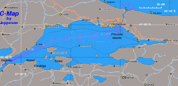
Chart of the Sea of Marmara -
For details click on a name or an area
Views
Page
Comments
View source
History
Personal tools
Forums
Log in
Navigation
HOME
WIKI CONTENTS
Countries
Countries (A to Z)
World Map
Categories
News Updates
Recent Changes
About and Contact
Register
Help
Wiki Help
Page Templates
Sandbox
The test editing page
Copyright Issues?
Report Here
Search
Toolbox
What links here
Related changes
Special pages
Printable version
Permanent link
advertisement
Friends of Cruisers Wiki
Cruisers Forum
Cruisers Log