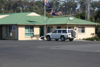
St Helens Tasmania
From CruisersWiki
| St Helens Tasmania
| |
| | |
St Helens is the northern most port on the east coast of Tasmania. The town is on the western edge of the large enclosed Georges Bay. It is a substantial regional centre, with a full range of services and good bus connections to the rest of the state.
There is a thriving fishing industry and a small marina, with a reasonable range of support services including a slipway. Access to Georges Bay is restricted by a very dangerous bar, but the local Volunteer Marine Rescue group, will, on request escort you over the bar.
When approaching from the north, either from a Bass Strait crossing or from further north in Tasmania, if you have traveled utilising an easterly weather system, conditions may be poor for crossing into Georges Bay and you may find it necessary to bypass St Helens. When approaching from the south, you are more likely to be utilising a weather system that favours a bar crossing, so long as there isn't a persistent eastery swell.
Charts
See Tasmania.
Weather
See Tasmania.
Passages
See Tasmania.
Islands
See Tasmania.
Communication
See Australia.
Contact St Helens Marine Rescue before attempting to enter Georges Bay.They monitor VHF 16 and 2524 on HF. Phone: +61 3 63762443.
If you are not familiar with the St Helens Bar, you should not attempt to cross it without assistance. Ideally cross in the last couple of hours of a rising tide. Easterly and North Easterly swells can break badly on the bar, making it unnavigable. To obtain guidance on the bar, call St Helens Marine Rescue on VHF 16. They will arrange to send a boat out to guide you over the bar. After the bar is crossed, there is a narrow channel leading into Georges Bay. Sections of this are very shallow (especially around Pelican Point) and should only be attempted on a high and rising tide by vessels with any significant draft.
Approaching Georges Bay from south, St Helens Island and St Helens Rocks are dangers to be avoided. Merrick Rock lies about 1nm east of St Helens Point.
Note that St Helens Marine Rescue are a voluntary organisation, relying on sponsorship and donations for funding. After they help you across the bar, drop by their office, say hello and make a generous donation.
Berthing
Jetties
Marinas & Yacht Clubs
St Helens Marina
Anchorages
List anchorages including the ones of nearby islands list under "Islands" above. If there is more then 1-3 paragraphs for a given anchorage, create a dedicated page for it (Port/Stop Template). Remove this section if not applicable.
- [[large Anchorage1]]
- [[large Anchorage1]]
Amenities
| Facilities | |
|---|---|
| Water | Good water is available on both jetties and the marina |
| Electricity | 240 V is available on both jetties and the marina |
| Toilets | ? |
| Showers | ? |
| Laundry | ? |
| Garbage | The St Helens Council provides limited number of rubbish bins around the waterfront, obviously not intended for disposing of large quantities of rubbish |
| Supplies | |
| Fuel | If you are prepared to haul fuel, it can be obtained from a Service Station less than a 5 minute walk from the water front |
| Bottled gas | ? |
| Chandlers | ? |
| Services | |
| Repairs | ? |
| Internet | ? |
| Mobile connectivity | Public internet is available at the library. |
| Vehicle rentals | ? |
Provisioning
- There are 2 IGA Supermarkets on the main street less than 5 minutes from the jetties.
- There is a good market each Saturday in the Library carpark.
Eating out
- Crossroads Winebar and Cafe 5/34 Quail St. Good food and live music on the weekends.
- Something Fabulous Licensed Cafe in the forum complex. Good food.
Transportation
- Callows Coaches run daily to Launceston and connect to Redline and Tassielink coaches to Hobart.
Tourism
History
Give a short history of the port.
Places to Visit
List places of interest, tours, etc.
Friends
Contact details of "Cruiser's Friends" that can be contacted for local information or assistance.
Forums
List links to discussion threads on partnering forums. (see link for requirements)
Links
- St Helens Tasmania at the Wikipedia
References
See Tasmania.
Comments
We welcome users' contributions to the Wiki. Please click on Comments to view other users' comments, add your own personal experiences or recommend any changes to this page following your visit.
Verified by
Date of member's last visit to St Helens Tasmania and this page's details validated:
- Pedro April 2012
| This page has an outline in place but needs completing. Please contribute if you can to help it grow further. Click on Comments to suggest further content or alternatively, if you feel confident to edit this page, click on the edit tab at the top and enter your changes directly. |
| |
|---|
|
Names: Pedro |


