Zaljev Raša
From CruisersWiki
Zaljev Rasa, Croatia
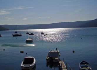
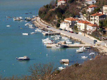
 Inlet of Zalyev Rasa from Trget - click for larger view | |
| | |
| | 44°56.58′N, 14°03.42′E |
|---|---|
| | [ Photo gallery] |
| | [ Local chartlet] |
The large natural inlet of Zaljev Rasa lies on the E coast of the Istrian peninsula in Croatia, just under 16 miles NE of Cape Kamenjak at its extreme southern tip. The inlet extends for nearly six miles inland and provides several well sheltered anchorages on its eastern side. Best shelter is to be found in the small inlet of Uvala Tunarica on the E side of Zaljev Rasa about three miles from the entrance.
Charts
British Admiralty 2719, 1426
Croatian charts 100-16, 50-3
Italian charts 924, 6001
Imray Nautical Chart M24
Radio Nets
Also see World Cruiser's Nets
Local Weather
Diurnal winds along the coast are mostly moderate during the summer months, predominantly from NW and rarely exceeding force 4/5. At night, katabatic winds off the mountains are a feature of some of the harbours along the NE Adriatic coast. During early spring and (especially) autumn conditions can be more unsettled, occasionally accompanied by violent thunderstorms - luckily of short duration - with winds of 30-35 knots or more and vicious, steep seas. In the winter the sudden, violent N wind off the mountains, the bora, is much to be feared.
Equally prevalent in winter - although not uncommon in summer - is the scirocco, a S/SE wind that blows up from North Africa, usually in advance of a depression moving E across the Mediterranean. Unlike the bora, the scirocco only occasionally exceeds gale force, but is still a phenomenon to be wary of, especially if on a lee coast.
For sources of weather forecasting, see Croatia.
The bay of Zaljev Rasa is entered at ![]() 44°56.58′N, 14°03.42′E. There are no dangers in the approach, although a heavy swell may be encountered in strong S winds. Shelter once in the inlet is good, although the bora can blow strongly down the inlet. In such circumstances, the small side inlet of Uvala Tunarica offers the best shelter. Other anchorages can be found at the small town of Trget four miles from the entrance or in the bays of Uvala Sebesnica or Uvala Teplica. A south-going current is usually experienced from the Rasa river, which flows into the northern end of the inlet.
44°56.58′N, 14°03.42′E. There are no dangers in the approach, although a heavy swell may be encountered in strong S winds. Shelter once in the inlet is good, although the bora can blow strongly down the inlet. In such circumstances, the small side inlet of Uvala Tunarica offers the best shelter. Other anchorages can be found at the small town of Trget four miles from the entrance or in the bays of Uvala Sebesnica or Uvala Teplica. A south-going current is usually experienced from the Rasa river, which flows into the northern end of the inlet.
Check-in facilities (for Customs and Immigration)
Once through the entrance, a visiting yacht has four options:
1. The small inlet of Uvala Tunarica ![]() 44°58.32′N, 14°05.82′E lies on the E side of Zaljev Rasa about three miles from the entrance. Anchor towards the N end of the inlet in 5.0 - 8.0 metres. The holding is good in mud and shelter excellent. There may also be space to moor up on the quay, where depths are 2.0 - 2.5 metres.
44°58.32′N, 14°05.82′E lies on the E side of Zaljev Rasa about three miles from the entrance. Anchor towards the N end of the inlet in 5.0 - 8.0 metres. The holding is good in mud and shelter excellent. There may also be space to moor up on the quay, where depths are 2.0 - 2.5 metres.
2. The cove of Uvala Sebesnica ![]() 44°59.04′N, 14°05.1′E on the E side of the inlet about half a mile N of Uvala Tunarica. Anchor in 8.0 - 10.0 metres and take a line ashore to the bollards. Holding is good in mud and shelter good except in strong southerlies.
44°59.04′N, 14°05.1′E on the E side of the inlet about half a mile N of Uvala Tunarica. Anchor in 8.0 - 10.0 metres and take a line ashore to the bollards. Holding is good in mud and shelter good except in strong southerlies.
3. The cove of Uvala Teplica ![]() 45°0.12′N, 14°04.56′E, also on the E side of the inlet, a further mile NW of Uvala Sebesnica. Anchor in 10.0 - 12.0 metres and take a line ashore to the bollards. Holding is good in mud and shelter is good except in strong southerlies.
45°0.12′N, 14°04.56′E, also on the E side of the inlet, a further mile NW of Uvala Sebesnica. Anchor in 10.0 - 12.0 metres and take a line ashore to the bollards. Holding is good in mud and shelter is good except in strong southerlies.
4. The small town of Trget ![]() 45°01.2′N, 14°03.36′E lies on the E side of the inlet a mile N of Uvala Teplica. Anchor clear of the piers used by the fishing boats and take a line ashore. It may be possible to lie alongside the longer of the two piers during quiet periods. Shelter is reasonably good except in southerlies.
45°01.2′N, 14°03.36′E lies on the E side of the inlet a mile N of Uvala Teplica. Anchor clear of the piers used by the fishing boats and take a line ashore. It may be possible to lie alongside the longer of the two piers during quiet periods. Shelter is reasonably good except in southerlies.
Offshore Islands and Groups
Marinas & Yacht Clubs
None.
Anchorages
See above.
Yacht Repairs and Services
Marine Stores
Submit addresses and contact details of marine related businesses that are of interest to cruisers.
Repairs/Yards
None.
Fuel, Water, & Electricity
No fuel dock anywhere in the inlet. Best to fill up before you arrive. No water or electricity.
Tourism and Things to do Ashore
Tourism
The inlet is an attractive port of call for a yacht cruising the eastern side of the Istrian peninsula, but there is little to do ashore.
Grocery & Supply Stores
- Limited provisions in the town of Trget.
Eateries
- A café and bar in Trget.
Internet/WiFi
None.
Laundry
None.
Motorbike & Car Rentals
None.
Garbage Disposal
None.
Transportation
Routes/Passages To/From
Popular passages/routes, timing, etc.
Cruiser's Friends
Contact details of "Cruiser's Friends" that can be contacted for local information or assistance.
Forum Discussions
List links to discussion threads on partnering forums. (see link for requirements)
External links
Links to relevant websites.
- Istria Tourism website: [1]
For other useful websites, see Croatia.
References & Publications
See entry for Croatia.
Last Visited & Details Checked (and updated here)
Date of member's visit to this Port/Stop & this page's details validated:
- Data compiled from web research (please update if possible)--Athene of Lymington 17:24, 27 February 2011 (GMT)
Personal Notes
Personal experiences?
|
|---|
|
Names: |
| |
|---|
| | HOMEPAGE | Wiki Contents | Croatia | Zaljev Rasa | |
