File:Baie du Carenage Anchorage.jpg
From CruisersWiki

Size of this preview: 800 × 393 pixels
Full resolution (850 × 418 pixels, file size: 47 KB, MIME type: image/jpeg)
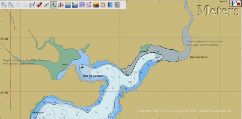
FOR INFORMATION ONLY. NOT FOR NAVIGATION PURPOSES. The anchor symbols show suitable areas to anchor. There is a mud bottom. Note that both arms of Carenage become very shallow beyond the anchorage areas and the water is unlikely to be clear enough to see rapid shoaling. Dinghy trips are marked.
File history
Click on a date/time to view the file as it appeared at that time.
| Date/Time | Thumbnail | Dimensions | User | Comment | |
|---|---|---|---|---|---|
| current | 09:34, 28 February 2013 |  | 850×418 (47 KB) | Peter McHugh (Talk | contribs) | (FOR INFORMATION ONLY. NOT FOR NAVIGATION PURPOSES. The anchor symbols show suitable areas to anchor. There is a mud bottom. Note that both arms of Carenage become very shallow beyond the anchorage areas and the water is unlikely to be clear enough to see) |
- Edit this file using an external application (See the setup instructions for more information)
File links
The following page links to this file: