Pacific Ocean
From CruisersWiki

The Pacific Ocean is the largest of the Earth's oceanic divisions. It extends from the Arctic in the north to the Southern Ocean (or, depending on definition, to Antarctica) in the south, bounded by Asia and Australia in the west, and the Americas in the east.
At 165.2 million square kilometres (63.8 million square miles) in area, this largest division of the World Ocean – and, in turn, the hydrosphere – covers about 46% of the Earth's water surface and about one-third of its total surface area, making it larger than all of the Earth's land area combined.
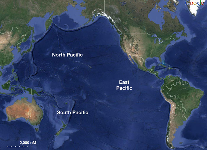
The equator subdivides the Pacific into the North Pacific Ocean and South Pacific Ocean, with two exceptions: the Galápagos and Gilbert Islands, while straddling the equator, are deemed wholly within the South Pacific. The Mariana Trench in the western North Pacific is the deepest point in the world, reaching a depth of 10,911 metres (35,797 ft).
The Pacific Ocean was sighted by Europeans early in the 16th century, first by the Spanish explorer Vasco Núñez de Balboa, who crossed the Isthmus of Panama in 1513 and named it Mar del Sur (South Sea). Its current name was given by Portuguese explorer Ferdinand Magellan during the Spanish expedition of world circumnavigation in 1521, who encountered favourable winds as he reached the ocean and called it Mar Pacifico in Portuguese, meaning "peaceful sea".
Landmass, Seamount Chains and Islands
The Pacific Ocean contains several long seamount chains, formed by hotspot volcanism. These include the Hawaiian – Emperor seamount chain and the Louisville seamount chain. The largest landmass entirely within the Pacific Ocean is the island of New Guinea— the second largest island in the world. Almost all of the smaller islands of the Pacific lie between 30°N and 30°S, extending from Southeast Asia to Easter Island; the rest of the Pacific Basin is almost entirely submerged. During the last glacial period, New Guinea was part of Australia so the largest landmass would have been Borneo–Palawan.
The great triangle of Polynesia, connecting Hawaii, Easter Island, and New Zealand, encompasses the island arcs and clusters of the Cook Islands, Marquesas Islands, Samoa, Society, Tokelau, Tonga, Tuamotu, Tuvalu and the Wallis and Futuna islands.
North of the equator and west of the International Date Line are the numerous small islands of Micronesia, including the Caroline Islands, the Marshall Islands and the Mariana Islands. Curiñanco in the coast of Southern Chile. In the southwestern corner of the Pacific lie the islands of Melanesia, dominated by New Guinea. Other important island groups of Melanesia include the Bismarck Archipelago, Fiji, New Caledonia, the Solomon Islands and Vanuatu.

Islands in the Pacific Ocean are of four basic types: continental islands, high islands, coral reefs, and uplifted coral platforms. Continental islands lie outside the andesite line and include New Guinea, the islands of New Zealand, and the Philippines. Some of these islands are structurally associated with nearby continents. High islands are of volcanic origin, and many contain active volcanoes. Among these are Bougainville, Hawaii, and the Solomon Islands.
The third and fourth types of islands are both the result of coralline island building. Coral reefs are low-lying structures that have built up on basaltic lava flows under the ocean's surface. One of the most dramatic is the Great Barrier Reef off northeastern Australia. A second island type formed of coral is the uplifted coral platform, which is usually slightly larger than the low coral islands. Examples include Banaba (formerly Ocean Island) and Makatea in the Tuamotu group of French Polynesia.
Charts
- Source
- Chart Number - Chart Name
- Chart Number - Chart Name
- Source
- Chart Number - Chart Name
Weather
Give weather conditions in the region or refer to another page (a country?) that covers these conditions.
Sources for weather information:
Currents & Tides
Give information on tides & currents.
Passages
- Trans-Pacific ("Puddle-Jump") - East to West
- Trans-Pacific Passage - West to East
- Pacific Circumnavigation
Communication
- Pacific Seafarer's Net 14.300MHz @ 0300 UTC
Also see World Cruiser's Nets.
Add any navigation notes such approaches, dangers etc here. If this section does not apply remove it.
Sectors
Friends
Contact details of "Cruiser's Friends" that can be contacted for local information or assistance.
Forums
List links to discussion threads on partnering forums. (see link for requirements)
- South Pacific topics on Cruisers Forum.
- Pacific and Australasia on Cruiser Log.
Links
- Pacific Ocean at the Wikipedia
References
- Michael Pocock/Ros Hogbin, The Pacific Crossing Guide, Second Edition, RCC Pilotage Foundation, London, ISBN 0713661828
- Warwick Clay, South Pacific Anchorages 2nd edition, Imray, ISBN 0852884826
- Earl R. Hinz, Landfalls of Paradise: Cruising Guide to the Pacific Islands, Latitude 20 Books, ISBN 0824830377
- Jimmy Cornell, World Cruising Routes: Sixth Edition, Adlard Coles, London, ISBN 007159289X
- Jimmy Cornell, World Cruising Destinations, Adlard Coles, London, ISBN 0071638245
Comments
We welcome users' contributions to the Wiki. Please click on Comments to view other users' comments, add your own personal experiences or recommend any changes to this page following your visit.
| This is a usable page of the cruising guide. However, please contribute if you can to help it grow further. Click on Comments to add your personal notes on this page or to discuss its contents. Alternatively, if you feel confident to edit the page, click on the edit tab at the top and enter your changes directly. |
| |
|---|
|
Names: Lighthouse, Redbopeep, Haiqu, Delatbabel |