Adriatic Sea/imagemap
From CruisersWiki
(Difference between revisions)
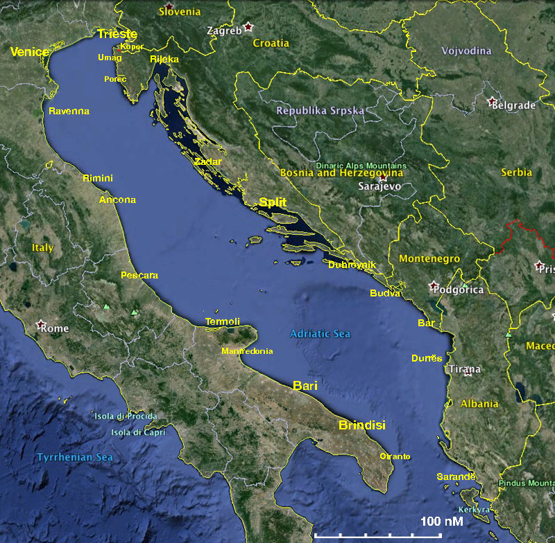
(Created page with "<imagemap> Image:AdraticSeaGoogle.jpg|frame|center|<center>Map of the Adriatic Sea Region - <em>For details click on a name or an area</em></center> rect 29 340 90 370 Italy ...") |
Istioploos (Talk | contribs) (Coords) |
||
| Line 1: | Line 1: | ||
| + | <center>{{infobox coordblock | ||
| + | | lat=42.77121|lon=15.26001|zoom=7 | ||
| + | | type=waypoint | ||
| + | }}</center> | ||
| + | |||
<imagemap> | <imagemap> | ||
Image:AdraticSeaGoogle.jpg|frame|center|<center>Map of the Adriatic Sea Region - <em>For details click on a name or an area</em></center> | Image:AdraticSeaGoogle.jpg|frame|center|<center>Map of the Adriatic Sea Region - <em>For details click on a name or an area</em></center> | ||
Latest revision as of 18:19, 21 May 2016