Okuklje
From CruisersWiki
m (Bot: Automated text replacement (-({{IsPartOf\|Mediterranean\|Adriatic Sea\|Croatia\|)(?!Southern Dalmatia) +\1Southern Dalmatia|)) |
Istioploos (Talk | contribs) (Template) |
||
| Line 1: | Line 1: | ||
{{IsPartOf|Mediterranean|Adriatic Sea|Croatia|Southern Dalmatia|Mljet}} | {{IsPartOf|Mediterranean|Adriatic Sea|Croatia|Southern Dalmatia|Mljet}} | ||
{{TOC block}} | {{TOC block}} | ||
| - | {{Infobox |42 | + | |
| + | {{Infobox | ||
| + | | lat= 42.7265|lon=17.67517 | ||
| + | | name= Okuklje | ||
| + | | portofentry= | ||
| zoom= 15 | | zoom= 15 | ||
| + | | chartlet = y | ||
| image= OkukljeAerial.jpg | | image= OkukljeAerial.jpg | ||
| - | | imagetext= Okuklje harbour from SE | + | | imagetext= Okuklje harbour from SE |
| - | | | + | | summary= The harbour of [[Okuklje]] lies on the NE coast of the island of [[Mljet]] in [[Croatia]], four miles WNW of the easternmost tip. It is situated at the head of a ‘J-shaped’ inlet, the head of which offers virtually all-around protection. As the closest of the island’s harbours to [[Dubrovnik]], Okuklje gets very busy during the peak summer months and its berthing options of restaurant quays, mooring buoys and small anchorage are soon taken up. Yachts visiting during peak periods should allow time to continue to the anchorage of [[Mljet#U. Prozura|U. Prozura]] or the harbour of [[Sobra]] if Okuklje is full to bursting. |
| - | + | | notes= | |
| - | + | | news= | |
| - | The harbour of Okuklje lies on the NE coast of the island of [[Mljet]] in [[Croatia]], four miles WNW of the easternmost tip. | + | }} |
==Charts== | ==Charts== | ||
| - | + | ''See [[Southern Dalmatia#Charts|Southern Dalmatia]]''. | |
| - | + | ||
| - | + | ||
| - | + | ||
| - | + | ||
| - | + | ||
| - | + | ||
==Weather== | ==Weather== | ||
| Line 26: | Line 25: | ||
==Communication== | ==Communication== | ||
| + | {{Green|Add here VHF channel for the coastguard, harbor masters. etc.}} | ||
| + | * | ||
* | * | ||
| Line 31: | Line 32: | ||
==Navigation== | ==Navigation== | ||
| - | There are no hazards in the immediate approach to Okuklje. | + | There are no hazards in the immediate approach to [[Okuklje]]. Depths in the harbour entrance are 10.0 -12.0 metres and in the harbour itself 4.0 - 6.0 metres. In the centre of the harbour, just E of the mooring buoys is a {{mark|type=danger|name=large rock|lat=42.72622|lon=17.67033|zoom=17}} with a red beacon on it. |
| + | |||
| + | {{Warning}}There are several other dangerous rocks inshore of the beacon to the SW and this area should be avoided. | ||
==Entrance== | ==Entrance== | ||
| - | [[ | + | [[Korčula (town)]] or [[Dubrovnik]] are the nearest year-round ports of entry. |
==Berthing== | ==Berthing== | ||
| Line 41: | Line 44: | ||
Yachts visiting Okuklje have two berthing options, both of which probably necessitate eating ashore: | Yachts visiting Okuklje have two berthing options, both of which probably necessitate eating ashore: | ||
| - | + | {{poi | lat= 42.72707|lon=17.67107 | |
| - | + | | type= harbour | |
| - | + | | name= Restaurant quays | |
| - | + | | altname= | |
| + | | url = | ||
| + | | zoom= 16 | ||
| + | | portofentry= | ||
| + | | image= | ||
| + | | imagetext= | ||
| + | | text= The quay on the N side of the inlet has moorings for 8-10 yachts laid by the restaurants ashore. Depths at the quay are 4.0 - 5.0 metres. Obviously, if you use the moorings, you eat in the restaurant that provides them. Water and electricity can be connected at most of the moorings (there may be an additional charge). These berths are quickly taken in July and August and you will need to arrive early to obtain one. | ||
| + | }} | ||
| + | {{poi | lat= 42.72644|lon=17.6695 | ||
| + | | type= bouys | ||
| + | | name= Mooring buoys | ||
| + | | altname= | ||
| + | | url = | ||
| + | | zoom= 17 | ||
| + | | portofentry= | ||
| + | | image= | ||
| + | | imagetext= | ||
| + | | text= There are a number of mooring buoys laid just W of the rock with the beacon on it. These should be approached from the N side to avoid the other rocks inshore. Depths at the buoys are 5.0 - 6.0 metres. Most of the buoys are owned by one or other of the restaurants, so you must be prepared to eat ashore if you pick one up. | ||
| + | }} | ||
| + | : | ||
===Marinas & Yacht Clubs=== | ===Marinas & Yacht Clubs=== | ||
None. | None. | ||
==Anchorages== | ==Anchorages== | ||
| - | If the quays and mooring buoys are full, it is possible with care to anchor in the entrance to the bay to the E of the rock with the red beacon. | + | {{poi | lat= 42.72612|lon=17.67112 |
| + | | type= anchorage | ||
| + | | name=E of the red beacon | ||
| + | | altname= | ||
| + | | url = | ||
| + | | zoom= 17 | ||
| + | | image= | ||
| + | | imagetext= | ||
| + | | text= If the quays and mooring buoys are full, it is possible with care to anchor in the entrance to the bay to the E of the rock with the red beacon. You will be anchoring in depths of 8.0 - 10 metres here. However, the holding is patchy and anchoring is not recommended in unsettled weather. Shelter here is adequate in most conditions, but poor in N and NE winds. | ||
| + | }} | ||
| - | == | + | ==Amenities== |
| - | + | {{tlist | |
| - | + | |header|Facilities | |
| - | + | ||
| - | + | |Water| | |
| - | + | ||
| - | + | ||
| - | ==== | + | |Electricity| {{mark | type= electricity |name= [[#Restaurant quays|Restaurant quays]] |lat= 42.72707|lon=17.67107| |zoom= 16 |text= at some of the restaurant quays}} |
| - | + | |Toilets| {{MagentaText|?}} | |
| + | |Showers| {{MagentaText|?}} | ||
| + | |Laundry| N/A (Not Available) | ||
| + | |Garbage| Limited. Take it with you | ||
| - | + | |header|Supplies | |
| - | + | |Fuel| N/A | |
| - | + | |Bottled gas| None | |
| + | |Chandlers| None | ||
| - | + | |header|Services | |
| - | + | |Repairs| N/A | |
| + | |Internet| WiFi in the restaurant "Maestral" (free) | ||
| + | |Mobile connectivity| {{Green|Is there mobile telephone signal such as G4, G3, GPRS on the island? How strong is the signal? Are there any blind spots?}} | ||
| + | |Vehicle rentals| N/A | ||
| + | }} | ||
| - | ==== | + | ==Provisioning== |
| - | + | {{mark |name= N quay | type= provisions | lat= 42.7273|lon=17.6712|zoom=17 | text= Small provisions shop.}} | |
| - | ==== | + | ==Eating out== |
| - | + | {{mark |name= ''Maestral''| type= eatingout | text=The jetty of the restaurant is found immediately on the right when entering the bay. Ten yachts can tie up to the moorings and there are two buoys in the bay. The family restaurant, now run by the third generation, is located on the opposite the S shore 10 minutes on foot from the pier. A transfer by dinghy is possible. On the roofed restaurant terrace grilled sardines, goat cheese, mussels from Sobra, ''Scampi buzara'', a brodetto of scorpionfish, risotto and, if pre-ordered, octopus or lamb ''Peka'' are served. For dessert, the chocolate soufflé is noteworthy, amongst others. The cook is the son, who studies at the gastronomic academy. Open 1300 - 2400 from 1 April to 1 November. Wifi. --Luksa2.}} | |
| - | === | + | {{mark |name= | type= eatingout | text= There are several restaurants around the bay, most with their own moorings.}} |
| - | + | ||
| - | + | ==Transportation== | |
None. | None. | ||
| + | |||
| + | ==Tourism== | ||
| + | Little to do except eating. | ||
==Friends== | ==Friends== | ||
| Line 102: | Line 140: | ||
''See [[Croatia#References|Croatia]]''. | ''See [[Croatia#References|Croatia]]''. | ||
| - | {{Comments | + | {{Comments}} |
* | * | ||
Revision as of 20:47, 30 April 2019
| Okuklje
| |
| |
 Okuklje harbour from SE |
The harbour of Okuklje lies on the NE coast of the island of Mljet in Croatia, four miles WNW of the easternmost tip. It is situated at the head of a ‘J-shaped’ inlet, the head of which offers virtually all-around protection. As the closest of the island’s harbours to Dubrovnik, Okuklje gets very busy during the peak summer months and its berthing options of restaurant quays, mooring buoys and small anchorage are soon taken up. Yachts visiting during peak periods should allow time to continue to the anchorage of U. Prozura or the harbour of Sobra if Okuklje is full to bursting.
Charts
See Southern Dalmatia.
Weather
See Croatia.
Passages
See Croatia.
Communication
Add here VHF channel for the coastguard, harbor masters. etc.
Also see World Cruiser's Nets.
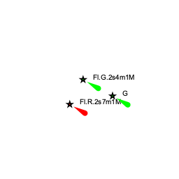
There are no hazards in the immediate approach to Okuklje. Depths in the harbour entrance are 10.0 -12.0 metres and in the harbour itself 4.0 - 6.0 metres. In the centre of the harbour, just E of the mooring buoys is a ![]() large rock [[Okuklje#large rock|large rock]] 42°43.573'N, 017°40.220'E with a red beacon on it.
large rock [[Okuklje#large rock|large rock]] 42°43.573'N, 017°40.220'E with a red beacon on it.
Warning: There are several other dangerous rocks inshore of the beacon to the SW and this area should be avoided.
Entrance
Korčula (town) or Dubrovnik are the nearest year-round ports of entry.
Berthing

Yachts visiting Okuklje have two berthing options, both of which probably necessitate eating ashore:
Restaurant quays
Mooring buoys
Marinas & Yacht Clubs
None.
Anchorages
E of the red beacon
Amenities
| Facilities | |
|---|---|
| Water | |
| Electricity | |
| Toilets | ? |
| Showers | ? |
| Laundry | N/A (Not Available) |
| Garbage | Limited. Take it with you |
| Supplies | |
| Fuel | N/A |
| Bottled gas | None |
| Chandlers | None |
| Services | |
| Repairs | N/A |
| Internet | WiFi in the restaurant "Maestral" (free) |
| Mobile connectivity | Is there mobile telephone signal such as G4, G3, GPRS on the island? How strong is the signal? Are there any blind spots? |
| Vehicle rentals | N/A |
Provisioning
![]() N quay [[Okuklje#N quay|N quay]] 42°43.638'N, 017°40.272'E Small provisions shop.
N quay [[Okuklje#N quay|N quay]] 42°43.638'N, 017°40.272'E Small provisions shop.
Eating out
![]() Maestral [[Okuklje#Maestral|Maestral]] The jetty of the restaurant is found immediately on the right when entering the bay. Ten yachts can tie up to the moorings and there are two buoys in the bay. The family restaurant, now run by the third generation, is located on the opposite the S shore 10 minutes on foot from the pier. A transfer by dinghy is possible. On the roofed restaurant terrace grilled sardines, goat cheese, mussels from Sobra, Scampi buzara, a brodetto of scorpionfish, risotto and, if pre-ordered, octopus or lamb Peka are served. For dessert, the chocolate soufflé is noteworthy, amongst others. The cook is the son, who studies at the gastronomic academy. Open 1300 - 2400 from 1 April to 1 November. Wifi. --Luksa2.
Maestral [[Okuklje#Maestral|Maestral]] The jetty of the restaurant is found immediately on the right when entering the bay. Ten yachts can tie up to the moorings and there are two buoys in the bay. The family restaurant, now run by the third generation, is located on the opposite the S shore 10 minutes on foot from the pier. A transfer by dinghy is possible. On the roofed restaurant terrace grilled sardines, goat cheese, mussels from Sobra, Scampi buzara, a brodetto of scorpionfish, risotto and, if pre-ordered, octopus or lamb Peka are served. For dessert, the chocolate soufflé is noteworthy, amongst others. The cook is the son, who studies at the gastronomic academy. Open 1300 - 2400 from 1 April to 1 November. Wifi. --Luksa2.
![]() [[Okuklje# | ]] There are several restaurants around the bay, most with their own moorings.
[[Okuklje# | ]] There are several restaurants around the bay, most with their own moorings.
Transportation
None.
Tourism
Little to do except eating.
Friends
Contact details of "Cruiser's Friends" that can be contacted for local information or assistance.
Forums
List links to discussion threads on partnering forums. (see link for requirements)
Links
- Okuklje at the Wikipedia
See also Croatia.
References
See Croatia.
Comments
We welcome users' contributions to the Wiki. Please click on Comments to view other users' comments, add your own personal experiences or recommend any changes to this page following your visit.
Verified by
Date of member's last visit to Okuklje and this page's details validated:
- July 2004 --Athene of Lymington
| This is a usable page of the cruising guide. However, please contribute if you can to help it grow further. Click on Comments to add your personal notes on this page or to discuss its contents. Alternatively, if you feel confident to edit the page, click on the edit tab at the top and enter your changes directly. |
| |
|---|
|
Names: Lighthouse, Athene of Lymington, Luksa2 |