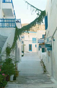
Amorgos
From CruisersWiki
Istioploos (Talk | contribs) ({{Guide2}} and several fixes) |
Istioploos (Talk | contribs) (→Amorgos: Format) |
||
| Line 76: | Line 76: | ||
===Anchorages=== | ===Anchorages=== | ||
====Kolofana Bay==== | ====Kolofana Bay==== | ||
| - | + | {| | |
| - | Kolofana Bay or Palos is a small bay about 0.5 nM E of the island's southern tip, right across from Gramvousa Island. Anchor 3-4 m at the head of the bay on sandy bottom. | + | |valign="top"|Kolofana Bay or Palos is a small bay about 0.5 nM E of the island's southern tip, right across from Gramvousa Island. Anchor 3-4 m at the head of the bay on sandy bottom. |
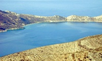
[[Image:Amorgos_Pal1.jpg|200px|thumb|center|Palos or Kolofana Bay<br/>''Click for larger view'']] | [[Image:Amorgos_Pal1.jpg|200px|thumb|center|Palos or Kolofana Bay<br/>''Click for larger view'']] | ||
| Line 96: | Line 96: | ||
* June 2003 --[[User:Istioploos|Istioploos]] 11:37, 6 June 2008 (MDT) | * June 2003 --[[User:Istioploos|Istioploos]] 11:37, 6 June 2008 (MDT) | ||
* | * | ||
| + | |||
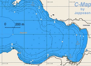
| + | |valign="top"|[[Image:Amorgos_Kolofana_h.jpg|300px|thumb|right|Chart of Kolofana Bay<br/>''Click for larger view'']] | ||
| + | |} | ||
====Cove in NE Amorgos==== | ====Cove in NE Amorgos==== | ||
Revision as of 12:17, 24 August 2008
Amorgos
Click for larger view
Background
Amorgos (Αμοργός) is the easternmost island of the Cyclades. It has an area of 121 km2 and about 1,800 inhabitants. Its tallest peaks are Mt. Krikelos at 826 m (2710 ft) at the NE end, Profitis Ilias at 698 m (2290 ft) in the middle of the island, and Mt. Korakas at 607 m (1991 ft) at the SW end.
Amorgos has been inhabited from as far back as 3300 BC. Artifacts excavated last century indicate that it traded with Milos and Egypt. Many Cycladic figurines have been unearthed from Amorgos, including the largest ever found, now in the National Museum in Athens. In the early historical period the island was colonized by the Samians, Milesians, and probably by the Naxians who settled in Minoa, Aigiali, and Kastri (modern Arkesini) respectively. They formed a commonwealth, mined their own coins, and worshipped Dionysus and Athena. During this time a fine transparent linen was produced in Amorgos which became famous to the ancient world as amorgina. After Alexander the Great, Amorgos fell under the rule of the Ptolemies and became a center for the worship of the Alexandrian gods Serapis and Isis. After the Romans occupied the island, they used it as a place for exile, a tradition which was renewed by the Junta that ruled Greece from 1967 to 1971. During the Byzantine era, it was often invaded by Goths, Vandals, and Slavs. In the Frankish period, it first became the fief of Andrea and Jeremiah Gizzi (1207) and later the fief of the Duke of Naxos Marco Sanudo. Then the Byzantines recaptured it and held it until 1269, to be followed by the Gizzis until 1309, the Sanudos until 1352, the Gizzis again in 1352, the Venetians in 1363, and finally by the Querinis of Astypalea in 1446. In 1537 it was captured by Barbarossa and eventually became part of the Ottoman Empire, which held it until the Greek War of Independence in 1821, except for a brief period of occupation by the Russians between 1770-1774. During the Ottoman period, Amorgos was a base for pirates. In the 17th century Amorgos started exporting exquisite embroideries and became quite wealthy from this trade. The island was off the beaten track for tourists until the filming there of Luc Besson's movie The Big Blue made it well known.
Charts
BA 1040 Nísos Íos to Vrakhonisídha Kandhelioússa
Imray-Tetra G34 Southern Cyclades
NIMA 54412 Nisos Amorgos & Plans in Astipalaia
Greek 423 Paros to Astypalia
Radio Nets
Also see Cruiser's Nets
- Coast Guard - VHF channel 12 & Tel. +30 22850 71 259 (Katapola)
- Olympia Radio - No VHF signal
Approaches to Amorgos are straightforward without navigational dangers. But,
Warning: There can be extremely strong gusts on the N side of the island when the meltemi blows and violent katabatic winds on the S side.
Check-in facilities
There are two ports, Katapola and Aegiali, and many anchorages.
Ports and Popular Stops
Katapola
| Katapola (Κατάπολα) [36° 49.6' B 25° 51.8' E] is the main harbor of Amorgos. It provides good shelter from the meltemi. Go stern-to to the quay at 3-5 m. The bottom is mostly sand with some rocks and weed and gives good holding. Often there is raw sewage discharge which causes an unpleasant odor, other than this Katapola is a pleasant but somewhat noisy harbor.
As another option to the harbor one can anchor off at the foot of the sandy beach just N of the harbor. Also, there is good shelter at a cove just NE of the harbor [36° 49.36' N 25° 51.26' E]. Anchor at 13 m. Good holding. Katapola can be easily reached from here with the dinghy.
Last Visited & Details Checked (and updated here)Date of member's visit to this Port/Stop & this page's details validated:
File:Amorgos Katapola1.jpg Katapola Click for larger view | File:Amorgos Katapola h.jpg Chart of Katapola Harbor Click for larger view |
Aegiali
| Aegiali (Αιγιάλη) [36° 54.2' B 25° 58.5' E] or Ayias Annas is the second harbor in Amorgos. It is located near the N end of the island. The harbor provides good shelter from the meltemi although when it is strong there cane be some swell. you can either dock side-to to the quay or anchor off-shore but within the harbor. This is preferable because you will be away from the strong lights and the maneuvering ferry. If you do so anchor at about 6 m away from the area where the ferry maneuvers. The bottom is mud and weed and provides good holding.
Warning: The information on Ayias Annas in Heikell's Greek Waters Pilot is incorrect.
Last Visited & Details Checked (and updated here)Date of member's visit to this Port/Stop & this page's details validated:
| File:Amorgos Aegiali h.jpg Chart of Aegiali Harbor Click for larger view |
Marinas & Yacht Clubs
None.
Anchorages
Kolofana Bay
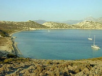
Kolofana Bay or Palos is a small bay about 0.5 nM E of the island's southern tip, right across from Gramvousa Island. Anchor 3-4 m at the head of the bay on sandy bottom.
Akrotiri BayA bay mid-way between Kolofana and Katapola. A small island, Petalidha, lies at its entrance. The bay is open to the NE. With any other weather it is a very safe anchorage. Anchor near the head of the bay in 5-8 m. The bottom is sand with light weed. A taverna is reported here but it looks abandoned. Last Visited & Details Checked (and updated here)Date of member's visit to this Port/Stop & this page's details validated:
VilakárdaA fantastic deserted narrow fiord [36° 55.5' N 25° 58.6' E] in NE Amorgos, about 3.5 nM E of Aegiali. It is totally exposed to the N but with S winds it is a great anchorage. Proceed to the head of the cove and anchor in 7 m over patch of sand, then take a stern anchor further towards the head. The bottom is coarse sand and patches of thick weed. Last Visited & Details Checked (and updated here)Date of member's visit to this Port/Stop & this page's details validated:
| File:Amorgos Kolofana h.jpg Chart of Kolofana Bay Click for larger view |
Cove in NE Amorgos
Just E of Vilakárda there is another very appealing cove [36° 55.9' N 25° 59.6' E], also suitable for S winds.
Offshore Islands
Gramvousa
Very good protection on the S side of the island [36° 48.1' N 25° 44.8' E] from the Southerlies. Looks that the protection from the meltemi should be good. Anchor in the middle of the bay in 8-12 m. The bottom has thick weed so there maybe some difficulties. It is a pleasant and deserted spot.
Last Visited & Details Checked (and updated here)Date of member's visit to this Port/Stop & this page's details validated:
| File:Amorgos Gramvousa h.jpg Chart of Gramvousa Anchorage Click for larger view |
Kalotiri Bay - Nikouria
Click for larger view
This is a rather pleasant anchorage [36° 52.9' N 25° 55.2' E], just 3 nM W of Aegiali, protected from the meltemi by Nikouria Island (Νικουριά). There are strong gusts.
Anchor under the church at 5-10 m on sandy bottom. Good holding but not everywhere (if having trouble try an non CQR anchor). The water here is very clean. Nikouria Island was once a leper colony but now there is hardly any evidence left from those days except for the foundations of some buildings.
The narrow channel between the Nikouria and Amorgos despite its name of Kakoperato (bad passage), is at least 5 m deep at its center.
Last Visited & Details Checked (and updated here)
Date of member's visit to this Port/Stop & this page's details validated:
- August 2006 --Istioploos 11:37, 6 June 2008 (MDT)
Routes/Passages To/From
Popular passages/routes, timing, etc.
Tourism & things to do ashore
Monastery of Hozoviotisa
This is the most interesting point in the island. The monastery is built within a cave on a cliff overlooking the S, stormy shore. It is one of the most dramatic sites in the Aegean.
The Monastery of Hozoviotisa (Χοζοβιώτησα) which is on the south cliffs of Profitis Ilias was founded by the Byzantine emperor Alexios Komnenos in 1088 AD. Legend has it that during the war of the iconoclasts an icon of the Madonna, reputed to be painted by St. Luke, miraculously floated from Constantinople to the cliffs of Amorgos after being cast into the sea by a pious lady who wanted to prevent its destruction. Now, this icon along with 98 precious Byzantine manuscripts, is part of the Monastery's treasure. The monastery built by Komnenos was at the location of an older monastery built around 800 AD by monks from Hozova in the Middle East, fleeing the iconoclasts.
The monastery is open 8:00-14:00 and 17:00-19:00. It is good 20 minute walk up a steep climb from the paved road. Be sure to have long pants for men and skirts for women.
Good swimming in the small beach of Ayia Anna below the road.
Minoa
Minoa is the oldest settlement on the island belonging to the late neolithic period. The site is located over the harbor of Katapola.
Chora
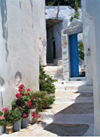
This is the capital of the island. It is 400 m above sea level, overlooking Katapola. It is a picturesque town alas with many tourists. There is nice shaded plateia (square), many churches, a small museum, and a Venetian fortress built by Geremia Gizzi in 1290 AD.
Kato MeriaThis is the south side of the island. There are some tombs and houses of ancient Arkesini near Vroútsi, a well preserved 4th century BC Hellenistic tower at Ayia Triada. Modern Arkesini is kind of disappointing. |
Ano Meria
This is the north side of the island. Its main town is the picturesque Aegiali. From there one can go to Tholaria, where there is a tholos Roman tomb, and Langáda, a picturesque village. From Langáda an unpaved road leads to the 8th century restored monastery of Ayios Ioannis Theologos and further to Stavros, a cave church with frescoes and an abandoned bauxite mine.
Fuel, Water, & Electricity
- Fuel - N/A
- Water - Limited, especially in July and August, at the quay in Katapola
- Electricity - N/A
Laundry
N/A.
Grocery Stores
There are many stores in Katapola and Aegiali.
Eateries
- At Xylokeratidi, the bay E of Katapola (walking distance) there are many pleasant restaurants
- The Vintzentos has a local specialty patatáto—lamb cooked with potatoes in a clay pot
- A good restaurant Aegiali is the Limani
- The Korali, in Aegiali, have their own fishing boat which provides with very fresh fish, but last time I ate there I was disappointed (--Istioploos 06:45, 3 May 2008 (MDT))
Motorbike & Car Rentals
Rentals are possible in both Katapola and Aegiali.
Marine Stores & Facilities
None.
Repairs
N/A.
Transportation
There are daily ferries from both Katapola and Aegiali to Naxos and other Cycladic islands and from there to Piraeus.
References & Publications
See Greece.
Cruiser's Friends
Contact details of "Cruiser's Friends" that can be contacted for local information or assistance.
Forum Discussions
List links to discussion threads on the Cruiser Log Forum
External Links
- Amorgos (Wikipedia)
Personal Notes
Personal experiences?
Last Visited & Details Checked (and updated here)
See individual ports in this page.
.
