File:Topographic map of Svalbard.png
From CruisersWiki
No higher resolution available.
Topographic_map_of_Svalbard.png (331 × 336 pixels, file size: 110 KB, MIME type: image/png)
Summary
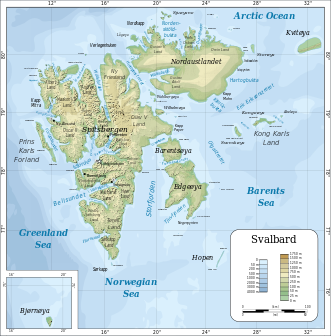
Topographic Map of Svalbard © Wikipedia
Licensing
- Creative Commons license: **cc-by-sa-1.0 Creative Commons license: **cc-by-sa-1.0
File history
Click on a date/time to view the file as it appeared at that time.
| Date/Time | Thumbnail | Dimensions | User | Comment | |
|---|---|---|---|---|---|
| current | 07:13, 22 June 2016 | | 331×336 (110 KB) | La0fd (Talk | contribs) | (Topographic Map of Svalbard © Wikipedia) |
- Edit this file using an external application (See the setup instructions for more information)
File links
The following page links to this file: