Barletta
From CruisersWiki
Istioploos (Talk | contribs) (Headings) |
m (Text replace - "#References & Publications|" to "#References|") |
||
| (37 intermediate revisions not shown) | |||
| Line 1: | Line 1: | ||
| - | + | {{IsPartOf|Mediterranean|Adriatic Sea|Italy|Adriatic Coast of Italy}} | |
| - | { | + | {{TOC block}} |
| - | + | ||
| - | + | ||
| - | | | + | |
| - | + | ||
| - | | | + | |
| - | + | ||
| - | + | ||
| - | + | ||
| - | + | ||
| - | + | ||
| - | + | ||
| - | + | ||
| - | + | ||
| - | + | ||
| - | Barletta is a large commercial port situated on the Adriatic coast of [[Italy]] at the SE end of the Gulf of Manfredonia, 12 miles NW of the port of [[Bisceglie]] and 30 miles SE of the equally large commercial port of [[Manfredonia]]. | + | {{Infobox |
| + | | lat= 41.33033| lon=16.29233 | ||
| + | | name= Barletta | ||
| + | | portofentry= y | ||
| + | | zoom= 14 | ||
| + | | chartlet = y | ||
| + | | image= BarlettaHarbour.jpg | ||
| + | | imagetext= Barletta harbour from SE | ||
| + | | summary= '''Barletta''' is a large commercial port situated on the Adriatic coast of [[Italy]] at the SE end of the Gulf of Manfredonia, 12 miles NW of the port of [[Bisceglie]] and 30 miles SE of the equally large commercial port of [[Manfredonia]]. The site is one of the oldest in southern Italy, being originally settled by the Phoenicians. Close inland of the town is the site of the ancient Battle of Cannae, where a huge Roman army was annihilated by the forces of Hannibal during the Second Punic War.<br /> | ||
| + | |||
| + | {{Warning}}The harbour has no facilities for yachts, both the Gurdia Costiera and the local Lega Navale will '''deny''' berth and should only be regarded as a port of refuge. | ||
| + | | notes= | ||
| + | | news= | ||
| + | }} | ||
==Charts== | ==Charts== | ||
| Line 26: | Line 25: | ||
: 198 | : 198 | ||
| - | == | + | ==Weather== |
| + | During the summer months, the prevailing winds in the Adriatic are light to moderate coastal sea breezes. In spring and autumn, northerly winds are more frequent and can quickly rise to near gale force, especially in the northern Adriatic, where the much-feared “bora” is caused by high pressure over the mountains to the NE coupled with low pressure over southern Italy. Fortunately, the fiercest “bora” is normally to be expected in the winter months. Thunderstorms are occasionally experienced in spring and especially autumn and can be accompanied by violent winds of gale force and above. Luckily they are rarely long-lasting. In the southern Adriatic, the “Scirocco”, a S/SE wind blowing up from North Africa which can last for several days, is more common. Unlike the “bora”, which can arrive without warning, a “scirocco” tends to build in strength over 24-48 hours, sometimes reaching gale force (especially in winter). | ||
| + | |||
| + | Sources for weather information: | ||
| + | * There is a continuous (computerized voice) weather forecast on VHF 68 - first in Italian and then followed with an English translation | ||
| + | * The same forecast is given in Italian and English on VHF coastal stations following a notification on channel 16 | ||
| + | * Navtex weather forecasts covering the Adriatic are broadcast from stations at Roma, Trieste, Kerkyra (Greece) and Split (Croatia) | ||
| + | |||
| + | ==Passages== | ||
| + | ''See [[Adriatic_Sea#Passages|Adriatic]]''. | ||
| + | |||
| + | ==Islands== | ||
| + | * [[Tremiti Islands]] | ||
| + | |||
| + | ==Communication== | ||
| + | {{Green|Add here VHF channel for the coastguard, harbor masters. etc.}} | ||
* | * | ||
* | * | ||
| Line 32: | Line 46: | ||
''Also see [[World MM Nets|World Cruiser's Nets]]''. | ''Also see [[World MM Nets|World Cruiser's Nets]]''. | ||
| - | == | + | ==Navigation== |
| - | + | The harbour is protected by two long breakwaters extending due N from the shore. The buildings of the city and silos at the port are clearly visible from distance. The harbour is entered from NNW. Depths in the entrance are 8.0 - 9.0 metres. | |
| - | + | ==Entrance== | |
| - | + | [[{{PAGENAME}}]] is a port of entry for Italy. For details ''see [[Italy#Entrance|Entrance: Italy]]''. | |
| - | + | ||
| - | + | ||
| - | == | + | ==Berthing== |
| - | + | * Berthing alongside the commercial quays is only permitted with the prior approval of the port authorities | |
| + | *: August 2103: several requests denied. --[[User:JeanF73|s/v Seatern]] 05:58, 20 September 2013 (BST) | ||
| + | * The most likely place for a yacht to find a berth is in the small basin at the SW end of the harbour, which has been excavated to a depth of 2.5 metres. The quays here and the mooring buoys are operated by the Italian ''Lega Navale''. It may be possible to moor at the quay or to pick up one of the buoys with the approval of the ''Lega Navale''. | ||
| + | *: August 2013: ''Lega Navale'' seems to only have facilities for smaller power boats; not one mast in sight. All buoys used by commercial fisherman. --[[User:JeanF73|s/v Seatern]] 05:58, 20 September 2013 (BST) | ||
| - | + | {{Note}}To get permision for using the harbour you could try contacting either the Harbour Master or Lega Navale. | |
| - | + | ; Harbour Master | |
| - | + | : : {{email|[email protected]}}; Tel: {{phone|39|0833|53 1020}}; Fax: {{fax|39|0833|883 533400}} | |
| - | + | ; Lega Navale | |
| - | + | :: {{email|barletta@leganavale.it}}; Tel/Fax: {{phone|39|0833|533 354}}; | |
| - | + | ||
| - | + | ||
| - | + | ||
| - | + | ||
| - | + | ||
| - | + | ||
| - | == | + | ==Anchorages== |
| - | + | Anchoring is NOT ANY MORE permitted in the SE corner of the harbour, clear of the commercial quays. Depths here are 3.5 - 4.5 metres and the holding is good in mud. | |
| - | + | : August 2013: permission to anchor denied by the Guardia Costiera --[[User:JeanF73|s/v Seatern]] 05:58, 20 September 2013 (BST) | |
| - | + | ||
| - | + | ||
| - | + | ||
| - | == | + | ==Amenities== |
| - | + | {{tlist | |
| - | + | |header|Facilities | |
| - | + | ||
| - | + | ||
| - | + | ||
| - | + | ||
| - | + | |Water| Some water on the Lega Navale quays | |
| + | |Electricity| Someelectrical points on the Lega Navale quays | ||
| + | |Toilets| {{MagentaText|?}} | ||
| + | |Showers| {{MagentaText|?}} | ||
| + | |Laundry| N/A (Not Available) | ||
| + | |Garbage| Bins near the harbour | ||
| - | + | |header|Supplies | |
| - | + | |Fuel| Fuel by tanker onl | |
| - | + | |Bottled gas| {{MagentaText|?}} | |
| + | |Chandlers| None | ||
| - | + | |header|Services | |
| - | + | |Repairs| Slipway. Basic repairs only | |
| - | + | |Internet| {{MagentaText|?}} | |
| + | |Mobile connectivity| {{MagentaText|?}} | ||
| + | |Vehicle rentals| Rental outlets in the town | ||
| + | }} | ||
| - | == | + | ==Provisioning== |
| - | + | Numerous provisions shops in the old town. Better ones in the new town. | |
| - | == | + | ==Eating out== |
| - | + | Several restaurants and pizzerias in the old town. | |
| - | ==== | + | ==Transportation== |
| - | + | * Buses to most other local destinations | |
| + | * Local and international flights from [[Bari]] airport (55 km) | ||
| + | * Train connections to most major cities | ||
| - | == | + | ==Tourism== |
| - | + | The old part of Barletta near the harbour has a few sites worth visiting. The well-restored castle, originally Norman but much extended, was originally built to accommodate soldiers leaving for the Crusades. The cathedral of Santa Maria Maggiore (12th/14th century) was built on the site of an early Christian basilica and contains tombs dating back to the 3rd century AD. Outside the Basilica del Santo Sepolcro in the old town is the famous Colossus of Barletta, a huge statue of an unknown eastern Roman emperor, reputedly recovered from the wreck of a ship returning from the sack of Constantinople during the Fourth Crusade in 1204. The site of the ancient Battle of Cannae can also be visited 9 km SW of the city. | |
| - | + | {{hgallery| | |
| - | + | {{himage|BarlettaCathedral.jpg| The cathedral of Santa Maria Maggiore}} | |
| - | + | {{himage|BarlettaColossus.jpg|The Colossus of Barletta}} | |
| - | + | {{himage|BarlettaCastle.jpg| The Castle of Barletta}} | |
| + | }} | ||
| - | == | + | ==Friends== |
| - | + | ||
| - | + | ||
| - | + | ||
| - | + | ||
Contact details of "Cruiser's Friends" that can be contacted for local information or assistance. | Contact details of "Cruiser's Friends" that can be contacted for local information or assistance. | ||
* | * | ||
| - | == | + | ==Forums== |
List links to discussion threads on [[Cruising Forums|partnering forums]]. (''see link for requirements'') | List links to discussion threads on [[Cruising Forums|partnering forums]]. (''see link for requirements'') | ||
* | * | ||
| - | == | + | ==Links== |
| - | + | * {{wikipedia}} | |
| + | * {{Wikivoyage}} | ||
| + | * [http://www.pagineazzurre.com/porti-della-puglia/porto-di-barletta/ Barletta] Pagine Azzurre | ||
* | * | ||
| - | |||
| - | |||
| - | |||
| - | == | + | ==References== |
| - | + | ''See [[Italy#References|Italy]]''. | |
| + | |||
| + | {{Comments}} | ||
* | * | ||
| - | + | {{Verified by}} | |
| - | + | ||
* Data compiled from web research (please update if possible)--[[User:Atheneoflymington|Athene of Lymington]] 16:38, 29 December 2010 (UTC) | * Data compiled from web research (please update if possible)--[[User:Atheneoflymington|Athene of Lymington]] 16:38, 29 December 2010 (UTC) | ||
| - | * | + | * --[[User:JeanF73|s/v Seatern]] 06:02, 20 September 2013 (BST) |
| - | + | * | |
| - | + | ||
| - | + | ||
| - | + | {{Page useable}} | |
| - | { | + | |
| - | + | ||
| - | + | ||
| - | + | ||
| - | + | ||
| - | + | ||
| - | + | ||
| - | |||
| - | |||
| - | |||
| - | |||
| - | |||
| - | |||
| + | {{Contributors|[[User:Atheneoflymington|Athene of Lymington]], [[User:JeanF73|s/v Seatern]]}} | ||
[[Category:Ports - Italy]] | [[Category:Ports - Italy]] | ||
Latest revision as of 07:39, 21 August 2018
| Barletta Port of Entry
| |
| |
 Barletta harbour from SE |
Barletta is a large commercial port situated on the Adriatic coast of Italy at the SE end of the Gulf of Manfredonia, 12 miles NW of the port of Bisceglie and 30 miles SE of the equally large commercial port of Manfredonia. The site is one of the oldest in southern Italy, being originally settled by the Phoenicians. Close inland of the town is the site of the ancient Battle of Cannae, where a huge Roman army was annihilated by the forces of Hannibal during the Second Punic War.
Warning: The harbour has no facilities for yachts, both the Gurdia Costiera and the local Lega Navale will deny berth and should only be regarded as a port of refuge.
Charts
- British Admiralty
- 186
- Italian
- 921
- 31
- 198
Weather
During the summer months, the prevailing winds in the Adriatic are light to moderate coastal sea breezes. In spring and autumn, northerly winds are more frequent and can quickly rise to near gale force, especially in the northern Adriatic, where the much-feared “bora” is caused by high pressure over the mountains to the NE coupled with low pressure over southern Italy. Fortunately, the fiercest “bora” is normally to be expected in the winter months. Thunderstorms are occasionally experienced in spring and especially autumn and can be accompanied by violent winds of gale force and above. Luckily they are rarely long-lasting. In the southern Adriatic, the “Scirocco”, a S/SE wind blowing up from North Africa which can last for several days, is more common. Unlike the “bora”, which can arrive without warning, a “scirocco” tends to build in strength over 24-48 hours, sometimes reaching gale force (especially in winter).
Sources for weather information:
- There is a continuous (computerized voice) weather forecast on VHF 68 - first in Italian and then followed with an English translation
- The same forecast is given in Italian and English on VHF coastal stations following a notification on channel 16
- Navtex weather forecasts covering the Adriatic are broadcast from stations at Roma, Trieste, Kerkyra (Greece) and Split (Croatia)
Passages
See Adriatic.
Islands
Communication
Add here VHF channel for the coastguard, harbor masters. etc.
Also see World Cruiser's Nets.
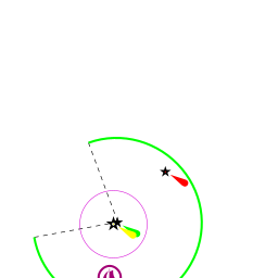
The harbour is protected by two long breakwaters extending due N from the shore. The buildings of the city and silos at the port are clearly visible from distance. The harbour is entered from NNW. Depths in the entrance are 8.0 - 9.0 metres.
Entrance
Barletta is a port of entry for Italy. For details see Entrance: Italy.
Berthing
- Berthing alongside the commercial quays is only permitted with the prior approval of the port authorities
- August 2103: several requests denied. --s/v Seatern 05:58, 20 September 2013 (BST)
- The most likely place for a yacht to find a berth is in the small basin at the SW end of the harbour, which has been excavated to a depth of 2.5 metres. The quays here and the mooring buoys are operated by the Italian Lega Navale. It may be possible to moor at the quay or to pick up one of the buoys with the approval of the Lega Navale.
- August 2013: Lega Navale seems to only have facilities for smaller power boats; not one mast in sight. All buoys used by commercial fisherman. --s/v Seatern 05:58, 20 September 2013 (BST)
Note: To get permision for using the harbour you could try contacting either the Harbour Master or Lega Navale.
- Harbour Master
- : [email protected]; Tel: +39 (0833) 53 1020; Fax: +39 (0833) 883 533400
- Lega Navale
- [email protected]; Tel/Fax: +39 (0833) 533 354;
Anchorages
Anchoring is NOT ANY MORE permitted in the SE corner of the harbour, clear of the commercial quays. Depths here are 3.5 - 4.5 metres and the holding is good in mud.
- August 2013: permission to anchor denied by the Guardia Costiera --s/v Seatern 05:58, 20 September 2013 (BST)
Amenities
| Facilities | |
|---|---|
| Water | Some water on the Lega Navale quays |
| Electricity | Someelectrical points on the Lega Navale quays |
| Toilets | ? |
| Showers | ? |
| Laundry | N/A (Not Available) |
| Garbage | Bins near the harbour |
| Supplies | |
| Fuel | Fuel by tanker onl |
| Bottled gas | ? |
| Chandlers | None |
| Services | |
| Repairs | Slipway. Basic repairs only |
| Internet | ? |
| Mobile connectivity | ? |
| Vehicle rentals | Rental outlets in the town |
Provisioning
Numerous provisions shops in the old town. Better ones in the new town.
Eating out
Several restaurants and pizzerias in the old town.
Transportation
- Buses to most other local destinations
- Local and international flights from Bari airport (55 km)
- Train connections to most major cities
Tourism
The old part of Barletta near the harbour has a few sites worth visiting. The well-restored castle, originally Norman but much extended, was originally built to accommodate soldiers leaving for the Crusades. The cathedral of Santa Maria Maggiore (12th/14th century) was built on the site of an early Christian basilica and contains tombs dating back to the 3rd century AD. Outside the Basilica del Santo Sepolcro in the old town is the famous Colossus of Barletta, a huge statue of an unknown eastern Roman emperor, reputedly recovered from the wreck of a ship returning from the sack of Constantinople during the Fourth Crusade in 1204. The site of the ancient Battle of Cannae can also be visited 9 km SW of the city.


Friends
Contact details of "Cruiser's Friends" that can be contacted for local information or assistance.
Forums
List links to discussion threads on partnering forums. (see link for requirements)
Links
References
See Italy.
Comments
We welcome users' contributions to the Wiki. Please click on Comments to view other users' comments, add your own personal experiences or recommend any changes to this page following your visit.
Verified by
Date of member's last visit to Barletta and this page's details validated:
- Data compiled from web research (please update if possible)--Athene of Lymington 16:38, 29 December 2010 (UTC)
- --s/v Seatern 06:02, 20 September 2013 (BST)
| This is a usable page of the cruising guide. However, please contribute if you can to help it grow further. Click on Comments to add your personal notes on this page or to discuss its contents. Alternatively, if you feel confident to edit the page, click on the edit tab at the top and enter your changes directly. |
| |
|---|
|
Names: Athene of Lymington, s/v Seatern |