Chania
From CruisersWiki
Istioploos (Talk | contribs) m (Period) |
Istioploos (Talk | contribs) m (Format) |
||
| Line 28: | Line 28: | ||
===Ports and Popular Stops=== | ===Ports and Popular Stops=== | ||
====Chania Harbor==== | ====Chania Harbor==== | ||
| - | + | {| | |
| - | The harbor of Chania [35° 31' N 24° 01' E] is a beautiful harbor and well protected from the ''meltemi''. The harbor consists of two sections: the West which is exposed to the North and is surrounded by a promenade with restaurants and cafes; no boats are allowed to dock there, the East which is narrow and has floating piers to accommodate the large number of boats. Unfortunately it is very crowded and hard to find a berth. If you do find a berth, you will be very lucky as you will be in heart of the picturesque old town. If you cannot, you may be able to find a berth in [[#Souda|Souda]]. | + | |The harbor of Chania [35° 31' N 24° 01' E] is a beautiful harbor and well protected from the ''meltemi''. The harbor consists of two sections: the West which is exposed to the North and is surrounded by a promenade with restaurants and cafes; no boats are allowed to dock there, the East which is narrow and has floating piers to accommodate the large number of boats. Unfortunately it is very crowded and hard to find a berth. If you do find a berth, you will be very lucky as you will be in heart of the picturesque old town. If you cannot, you may be able to find a berth in [[#Souda|Souda]]. |
The bottom is soft mud interspersed with rocks. The holding is not always secure. Many boats use two anchors. | The bottom is soft mud interspersed with rocks. The holding is not always secure. Many boats use two anchors. | ||
<font color="red">Warning:</font> When a strong northerly gale is blowing, take a line to the other side of the harbor. | <font color="red">Warning:</font> When a strong northerly gale is blowing, take a line to the other side of the harbor. | ||
| + | |||
| + | |valign="top"|[[Image:Crete_Chania_h.jpg|300px|thumb|right|Chart of Chania Harbor<br/>''Click for larger view'']] | ||
| + | |} | ||
[[Image:Crete_Hania.jpg|200px|thumb|center|The Venetian Lighthouse in Chania Harbor<br/>''Click for larger view'']] | [[Image:Crete_Hania.jpg|200px|thumb|center|The Venetian Lighthouse in Chania Harbor<br/>''Click for larger view'']] | ||
| + | |||
====Souda==== | ====Souda==== | ||
Revision as of 17:30, 24 August 2008
Chania (Port of Entry)
Background
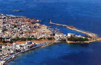
Chania or Hania or Khania (Χανιά) [35° 31' N 24° 01' E] is in my opinion the most beautiful city in Crete if not the whole Aegean. It is a delightful town. The old city is very picturesque and has the inevitable souvenir stores, rooms for rent, restaurants, and jewelry stores. A whole street is devoted to leather goods. The marketplace (food) is amazing; it is crowded with small and a large stores selling anything from meat, wines, dried fruits, to herbs, chocolates, fruits, breads, pastries, fish, flowers, etc.
Chania is the site of the Minoan settlement the Greeks called Cydonia, Greek for quince (κυδώνι - kydoni). It also flourished after the Dorian Greeks settled on Crete.
Charts
See Crete
Radio Nets
- Coast Guard - VHF channel 12 (Chania) & 09 (Souda), Tel. +30 2810 98 888
- Navy operated Souda Control - VHF channel 16
See also Crete
Weather
For details see Chania Weather.
See Crete.
Check-in facilities
There are only two harbors: Chania Harbor and Souda.
Ports and Popular Stops
Chania Harbor
| The harbor of Chania [35° 31' N 24° 01' E] is a beautiful harbor and well protected from the meltemi. The harbor consists of two sections: the West which is exposed to the North and is surrounded by a promenade with restaurants and cafes; no boats are allowed to dock there, the East which is narrow and has floating piers to accommodate the large number of boats. Unfortunately it is very crowded and hard to find a berth. If you do find a berth, you will be very lucky as you will be in heart of the picturesque old town. If you cannot, you may be able to find a berth in Souda.
The bottom is soft mud interspersed with rocks. The holding is not always secure. Many boats use two anchors. Warning: When a strong northerly gale is blowing, take a line to the other side of the harbor. | File:Crete Chania h.jpg Chart of Chania Harbor Click for larger view |
Click for larger view
Souda
Click for larger view
Souda (Σούδα) [35° 29.5' N 24° 04.5' E], about 7 km E of Chania, is the best harbor in Crete situated in the large Souda Bay. However, Souda is also a main Greek and NATO naval base. All non-Greek registered boats are prohibited from entering the bay. Greek boats, with Greek nationals are allowed but they must first obtain clearance before you enter the bay by calling the Limenarchio (Coast Guard) at +30 2810 98 888.
As soon as you enter the bay you should contact the Limenarchio (Coast Guard) in VHF channel 09. You will then be instructed to contact the Navy operated Souda Control on VHF channel 16. They will ask for your Greek ID or passport number and will then instruct you on your approach.
Once in the harbor you can moor side-to.
Warning: If you leave the boat for any length of time, make sure that all the hatches are well sealed. Freighters load wheat and the wind can bring lots of wheat germ into your cabin.
Marinas & Yacht Clubs
None.
Routes/Passages To/From
Popular passages/routes, timing, etc.
Tourism & things to do ashore
In Chania
In town visit the Archaeological Museum. It is housed in a large Venetian building and it is very well appointed. It has exhibits from the Minoan to the Hellenistic times, all well-lit and labeled. There are some very nice floor mosaics.
Also there is a Maritime Museum worth visiting.
Samaria Gorge
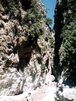
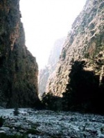
The Samaria Gorge is a "must see" place in Crete. The gorge is a 17 km walk (about 6 hours) and the visit will take a day. The best way is to take the earliest bus from Chania to Omalos where the gorge begins. From Xyloscala in Omalos you walk downhill into the gorge and eventually to the town of Ayia Roumeli on the south side of Crete. From Ayia Roumeli, where you can have lunch, you take a local boat to Hora Sphakion and from there a bus back to Chania. It is good to have water and something to eat with you during the hike.
The way down is very, very, steep and slippery. Having good shoes is very useful. It is very green with pine and cedar trees. The path starts at an altitude of 1,235 m and descends in switch backs, with a crude wooden rail at the most slippery spots, down to 600 m in less than 3 km. At that point, the going becomes easier and the scenery is magnificent with the high peaks towering over the gorge. There is water flowing in the gorge, even in October, not a lot but it is crystal clear. There are many fountains of icy cold pure water along the path. There are also plenty of tourists, way too many. The path is rough but less difficult to walk on than the one in the Hohlakies gorge.
Fuel, Water, & Electricity
- Fuel - In Chania Harbor a mini-tank delivers, in Souda you will have to carry jerry-cans from a local filing station
- Water -Available in the quay of Chania Harbor but not in Souda
- Electricity - N/A
Laundry
Grocery & Supply Stores
- There good supermarkets in both Souda and Chania
- The food market in Chania is amazing; it is crowded with small and a large stores selling anything from meat, wines, dried fruits, to herbs, chocolates, fruits, breads, pastries, fish, flowers, etc.
Eateries
- Many good tavernas
- The Grill (Οβελιστήριο) across from Souda Harbor is worth trying
Internet/WiFi
In Cafés.
Motorbike & Car Rentals
- Many agencies in Chania.
Marine Stores & Facilities
- A very basic chandlery in Chania
- A larger chandlery in Souda
Repairs
- There several machinists in Chania
Transportation
There are daily, and in the summer several per day, flights and ferries to Athens.
References & Publications
See Greece.
Cruiser's Friends
Contact details of "Cruiser's Friends" that can be contacted for local information or assistance.
Forum Discussions
List links to discussion threads on the Cruiser Log Forum
External Links
- Chania (Wikipedia)
Personal Notes
Personal experiences?
Last Visited & Details Checked (and updated here)
Date of member's visit to this Port/Stop & this page's details validated:
- October 1997 --Istioploos 13:40, 23 July 2008 (MDT)
.


