Ithaca
From CruisersWiki
Ithaca
An online cruising guide for yachts sailing to Ithaca.
| | |
| | 38°21.91′N, 20°43.11′E |
|---|---|
| | Photo gallery |
| | Local chartlet |
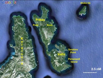 Satellite view of Ithaca - Click for larger view Satellite view of Ithaca - Click for larger view
| |
Overview
Ithaca or Ithake (Ιθάκη) or Ithaka has an area of about 95 km2, is 29 Km long and 6.5 km wide. There are about 2500 inhabitants. It is a beautiful island, a favorite, in the Ionian.
Ithaca has a long history. As everyone knows, Mycenian Ithaca was the home of Odysseus. During this time (1500-1100 B.C.) Ithaca rose to the highest level of its ancient history. The island became the capital of the Cephalonians states, which included the surrounding islands, and the opposite lands, and was referred to as one of the most powerful states of that time. The lthacans were characterized as great navigators and explorers with daring expeditions reaching further than the Mediterranean Sea. On classical times the island was under the influence of Corinth and declined. In Roman times (180 B.C.-394 A.D.) the island was part of the province of Illyria. In Byzantine times (394-1185 A.D.) Ithaca was annexed to Cephallonia and both islands were under the authority of the Epirus province. The Byzantine Empire coerced the population into paying heavy taxes for any property or income they owned. The inhabitants had to deal with invasions from pirates, which forced them to seek refuge up in the mountains, where they established their homes and remained there until the Venetian rule. During this period the Christian religion was instituted and churches and monasteries were erected in different areas of Ithaca. The Norman Occupation (1185-1204 AD.) is the first in a number of continuous but rather short dominations, which altogether lasted for almost three centuries.
During the Crusades the Normans ruled Ithaca which became part of the Cephallonian-Zante county and was somewhat neglected. The county is ceded by the Normans to the Orsini Family of Rome (1204-1357 A.D.) who controlled the island by force with the cooperation of the pirates. The Orsinis' rule was ended by King Richard of Napoli, who placed the county under the jurisdiction of the Toques Family (1357-1479 A.D.) The Toques strengthened the county developing it into an independent state with a well equipped army and a naval fleet. They kept their authority until 1479. They abandoned the islands when they were informed that the then very powerful Turks were planning to annex the island to the Ottoman Empire. In 1479 the Turkish forces landed on the islands setting the villages on fire, plundering, killing people and taking them captives. Ithaca became desolate and isolated. Many of the people fled from the island out of fear of the Turkish occupiers. Those that remained, were hiding up in the mountains to avoid the pirates who controlled the channel between Cephallonia and Ithaca and the bays of the island. In the following five years the Turks, Toques and Venetians placed claims on the islands diplomatically. The possession of the islands were finally given to the Turkish Empire (1484-1499 A.D.). During this time the Venetians had strengthened into major power with an organized fleet. The Ionian islands were part of their pursuits, and in 1499 a war between the Venetians and the Turks started. Ithaca, and the other islands were besieged by the allied fleets of the Venetians and the Spanish. The fleets prevailed, and from 1500 A.D. the Venetians controlled the islands. According to a treaty of 1503, Ithaca, Cephallonia and Zante belonged to the Venetians, and Lefkas to the Turks.
The Venetian rule (1504-1797 A.D.) of Ithaca officially began in 1504 with an appointed governor representing Venice. In order to build up Ithaca, the Venetians offered the sale of land for cultivation leaving a tax free period for the first five years. During the Venetian occupation Ithaca was considered a semi-independent island ruled with a liberal and democratic system, and was the only Ionian island where no aristocracy, upper and lower classes existed. Production, export and shipping were the main factors of the economical and social improvement on the island. The population steadily increased to 4,500 by the middle of the 17th century and reached a total of 10,000 at the end of the Venetian period. In that period the systematic cultivation, especially that of the raisin, which large amounts were exported, brought about a better economical situation for the people. In the same century ships were built on the island to confront the pirates. Within a short period of time a remarkable naval force was created with the over fifty large ships in its fleet and many excellent sailors from the population.
A few years after the French Revolution, the Ionian area came under the rule of the French Democrats (1797-1798 A.D.) and the island became the honorary capital of Cephallonia, Lefkas, and part of the Greek mainland which formed the Ithaca country. The population welcomed the French, who took care in the control of the administrative and judicial systems, but later the heavy taxation they demanded, caused a feeling of indignation among the people. During this short historical period the new ideas of system and social structure greatly influenced the inhabitants of the island. At the end of 1798 the French were succeeded by Russia and Turkey (1798-1807 A.D.) which were allies at that time. Corfu became the capital of the Ionian States, and the form of government was democratic with a fourteen member senate in which Ithaca had one representative. The Ithaca fleet flourished when it was allowed to carry cargo up to the ports of the Black Sea. In 1807, according to an agreement with Turkey the Ionian islands, once again, came under the French rule (1807-1809 A.D.). The French quickly began preparing to face the English fleet, which had become very powerful, by building a fort in Vathy.
In 1809 England gained possession of the Ionian Sea and Ithaca after the siege on the French fort at Vathy. Under the English rule (1809-1864 A.D.) The United States of the Ionian Islands was formed, governed by a constitution, which was imposed in 1817, and Ithaca was represented in the Ionian Senate by one member. In the years of the Greek Revolution against the Turkish occupation, Ithaca was one of the islands where hospitality and medical care were offered to the revolutionaries. A number of Ithacans also participated in the Greek fleet. The population steadily increased and reached a total of 15,000 by the end of the English period. A few people emigrated most drawn to Romania, the number of sailors were increasing and several Ithacans kept high positions either in intellectual or financial areas in Europe. The island and the people were progressing in all fields and there was a lot of construction including that of the road from Vathy to Northern Ithaca. During the last years of the English rule three main parties were formed. The most important of the three was the Radical Party which supported the Union with Greece. Finally, because of the international situation in Europe, and after a series of negotiations, England granted the Ionian islands to Greece in 1864.
In WWII the island was first occupied by the Italians who were followed by the Germans. During this time the inhabitants suffered. A 7.2 earthquake damaged most of the buildings in the 1953 and many had to be rebuild. Finally in more recent times, Ithaca, like many other Greek islands, was invaded by the tourists.
Charts
- BA
- 203 Nisos Zakinthos to Nisos Paxoi
- 1557 Argostoli Port
- Imray-Tetra
- G12 Nísos Levkas to Nísos Zákinthos
- NIMA
- 54280 Corfu Channel to Nisis Proti
- Greek
- 30 Kefalonia, Ithaki
Radio Nets
- Coast Guard - VHF channel 12
- Olympia Radio - VHF channel 03
Also see World Cruiser's Nets.
Weather
- See Ionian Sea Weather
- Also see Ionian Sea Currents & Tides
All approaches are straightforward. Be prepared for some strong katabatic winds entering the outer harbour.
Berthing Options
Ports
Vathi
![]() 38°21.91′N, 20°43.11′E
38°21.91′N, 20°43.11′E
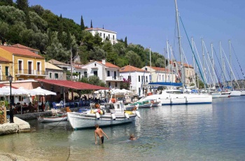
Vathi (Βαθύ) or Vathy or Port Vathi is the main harbor of the island. You can either moor stern-to along the quay or anchor off the E side. The bottom is mud and weed and the holding is not always good.
When approaching Vathi bay you will find on the left site a restaurant with a quay. This one is usually well occupied which also means it must be good. The north side of the harbor is quite shallow which is good for motor but not so good for sailing boats. The southwest part provides better depth for sailing boats but don't go to far into the bay. When the ferry comes traffic toward the town and noise will increase dramatically. Rodger 08:08, 6 May 2010 (UTC)
Last Visited Details Checked (and updated here)
Date of member's visit to this Port/Stop & this page's details validated:
- June 1995 --Istioploos

- June 2009 --Rodger

- May 2012 - Monterey

Frikes
![]() 38°27.6′N, 20°39.89′E
38°27.6′N, 20°39.89′E
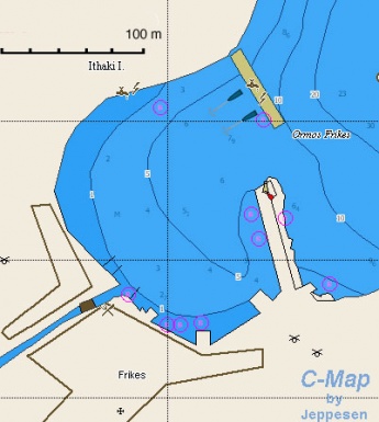
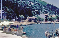
Frikes (Φρίκες) is a small harbor in the NE. You can moor side-to, if there is room. The small village is charming and the food is good.
Last Visited & Details Checked (and updated here)
Date of member's visit to this Port/Stop & this page's details validated:
- July 1988 --Istioploos

- May 2010 Although Frikes is a nice little place, it is treacherous if the wind changes to the East and is funneled into the harbour. This happened to me in 2008 and we nearly had the boat washed up onto the north quay. Pilot books warn of the prevailing westerly, but not the easterlies.Suggest you are not tempted to moor alongside north quay. --Fourplay 13:01, 8 May 2010 (UTC)
Kioni
![]() 38°26.9′N, 20°41.5′E
38°26.9′N, 20°41.5′E
Kioni (Κιόνι) or Port Kioni is a pleasant village. Anchor on the S corner or moor stern-to the quay. The bottom is hard mud and weed. Holding is not always good.
Warning: Strong down down-draughts and gusts from the NW.
Last Visited & Details Checked (and updated here)
Date of member's visit to this Port/Stop & this page's details validated:
- June 1995 --Istioploos

- July 2005 --Atheneoflymington 16:55, 12 January 2010 (UTC)
Anchorages
Polis
That very Moment
great Odysseus woke from sleep on native ground at last—
he'd been away for years—but failed to know the land,
for the goddess Pallas Athena, Zeus's daughter,
showered mist over all ...
Odyssey Book 13:213 (Trans Robert Fagles)
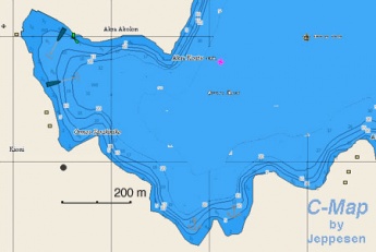
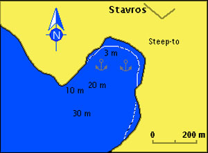
Polis (Πόλις) is the cove where it is believed that Odysseus first landed on his return to Ithaca. Anchor in the middle of the cove. It safe to leave the boat and visit Stavros, about 30 minutes uphill, where it is believed that Odysseus' palace was located.
Last Visited & Details Checked (and updated here)
Date of member's visit to this Port/Stop & this page's details validated:
- June 1995 --Istioploos

Sarakino Point
Is a small cove N of Parapigadi Island.
Marinas & Yacht Clubs
None.
Offshore Islands
Parapigadi Island
![]() 38°20.1′N, 20°44.8′E
38°20.1′N, 20°44.8′E
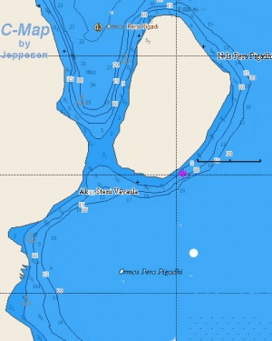
Parapigadi Island is a pleasant and deserted anchorage. Anchor in 4-5 m between Ithake and the island. Reasonable holding. There are also 2 small coves just few hundred meters to the south.
Warning: It is reported that large rats live on the island. Do not tie a line to the small quay.
Last Visited & Details Checked (and updated here)
Date of member's visit to this Port/Stop & this page's details validated:
- July 1988 --Istioploos

Yacht Services and Repairs
Marine Stores
None, only fishing supplies.
Yacht Services/Repairs/Yards
Minimal.
Fuel, Water, & Electricity
- Fuel
- In gas station in Vathi, carry cans
- Water
- N/A (Not Available)
- Electricity
- N/A
Things to do Ashore
Tourism
In Vathi
The Archaeological Museum has exhibits from the Geometric to the Roman periods.
Stavros
It is believed that Odysseus' palace was located here. There is a small Museum.
Grocery & Supply Stores
- Good shopping in Vathi
- The local wine is worth buying
Eateries
- Nickos near the square is one of the best tavernas in the Ionian. Great roast meats and prepared Greek dishes
- In Vathi, try the Eumeos (Εύμαιος), there are also several other tavernas there
- Good food in Frikes
Internet/WiFi
Internet Café in Vathi
Laundry
?
Motorbike & Car Rentals
In Vathi.
Garbage Disposal
There are bins around the harbor and in several anchorages.
Transportation
There are daily ferries to Cephalonia and Patras.
Routes/Passages To/From
Cruiser's Friends
Contact details of "Cruiser's Friends" that can be contacted for local information or assistance.
Forum Discussions
List links to discussion threads on partnering forums. (see link for requirements)
External Links
References & Publications
See Ionian Sea.
Personal Notes
Personal experiences?
Last Visited & Details Checked (and updated here)
Date of member's visit to this Island & this page's details validated: See individual ports in this page.
|
|---|
|
Names: Lighthouse, Istioploos, Athene of Lymington, Rodger, Fourplay, Monterey |
| |
|---|
| | HOMEPAGE | Wiki Contents | Mediterranean | Ionian Sea | Greece | Ithaca | |

