Leros
From CruisersWiki
Leros
Click for larger view
Background
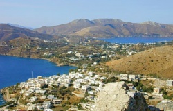
Leros (Λὲρος) is a fairly low an island of 53 km2 and 8,000 inhabitants. It has many beautiful beaches and unspoiled villages and a wildly serrated coastline. Poor Leros, she has been downgraded for centuries. First, the name which means "dirty" and "malodorous." Then, the large psychiatric hospitals, then the terrible legacy of the very destructive Battle of Leros during the WW II when she was bombarded for over 50 days and finally invaded by the Germans in a dramatic landing. During the days of the junta Leros was a place of exile and torture housing the infamous prison of Partheni. Finally, in more recent time it has received some very bad press concerning the condition in the remaining psychiatric hospital.
The island has been inhabited since prehistoric times. The first inhabitants were most likely Pelasgians, Lelekes, and Karians. They were followed by the Dorians who were succeeded by the Ionians from Miletus. Homer mentions Leros, together with Kalymnos, as the "Kalydian islands" and included them in his Catalogue of Ships in the Iliad.
Leros was the sacred island of Artemis. According to the Mythology, after the death of the hero Meleager (the killer of the Calydonian Boar), Artemis took pity on the sorrow of his sisters and turned them into a guinea fowl and put them in her temple at Partheni.
Leros was occupied by the Persians who departed after their defeat in Salamis. During the Peloponnesian War, Leros sided with Sparta. In the Roman times, Leros and the surrounding islands were dominated by pirates. During the Byzantine times the island was part of the Samos prefecture. In 1316 AD Leros was taken by the Knights of St. John and was governed by the Duke of Naxos. From 1455 until 1527 the island was ravaged by pirates until finally it was occupied in 1527 by the Ottomans. In 1821, Leros took part in the War of Independence and became part of the new Greek state. In 1912, along with the rest of the Dodecanese, Leros fell under the Italians who held it until 1943. During this period the Italians built the town of Lakki. They were succeeded by the allied forces, mostly British. The island was then invaded by a large force of German paratroopers and many buildings were destroyed during the Battle of Leros (November 12-16, 1943). The Germans held Leros until the end World War II, when it was united with the rest of Greece in 1948. During the terrible years of the Greek junta (1967-74) the military camp in Partheni was used as a concentration camp for political prisoners.
Music making is a long tradition in Leros. Even today one can encountered live music here with traditional instruments such as: santouri (dulcimer), tsanbouna (bagpipes), lagouto (lute), and thelyra (a small violin-like instrument). The traditional songs and dances are: the Issos Lerikos, the Sousta, the Stavrotos, the Passoumaki, and the Dance of the Broom.
Charts
BA 2682 Kolpos Patalion to Nisos Nisiros
BA 3926 Lero island and approaches
Imray-Tetra G34 Southern Cyclades
NIMA 54400 Samos to Rodhos
Greek 451 Leros to Rhodos
Radio Nets
Also see Cruiser's Nets
Coast Guard - VHF channel 12
The approaches to Leros are straightforward.
Danger: With a strong meltemi there are violent gusts when entering the bays of Lakki and Alindas. Also, with strong southerlies there are gusts and large swells in the bay of Lakki.
Check-in facilities
See Ports
Ports and Popular Stops
Lakki
Click for larger view
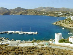
This is the main harbor of the island. It is located on the W side of the island. Lakki (Λακκί) [37° 08' N 26° 51' E] is a deep inlet and it is the largest harbor of the Dodecanese and it affords all around protection. On the N side of the harbor there is small marina operated by Agmar see below.
On the S side there is the Evros shipyard and marina, see below.
You can anchor off in front of the town at 3-5 m depth. There may be some uncomfortable swell but with northerlies it safe. The bottom is mud and provides good holding.
Lakki is a strange town, not very attractive, but one can find any necessary provisions. It was built by Mussolini and it reflects a fascist architecture. It reminds one of a De Chirico painting.
Pandéli
Click for larger view
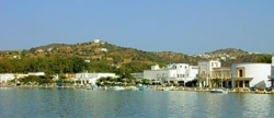
Pandéli (Παντέλι) or Panali is a small harbor on the E side of the island. Come side-to. There is room only for a few yachts. It is reported that during a strong meltemi, there is an uncomfortable swell.
Marinas & Yacht Clubs
Anchorages
Xerocambos
Click for larger view
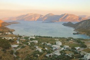
Xerocambos (Ξηρόκαμπος) or Xirocambos [37° 06.5' N 26° 52.4' E] is a very attractive and large anchorage is on the S side of the island. It affords very good protection from the meltemi but it is exposed the S. The bottom is mostly weed and holding is not always very good. Look for a spot of sand and anchor at 5-6 m. Once the anchor holds the cove is very secure. There are two attractive tavernas ashore, the one on the W side Aloni (Lefteris and Evelyn) is particularly friendly to yachtsmen. It is about 1 hr. walk to Lakki which is also served by bus. Two of the tavernas provide free layed moorings.
About an hour walk up the ridge on the E side of Xerocambos there is an abandoned WW II Italian house with wall frescoes painted by the Italian soldiers garrisoned there.
Vromolithos
Vromolithos (Βρωμόλιθος) is a small anchorage on the SE side of the island, looks very attractive, with room for a yacht or two to anchor off-shore under the protection of the NW bight. It appears to afford good protection from the meltemi. There is a good restaurant ashore.
Alindas
Click for larger view
´Alindas (Άλινδας) or Alinda [37° 09.5' N 26° 51' E] is large bay that does not appear to be as protected from the swell raised by a strong meltemi. Nevertheless, on calm weather, it is an attractive spot. There is an interesting folklore/WW II museum in a nicely maintained private mansion, the Bellini Tower.
Routes/Passages To/From
Popular passages/routes, timing, etc.
Tourism & things to do ashore
List places of interest, tours, eateries, etc.
Fuel, Water, & Electricity
Laundry
Grocery Stores
Eateries
Motorbike & Car Rentals
Marine Stores & Facilities
Submit addresses and contact details of marine related businesses that are of interest to cruisers.
Repairs
Transportation
Transportation to mainland or other countries, etc.
References & Publications
Publications, Guides, etc.
Cruiser's Friends
Contact details of "Cruiser's Friends" that can be contacted for local information or assistance.
Forum Discussions
List links to discussion threads on the Cruiser Log Forum
External Links
- Leros (Wikipedia)
Personal Notes
Personal experiences?
.
