Lignano
From CruisersWiki
m (bot: Personal notes replacement) |
m (Text replace - "#References & Publications|" to "#References|") |
||
| (18 intermediate revisions not shown) | |||
| Line 1: | Line 1: | ||
{{IsPartOf|Mediterranean|Italy|Venice to Trieste}} | {{IsPartOf|Mediterranean|Italy|Venice to Trieste}} | ||
{{TOC block}} | {{TOC block}} | ||
| - | + | ||
| - | {{Infobox |45 | + | {{Infobox |
| - | | | + | | lat= 45.70354| lon=13.1525 |
| + | | name= Lignano (Sabbiadoro) | ||
| + | | portofentry= | ||
| + | | zoom= 14 | ||
| + | | chartlet = y | ||
| image= LignanoPeninsula.jpg | | image= LignanoPeninsula.jpg | ||
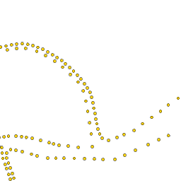
| - | | imagetext= The Lignano peninsula from the NE | + | | imagetext= The Lignano peninsula from the NE |
| - | + | | summary= The settlement of '''Lignano''' (or to give it its full name, Lignano Sabbiadoro) lies at the end of a peninsula on the Adriatic coast of [[Italy]], 5 miles NE of the river marinas of [[Lignano Riviera]] and at the western entrance to the [[Laguna di Marano]]. Until the early 20th century, Lignano was an isolated fishing community with few links to the mainland. Since the advent of tourism in the early 1900s, the Lignano peninsula has become one of the most thriving tourist destinations in the northern Adriatic. While its beaches are thronged with sun worshippers during the summer, there are still quiet spots to be found in the lagoon and the area retains much of its former richness in flora and fauna. Yachts visiting Lignano have a choice of the huge 1200 berth [[Marina Punta Faro]] or the smaller municipal basin of [[Darsena Porto Vecchio]] with 400 berths. | |
| - | The settlement of Lignano (or to give it its full name, Lignano Sabbiadoro) lies at the end of a peninsula on the Adriatic coast of [[Italy]], | + | | notes= |
| - | + | | news= | |
| - | + | }} | |
| - | + | ||
| - | + | ||
| - | + | ||
| - | + | ||
| - | + | ||
| - | + | ||
| - | + | ||
==Charts== | ==Charts== | ||
| Line 26: | Line 23: | ||
: 39 | : 39 | ||
| - | == | + | ==Weather== |
| + | During the summer months, the prevailing winds in the Adriatic are light to moderate coastal sea breezes. In spring and autumn, northerly winds are more frequent and can quickly rise to near gale force, especially in the northern Adriatic, where the much-feared “bora” is caused by high pressure over the mountains to the NE coupled with low pressure over southern Italy. Fortunately, the fiercest “bora” is normally to be expected in the winter months. Thunderstorms are occasionally experienced in spring and especially autumn and can be accompanied by violent winds of gale force and above. Luckily they are rarely long-lasting. Fog is a further hazard often encountered in the lagoon of Venice, especially in the early and late season. | ||
| + | |||
| + | Sources for weather information: | ||
| + | |||
| + | * There is a continuous (computerized voice) weather forecast on VHF 68 - first in Italian and then followed with an English translation | ||
| + | * The same forecast is given in Italian and English on VHF coastal stations following a notification on channel 16 | ||
| + | * Navtex weather forecasts covering the Adriatic are broadcast from stations at Roma, Trieste, Kerkyra (Greece) and Split (Croatia) | ||
| + | |||
| + | ==Islands== | ||
| + | * Isola de Martignano | ||
| + | * Isola di Sant’Andrea | ||
| + | |||
| + | ==Communication== | ||
| + | {{Green|Add here VHF channel for the coastguard, harbor masters. etc.}} | ||
* | * | ||
* | * | ||
| Line 33: | Line 44: | ||
| - | == | + | ==Navigation== |
| - | The entrance to Lignano, which is also the main, westernmost entrance to the [[Laguna di Marano]], is at | + | The entrance to Lignano, which is also the main, westernmost entrance to the [[Laguna di Marano]], is at entrance of the {{mark | lat= 45.69994| lon=13.15765 |zoom=15| type= waypoint| name= Canale di Marano}}. Dangerous sandbanks extend offshore for over a mile on either side of the entrance and the safe water between the banks (which shift constantly) is marked by a red and white fairway buoy situated about 1.5 miles SSE of the channel. Yachts entering should pass within 50 metres of the buoy, which is moved to reflect the shifts, before turning on a course of c. 355 degrees to cross the bar and pick up the channel, which is marked with wooden posts (white to starboard and red to port). Depths in the channel are around 6.0 metres, but can be as little as 2.5 metres over the bar. The entry should therefore only be attempted close to high water and on a rising tide and never in strong onshore winds. Once in the channel, proceed for about a mile and the entrance to [[Marina Punta Faro]] will be visible to port. |
| + | |||
| + | For the entrance to the basin of [[Darsena Porto Vecchio]], continue W up the channel that passes the entrance to the [[Marina Punta Faro]] and along the curved breakwater until the basin opens up to port after 600 metres. | ||
| - | ==Berthing | + | ==Berthing== |
===Marinas & Yacht Clubs=== | ===Marinas & Yacht Clubs=== | ||
There are two berthing options in the river: | There are two berthing options in the river: | ||
| - | + | {{poi | lat= 45.70226| lon=13.14645 | |
| - | + | | type= marina | |
| + | | name= [[Marina Punta Faro]] | ||
| + | | altname= | ||
| + | | url = | ||
| + | | zoom= 14 | ||
| + | | portofentry= | ||
| + | | image= | ||
| + | | imagetext= | ||
| + | | text= The marina has 1200 berths for yachts up to 35 metres in depths of 2.5 - 3.5 metres. | ||
| + | }} | ||
| - | + | {{poi | lat= 45.69705| lon=13.14358 | |
| + | | type= marina | ||
| + | | name= [[Darsena Porto Vecchio]] | ||
| + | | altname= | ||
| + | | url = | ||
| + | | zoom= 15 | ||
| + | | portofentry= | ||
| + | | image= | ||
| + | | imagetext= | ||
| + | | text= he marina has 400 berths for yachts up to 16 metres in depths of 2.5 - 3.0 metres. | ||
| + | }} | ||
| - | + | ==Anchorages== | |
| - | Yachts can anchor with care anywhere in the lagoon providing they do not obstruct the channels. | + | Yachts can anchor with care anywhere in the lagoon providing they do not obstruct the channels. |
| - | + | {{Note}}Fore and aft anchors are necessary to avoid swinging into the channel with the tides. | |
| - | + | ||
| - | + | ||
| - | == | + | ==Amenities== |
| - | + | {{tlist | |
| - | {{ | + | |
| - | + | ||
| - | + | |header|Facilities | |
| - | + | ||
| - | + | |Water| In [[Marina Punta Faro]] and [[Darsena Porto Vecchio]] | |
| - | + | |Electricity| In [[Marina Punta Faro]] and [[Darsena Porto Vecchio]] | |
| + | |Toilets| In [[Marina Punta Faro]] and [[Darsena Porto Vecchio]] | ||
| + | |Showers| In [[Marina Punta Faro]] and [[Darsena Porto Vecchio]] | ||
| + | |Laundry| In [[Marina Punta Faro]] | ||
| + | |Garbage| Bins in [[Marina Punta Faro]] and [[Darsena Porto Vecchio]] | ||
| - | + | |header|Supplies | |
| - | + | |Fuel| In [[Marina Punta Faro]] station on the quay (0800-1200 & 1400-1800); and [[Darsena Porto Vecchio]] | |
| - | {{ | + | |Bottled gas| {{MagentaText|?}} |
| + | |Chandlers| None | ||
| - | + | |header|Services | |
| + | |Repairs| | ||
| + | * [[Marina Punta Faro]] - Slipway. Travel lift (80 T). Mobile crane (20 T). Hardstanding. Engine, electrical and electronic repairs. Wood, steel and fiberglass hull repairs. Sail repairs. Divers | ||
| + | * and [[Darsena Porto Vecchio]] - Fixed crane (20 T). Hard standing. Engine, electrical and electronic repairs. Fiberglass hull repairs | ||
| + | |Internet| WiFi in [[Marina Punta Faro]] | ||
| + | |Mobile connectivity| {{MagentaText|?}} | ||
| + | |Vehicle rentals| Rental outlets in Lignano Sabbiadoro | ||
| + | }} | ||
| - | == | + | ==Provisioning== |
| - | Good provisions shops in Lignano Sabbiadoro. | + | Good provisions shops in Lignano Sabbiadoro. |
| - | ==== | + | ==Eating out== |
| - | Numerous bars and restaurants in Lignin Sabbiadoro | + | * Restaurant in [[Marina Punta Faro]] and [[Darsena Porto Vecchio]] |
| + | * Numerous bars and restaurants in Lignin Sabbiadoro | ||
| - | + | ==Transportation== | |
| - | + | ||
| - | + | ||
| - | + | ||
| - | + | ||
| - | + | ||
| - | + | ||
| - | + | ||
| - | + | ||
| - | + | ||
| - | + | ||
| - | + | ||
| - | + | ||
{{GreenText|List transportation (local and/or international.)}} | {{GreenText|List transportation (local and/or international.)}} | ||
* | * | ||
| - | |||
| - | |||
| - | |||
* | * | ||
| - | == | + | ==Tourism== |
| + | ====History==== | ||
| + | {{Green|Give a short history of the port.}} | ||
| + | |||
| + | ====Places to Visit==== | ||
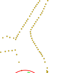
| + | {{Image right| MaranoLagoon.jpg| Typical Marano lagoon landscape }} | ||
| + | |||
| + | The town of Lignano Sabbiadoro has few historic attractions, but most visitors come here for the beaches, which are superb, or (occasionally) for the beautiful landscape and abundant wildlife of the Marano lagoon inland from the town. | ||
| + | |||
| + | ==Friends== | ||
Contact details of "Cruiser's Friends" that can be contacted for local information or assistance. | Contact details of "Cruiser's Friends" that can be contacted for local information or assistance. | ||
* | * | ||
| - | == | + | ==Forums== |
List links to discussion threads on [[Cruising Forums|partnering forums]]. (''see link for requirements'') | List links to discussion threads on [[Cruising Forums|partnering forums]]. (''see link for requirements'') | ||
* | * | ||
| - | == | + | ==Links== |
* {{wikipedia}} | * {{wikipedia}} | ||
| + | * {{Wikivoyage}} | ||
* [http://www.lignano.it/en/ Tourism website] | * [http://www.lignano.it/en/ Tourism website] | ||
* | * | ||
| - | ==References | + | ==References== |
| - | ''See [[Italy#References | + | ''See [[Italy#References|Italy]]''. |
| - | {{Comments | + | {{Comments}} |
| + | * | ||
| - | + | {{Verified by}} | |
| - | + | ||
* Data compiled from web research (please update if possible)--[[User:Atheneoflymington|Athene of Lymington]] 15:53, 28 January 2011 (UTC) | * Data compiled from web research (please update if possible)--[[User:Atheneoflymington|Athene of Lymington]] 15:53, 28 January 2011 (UTC) | ||
* | * | ||
| + | |||
| + | {{GreenText|If you provide a lot of info and this page is almost complete, change <nowiki>{{Page outline}} to {{Page useable}}</nowiki>.}} | ||
Latest revision as of 07:50, 21 August 2018
| Lignano (Sabbiadoro)
| |
| |
 The Lignano peninsula from the NE |
The settlement of Lignano (or to give it its full name, Lignano Sabbiadoro) lies at the end of a peninsula on the Adriatic coast of Italy, 5 miles NE of the river marinas of Lignano Riviera and at the western entrance to the Laguna di Marano. Until the early 20th century, Lignano was an isolated fishing community with few links to the mainland. Since the advent of tourism in the early 1900s, the Lignano peninsula has become one of the most thriving tourist destinations in the northern Adriatic. While its beaches are thronged with sun worshippers during the summer, there are still quiet spots to be found in the lagoon and the area retains much of its former richness in flora and fauna. Yachts visiting Lignano have a choice of the huge 1200 berth Marina Punta Faro or the smaller municipal basin of Darsena Porto Vecchio with 400 berths.
Charts
- British Admiralty
- 204
- 1471
- Italian
- 924
- 39
Weather
During the summer months, the prevailing winds in the Adriatic are light to moderate coastal sea breezes. In spring and autumn, northerly winds are more frequent and can quickly rise to near gale force, especially in the northern Adriatic, where the much-feared “bora” is caused by high pressure over the mountains to the NE coupled with low pressure over southern Italy. Fortunately, the fiercest “bora” is normally to be expected in the winter months. Thunderstorms are occasionally experienced in spring and especially autumn and can be accompanied by violent winds of gale force and above. Luckily they are rarely long-lasting. Fog is a further hazard often encountered in the lagoon of Venice, especially in the early and late season.
Sources for weather information:
- There is a continuous (computerized voice) weather forecast on VHF 68 - first in Italian and then followed with an English translation
- The same forecast is given in Italian and English on VHF coastal stations following a notification on channel 16
- Navtex weather forecasts covering the Adriatic are broadcast from stations at Roma, Trieste, Kerkyra (Greece) and Split (Croatia)
Islands
- Isola de Martignano
- Isola di Sant’Andrea
Communication
Add here VHF channel for the coastguard, harbor masters. etc.
Also see World Cruiser's Nets.
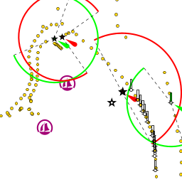
The entrance to Lignano, which is also the main, westernmost entrance to the Laguna di Marano, is at entrance of the ![]() Canale di Marano [[Lignano#Canale di Marano|Canale di Marano]] 45°41.996'N, 013°09.459'E . Dangerous sandbanks extend offshore for over a mile on either side of the entrance and the safe water between the banks (which shift constantly) is marked by a red and white fairway buoy situated about 1.5 miles SSE of the channel. Yachts entering should pass within 50 metres of the buoy, which is moved to reflect the shifts, before turning on a course of c. 355 degrees to cross the bar and pick up the channel, which is marked with wooden posts (white to starboard and red to port). Depths in the channel are around 6.0 metres, but can be as little as 2.5 metres over the bar. The entry should therefore only be attempted close to high water and on a rising tide and never in strong onshore winds. Once in the channel, proceed for about a mile and the entrance to Marina Punta Faro will be visible to port.
Canale di Marano [[Lignano#Canale di Marano|Canale di Marano]] 45°41.996'N, 013°09.459'E . Dangerous sandbanks extend offshore for over a mile on either side of the entrance and the safe water between the banks (which shift constantly) is marked by a red and white fairway buoy situated about 1.5 miles SSE of the channel. Yachts entering should pass within 50 metres of the buoy, which is moved to reflect the shifts, before turning on a course of c. 355 degrees to cross the bar and pick up the channel, which is marked with wooden posts (white to starboard and red to port). Depths in the channel are around 6.0 metres, but can be as little as 2.5 metres over the bar. The entry should therefore only be attempted close to high water and on a rising tide and never in strong onshore winds. Once in the channel, proceed for about a mile and the entrance to Marina Punta Faro will be visible to port.
For the entrance to the basin of Darsena Porto Vecchio, continue W up the channel that passes the entrance to the Marina Punta Faro and along the curved breakwater until the basin opens up to port after 600 metres.
Berthing
Marinas & Yacht Clubs
There are two berthing options in the river:
Marina Punta Faro
Darsena Porto Vecchio
Anchorages
Yachts can anchor with care anywhere in the lagoon providing they do not obstruct the channels.
Note: Fore and aft anchors are necessary to avoid swinging into the channel with the tides.
Amenities
| Facilities | |
|---|---|
| Water | In Marina Punta Faro and Darsena Porto Vecchio |
| Electricity | In Marina Punta Faro and Darsena Porto Vecchio |
| Toilets | In Marina Punta Faro and Darsena Porto Vecchio |
| Showers | In Marina Punta Faro and Darsena Porto Vecchio |
| Laundry | In Marina Punta Faro |
| Garbage | Bins in Marina Punta Faro and Darsena Porto Vecchio |
| Supplies | |
| Fuel | In Marina Punta Faro station on the quay (0800-1200 & 1400-1800); and Darsena Porto Vecchio |
| Bottled gas | ? |
| Chandlers | None |
| Services | |
| Repairs |
|
| Internet | WiFi in Marina Punta Faro |
| Mobile connectivity | ? |
| Vehicle rentals | Rental outlets in Lignano Sabbiadoro |
Provisioning
Good provisions shops in Lignano Sabbiadoro.
Eating out
- Restaurant in Marina Punta Faro and Darsena Porto Vecchio
- Numerous bars and restaurants in Lignin Sabbiadoro
Transportation
List transportation (local and/or international.)
Tourism
History
Give a short history of the port.
Places to Visit

The town of Lignano Sabbiadoro has few historic attractions, but most visitors come here for the beaches, which are superb, or (occasionally) for the beautiful landscape and abundant wildlife of the Marano lagoon inland from the town.
Friends
Contact details of "Cruiser's Friends" that can be contacted for local information or assistance.
Forums
List links to discussion threads on partnering forums. (see link for requirements)
Links
- Lignano at the Wikipedia
- Lignano at the Wikivoyage
- Tourism website
References
See Italy.
Comments
We welcome users' contributions to the Wiki. Please click on Comments to view other users' comments, add your own personal experiences or recommend any changes to this page following your visit.
Verified by
Date of member's last visit to Lignano and this page's details validated:
- Data compiled from web research (please update if possible)--Athene of Lymington 15:53, 28 January 2011 (UTC)
If you provide a lot of info and this page is almost complete, change {{Page outline}} to {{Page useable}}.
| This page has an outline in place but needs completing. Please contribute if you can to help it grow further. Click on Comments to suggest further content or alternatively, if you feel confident to edit this page, click on the edit tab at the top and enter your changes directly. |
| |
|---|
|
Names: Athene of Lymington |