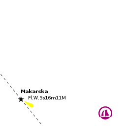
Makarska
From CruisersWiki
| Makarska
| |
| |
 Makarska harbour looking E |
The town and harbour of Makarska lie on the so-called Makarska Riviera on the Adriatic coast of Croatia, seven miles SE of the harbour of Baška Voda and four miles NW of the small harbour of Tučepi. The island of Brač lies six miles to the W and the steep Biokovo mountain range two miles inland. A popular beach resort, the natural harbour on which Makarska sits has been quayed to create several hundred metres of berthing space, albeit only the eastern part of the harbour has suitable depths for a yacht.
Visiting yachts berth either alongside or stern/bows-to the quays using their anchors. Alternatively, it is possible to anchor in the SE corner of the harbour in depths of 5.0 - 8.0 metres.
Charts
See Central Dalmatia.
Weather
See Croatia.
Passages
See Croatia.
Islands
Communication
Add here VHF channel for coastguard, harbor masters. etc.
Also see World Cruiser's Nets
The bay of Makarska sits inside the eastern arm of a long, cigar-shaped peninsula, probably at one time an island but now joined to the mainland by a shallow, sandy spit. The peninsula is conspicuous from distance. The W side of it is low and sandy, while the E side, behind which the harbour lies, is bounded by steep cliffs, as is the coastline on the E side of the bay. The bay opens up once rounding the peninsula and the quays are clearly visible.
Berthing

Makarska Quay
There are laid moorings for a small number of visiting yachts in the northeast corner of the harbour, 50 meters north of the large jetty. Depths at the quays are 3.0 metres on the E side of the bay but shoal to under a metre on the W side.
The short pier at the SE end of the harbour has depths of 4.0 - 5.0 metres but is in constant use by tripper boats during the day. It may be possible to find space here overnight.Marinas & Yacht Clubs
None.
Anchorages
SE of the pier
Amenities
| Facilities | |
|---|---|
| Water | |
| Electricity | N/A (Not Available) |
| Toilets | N/A |
| Showers | N/A |
| Laundry | N/A |
| Garbage | Some bins in the village |
| Supplies | |
| Fuel | |
| Bottled gas | None |
| Chandlers | None |
| Services | |
| Repairs | N/A |
| Internet | WiFi in internet cafes |
| Mobile connectivity | Is there mobile telephone signal such as G4, G3, GPRS on the island? How strong is the signal? Are there any blind spots? |
| Vehicle rentals | |
| Health | |
Provisioning
Several supermarkets and provisions shops in the town.
Eating out
Several cafes and restaurants in the village.
Transportation
- Buses to Split
- Ferries from Split to Rijeka, Dubrovnik and Ancona (Italy)
- Local ferries to the island of Brač
- International flights from Split airport (60 kms)
Tourism

The town contains a number of old buildings dating from the Venetian occupation, a Baroque palace, Ivanisevic Palace, and a Franciscan monastery that houses a renowned museum of seashells.
Links
- Makarska at the Wikipedia
- Makarska at the Wikivoyage
- Noonsite
- Dalmacija Net
- Makarska Riviera website
For other useful websites, see Croatia.
References
See Croatia.
Comments
We welcome users' contributions to the Wiki. Please click on Comments to view other users' comments, add your own personal experiences or recommend any changes to this page following your visit.
Verified by
Date of member's last visit to Makarska and this page's details validated:
- Data compiled from web research (please update if possible) --Athene of Lymington 14:07, 8 August 2011 (BST)
If you provide a lot of info and this page is almost complete, change {{Page outline}} to {{Page useable}}.
| This page has an outline in place but needs completing. Please contribute if you can to help it grow further. Click on Comments to suggest further content or alternatively, if you feel confident to edit this page, click on the edit tab at the top and enter your changes directly. |
| |
|---|
|
Names: Haiqu, Athene of Lymington |