Marathokambos
From CruisersWiki
Lighthouse (Talk | contribs) (Minor edit) |
m (Text replace - "==References & Publications==" to "==References==") |
||
| (38 intermediate revisions not shown) | |||
| Line 1: | Line 1: | ||
| - | + | {{IsPartOf|Mediterranean|Aegean Sea|Greece|NE Aegean|Samos}} | |
| - | {| | + | {{TOC block}} |
| - | | | + | {{infobox |37|42.54|N|26|42.18|E| |
| - | | | + | | zoom= 16 |
| - | + | | chartlet = y | |
| - | + | | image= MarathokambosBay.jpg | |
| - | + | | imagetext= The bay of Marathokambos | |
| - | | | + | }} |
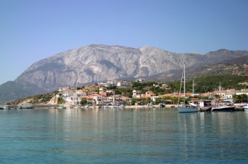
| - | + | [http://www.marathokampos.gr/ Marathokambos] (Μαραθόκαμπος) is a small harbour on the SW side of Samos, lying 15 miles west of Pythagorion and around 14 miles NE of the Fournoi Islands. In settled weather it is a delightful anchorage with water clear enough to swim off your boat and several tavernas ashore. However, it is not a good place to be with a strong ''meltemi'' (as the row of wind turbines on the ridge above suggests), since it is subject to very violent gusts and is not recommended in such conditions. | |
| - | | | + | |
| - | | | + | |
| - | + | ||
| - | | | + | |
| - | + | ||
| - | [http://www.marathokampos.gr/ Marathokambos] (Μαραθόκαμπος) is a small harbour on the SW side of Samos, lying 15 miles west of Pythagorion and around 14 miles NE of the Fournoi Islands. In settled weather it is a delightful anchorage with water clear enough to swim off your boat and several tavernas ashore. However, it is not a good place to be with a strong meltemi (as the row of wind turbines on the ridge above suggests), since it is subject to very violent gusts and is not recommended in such conditions. | + | |
| - | + | {{Caution}}There are very strong gusts here which can sometimes make the harbor untenable. | |
| - | {{ | + | {{image right|Marathokambos.jpeg | Fishing boats, Marathokambos }} |
| - | [[ | + | ==Charts== |
| + | ''See [[Samos#Charts|Samos]]''. | ||
| - | [[ | + | ==Weather== |
| + | ''See [[Samos#Weather|Samos]]''. | ||
| - | == | + | ==Passages== |
| - | [[ | + | ''See [[Samos#Passages|Samos]]''. |
| - | + | ==Islands== | |
| + | * [[Samos#Samiopoula|Samiopoula]] | ||
| - | == | + | ==Communication== |
| - | + | ||
* Coast Guard - VHF channel 12 | * Coast Guard - VHF channel 12 | ||
| + | * | ||
| - | + | ''Also see [[HF_Radio|Cruiser's Nets]]''. | |
| - | '' | + | |
| - | == | + | ==Navigation== |
Approach to Marathokambos is straightforward, although caution should be exercised on the approach in strong northerlies, when there are strong gusts off the mountains. There may even be times when the harbour is untenable. | Approach to Marathokambos is straightforward, although caution should be exercised on the approach in strong northerlies, when there are strong gusts off the mountains. There may even be times when the harbour is untenable. | ||
| - | ''See also [[Samos# | + | ''See also [[Samos#Navigation|Samos]]''. |
| - | == | + | ==Berthing== |
| - | + | Yachts usually anchor in the outer harbour, where the depths are 3.5 – 4.0 metres and the holding good on sand. There is room for around 4/5 yachts to swing to their anchors here. | |
| - | + | ||
| - | + | ||
| - | + | ||
| - | + | ||
| - | + | ||
| - | + | ||
| - | + | ||
| - | + | Alternatively it may be possible to find a berth among the laid moorings on the SW quay (avoiding the quay extension at the end, where the ferry berths). Depths here range from 2.0 metres at the inner end to 4.0 metres at the outer. You will need to lay your anchor at least 35 metres out to avoid the moorings. It may also be possible to anchor moor on the end of the jetty which extends from the north side of the harbour, although depths here are barely 2.0 metres. There are usually a couple of local moorings at the end of the jetty which you may be able to pick up if the owner is away. | |
| - | + | ||
| - | + | Finally, at the time of visit (August 2010), work was in progress to quay the whole length of the north breakwater. When completed, it may be possible to moor up to the outer end of this (although depths are only around 2.0 – 2.5 metres and local boats have already taken up most of the space). | |
| - | + | ||
| - | + | {{hgallery| | |
| - | + | {{himage|MarathokambosQuay.jpg| Marathokambos, the SW quay }} | |
| - | + | {{himage|MarathokambosJetty.jpg|Marathokambos, the northern jetty }} | |
| + | {{himage|MarathakambosBreakwater.jpg|Works in progress on the N breakwater}} | ||
| + | {{himage|MarathokambosAnchorage.jpg|The anchorage from north }} | ||
| + | }} | ||
| - | === | + | ===Marinas & Yacht Clubs=== |
| - | + | The only serious marina is [[Pythagorio_Marina|Samos Marina]] in [[Pythagorio]]. | |
| - | == | + | ==Amenities== |
| - | + | {{tlist | |
| - | + | |header|Facilities | |
| - | + | ||
| - | + | ||
| + | |Water| Available from a long hose on the ferry quay | ||
| + | |Electricity| N/A (Not Available) | ||
| + | |Toilets| N/A | ||
| + | |Showers| N/A | ||
| + | |Laundry| {{MagentaText|?}} | ||
| + | |Garbage| There are bins at the root of the quay | ||
| - | + | |header|Supplies | |
| - | None | + | |Fuel| N/A |
| + | |Bottled gas| {{MagentaText|?}} | ||
| + | |Chandlers| None | ||
| - | + | |header|Services | |
| - | + | |Repairs| Some work, mostly on wooden boats | |
| + | |Internet| {{MagentaText|?}} | ||
| + | |Mobile connectivity| {{MagentaText|?}} | ||
| + | |Vehicle rentals| {{MagentaText|?}} | ||
| + | }} | ||
| - | == | + | ==Provisioning== |
| - | + | ''Proton'' supermarket in the town. Other provisions. | |
| - | == | + | ==Eating out== |
| - | + | Several tavernas around the bay | |
| - | |||
| - | |||
| - | == | + | ==Transportation== |
| - | There are | + | There are buses and taxis to other towns and villages in the island. |
| - | + | ''See [[Samos#Transportation|Samos]] for transportation to elsewhere''. | |
| - | + | ||
| - | == | + | ==Tourism== |
| - | ''See [[Samos# | + | ''See [[Samos#Tourism|Samos]]''. |
| - | == | + | ==Friends== |
Contact details of "Cruiser's Friends" that can be contacted for local information or assistance. | Contact details of "Cruiser's Friends" that can be contacted for local information or assistance. | ||
* | * | ||
| - | == | + | ==Forums== |
| - | List links to discussion threads on [[Cruising Forums|partnering forums]]. (see link for requirements) | + | List links to discussion threads on [[Cruising Forums|partnering forums]]. (''see link for requirements'') |
* | * | ||
* | * | ||
| - | == | + | ==Links== |
| - | + | * {{wikipedia|Marathokampos}} | |
* [http://www.marathokampos.gr/ Marathokambos] | * [http://www.marathokampos.gr/ Marathokambos] | ||
| - | * | + | * |
| - | ==References | + | ==References== |
| - | See [[Greece#References_&_Publications|Greece]]. | + | ''See [[Greece#References_&_Publications|Greece]]''. |
| + | |||
| + | {{Comments}} | ||
| + | * An idyllic stop in settled weather en route between Samos and the Fournoi Islands or Ikaria --[[User:Atheneoflymington|Athene of Lymington]] 12:54, 2 September 2010 (UTC) | ||
| - | + | {{Verified by}} | |
| - | + | ||
| - | + | ||
* August 2010 --[[User:Atheneoflymington|Athene of Lymington]] 12:54, 2 September 2010 (UTC) | * August 2010 --[[User:Atheneoflymington|Athene of Lymington]] 12:54, 2 September 2010 (UTC) | ||
| + | * August 2014 {{Istioploos2}} | ||
| - | |||
| - | |||
| - | |||
| + | {{Page useable}} | ||
| - | |||
| - | + | {{Contributors|[[User:Lighthouse|Lighthouse]], [[User:Istioploos|Istioploos]], [[User:Atheneoflymington|Athene of Lymington]]}} | |
| - | { | + | |
| - | + | ||
| - | + | ||
| - | + | ||
| - | + | ||
| - | + | ||
[[Category:Ports - Greece]] | [[Category:Ports - Greece]] | ||
| - | |||
| - | |||
Latest revision as of 12:04, 15 August 2018
| Marathokambos
| |
| | |
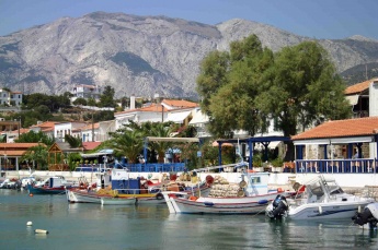
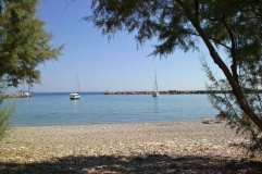
Marathokambos (Μαραθόκαμπος) is a small harbour on the SW side of Samos, lying 15 miles west of Pythagorion and around 14 miles NE of the Fournoi Islands. In settled weather it is a delightful anchorage with water clear enough to swim off your boat and several tavernas ashore. However, it is not a good place to be with a strong meltemi (as the row of wind turbines on the ridge above suggests), since it is subject to very violent gusts and is not recommended in such conditions.
Caution: There are very strong gusts here which can sometimes make the harbor untenable.
Charts
See Samos.
Weather
See Samos.
Passages
See Samos.
Islands
Communication
- Coast Guard - VHF channel 12
Also see Cruiser's Nets.
Approach to Marathokambos is straightforward, although caution should be exercised on the approach in strong northerlies, when there are strong gusts off the mountains. There may even be times when the harbour is untenable.
See also Samos.
Berthing
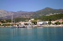
Yachts usually anchor in the outer harbour, where the depths are 3.5 – 4.0 metres and the holding good on sand. There is room for around 4/5 yachts to swing to their anchors here.
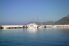
Alternatively it may be possible to find a berth among the laid moorings on the SW quay (avoiding the quay extension at the end, where the ferry berths). Depths here range from 2.0 metres at the inner end to 4.0 metres at the outer. You will need to lay your anchor at least 35 metres out to avoid the moorings. It may also be possible to anchor moor on the end of the jetty which extends from the north side of the harbour, although depths here are barely 2.0 metres. There are usually a couple of local moorings at the end of the jetty which you may be able to pick up if the owner is away.
Finally, at the time of visit (August 2010), work was in progress to quay the whole length of the north breakwater. When completed, it may be possible to moor up to the outer end of this (although depths are only around 2.0 – 2.5 metres and local boats have already taken up most of the space).
Marinas & Yacht Clubs
The only serious marina is Samos Marina in Pythagorio.
Amenities
| Facilities | |
|---|---|
| Water | Available from a long hose on the ferry quay |
| Electricity | N/A (Not Available) |
| Toilets | N/A |
| Showers | N/A |
| Laundry | ? |
| Garbage | There are bins at the root of the quay |
| Supplies | |
| Fuel | N/A |
| Bottled gas | ? |
| Chandlers | None |
| Services | |
| Repairs | Some work, mostly on wooden boats |
| Internet | ? |
| Mobile connectivity | ? |
| Vehicle rentals | ? |
Provisioning
Proton supermarket in the town. Other provisions.
Eating out
Several tavernas around the bay
Transportation
There are buses and taxis to other towns and villages in the island.
See Samos for transportation to elsewhere.
Tourism
See Samos.
Friends
Contact details of "Cruiser's Friends" that can be contacted for local information or assistance.
Forums
List links to discussion threads on partnering forums. (see link for requirements)
Links
- Marathokambos at the Wikipedia
- Marathokambos
References
See Greece.
Comments
We welcome users' contributions to the Wiki. Please click on Comments to view other users' comments, add your own personal experiences or recommend any changes to this page following your visit.
- An idyllic stop in settled weather en route between Samos and the Fournoi Islands or Ikaria --Athene of Lymington 12:54, 2 September 2010 (UTC)
Verified by
Date of member's last visit to Marathokambos and this page's details validated:
- August 2010 --Athene of Lymington 12:54, 2 September 2010 (UTC)
- August 2014 --Istioploos

 Travels with S/Y Thetis
| This is a usable page of the cruising guide. However, please contribute if you can to help it grow further. Click on Comments to add your personal notes on this page or to discuss its contents. Alternatively, if you feel confident to edit the page, click on the edit tab at the top and enter your changes directly. |
| |
|---|
|
Names: Lighthouse, Istioploos, Athene of Lymington |
