Orebić
From CruisersWiki
(Created page with "==Orebic, Croatia== {| class="infobox bordered" style="width: 28em; text-align: left; font-size: 90%;" |- | colspan="2" style="text-align:center;" | [[Image:imagename.jpg|330px| ...") |
Istioploos (Talk | contribs) m (Typos) |
||
| (42 intermediate revisions not shown) | |||
| Line 1: | Line 1: | ||
| - | + | {{IsPartOf|Mediterranean|Adriatic Sea|Croatia|Southern Dalmatia|Pelješac}} | |
| - | { | + | {{TOC block}} |
| - | + | ||
| - | + | ||
| - | + | ||
| - | + | ||
| - | | | + | |
| - | + | ||
| - | | | + | |
| - | + | ||
| - | + | ||
| - | + | ||
| - | + | ||
| - | + | ||
| - | + | ||
| - | + | ||
| - | + | ||
| - | + | ||
| - | + | ||
| - | + | ||
| - | + | ||
| - | + | ||
| - | + | ||
| - | + | ||
| - | + | ||
| - | + | ||
| - | + | ||
| - | + | ||
| - | + | ||
| - | + | ||
| - | + | ||
| - | + | ||
| - | + | ||
| - | + | {{Infobox | |
| + | | lat=42.97401|lon=17.1739 | ||
| + | | name= Orebić | ||
| + | | zoom= 16 | ||
| + | | image= OrebicAerial.jpg | ||
| + | | imagetext= Orebic harbour from N | ||
| + | | chartlet=y | ||
| + | | summary=The harbour of [[Orebić]] lies on the S coast of the [[Pelješac|Peljesac Peninsula]] on the Adriatic coast of [[Croatia]], just two miles NE of the town of [[Korčula (town)|Korčula]] on the island of the same name. A former maritime centre and now a popular tourist resort, Orebic is the largest settlement along this stretch of coast until arriving at [[Dubrovnik]]. In addition to its thriving tourist industry, the town is also a centre for exploring the Peljesac wine-producing area, one of the most productive in Croatia. | ||
| - | + | A small 240-berth marina caters for the large number of yachts cruising along the Peljesac channel to and from [[Dubrovnik]]. Shelter in the marina is good, although strong W winds send in a swell. | |
| - | + | }} | |
| - | + | ||
| - | + | ||
| - | + | ==Charts== | |
| + | ''See [[Southern Dalmatia#Charts|Southern Dalmatia]]''. | ||
| - | == | + | ==Weather== |
| - | + | ''See [[Croatia#Weather|Croatia]]''. | |
| - | + | ==Passages== | |
| - | + | ''See [[Croatia#Passages|Croatia]]''. | |
| - | == | + | ==Islands== |
| - | + | * [[Korčula]] | |
| - | + | ||
| - | + | ||
| - | + | ||
| - | == | + | ==Communication== |
| - | + | {{Green|Add here VHF channel for the coastguard, harbor masters. etc.}} | |
| + | * | ||
* | * | ||
| - | + | ''Also see [[World MM Nets|World Cruiser's Nets]]''. | |
| - | + | ||
| - | == | + | ==Navigation== |
| - | + | Access to [[Orebic]] is from the E or the W along the '''Peljesac''' channel. If arriving from the E, a yacht needs to negotiate the numerous islands off [[Korčula]]. | |
| - | + | From the W, the approach is straightforward as long as a yacht keeps half a mile offshore to avoid some inshore shallows to the W of the harbour. | |
| - | + | ||
| - | + | ||
| - | + | The harbour lies towards the W end of the town, protected from the S and the E by a T-shaped breakwater. There is a light structure Fl G 3 s on the end of the breakwater. Entrance is from the W. Ferries berth on the jetty on the N side of the entrance and a good lookout should be maintained when entering. | |
| - | + | ||
| - | ==== | + | ==Berthing== |
| - | + | {{poi | lat=42.97393|lon=17.17516 | |
| - | + | | type= harbour | |
| + | | name= Orebić Harbour | ||
| + | | altname= Marina | ||
| + | | url = | ||
| + | | zoom= 17 | ||
| + | | portofentry= | ||
| + | | image= OrebicMoorings.jpg | ||
| + | | imagetext= Yachts moored in Orebić | ||
| + | | text= Orebic harbour is operated as a marina, although it does not have the full facilities to be expected of a marina. Of a total of 240 berths, 30 are reserved for yachts in transit. | ||
| - | + | A visiting yacht should berth where directed, usually stern/bows-to the breakwater, where there are laid moorings. Depths along the breakwater range from 2.0 metres at the root to 4.0 metres at the end. Water and electricity at all berths. Other facilities include toilets and showers. | |
| - | + | }} | |
| - | + | ||
| - | + | ||
| - | === | + | ===Marinas & Yacht Clubs=== |
| - | + | No other marinas. | |
| - | ==== | + | ==Anchorages== |
| - | + | None. | |
| - | + | ||
| - | + | ||
| - | + | ||
| - | + | ||
| - | + | ||
| - | == | + | ==Amenities== |
| - | + | {{tlist | |
| - | + | ||
| - | + | ||
| - | + | |header|Facilities | |
| - | + | ||
| - | ==== | + | |Water| {{mark | type= water |name= [[ #Orebić Harbour|Orebić Harbour]] |text= at all berths}} |
| - | + | |Electricity| {{mark | type= electricity |name= [[ #Orebić Harbour|Orebić Harbour]] |text= at all berths}} | |
| + | |Toilets| In the [[ #Orebić Harbour|Orebić Harbour]] | ||
| + | |Showers| In the [[ #Orebić Harbour|Orebić Harbour]] | ||
| + | |Laundry| N/A (Not Available) | ||
| + | |Garbage| Bins in [[ #Orebić Harbour|Orebić Harbour]] | ||
| - | + | |header|Supplies | |
| - | + | ||
| - | + | |Fuel| N/A | |
| - | + | |Bottled gas| None | |
| + | |Chandlers| None | ||
| - | + | |header|Services | |
| - | + | ||
| - | ==== | + | |Repairs| {{mark | type= service |name= [[ #Orebić Harbour|Orebić Harbour]] |text= Some mechanical repairs}} |
| - | + | |Internet| WiFi in {{MagentaText|?}} | |
| + | |Mobile connectivity| {{Green|Is there mobile telephone signal such as G4, G3, GPRS on the island? How strong is the signal? Are there any blind spots?}} | ||
| + | |Vehicle rentals| {{mark | type= car |name= In the Town | text= rental outlets}} | ||
| + | |Health| | ||
| + | }} | ||
| - | ==== | + | ==Provisioning== |
| - | + | {{mark | type= provisions |name= In the Town |text= Several supermarkets and other provisions shops.}} | |
| - | + | ||
| - | == | + | ==Eating out== |
| - | + | * In the Town | |
| - | * | + | : {{mark |name= | type= eatingout | text=Numerous bars and restaurants.}} |
| - | == | + | ==Transportation== |
| - | + | * Buses to [[Dubrovnik]], [[Split]] and Zagreb. | |
| - | * | + | * Ferries to [[Korčula]]. |
| - | == | + | ==Tourism== |
| - | + | {{Image right| OrebicMonastery.jpg| The 16th century monastery of Orebic }} | |
| - | + | {{Image right| OrebicSummit.jpg| View from the summit of Mt. St. Elijah }} | |
| - | + | The 16th-century Franciscan monastery of Our Lady of Angels, sited on a crag above the town, is a popular tourist attraction. The view over the '''Pelješac channel''' and [[Korčula (town)]] is superb. Even more impressive views can be enjoyed from the summit of '''St Elijah’s''' mountain behind the town. There are several good walking trails that lead to the summit. In the town, there is a small maritime museum with exhibits reflecting Orebić’s important role in maritime trade and fishing. | |
| - | + | ||
| - | + | ||
| - | == | + | ==Links== |
| - | + | * {{wikipedia|Orebić}} | |
| - | * | + | * {{Wikivoyage}} |
| - | + | * [http://www.noonsite.com/place/croatia/southern-mainland-trogir-and-southwards/orebic/ Noonsite] | |
| - | + | ||
| - | + | ||
* | * | ||
| - | + | ''For other useful websites, see [[Croatia#Links|Croatia]]''. | |
| - | + | ||
| - | + | ||
| + | ==References== | ||
| + | ''See [[Croatia#References|Croatia]]''. | ||
| - | {{ | + | {{Comments}} |
| + | * | ||
| + | * | ||
| + | {{Verified by}} | ||
| + | * Data compiled from web research (please update if possible)--[[User:Atheneoflymington|Athene of Lymington]] | ||
| + | * | ||
| - | + | {{Page outline}} | |
| - | { | + | |
| - | + | ||
| - | + | ||
| - | + | ||
| - | + | ||
| - | + | ||
| - | + | ||
| - | + | ||
| - | { | + | |
| - | + | ||
| - | + | ||
| - | + | ||
| - | + | ||
| + | {{Contributors|[[User:Haiqu|Haiqu]], [[User:Atheneoflymington|Athene of Lymington]]}} | ||
| - | [[Category:Ports - Croatia]] | + | [[Category:Ports - Croatia]] [[Category:Marinas - Croatia]] |
Latest revision as of 20:40, 2 May 2019
| Orebić
| |
| |
 Orebic harbour from N |
The harbour of Orebić lies on the S coast of the Peljesac Peninsula on the Adriatic coast of Croatia, just two miles NE of the town of Korčula on the island of the same name. A former maritime centre and now a popular tourist resort, Orebic is the largest settlement along this stretch of coast until arriving at Dubrovnik. In addition to its thriving tourist industry, the town is also a centre for exploring the Peljesac wine-producing area, one of the most productive in Croatia.
A small 240-berth marina caters for the large number of yachts cruising along the Peljesac channel to and from Dubrovnik. Shelter in the marina is good, although strong W winds send in a swell.
Charts
See Southern Dalmatia.
Weather
See Croatia.
Passages
See Croatia.
Islands
Communication
Add here VHF channel for the coastguard, harbor masters. etc.
Also see World Cruiser's Nets.
Access to Orebic is from the E or the W along the Peljesac channel. If arriving from the E, a yacht needs to negotiate the numerous islands off Korčula.
From the W, the approach is straightforward as long as a yacht keeps half a mile offshore to avoid some inshore shallows to the W of the harbour.
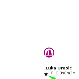
The harbour lies towards the W end of the town, protected from the S and the E by a T-shaped breakwater. There is a light structure Fl G 3 s on the end of the breakwater. Entrance is from the W. Ferries berth on the jetty on the N side of the entrance and a good lookout should be maintained when entering.
Berthing

Orebić Harbour
Orebic harbour is operated as a marina, although it does not have the full facilities to be expected of a marina. Of a total of 240 berths, 30 are reserved for yachts in transit.
A visiting yacht should berth where directed, usually stern/bows-to the breakwater, where there are laid moorings. Depths along the breakwater range from 2.0 metres at the root to 4.0 metres at the end. Water and electricity at all berths. Other facilities include toilets and showers.Marinas & Yacht Clubs
No other marinas.
Anchorages
None.
Amenities
| Facilities | |
|---|---|
| Water | |
| Electricity | |
| Toilets | In the Orebić Harbour |
| Showers | In the Orebić Harbour |
| Laundry | N/A (Not Available) |
| Garbage | Bins in Orebić Harbour |
| Supplies | |
| Fuel | N/A |
| Bottled gas | None |
| Chandlers | None |
| Services | |
| Repairs | |
| Internet | WiFi in ? |
| Mobile connectivity | Is there mobile telephone signal such as G4, G3, GPRS on the island? How strong is the signal? Are there any blind spots? |
| Vehicle rentals | |
| Health | |
Provisioning
![]() In the Town [[Orebić#In the Town|In the Town]] Several supermarkets and other provisions shops.
In the Town [[Orebić#In the Town|In the Town]] Several supermarkets and other provisions shops.
Eating out
- In the Town
-
 [[Orebić# | ]] Numerous bars and restaurants.
Transportation
Tourism


The 16th-century Franciscan monastery of Our Lady of Angels, sited on a crag above the town, is a popular tourist attraction. The view over the Pelješac channel and Korčula (town) is superb. Even more impressive views can be enjoyed from the summit of St Elijah’s mountain behind the town. There are several good walking trails that lead to the summit. In the town, there is a small maritime museum with exhibits reflecting Orebić’s important role in maritime trade and fishing.
Links
For other useful websites, see Croatia.
References
See Croatia.
Comments
We welcome users' contributions to the Wiki. Please click on Comments to view other users' comments, add your own personal experiences or recommend any changes to this page following your visit.
Verified by
Date of member's last visit to Orebić and this page's details validated:
- Data compiled from web research (please update if possible)--Athene of Lymington
| This page has an outline in place but needs completing. Please contribute if you can to help it grow further. Click on Comments to suggest further content or alternatively, if you feel confident to edit this page, click on the edit tab at the top and enter your changes directly. |
| |
|---|
|
Names: Haiqu, Athene of Lymington |