Petriti
From CruisersWiki
(Created page with "==Petriti== {{TOCleft}} {| class="infobox bordered" style="width: 28em; text-align: left; font-size: 90%;" |- | colspan="2" style="text-align:center; font-size: smaller;" | {{Sma...") |
m |
||
| Line 52: | Line 52: | ||
==Berthing options== | ==Berthing options== | ||
| - | Fishing boats use the NW quay, nearest the village, and local boats on laid moorings occupy the inner | + | Fishing boats use the NW quay, nearest the village, and local boats on laid moorings occupy the inner 50 metres of the breakwater quay. The only berths available for visiting yachts are along the outermost 50 metres of the breakwater quay, where some 8 -10 yachts can moor bows or stern-to using their anchors. The quay here has been extended and resurfaced and fitted with heavy duty mooring rings. Depths are at least 3.0 metres along this section. You will be dropping anchor in little more than 2.25 – 2.5 metres in the centre of the harbour, so this needs to be done with care. Holding is good in mud and weed. |
It is also possible to moor stern-to or even alongside the outer end of the breakwater, which is also supplied with mooring rings. Depths here are 3.0 metres for the first 20 metres from the end but shoal very quickly to less than a metre after that. This position is only really tenable in very settled weather, since any swell makes it very uncomfortable here. | It is also possible to moor stern-to or even alongside the outer end of the breakwater, which is also supplied with mooring rings. Depths here are 3.0 metres for the first 20 metres from the end but shoal very quickly to less than a metre after that. This position is only really tenable in very settled weather, since any swell makes it very uncomfortable here. | ||
Revision as of 18:22, 16 September 2012
Petriti
| | |
| | 39°27.19′N, 20°00.19′E |
|---|---|
| | Photo gallery |
| | Chartlet |
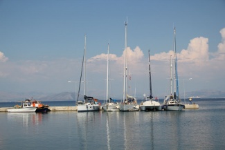
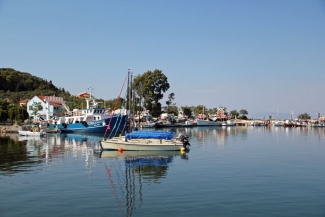
Petriti is a small and somewhat sleepy fishing harbour on the SE coast of Corfu, 10 miles S of Corfu Town. Nestling in a small bay protected from the prevailing NW winds, the harbour consists of a 100 metre long breakwater extending S from the N side of the bay. A rocky shoal to the S of the harbour affords some protection from southerly winds and swell. The harbour is a popular port of call for yachts transiting the W side of the Corfu Channel and is frequently visited by charter flotillas. Visiting yachts berth on the outer 50 metres or so of the breakwater, using their anchors to go bows or stern-to, or anchor off in the bay SE of the harbour. Depths in the harbour are 3.0 metres and, if using the anchorage, it is necessary to anchor outside the line extending S from the breakwater end if you wish to be in greater depths.
Charts
- BA
- 189 Nisos Sapiénza to Nisos Paxoi
- 203 Zakinthos to Paxoi
- Imray-Tetra
- G11 Nísos Kérkira to Nísos Levkas
- NIMA
- 54280 Corfu Channel to Nisis Proti
- Greek
- 212 Othonoi I. to Amvrakikos Gulf- Kerkyra I. And Paxoi I. Inset: Northern Kerkyra Strait
Radio Nets
Also see Cruiser's Nets
- Coast Guard - VHF channel 12
Local Weather
- See Ionian Sea Weather
- Also see Ionian Sea Currents & Tides
Petriti harbour and the bay in which it sits are quite shallow, the 5.0 metre contour beginning some 100 metres E of the harbour and decreasing to 3.0 metres by the end of the breakwater. In the centre of the harbour depths are even less, between 2.0 and 2.5 metres. Other than that, the approach is straightforward, although yachts arriving from S need to be aware of the shallows extending over half a mile N of Cape Levkimmis three miles to the east of Petriti.
Check-in facilities
None. Corfu Town is the nearest port of entry.
Offshore Islands and Groups
Berthing options
Fishing boats use the NW quay, nearest the village, and local boats on laid moorings occupy the inner 50 metres of the breakwater quay. The only berths available for visiting yachts are along the outermost 50 metres of the breakwater quay, where some 8 -10 yachts can moor bows or stern-to using their anchors. The quay here has been extended and resurfaced and fitted with heavy duty mooring rings. Depths are at least 3.0 metres along this section. You will be dropping anchor in little more than 2.25 – 2.5 metres in the centre of the harbour, so this needs to be done with care. Holding is good in mud and weed.
It is also possible to moor stern-to or even alongside the outer end of the breakwater, which is also supplied with mooring rings. Depths here are 3.0 metres for the first 20 metres from the end but shoal very quickly to less than a metre after that. This position is only really tenable in very settled weather, since any swell makes it very uncomfortable here.
Shelter in the harbour is good in winds from W round to NW, but strong winds from NE round to S would probably render it untenable.
Anchorages
Yachts anchor in the bay SE of the harbour, where depths of 3.0 – 7.0 metres can be found. The holding is excellent in sand and weed. Shelter here is reasonable in the prevailing NW winds, although there is a slight swell even in light northerlies. Anything E or S in the wind if strong would render the anchorage untenable.
Marinas & Yacht Clubs
None.
Yacht Repairs and Services
None.
Boat Yards
None.
Fuel, Water, & Electricity
- Fuel
- None, although it might be possible to arrange a fuel tanker.
- Water
- One water point towards the N end of the quay. You will need a long hose unless you go alongside on the outside of the quay. Showers offered by some of the tavernas.
- Electricity
- One electricity point towards the N end of the quay. You will need a long extenskjon to use it. Payment is via a prepaid card available from local taverans.
Things to do Ashore
Tourism
Not much to do ashore, but if you have bicycles aboard the road leading along the coast both N and S from Petriti offers an alternative view to the one from the water. The beach to the S of the harbour is good for swimming.
Grocery & Supply Stores
- Small supermarket 200 metres inland on the road S from the harbour.
- Bakery 25 metres further on.
Eateries
- Several bars, cafes and tavernas in the village.
- Leonidas Taverna near the root of the breakwater was good in September 2012 --Athene of Lymington 13:57, 4 September 2012 (BST)
Internet/WiFi
- At several of the bars and tavernas.
Laundry
- None.
Motorbike & Car Rentals
- None.
Garbage Disposal
Bins on the fishing boat quay.
Transportation
None.
Useful Contacts
Routes/Passages To/From
Popular passages/routes, timing, etc.
Cruiser's Friends
Contact details of "Cruiser's Friends" that can be contacted for local information or assistance.
Forum Discussions
List links to discussion threads on partnering forums. (see link for requirements)
External links
References & Publications
See Ionian Sea.
Personal Notes
Personal experiences?
Last Visited & Details Checked (and updated here)
Date of member's visit to this Port/Stop & this page's details validated:
- September 2012 --Athene of Lymington 17:41, 16 September 2012 (BST)
|
|---|
|
Names: Athene of Lymington, |
| |
|---|
| | HOMEPAGE | Wiki Contents | Mediterranean | Ionian Sea | Greece | Corfu | Petriti |


