Serifos
From CruisersWiki
Istioploos (Talk | contribs) m (Reverted edits by Riley Huntley (talk) to last revision by Istioploos) |
Istioploos (Talk | contribs) (Headings) |
||
| Line 12: | Line 12: | ||
! <center>[[image:Chart_icon.png]]</center> | ! <center>[[image:Chart_icon.png]]</center> | ||
| [http://mapserver.mytopo.com/homepage/index.cfm?lat=37.1628881925131&lon=24.477836756674265&scale=150000&zoom=50&type=0&icon=0&width=498&height=498&searchscope=dom&CFID=17583484&CFTOKEN=79232580&scriptfile=http://mapserver.mytopo.com/homepage/index.cfm&latlontype=DMS Local chartlet] | | [http://mapserver.mytopo.com/homepage/index.cfm?lat=37.1628881925131&lon=24.477836756674265&scale=150000&zoom=50&type=0&icon=0&width=498&height=498&searchscope=dom&CFID=17583484&CFTOKEN=79232580&scriptfile=http://mapserver.mytopo.com/homepage/index.cfm&latlontype=DMS Local chartlet] | ||
| + | |- | ||
| + | | colspan="2" style="text-align:center; font-size: smaller;" | [[Image:Greece_Serifos_m.jpg|350px]]Map of Serifos - ''Click for larger view'' | ||
|}{{TOCleft}} | |}{{TOCleft}} | ||
| - | [[Image:Greece_Serifos3.jpg | + | [[Image:Greece_Serifos3.jpg|frame|right|Dovecote in Serifos]] |
[http://en.wikipedia.org/wiki/Serifos Serifos] (Σέριφος) is a barren rocky island in the [http://en.wikipedia.org/wiki/Cyclades Cyclades] with an area of 75 km<sup>2</sup>, about 1,400 inhabitants, and with a number of abandoned mines. | [http://en.wikipedia.org/wiki/Serifos Serifos] (Σέριφος) is a barren rocky island in the [http://en.wikipedia.org/wiki/Cyclades Cyclades] with an area of 75 km<sup>2</sup>, about 1,400 inhabitants, and with a number of abandoned mines. | ||
| Line 25: | Line 27: | ||
Today tourism has given the island a new prosperity. | Today tourism has given the island a new prosperity. | ||
| - | |||
| - | |||
| + | ==Charts== | ||
;BA | ;BA | ||
:2682 Kólpos Patalion to Nísos Nísiros | :2682 Kólpos Patalion to Nísos Nísiros | ||
| Line 41: | Line 42: | ||
==Radio Net== | ==Radio Net== | ||
| - | |||
| - | |||
* Coast Guard - VHF channel 12 & Tel. +30 2810 51 470 | * Coast Guard - VHF channel 12 & Tel. +30 2810 51 470 | ||
* Olympia Radio - VHF channel 03 in [[#Livadhi|Livadhi]] | * Olympia Radio - VHF channel 03 in [[#Livadhi|Livadhi]] | ||
| + | |||
| + | ''Also see [[World MM Nets|World Cruiser's Nets]]''. | ||
==Weather== | ==Weather== | ||
| Line 52: | Line 53: | ||
Approaches to Serifos are straightforward but: | Approaches to Serifos are straightforward but: | ||
| - | <font color="red">Warning:</font> With a meltemi there are strong gusts on the south side of the island | + | <font color="red">Warning:</font> With a ''meltemi'' there are strong gusts on the south side of the island. |
| - | + | ||
| - | + | ||
| - | + | ||
<div style="clear: both;"></div> | <div style="clear: both;"></div> | ||
| - | == | + | ==Berthing Options== |
===Ports=== | ===Ports=== | ||
====Livadhi==== | ====Livadhi==== | ||
| - | [[Image:Greece_Serifos_Livadhi_h.jpg| | + | [[Image:Greece_Serifos_Livadhi_h.jpg|345px|thumb|right|Chart of Livadhi - [http://mapserver.maptech.com/homepage/index.cfm?lat=37.143333&lon=24.52&scale=24000&zoom=50&type=1 Chartlet]<br />''Click for larger view'']] |
| + | |||
[[image:World_icon.png]] {{Coord|37|08.6|N|24|31.2|E|}}<br /> | [[image:World_icon.png]] {{Coord|37|08.6|N|24|31.2|E|}}<br /> | ||
Livadhi (Λιβάδι - meadow) is the only harbor in the island. There are two alternatives here. You can either dock stern-to on the south side of the quay or anchor off. Either way there is good shelter from the meltemi despite the strong gusts. With a strong south-east wind there is appreciable swell into the bay. The docking area is usually very crowded and noisy. Yachts also anchor moor stern-to on the north side of the quay, but it is not to be recommended in strong northerlies as the holding is not good. | Livadhi (Λιβάδι - meadow) is the only harbor in the island. There are two alternatives here. You can either dock stern-to on the south side of the quay or anchor off. Either way there is good shelter from the meltemi despite the strong gusts. With a strong south-east wind there is appreciable swell into the bay. The docking area is usually very crowded and noisy. Yachts also anchor moor stern-to on the north side of the quay, but it is not to be recommended in strong northerlies as the holding is not good. | ||
| Line 67: | Line 66: | ||
Many cruisers prefer the alternative of anchoring off. Anchor at 6 m towards the north-west of the bay but stay clear from the area where the ferries maneuver. | Many cruisers prefer the alternative of anchoring off. Anchor at 6 m towards the north-west of the bay but stay clear from the area where the ferries maneuver. | ||
| - | <font color="red">Warning:</font> One drawback in this otherwise good anchorage | + | <font color="red">Warning:</font> One drawback in this otherwise good anchorage are mosquitoes, in great numbers. |
| - | ===== | + | =====Last Visited & Details Checked (and updated here)===== |
''Date of member's visit to this Port/Stop & this page's details validated'': | ''Date of member's visit to this Port/Stop & this page's details validated'': | ||
| - | |||
* July 2006 --[[User:atheneoflymington|Athene of Lymington]] | * July 2006 --[[User:atheneoflymington|Athene of Lymington]] | ||
| - | + | * September 2007 --[[User:Istioploos|Istioploos]] [[Image:Greece_Icon.png]] | |
<center style="clear: both;"><gallery widths="200px" heights="150px" perrow="3"> | <center style="clear: both;"><gallery widths="200px" heights="150px" perrow="3"> | ||
| - | Image:Serifos.jpeg|The south side of the mole during a meltemi | + | Image:Serifos.jpeg|The south side of the mole during a ''meltemi''<br />''Click for larger view'' |
Image:Greece_Serifos_Livadhi.jpg|View of Livadhi<br />''Click for larger view'' | Image:Greece_Serifos_Livadhi.jpg|View of Livadhi<br />''Click for larger view'' | ||
Image:Greece_Serifos_Livadhi2.jpg|The S side of the mole in Livadhi<br />''Click for larger view'' | Image:Greece_Serifos_Livadhi2.jpg|The S side of the mole in Livadhi<br />''Click for larger view'' | ||
</gallery></center> | </gallery></center> | ||
| + | |||
| + | ===Marinas & Yacht Clubs=== | ||
| + | None. | ||
===Anchorages=== | ===Anchorages=== | ||
====Koutala Bay==== | ====Koutala Bay==== | ||
| - | [[Image:Greece_Serifos_Koutala_r.jpg| | + | [[Image:Greece_Serifos_Koutala_r.jpg|345px|thumb|right|Chart of Koutala Bay - [http://mapserver.maptech.com/homepage/index.cfm?lat=37.131667&lon=24.456667&scale=24000&zoom=50&type=1 Chartlet]<br />''Click for larger view'']] |
| + | |||
[[image:World_icon.png]] {{Coord|37|07.9|N|24|27.4|E|}}<br /> | [[image:World_icon.png]] {{Coord|37|07.9|N|24|27.4|E|}}<br /> | ||
Koutala (Κουτάλα - spoon) Bay is a large bay on the south side of the island. It provides good shelter from the ''meltemi'' but it is subject to very violent [http://en.wikipedia.org/wiki/Katabatic katabatic] gusts; they can go from 0 to 25 knots in almost no time. | Koutala (Κουτάλα - spoon) Bay is a large bay on the south side of the island. It provides good shelter from the ''meltemi'' but it is subject to very violent [http://en.wikipedia.org/wiki/Katabatic katabatic] gusts; they can go from 0 to 25 knots in almost no time. | ||
| Line 95: | Line 97: | ||
The bottom is mostly sand, good holding. The beaches here are nice and clean. | The bottom is mostly sand, good holding. The beaches here are nice and clean. | ||
| - | ===== | + | =====Last Visited & Details Checked (and updated here)===== |
''Date of member's visit to this Port/Stop & this page's details validated'': | ''Date of member's visit to this Port/Stop & this page's details validated'': | ||
* September 1999 --[[User:Istioploos|Istioploos]] [[Image:Greece_Icon.png]] | * September 1999 --[[User:Istioploos|Istioploos]] [[Image:Greece_Icon.png]] | ||
| Line 104: | Line 106: | ||
Megalo Livadhi (big meadow) [37° 09' N 24° 26' E] is an inlet just north-west of Cape Kyklops. The shelter here is good but the surroundings are somewhat bleak and isolated. | Megalo Livadhi (big meadow) [37° 09' N 24° 26' E] is an inlet just north-west of Cape Kyklops. The shelter here is good but the surroundings are somewhat bleak and isolated. | ||
| - | ===== | + | =====Last Visited & Details Checked (and updated here)===== |
''Date of member's visit to this Port/Stop & this page's details validated'': | ''Date of member's visit to this Port/Stop & this page's details validated'': | ||
* June 1994 --[[User:Istioploos|Istioploos]] [[Image:Greece_Icon.png]] | * June 1994 --[[User:Istioploos|Istioploos]] [[Image:Greece_Icon.png]] | ||
* | * | ||
| - | == | + | ==Offshore Islands== |
| - | + | * [[Kythnos]] | |
| + | * [[Sifnos]] | ||
==Yacht Services and Repairs== | ==Yacht Services and Repairs== | ||
| Line 127: | Line 130: | ||
: N/A (Not Available) | : N/A (Not Available) | ||
| - | == | + | ==Things to do Ashore== |
| - | + | ||
| - | + | ||
| - | + | ||
| - | + | ||
{| class="wikitable" align=right | {| class="wikitable" align=right | ||
|- | |- | ||
| Line 147: | Line 146: | ||
|} | |} | ||
| - | ===Tourism=== | + | ====Tourism==== |
| - | ====Chora==== | + | =====Chora===== |
The must see place here is the main town of [http://www.culture.gr/2/21/212/21202a/e212ba01.html Chora]. It is one of the more picturesque Cycladic towns with a [http://www.culture.gr/2/21/212/21202a/e212ba04.html Venetian Castle], many white washed houses in narrow streets and stairs, decorated with geraniums. Many of these houses have been restored by rich Athenians, British, and Germans. | The must see place here is the main town of [http://www.culture.gr/2/21/212/21202a/e212ba01.html Chora]. It is one of the more picturesque Cycladic towns with a [http://www.culture.gr/2/21/212/21202a/e212ba04.html Venetian Castle], many white washed houses in narrow streets and stairs, decorated with geraniums. Many of these houses have been restored by rich Athenians, British, and Germans. | ||
There is a bus from Livadhi to Chora. | There is a bus from Livadhi to Chora. | ||
| - | ====Kastro tis Grias==== | + | =====Kastro tis Grias===== |
Near Koutala there is the 6th century AD white marble ''Kastro tis Grias'' (Κάστρο της Γριάς - Castle of the Hag) and the castle is the ''Cave of the Cyclops'', with two stalactite chambers and a small lake. Bring a flash light. | Near Koutala there is the 6th century AD white marble ''Kastro tis Grias'' (Κάστρο της Γριάς - Castle of the Hag) and the castle is the ''Cave of the Cyclops'', with two stalactite chambers and a small lake. Bring a flash light. | ||
| - | ===Grocery & Supply Stores=== | + | ====Grocery & Supply Stores==== |
* Stores in [[#Livadhi|Livadhi]] | * Stores in [[#Livadhi|Livadhi]] | ||
* | * | ||
| - | ===Eateries=== | + | ====Eateries==== |
* At the main square in Chora they serve nice ''mezedes'' (snacks) | * At the main square in Chora they serve nice ''mezedes'' (snacks) | ||
* Many restaurants in [[#Livadhi|Livadhi]] | * Many restaurants in [[#Livadhi|Livadhi]] | ||
* There is at least one restaurant in [[#Koutala_Bay|Koutala]] | * There is at least one restaurant in [[#Koutala_Bay|Koutala]] | ||
| - | ===Internet/WiFi=== | + | ====Internet/WiFi==== |
In Internet cafés. | In Internet cafés. | ||
| - | ===Laundry=== | + | ====Laundry==== |
* ? | * ? | ||
* | * | ||
| - | ===Motorbike & Car Rentals=== | + | ====Motorbike & Car Rentals==== |
* In [[#Livadhi|Livadhi]] | * In [[#Livadhi|Livadhi]] | ||
| - | ===Garbage Disposal=== | + | ====Garbage Disposal==== |
There are bins around the harbor and in several anchorages. | There are bins around the harbor and in several anchorages. | ||
| - | ===Transportation=== | + | ====Transportation==== |
* Ferries to [[Milos]] and Piraeus | * Ferries to [[Milos]] and Piraeus | ||
* For Taxi call +30 6977 370 471 | * For Taxi call +30 6977 370 471 | ||
| Line 191: | Line 190: | ||
==Forum Discussions== | ==Forum Discussions== | ||
| - | List links to discussion threads on [[Cruising Forums|partnering forums]]. (see link for requirements) | + | List links to discussion threads on [[Cruising Forums|partnering forums]]. (''see link for requirements'') |
* | * | ||
* | * | ||
| Line 202: | Line 201: | ||
==References & Publications== | ==References & Publications== | ||
| - | See [[Greece#References_&_Publications|Greece]] | + | ''See [[Greece#References_&_Publications|Greece]]''. |
| - | + | ||
| - | + | ||
| - | + | ||
| - | + | ||
==Personal Notes== | ==Personal Notes== | ||
Personal experiences? | Personal experiences? | ||
| + | |||
| + | ====Last Visited & Details Checked (and updated here)==== | ||
| + | ''See individual [[#Ports|ports]] and [[#Anchorages|anchorages]] in this page''. | ||
<div style="clear: both;"></div> | <div style="clear: both;"></div> | ||
| + | |||
| + | |||
{{Guide2}} | {{Guide2}} | ||
| Line 231: | Line 231: | ||
|} | |} | ||
| - | |||
[[Category:Islands - Greece]] [[Category:Ports - Greece]] [[Category:Anchorages - Greece]] | [[Category:Islands - Greece]] [[Category:Ports - Greece]] [[Category:Anchorages - Greece]] | ||
Revision as of 22:22, 16 February 2013
Serifos
| | |
| | 37°08.6′N, 24°31.2′E |
|---|---|
| | Photo gallery |
| | Local chartlet |
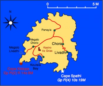 Map of Serifos - Click for larger view Map of Serifos - Click for larger view
| |
Serifos (Σέριφος) is a barren rocky island in the Cyclades with an area of 75 km2, about 1,400 inhabitants, and with a number of abandoned mines.
According to the mythology, Danae and her son Perseus were washed ashore on Serifos after drifting in a box that her father had placed them and cast them ashore fearing a prophesy that he would be killed by his grandson. The king of Serifos, Polydectes took a fancy to Danae and wanted to marry her but she refused. When Perseus grew up Polydectes sent him on an impossible quest: to slay the Medusa. With the help of Athena he did so and after returning to Serifos he showed Polydectes Medusa's head. The sight of the head turned Polydectes, his court, and most of the island into stone.
The first inhabitants of Serifos were Ionian Greeks. The island was fairly wealthy in antiquity because of its rich iron and copper mines and minted its own coins. In Hellenistic times it was conquered by the Macedonians and the Ptolemies from Egypt. During the 3rd century AD it was taken over by the Romans who used it as a place of exile. After the Byzantines, Serifos was taken by the Venetians who held it like the rest of the Cyclades. They built the castle of Chora. Following the Venetians it was taken by the Ottomans.
In modern times Serifos took an active role during the Greek War of Independence in 1821 following which it became part of Greece. In 1916 there was a violent miner's strike after which the mines declined and were eventually abandoned by 1960. The island's population declined to about 1400 inhabitants.
Today tourism has given the island a new prosperity.
Charts
- BA
- 2682 Kólpos Patalion to Nísos Nísiros
- 1038 Stenó Sífnou to Stenó Kafiréa
- Imray-Tetra
- G33 Southern Cyclades (West)
- NIMA
- 54320 Kiklades Nisoi to Kriti
- 54330 Plans in the Kikladhes
- Greek
- 41 Cavos Maleas to Cavos Kimis
- 415 Ydra to Sikinos
Radio Net
- Coast Guard - VHF channel 12 & Tel. +30 2810 51 470
- Olympia Radio - VHF channel 03 in Livadhi
Also see World Cruiser's Nets.
Weather
See Aegean Sea.
Approaches to Serifos are straightforward but:
Warning: With a meltemi there are strong gusts on the south side of the island.
Berthing Options
Ports
Livadhi
![]() 37°08.6′N, 24°31.2′E
37°08.6′N, 24°31.2′E
Livadhi (Λιβάδι - meadow) is the only harbor in the island. There are two alternatives here. You can either dock stern-to on the south side of the quay or anchor off. Either way there is good shelter from the meltemi despite the strong gusts. With a strong south-east wind there is appreciable swell into the bay. The docking area is usually very crowded and noisy. Yachts also anchor moor stern-to on the north side of the quay, but it is not to be recommended in strong northerlies as the holding is not good.
Many cruisers prefer the alternative of anchoring off. Anchor at 6 m towards the north-west of the bay but stay clear from the area where the ferries maneuver.
Warning: One drawback in this otherwise good anchorage are mosquitoes, in great numbers.
Last Visited & Details Checked (and updated here)
Date of member's visit to this Port/Stop & this page's details validated:
- July 2006 --Athene of Lymington
- September 2007 --Istioploos

Marinas & Yacht Clubs
None.
Anchorages
Koutala Bay
![]() 37°07.9′N, 24°27.4′E
37°07.9′N, 24°27.4′E
Koutala (Κουτάλα - spoon) Bay is a large bay on the south side of the island. It provides good shelter from the meltemi but it is subject to very violent katabatic gusts; they can go from 0 to 25 knots in almost no time.
There are several possible places to anchor: In the north-west cove at 6-15 m, north-east cove 5-10 m, and on the Eeastcove at about 5 m.
If there is any suspicion of a south wind, the Eeastcove is your best bet.
Warning: With strong gusts, two anchors may be advisable.
The bottom is mostly sand, good holding. The beaches here are nice and clean.
Last Visited & Details Checked (and updated here)
Date of member's visit to this Port/Stop & this page's details validated:
- September 1999 --Istioploos

Megalo Livadhi
![]() 37°08.7′N, 24°25.5′E
37°08.7′N, 24°25.5′E
Megalo Livadhi (big meadow) [37° 09' N 24° 26' E] is an inlet just north-west of Cape Kyklops. The shelter here is good but the surroundings are somewhat bleak and isolated.
Last Visited & Details Checked (and updated here)
Date of member's visit to this Port/Stop & this page's details validated:
- June 1994 --Istioploos

Offshore Islands
Yacht Services and Repairs
Marine Stores
None.
Yacht Services/Repairs/Yards
None.
Fuel, Water, & Electricity
- Fuel
- A truck delivers fuel at the quay of Livadhi. Call them on VHF channel 08l
- Water
- Limited water at the quay of Livadhi
- Electricity
- N/A (Not Available)
Things to do Ashore
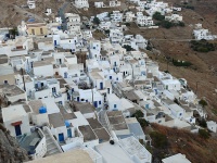 The Town Click for larger view |
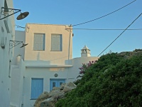 A House Click for larger view |
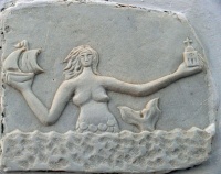 A Fountain Click for larger view |
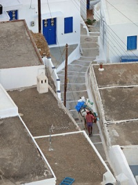 A Street Click for larger view |
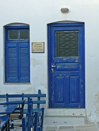 A Door Click for larger view |
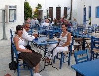 The Square Click for larger view |
Tourism
Chora
The must see place here is the main town of Chora. It is one of the more picturesque Cycladic towns with a Venetian Castle, many white washed houses in narrow streets and stairs, decorated with geraniums. Many of these houses have been restored by rich Athenians, British, and Germans.
There is a bus from Livadhi to Chora.
Kastro tis Grias
Near Koutala there is the 6th century AD white marble Kastro tis Grias (Κάστρο της Γριάς - Castle of the Hag) and the castle is the Cave of the Cyclops, with two stalactite chambers and a small lake. Bring a flash light.
Grocery & Supply Stores
- Stores in Livadhi
Eateries
- At the main square in Chora they serve nice mezedes (snacks)
- Many restaurants in Livadhi
- There is at least one restaurant in Koutala
Internet/WiFi
In Internet cafés.
Laundry
- ?
Motorbike & Car Rentals
- In Livadhi
Garbage Disposal
There are bins around the harbor and in several anchorages.
Transportation
- Ferries to Milos and Piraeus
- For Taxi call +30 6977 370 471
Routes/Passages To/From
- Passages between Athens Region and Samos - Kusadasi
- Passages between Athens Region and Rhodes - Marmaris
- Cruising the Cyclades Islands
Cruiser's Friends
Contact details of "Cruiser's Friends" that can be contacted for local information or assistance.
Forum Discussions
List links to discussion threads on partnering forums. (see link for requirements)
External Links
References & Publications
See Greece.
Personal Notes
Personal experiences?
Last Visited & Details Checked (and updated here)
See individual ports and anchorages in this page.
|
|---|
|
Names: Istioploos, Athene of Lymington |
| |
|---|
| | HOMEPAGE | Wiki Contents | Mediterranean | Aegean Sea | Greece | Serifos | |


