Template:Infobox/doc
From CruisersWiki
(show template's behaviour) |
|||
| Line 1: | Line 1: | ||
{{infobox port |41|14.74|N|09|11.93|E| | {{infobox port |41|14.74|N|09|11.93|E| | ||
| - | |||
| - | |||
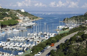
| image=SantaTeresa.jpg | | image=SantaTeresa.jpg | ||
| imagetext=The port of Santa Teresa | | imagetext=The port of Santa Teresa | ||
| Line 10: | Line 8: | ||
<pre><nowiki>{{infobox |||N|||E| | <pre><nowiki>{{infobox |||N|||E| | ||
| name= | | name= | ||
| - | |||
| - | |||
| maplat= | | maplat= | ||
| maplon= | | maplon= | ||
| Line 23: | Line 19: | ||
Example 1: | Example 1: | ||
<pre><nowiki>{{infobox |41|14.74|N|09|11.93|E| | <pre><nowiki>{{infobox |41|14.74|N|09|11.93|E| | ||
| - | |||
| - | |||
| image= SantaTeresa.jpg | | image= SantaTeresa.jpg | ||
| imagetext= The port of Santa Teresa | | imagetext= The port of Santa Teresa | ||
Revision as of 16:51, 13 March 2016
| Infobox/doc
| |
This template was designed to be used to place a table with some standard data (an "information box") at the beginning of an article. Such a table is described at the Pagetemplates article. This template allows creating such a table a more simple way:
{{infobox |||N|||E|
| name=
| maplat=
| maplon=
| mapzoom=
| image=
| imagetext=
}}
NB: Mind a vertical bar "|" at the end of coordinate parameters. Also, if you omit the line |chartlet= it automatically places a Navionics chartlet. See Example 2 below.
Example 1:
{{infobox |41|14.74|N|09|11.93|E|
| image= SantaTeresa.jpg
| imagetext= The port of Santa Teresa
}}
Example 2 Defaults (Navionics & Panoramio):
| Infobox/doc
| |
{{infobox |41|14.74|N|09|11.93|E|
| image= SantaTeresa.jpg
| imagetext= The port of Santa Teresa
}}
Example 3:
| Fourni
|
Here we specify chartlet coordinates with maplat and maplon (the gallery used the Infobox coordinates). Zooming for both gallery & chartlet is specified with map zoom.
{{infobox |37|34.7|N|26|28.5|E|
| name= Fourni
| maplat= 37.564
| maplon= 26.477
| mapzoom= 15
}}
Note: The title of table is automatically created from this page title hence it reads here as "Embeddable templates".
