User:Vadim/Sandbox2
From CruisersWiki
(Difference between revisions)
| Line 13: | Line 13: | ||
{{anchorencode:test space}} | {{anchorencode:test space}} | ||
| + | |||
| + | {{localurl:test space}} | ||
{{poi |41|14.925|N|9|12.707|E| | {{poi |41|14.925|N|9|12.707|E| | ||
Revision as of 21:48, 4 April 2015
| Vadim/Sandbox2
| |
test+space
test_space
/wiki/Test_space
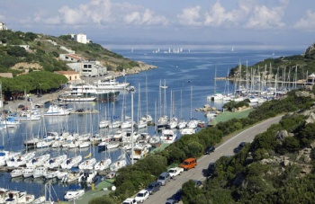
Porto quadro
A smaller bay, closer to Santa Teresa Gallura, but unsuitable with W - NW winds. There is an ugly hotel complex on the shore.
Porto quadro
A smaller bay, closer to Santa Teresa Gallura, but unsuitable with W - NW winds. There is an ugly hotel complex on the shore.
#jump-to-nav + h2,
script + h2
{
    display: none;
}
