Vrgada
From CruisersWiki
m |
Istioploos (Talk | contribs) (Template) |
||
| (30 intermediate revisions not shown) | |||
| Line 1: | Line 1: | ||
| - | + | {{IsPartOf|Mediterranean|Adriatic Sea|Croatia|Northern Dalmatia}} | |
| - | + | {{TOC block}} | |
| - | {{ | + | |
| - | + | ||
| - | | | + | |
| - | | | + | |
| - | + | ||
| - | + | ||
| - | + | ||
| - | + | ||
| - | + | ||
| - | + | ||
| - | + | ||
| - | + | ||
| - | + | ||
| - | + | ||
| - | + | ||
| - | + | ||
| - | + | ||
| - | The small island of Vrgada lies off the mainland coast of [[Croatia]] six miles SSE of the harbour of [[Biograd]]. | + | {{Infobox |
| - | + | | lat= 43.85217|lon=15.50133 | |
| - | + | | name= Vrgada | |
| - | + | | portofentry= | |
| - | + | | containsportofentry= | |
| - | + | | zoom= 13 | |
| - | + | | chartlet = y | |
| + | | image= VrgadaAerial.jpg | ||
| + | | imagetext= Harbour of U. Luka from N | ||
| + | | summary= The small island of [[Vrgada]] lies off the mainland coast of [[Croatia]] six miles SSE of the harbour of [[Biograd na Moru|Biograd]]. The island is situated halfway between the larger islands of [[Pašman]] to the NW and [[Murter]] to the SE. The island has a total area of only around 1.4 square miles but–for its size–a thriving population of nearly 250, mostly in the main settlement of Vrgada on the N coast. The island’s main harbour is in the bay of [[#U. Luka|U. Luka]] at the NE coast of the island, which offers good protection except in E winds, when the sandy bay of [[#U. Sv. Andrija|U. Sv. Andrija]] immediately W of a headland separating it from U. Luka is a better option. A further anchorage, [[#U. Kranje|U. Kranje]] on the S coast of the island offers better shelter from N winds. There are several fish farms in the channels between the small islets to the S. | ||
| + | | notes= | ||
| + | | news= | ||
| + | }} | ||
| - | '' | + | ==Charts== |
| - | + | ''See [[Northern Dalmatia#Charts|Northern Dalmatia]]''. | |
| - | '' | + | ==Weather== |
| - | + | ''See [[Croatia#Weather|Croatia]]''. | |
| - | '' | + | ==Passages== |
| - | + | ''See [[Croatia#Passages|Croatia]]''. | |
| - | == | + | ==Islands== |
| - | + | * [[Pašman]] | |
| - | + | * [[Murter]] | |
| - | + | ||
| - | + | ||
| - | + | ||
| - | + | ||
| - | + | ||
| - | == | + | ==Communication== |
| - | + | {{Green|Add here VHF channel for coastguard, harbor masters. etc.}} | |
| + | * | ||
| - | + | ''Also see [[World MM Nets|World Cruiser's Nets]]'' | |
| - | + | ==Berthing== | |
| + | The berthing options on the island consist of the two harbours of [[#U. Luka|U. Luka]] and [[#U. Sv. Andrija|U. Sv. Andrija]] on the NE coast and the anchorage of [[#U. Kranje|U. Kranje]] at the SE end of the island. | ||
| - | == | + | ===Ports=== |
| - | + | {{hold vertical}} | |
| + | {{Poi | lat= 43.85762278942491| lon= 15.502893531893072 | type= harbour | name= U. Luka | zoom= 17 | ||
| + | | image= VrgadaTown.jpg | ||
| + | | imagetext= Vrgada village from seaward | ||
| + | | imagewidth= | ||
| + | | text= The harbour of U. Luka lies on the E side of a promontory which shelters it from W. An islet, {{mark|type=island|name=O. Artina|lat=43.8634|lon=15.50245|zoom=15}}, lies just off the promontory and is connected to it by a shallow spit. The harbour consists of a series of short jetties protected by a long breakwater with a red light structure on the end extending from the S shore. | ||
| - | + | Berth alongside or stern/bows-to the inside of the breakwater using your anchor as space permits. Depths on the breakwater are 3.5 - 4.0 metres. Depths at the jetties further in are 2.0 metres or less. Shelter in the harbour is good in winds from the NW through the W to SE but the bay is exposed in winds from the N and the E.}} | |
| - | + | ||
| - | ==Yacht | + | ===Marinas & Yacht Clubs=== |
None. | None. | ||
| - | ==== | + | ==Anchorages== |
| - | + | {{hold vertical}} | |
| + | {{Poi |lat= 43.858075742508476| lon= 15.496201083026381 | ||
| + | | type= anchorage | ||
| + | | name= U. Sv. Andrija | ||
| + | | zoom= 16 | ||
| + | | image= VrgadaAndrija.jpg | ||
| + | | imagetext= Shallow anchorage of U. Sv. Andrija from SW | ||
| + | | imagewidth= | ||
| + | | text= The bay of U. Sv. Andrija lies on the W side of the promontory, just ‘round the corner’ from [[#U. Luka|U. Luka]]. Although it is relatively shallow, it offers better shelter with anything E in the wind. Anchor in the middle of the bay in 3.0 metres. The holding is good in sand. The bay is open to the NW and can be uncomfortable in the afternoon sea breezes. | ||
| - | == | + | {{Note}}tThere is a shoal patch on the headland on the E side of the bay, marked with a W cardinal mark.}} |
| - | + | {{hold vertical}} | |
| - | + | {{Poi |lat= 43.8485115213476| lon= 15.51148367179747 | |
| + | | type= anchorage | ||
| + | | name= U. Kranje | ||
| + | | zoom= 17 | ||
| + | | image= VrgadaKranje.jpg | ||
| + | | imagetext= Anchorage of U. Kranje | ||
| + | | imagewidth= | ||
| + | | text= The anchorage of U. Kranje is located at the SE end of the island overlooking the islet of '''Murvenjak''' and a cluster of smaller islets surrounded by fish farms. It is a popular anchorage in summer and offers good shelter in moderate northerly winds but is completely open to the S and the SE. Anchor in 4.0 - 5.0 metres, taking a line ashore if preferred. Holding is good in sand and weed. There are no facilities ashore.}} | ||
| - | == | + | ==Amenities== |
| - | + | {{tlist | |
| - | + | ||
| - | + | |header|Facilities | |
| - | + | ||
| - | + | |Water| N/A (Not Available) | |
| - | + | |Electricity| N/A | |
| + | |Toilets| {{MagentaText|?}} | ||
| + | |Showers| {{MagentaText|?}} | ||
| + | |Laundry| {{MagentaText|?}} | ||
| + | |Garbage| {{MagentaText|?}} | ||
| - | + | |header|Supplies | |
| - | None | + | |Fuel| N/A |
| + | |Bottled gas| None | ||
| + | |Chandlers| None | ||
| - | + | |header|Services | |
| - | + | |Repairs| N/A | |
| + | |Internet| N/A | ||
| + | |Mobile connectivity| {{Green|Is there mobile telephone signal such as G4, G3, GPRS on the island? How strong is the signal? Are there any blind spots?}} | ||
| + | |Vehicle rentals| N/A | ||
| + | }} | ||
| - | === | + | ==Provisioning== |
| - | + | {{mark | type= provisions |name= Vrgada village |text= small provisions shop.}} | |
| - | === | + | ==Eating out== |
| + | {{mark |name= [[#U. Luka|U. Luka]]| type= eatingout |text=there is a restaurant.}} | ||
| + | |||
| + | ==Transportation== | ||
Tripper boats only. | Tripper boats only. | ||
| - | == | + | ==Tourism== |
| + | ====History==== | ||
| + | Mentioned in the year 950 under the name of '''Lumbricaton''', the island of Vrgada first served as a home to shepherds who came from the '''Velebit''' mountain. The name Vrgada, which was documented in the 15th century, derives from “La Vergada”, meaning “the hilly island”. Vrgada, unlike most Adriatic islands in the Middle Ages, was inhabited and served as an important fort due to its position on the main straight of navigation. | ||
| + | |||
| + | The church, found at the top of the hill, is dedicated to St Andrew. First constructed in 824 AC, it is one of the oldest churches found in the Dalmatian islands. | ||
| + | |||
| + | ====Places to Visit==== | ||
| + | There is little to do on the island, but lovers of peace and quiet will find a good haven here - except during high tourist season when day-trippers flock to its several good beaches, especially in [[#U. Sv. Andrija|U. Sv. Andrija]]. | ||
| + | |||
| + | ==Friends== | ||
Contact details of "Cruiser's Friends" that can be contacted for local information or assistance. | Contact details of "Cruiser's Friends" that can be contacted for local information or assistance. | ||
* | * | ||
| - | == | + | ==Forums== |
| - | List links to discussion threads on [[Cruising Forums|partnering forums]]. (see link for requirements) | + | List links to discussion threads on [[Cruising Forums|partnering forums]]. (''see link for requirements'') |
* [http://www.cruisersforum.com/forums/tags/croatia.html Croatia Sailing and Cruising Discussions on Cruisers Forum] | * [http://www.cruisersforum.com/forums/tags/croatia.html Croatia Sailing and Cruising Discussions on Cruisers Forum] | ||
| - | * | + | * |
| - | + | ||
| - | + | ||
| - | + | ||
| - | + | ||
| - | + | ||
| - | + | ||
| - | + | ||
| - | == | + | ==Links== |
| - | + | * {{wikipedia}} | |
| - | + | * [http://www.pakostane.hr/en/good-to-know/vrgada Vrgada tourism] | |
| - | + | ||
| - | + | ||
* | * | ||
| - | + | For other useful websites, ''see [[Croatia#Links|Croatia]]''. | |
| - | '' | + | |
| - | + | ||
| + | ==References== | ||
| + | ''See [[Croatia#References|Croatia]]''. | ||
| - | {{ | + | {{Comments}} |
| + | * | ||
| + | * | ||
| + | |||
| + | {{Verified by}} | ||
| + | * July 2004 --[[User:Atheneoflymington|Athene of Lymington]] | ||
| + | * | ||
| - | + | {{Page useable}} | |
| - | { | + | |
| - | + | ||
| - | + | ||
| - | + | ||
| - | + | ||
| - | + | ||
| - | |||
| - | |||
| - | |||
| - | |||
| - | |||
| - | |||
| + | {{Contributors|[[User:Atheneoflymington|Athene of Lymington]]}} | ||
| - | [[Category:Islands - Croatia]] [[Category:Anchorages - Croatia]] | + | [[Category:Islands - Croatia]] [[Category:Anchorages - Croatia]] [[Category:Ports - Croatia]] |
Latest revision as of 20:05, 31 March 2019
| Vrgada
| |
| |
 Harbour of U. Luka from N |
The small island of Vrgada lies off the mainland coast of Croatia six miles SSE of the harbour of Biograd. The island is situated halfway between the larger islands of Pašman to the NW and Murter to the SE. The island has a total area of only around 1.4 square miles but–for its size–a thriving population of nearly 250, mostly in the main settlement of Vrgada on the N coast. The island’s main harbour is in the bay of U. Luka at the NE coast of the island, which offers good protection except in E winds, when the sandy bay of U. Sv. Andrija immediately W of a headland separating it from U. Luka is a better option. A further anchorage, U. Kranje on the S coast of the island offers better shelter from N winds. There are several fish farms in the channels between the small islets to the S.
Charts
See Northern Dalmatia.
Weather
See Croatia.
Passages
See Croatia.
Islands
Communication
Add here VHF channel for coastguard, harbor masters. etc.
Also see World Cruiser's Nets
Berthing
The berthing options on the island consist of the two harbours of U. Luka and U. Sv. Andrija on the NE coast and the anchorage of U. Kranje at the SE end of the island.
Ports

U. Luka
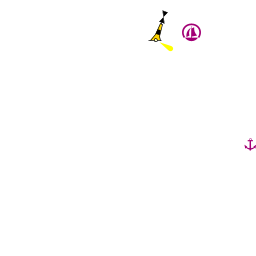
The harbour of U. Luka lies on the E side of a promontory which shelters it from W. An islet, ![]() O. Artina [[Vrgada#O. Artina|O. Artina]] 43°51.804'N, 015°30.147'E , lies just off the promontory and is connected to it by a shallow spit. The harbour consists of a series of short jetties protected by a long breakwater with a red light structure on the end extending from the S shore.
O. Artina [[Vrgada#O. Artina|O. Artina]] 43°51.804'N, 015°30.147'E , lies just off the promontory and is connected to it by a shallow spit. The harbour consists of a series of short jetties protected by a long breakwater with a red light structure on the end extending from the S shore.
Marinas & Yacht Clubs
None.
Anchorages

U. Sv. Andrija
The bay of U. Sv. Andrija lies on the W side of the promontory, just ‘round the corner’ from U. Luka. Although it is relatively shallow, it offers better shelter with anything E in the wind. Anchor in the middle of the bay in 3.0 metres. The holding is good in sand. The bay is open to the NW and can be uncomfortable in the afternoon sea breezes.
Note: tThere is a shoal patch on the headland on the E side of the bay, marked with a W cardinal mark.
U. Kranje
Amenities
| Facilities | |
|---|---|
| Water | N/A (Not Available) |
| Electricity | N/A |
| Toilets | ? |
| Showers | ? |
| Laundry | ? |
| Garbage | ? |
| Supplies | |
| Fuel | N/A |
| Bottled gas | None |
| Chandlers | None |
| Services | |
| Repairs | N/A |
| Internet | N/A |
| Mobile connectivity | Is there mobile telephone signal such as G4, G3, GPRS on the island? How strong is the signal? Are there any blind spots? |
| Vehicle rentals | N/A |
Provisioning
![]() Vrgada village [[Vrgada#Vrgada village|Vrgada village]] small provisions shop.
Vrgada village [[Vrgada#Vrgada village|Vrgada village]] small provisions shop.
Eating out
![]() U. Luka [[Vrgada#U. Luka|U. Luka]] there is a restaurant.
U. Luka [[Vrgada#U. Luka|U. Luka]] there is a restaurant.
Transportation
Tripper boats only.
Tourism
History
Mentioned in the year 950 under the name of Lumbricaton, the island of Vrgada first served as a home to shepherds who came from the Velebit mountain. The name Vrgada, which was documented in the 15th century, derives from “La Vergada”, meaning “the hilly island”. Vrgada, unlike most Adriatic islands in the Middle Ages, was inhabited and served as an important fort due to its position on the main straight of navigation.
The church, found at the top of the hill, is dedicated to St Andrew. First constructed in 824 AC, it is one of the oldest churches found in the Dalmatian islands.
Places to Visit
There is little to do on the island, but lovers of peace and quiet will find a good haven here - except during high tourist season when day-trippers flock to its several good beaches, especially in U. Sv. Andrija.
Friends
Contact details of "Cruiser's Friends" that can be contacted for local information or assistance.
Forums
List links to discussion threads on partnering forums. (see link for requirements)
Links
- Vrgada at the Wikipedia
- Vrgada tourism
For other useful websites, see Croatia.
References
See Croatia.
Comments
We welcome users' contributions to the Wiki. Please click on Comments to view other users' comments, add your own personal experiences or recommend any changes to this page following your visit.
Verified by
Date of member's last visit to Vrgada and this page's details validated:
- July 2004 --Athene of Lymington
| This is a usable page of the cruising guide. However, please contribute if you can to help it grow further. Click on Comments to add your personal notes on this page or to discuss its contents. Alternatively, if you feel confident to edit the page, click on the edit tab at the top and enter your changes directly. |
| |
|---|
|
Names: Athene of Lymington |