Morinjski Zaljev
From CruisersWiki
| Morinjski Zaljev
| |
| |
 Bridge over the entrance into the cove |
Charts
See Northern Dalmatia.
Weather
See Croatia.
Islands
Communication
Add here VHF channel for the coastguard, harbor masters. etc.
Also see Cruiser's Nets
![]() D8 highway bridge [[Morinjski Zaljev#D8 highway bridge|D8 highway bridge]] 43°40.367'N, 015°55.670'E There is a highway bridge above the entrance to the bay. The clearance under the bridge is 18.4 m Morinje Bridge.
D8 highway bridge [[Morinjski Zaljev#D8 highway bridge|D8 highway bridge]] 43°40.367'N, 015°55.670'E There is a highway bridge above the entrance to the bay. The clearance under the bridge is 18.4 m Morinje Bridge.
Berthing
None
For the closest options check the island of Krapanj (approx. 0.5 nM W) and a small Marina Solaris (approx. 3 NM NW along the shore).
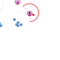
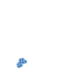
Anchorages
The main body of the cove is very shallow, but the channel leading to it provides a few good anchorages (view towards the cove entrance)

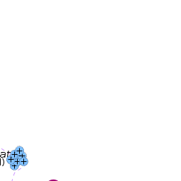
3 inlets at entrance

Kanal Morinje
Amenities
None.
Provisioning
None
Eating out
N/A (Not Available)
Transportation
List transportation (local and/or international.)
Tourism
List places of interest, tours, etc.
Friends
Contact details of "Cruiser's Friends" that can be contacted for local information or assistance.
Forums
List links to discussion threads on partnering forums. (see link for requirements)
Links
For other useful websites, see Croatia.
References
See Croatia.
Comments
We welcome users' contributions to the Wiki. Please click on Comments to view other users' comments, add your own personal experiences or recommend any changes to this page following your visit.
Verified by
Date of member's last visit to Morinjski Zaljev and this page's details validated:
- Sep 2016 -- Vadim
If you provide a lot of info and this page is almost complete, change {{Page outline}} to {{Page useable}}.
| This page has an outline in place but needs completing. Please contribute if you can to help it grow further. Click on Comments to suggest further content or alternatively, if you feel confident to edit this page, click on the edit tab at the top and enter your changes directly. |
| |
|---|
|
Names: Vadim |