File:Cid Harbour Whitsunday Island Mud Map.jpg
From CruisersWiki
Revision as of 09:06, 28 February 2013 by Peter McHugh (Talk | contribs)
Size of this preview: 800 × 495 pixels
Full resolution (850 × 526 pixels, file size: 71 KB, MIME type: image/jpeg)
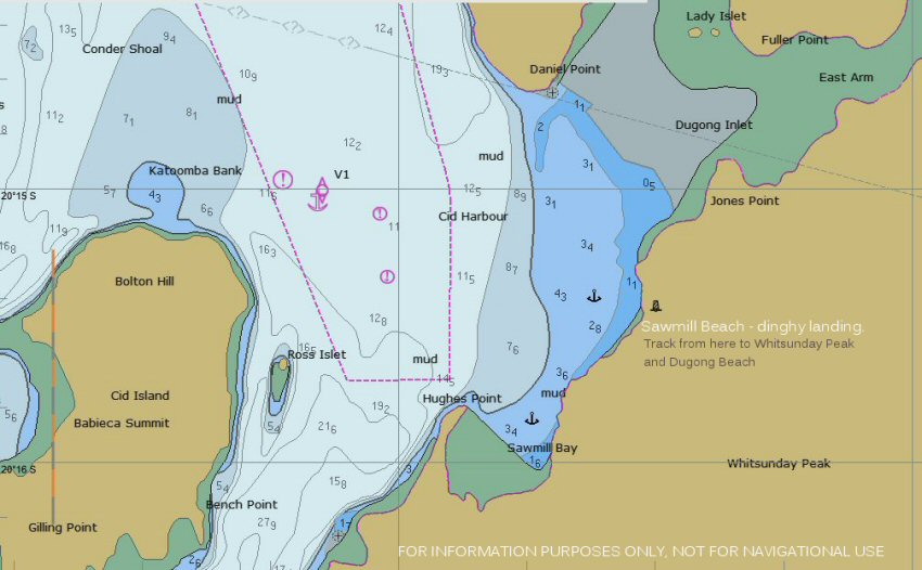
FOR INFORMATION ONLY. NOT FOR NAVIGATION PURPOSES. Cid Harbour anchorage at Whitsunday Island. There is a large area in the vicinity of the anchor symbols suitable for anchorage unless there are westerly conditions. The dinghy landing spot at Sawmill Beach is marked.
File history
Click on a date/time to view the file as it appeared at that time.
| Date/Time | Thumbnail | Dimensions | User | Comment | |
|---|---|---|---|---|---|
| current | 09:06, 28 February 2013 | | 850×526 (71 KB) | Peter McHugh (Talk | contribs) | (FOR INFORMATION ONLY. NOT FOR NAVIGATION PURPOSES. Cid Harbour anchorage at Whitsunday Island. There is a large area in the vicinity of the anchor symbols suitable for anchorage unless there are westerly conditions. The dinghy landing spot at Sawmill B) |
- Edit this file using an external application (See the setup instructions for more information)
File links
The following page links to this file: