Port de Mueo
From CruisersWiki
Peter McHugh (Talk | contribs) |
Peter McHugh (Talk | contribs) |
||
| Line 62: | Line 62: | ||
====Anchorages==== | ====Anchorages==== | ||
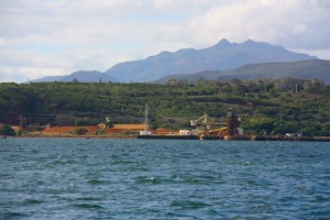
| - | + | [[Image:Mueo_Anchorage.jpg|300px|thumb|right|'''Baie de Nepouli Anchorage'''<br/>''Click for larger view'']] | |
* The most convenient anchorages are in Baie de Nepoui. It is possible to anchor off the fuel depot, but a better anchorage is to be found a further 500 metres to the north. As this is a mining area, red mud predominates in the anchorages. The launching ramp near the fuel depot is the best spot to land a dinghy. There is a tap by the edge of the ramp. From the ramp, walk a short distance towards the power station until just before the large fuel tanks. Follow the fence line up the hill and you find a rough track which provides a short cut to the top of the hill. You are then a short walk from the town. | * The most convenient anchorages are in Baie de Nepoui. It is possible to anchor off the fuel depot, but a better anchorage is to be found a further 500 metres to the north. As this is a mining area, red mud predominates in the anchorages. The launching ramp near the fuel depot is the best spot to land a dinghy. There is a tap by the edge of the ramp. From the ramp, walk a short distance towards the power station until just before the large fuel tanks. Follow the fence line up the hill and you find a rough track which provides a short cut to the top of the hill. You are then a short walk from the town. | ||
Revision as of 11:17, 4 August 2011
Port de Mueo, New Caledonia
| | |
| | DD°M.M′N/S, DD°M.M′E/W |
|---|---|
| | Photo gallery |
| | Local chartlet |
Overview
Port de Mueo provides an overnight stop for vessels cruising the west coast of New Caledonia. It is not a particularly scenic stop over, but the anchorage is sheltered and the mining village of Nepoui (pop ~1,000) is a short walk from the dinghy landing. There is a small supermarket, a restaurant, fuel, post office and other such facilities.
Cruising the region
The section of the west coast of New Caledonia between Baie D'Ouarai (Ile Lebris anchorage) and Voh, a distance of about 80nm, is not navigable inside the barrier reef. Fortunately, there are a number of accessible, secure anchorages that can be reached through well marked passes and the maximum distance between anchorages is only about 30 nm. Bearing in mind that the ideal cruising time in New Caledonia is winter, when days are short, and the need to maintain good sun angles when navigating around coral, there is a definite need for relatively short daily distances.
The next anchorage to the north is about 25 nm away at Ile Koniene. This involves travelling some 5 nm out to the Passe De Mueo, a 15 nm run outside the reef, entering Passe de Pouembout and a 6 nm run inside the reef to Ile Koniene.
The next significant anchorage to the south is Baie de Bourail. This requires the 5 nm run out to Passe de Mueo, a 31 nm run outside the reef and then a short run into the wide Baie de Bourail, where anchorage is found in the side arm of Baie de Nessadiou.
Local Weather
Local weather conditions?
Sources for Weather forecasts:
Charts
Submit the chart details that are required for safe navigation.
- Chart Source
- Chart No
- Chart No
Radio Nets
Also see World Cruiser's Nets
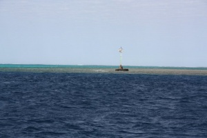
Passe de Mueo is well marked and a channel suitable for large ships is marked all the way to Nepoui. Passe De Mueo is about 500 metres wide, with a substantial light tower (Fl 4sec) on the southern side of the Passe. Once inside the Passe, red and green markers clearly define the channel. As there are some shoal patches outside the channel, it is probably wisest to not take short cuts. Note that it is about 5 nm from the Passe to the anchorage at Nepoui.
Approaching the port facility on the southern end of Presqu'ile de Mueo, you should head into the western inlet, Baie de Nepoui. Note that there is a green bouy to the west of the ore loader and you should keep to the west of this to avoid a shoal patch. Once passed this bouy, you can head in towards the obvious power station to the anchorage.
Check-in facilities (for Customs and Immigration)
You must check in with Customs at Noumea before progressing anywhere else in New Caledonia.
Offshore Islands and Groups
List Islands
Marinas & Yacht Clubs
- The Cruising Guide to New Caledonia describes a small marina in front of the fuel depot. This is hardly more than a rock wall protecting a launching ramp. It makes a useful dinghy landing, but nothing more than this
Anchorages
- The most convenient anchorages are in Baie de Nepoui. It is possible to anchor off the fuel depot, but a better anchorage is to be found a further 500 metres to the north. As this is a mining area, red mud predominates in the anchorages. The launching ramp near the fuel depot is the best spot to land a dinghy. There is a tap by the edge of the ramp. From the ramp, walk a short distance towards the power station until just before the large fuel tanks. Follow the fence line up the hill and you find a rough track which provides a short cut to the top of the hill. You are then a short walk from the town.
Yacht Repairs and Services
Marine Stores
Submit addresses and contact details of marine related businesses that are of interest to cruisers.
Repairs/Yards
Fuel, Water, & Electricity
- Fuel
- fuel notes
- Water
- water notes
- Electricity
- electricity notes
Things to do Ashore
Tourism
List places of interest, tours, etc.
- Unless mining towns excite you, there are not a lot of tourist attractions here.
Grocery & Supply Stores
- There is a small grocery store in Nepoui
Eateries
- There is at least one restaurant at Nepoui.
Internet/WiFi
Available? No
Laundry
Motorbike & Car Rentals
- Unlikely
Garbage Disposal
Nothing obvious.
Transportation
Transportation (local and/or international)
Routes/Passages To/From
Popular passages/routes, timing, etc.
Cruiser's Friends
Contact details of "Cruiser's Friends" that can be contacted for local information or assistance.
Forum Discussions
List links to discussion threads on partnering forums. (see link for requirements)
External Links
Links to relevant websites.
References & Publications
Publications, Guides, etc.
Personal Notes
Personal experiences?
Last Visited & Details Checked (and updated here)
Date of member's visit to this Port/Stop & this page's details validated:
- June 2010 - Pedro
|
|---|
|
Names: Pedro |
| |
|---|
| | HOMEPAGE | Wiki Contents | South Pacific | New Caledonia | Port de Mueo | |


