Voh
From CruisersWiki
m (Text replace - "==References & Publications==" to "==References==") |
m (Text replace - "===Anchorages===" to "==Anchorages==") |
||
| Line 72: | Line 72: | ||
* None | * None | ||
| - | + | ===Anchorages=== | |
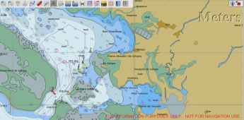
[[Image:Baie_Chasseloup_Anchorage Sketch.jpg|345px|thumb|right|'''Baie Chasseloup Anchorage''']] | [[Image:Baie_Chasseloup_Anchorage Sketch.jpg|345px|thumb|right|'''Baie Chasseloup Anchorage''']] | ||
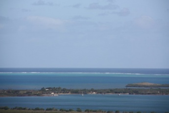
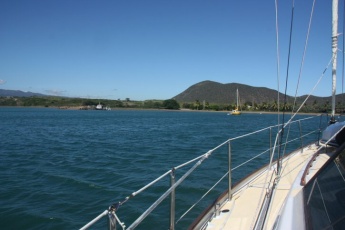
[[Image:Baie_Chasseloup_Anchorage.jpg|345px|thumb|right|'''Baie Chasseloup Anchorage''']] | [[Image:Baie_Chasseloup_Anchorage.jpg|345px|thumb|right|'''Baie Chasseloup Anchorage''']] | ||
Latest revision as of 08:02, 16 August 2018
| Voh
| |
Baie Chasseloup is a sheltered anchorage in the NW of New Caledonia. The anchorage is about 6 km from the town of Voh, which makes access to facilities difficult unless you have transport. There is a pleasant beach front inshore from the anchorage and a road leading to Voh, but no regular transport and no facilities of any sort nearby.
If you are traveling north on the west coast of New Caledonia, once you reach Baie Chasseloup it is possible to stay inside the barrier reef for the rest of the way up the coast. If you are traveling south on the coast, from here on for the next 80nm , you must travel outside the barrier reef to get between anchorages.
Heading south, exit through Passe Du Duroc and travel about 9 nm south along the reef and re enter through Passe de Kone. Once inside the reef, there is a well marked track which will take you to Ille Koniene. This is really only useful as an overnight stopping point.
Heading north, the next significant stopping point is Koumac, about 32 nm away. This can be undertaken inside the barrier reef. While there is a significant amount of reef dodging to be done, all dangers are charted and marked, provided you stick a relatively direct route. It is easy to see from chart sounding densities that specific tracks have been well examined, but it can be assumed that you venture outside those tracks at your own risk.
Charts
- Source
- Chart Number - Chart Name
- Chart Number - Chart Name
- Source
- Chart Number - Chart Name
Weather
Local weather conditions?
Sources for Weather forecasts:
Local forecasts are, of course, in French, but non-French speakers should find them relatively easy to understand. A very useful vocabulary can be found at How to Understand French Weather Forecasts for Sailors.
The main source of weather information for the area around New Caledonia is Meteo France Nouvelle-Calédonie. The marine section provides a 6 day forecast for the whole region, with details for each of the passes through the barrier reef.
Nouméa radio broadcasts the weather report in French on VHF 16, everyday at 6:30, 9:30, 15:15, 18:30.
There is a set of repeater channels allowing receipt of weather info anywhere in the country:
- Nouméa area: VHF 26
- Southern portion of the Grande Terre: VHF 28
- Isle of Pines and the Southern Lagoon: VHF 25
- Grande Terre North West coast: VHF 25
- Northern portion of Grande Terre: VHF 24
- Ouvea: VHF 23
- Lifou: VHF 26
- Maré: VHF 87
Passages
List popular passages/routes, timing, etc.
Communication
Also see World Cruiser's Nets
Approaching from seaward, Passe Duroc is deep and half a mile wide. There are a number of ore port facilities nearby, so navigation markers are good.
Once through the Passe, keep to the north as there is a large shoal area (Le Grand Ronfleur) immediately to the right of the track to Baie Chasseloup. There is a green starboard marker off Pointe Te Giboudot, which allows you to clear the reefs that extend from this point. Continue along the north coast until you pass a white monument on the shore. There are a number of occupied moorings in the bay.
Entrance
You must clear Customs at Noumea before progressing elsewhere in New Caledonia.
Berthing
Marinas & Yacht Clubs
- None
Anchorages
- Anchor off the beach in Baie Chasseloup, just outside the moorings. There is a ramp and jetty on the eastern side of the bay. The jetty appears to be used by tugs that escort ore carriers. Approaching from seaward, look for a white monument on the shore and continue passed this to the area of moorings. It is straight forward to land a dinghy on the beach.
Yacht Repairs and Services
Marine Stores
Submit addresses and contact details of marine related businesses that are of interest to cruisers.
- None
Repairs/Yards
- None
Fuel, Water, & Electricity
- Fuel
- Would have to be brought from Voh
- Water
- A tap on the beach
- Electricity
- Not available
Things to do Ashore
Tourism
- Voh is a pleasant little town if you can get there from the anchorage (about 6km)
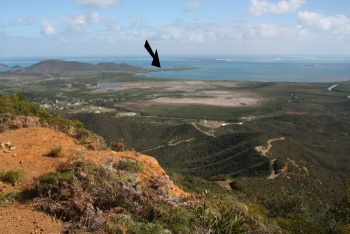
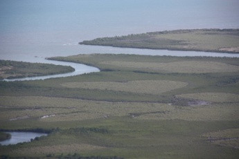
- There is a track from Voh that climbs steeply up a nearby hill. From the lookout at the top of the hill, you can see the "Heart of Voh", a unique natural mangrove formation. The climb takes about an hour. Ask at the Maire in Voh for directions. While the "Heart" is probably best seen from an aircraft directly overhead, the view of Voh and the surrounding countryside more than justifies the climb.
Grocery & Supply Stores
- Market and small shop in Voh.
Eateries
- None
Internet/WiFi
None
Laundry
- None
Motorbike & Car Rentals
- None
Garbage Disposal
No
Transportation
Transportation (local and/or international)
- No transport to Voh.
Friends
Contact details of "Cruiser's Friends" that can be contacted for local information or assistance.
Forums
List links to discussion threads on partnering forums. (see link for requirements)
Links
- Voh at the Wikipedia
References
Publications, Guides, etc.
Comments
We welcome users' contributions to the Wiki. Please click on Comments to view other users' comments, add your own personal experiences or recommend any changes to this page following your visit.
Verified by
Date of member's last visit to Voh and this page's details validated:
- June and July 2010 - Pedro
| |
|---|
|
Names: Pedro |
