File:Anse Majic Anchorage Sketch.jpg
From CruisersWiki
Size of this preview: 800 × 397 pixels
Full resolution (850 × 422 pixels, file size: 72 KB, MIME type: image/jpeg)
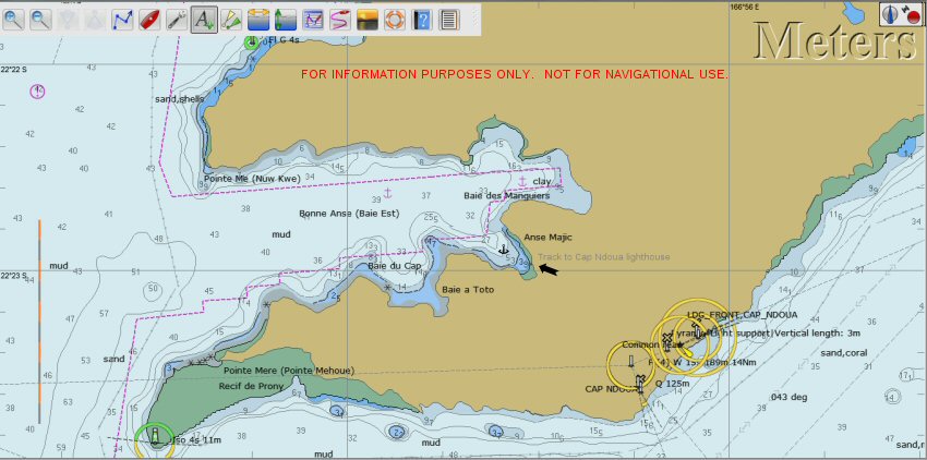
FOR INFORMATION ONLY. NOT FOR NAVIGATION PURPOSES. The anchor symbol shows a suitable area to anchor. There is a mud bottom. The buoy mentioned in the Guide was not there in 2010. The jetty shown on the chart does not exist, but there is a suitable area for a dinghy landing. The track to Cap Ndoua leaves from this landing spot.
File history
Click on a date/time to view the file as it appeared at that time.
| Date/Time | Thumbnail | Dimensions | User | Comment | |
|---|---|---|---|---|---|
| current | 10:46, 1 March 2013 | | 850×422 (72 KB) | Peter McHugh (Talk | contribs) | (FOR INFORMATION ONLY. NOT FOR NAVIGATION PURPOSES. The anchor symbol shows a suitable area to anchor. There is a mud bottom. The buoy mentioned in the Guide was not there in 2010. The jetty shown on the chart does not exist, but there is a suitable area ) |
- Edit this file using an external application (See the setup instructions for more information)
File links
The following page links to this file: