Ancona
From CruisersWiki
m (Text replace - "World Cruiser's Nets" to "World Cruiser's Nets") |
m (Text replace - "{| class="infobox bordered" style="width: 33em; text-align: left; font-size: 85%;" " to "{| class="infobox bordered" style="width: 28em; text-align: left; font-size: 90%;"") |
||
| Line 1: | Line 1: | ||
==Ancona, Italy== | ==Ancona, Italy== | ||
| - | {| class="infobox bordered" style="width: | + | {| class="infobox bordered" style="width: 28em; text-align: left; font-size: 90%;"|- |
| - | |- | + | |
| colspan="2" style="text-align:center; font-size: smaller;" | {{Small info}} (''Click links for more information'') | | colspan="2" style="text-align:center; font-size: smaller;" | {{Small info}} (''Click links for more information'') | ||
|- | |- | ||
Revision as of 19:56, 15 June 2011
Ancona, Italy
| | |
| | 43°37.9′N, 13°29.68′E |
|---|---|
| | [ Photo gallery] |
| | [ Local chartlet] |
Ancona is a city and major commercial seaport situated on the Adriatic coast of Italy around 10 miles NW of the port of Numana and 30 miles SSE of the harbour of Fano. Originally a Greek colony founded by the city state of Syracuse in Sicily around 387 BC, it became an important harbour during the Roman imperial age as the closest harbour to the province of Dalmatia. The harbour was expanded during the reign of the emperor Trajan, in whose honour a triumphal arch was erected at the northern end of the harbour, which still stands today. By the start of the 11th century Ancona was an important maritime republic, often clashing with the powerful republic of Venice to the north. The city became part of the Papal States in 1532, when the massive citadel was started. Further fortifications were added on the hills above the port in the 19th century. Nevertheless, the city was easily captured in July 1944 following encirclement by the Polish II Corps as part of the Allied push to drive the Nazi forces out of Italy. Today the port is one of the main ferry ports on the Adriatic coast of Italy, with services to Croatia, Greece and even Turkey. Visiting yachts normally berth in the large Marina Dorica a mile SW of the entrance to the Porto Commerciale or, if over 20 metres in length or over 4.5 metres draft, in the Porto Commerciale itself.
Charts
British Admiralty 220
Italian charts 922, 35, 36, 209, 210
Radio Nets
Also see World Cruiser's Nets
Local Weather
During the summer months the prevailing winds in the Adriatic are light to moderate coastal seabreezes. In spring and autumn, northerly winds are more frequent and can quickly rise to near gale force, especially in the northern Adriatic, where the much-feared “bora” is caused by high pressure over the mountains to the NE coupled with low pressure over southern Italy. Fortunately, the fiercest “bora” is normally to be expected in the winter months. Thunderstorms are occasionally experienced in spring and especially autumn and can be accompanied by violent winds of gale force and above. Luckily they are rarely long-lasting. In the southern Adriatic, the “scirocco”, a S/SE wind blowing up from North Africa which can last for several days, is more common. Unlike the “bora”, which can arrive without warning, a “scirocco” tends to build in strength over 24-48 hours, sometimes reaching gale force (especially in winter).
Sources for weather information:
- There is a continuous (computerised voice) weather forecast on VHF 68 - first in Italian and then followed with an English translation.
- The same forecast is given in Italian and English on VHF coastal stations following a notification on channel 16.
- Navtex weather forecasts covering the Adriatic are broadcast from stations at Roma, Trieste, Kerkyra (Greece) and Split (Croatia).
Ancona lies on the NW of a large promontory. In the approach from S the first sign on rounding the headland is the huge white buildings of the shipyard at the N extremity of the harbour. The headland and the mole with the shipyard on its should be given a berth of at least 200 metres to avoid shallow patches. From N the buildings of the city (and especially the cathedral) are visible from several miles off. A long jetty extends over half a mile from its associated oil terminal about three miles WNW of the harbour. The entrance to Ancona is affected by strong currents at certain states of tide which set across the harbour entrance from SW and then continue around the headland, turning SE as they go. Shelter is good in the inner part of the Porto Commerciale in all conditions. Shelter is good in the Marina Dorica in most conditions, although strong westerlies make a stay here uncomfortable.
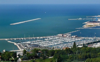
If approaching the basin of Marina Dorica ![]() 43°36.65′N, 13°28.91′E, from SE, a yacht should continue a further mile past the entrance to the Porto Commerciale to the W end of the long curved breakwater that protects the marina. Entrance is from WSW, giving the end of the breakwater a clearance of at least 200 metres to avoid the shoal patch around it. If approaching from NW, the marina is clearly identifiable from the forest of masts at the SW end of the port. The marina entrance is shallow, with only 2.5 - 3.5 metres, and entrance is inadvisable with any swell.
43°36.65′N, 13°28.91′E, from SE, a yacht should continue a further mile past the entrance to the Porto Commerciale to the W end of the long curved breakwater that protects the marina. Entrance is from WSW, giving the end of the breakwater a clearance of at least 200 metres to avoid the shoal patch around it. If approaching from NW, the marina is clearly identifiable from the forest of masts at the SW end of the port. The marina entrance is shallow, with only 2.5 - 3.5 metres, and entrance is inadvisable with any swell.
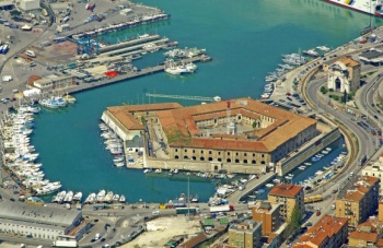
If entering the Porto Commerciale ![]() 43°37.9′N, 13°29.68′E, pass inside the detached breakwater 400 metres off the harbour entrance and enter between the two moles with stone light towers at their ends. Large yachts (over 20 metres) are allowed to berth alongside the commercial quays wherever convenient as long as they are not impeding large vessels using the port and provided crew remain aboard to move the yacht if requested. A yacht may find a berth around the quays in the small basin of the so-called Porto Commerciale ‘marina’, which is constructed around a pentagonal building, originally an isolation hospital and now a cultural centre. However, these berths are usually reserved for local yacht club members and there is seldom room for a visiting yacht here.
43°37.9′N, 13°29.68′E, pass inside the detached breakwater 400 metres off the harbour entrance and enter between the two moles with stone light towers at their ends. Large yachts (over 20 metres) are allowed to berth alongside the commercial quays wherever convenient as long as they are not impeding large vessels using the port and provided crew remain aboard to move the yacht if requested. A yacht may find a berth around the quays in the small basin of the so-called Porto Commerciale ‘marina’, which is constructed around a pentagonal building, originally an isolation hospital and now a cultural centre. However, these berths are usually reserved for local yacht club members and there is seldom room for a visiting yacht here.
Note: along this stretch of the Adriatic coast tidal ranges can exceed 1.0 metre at springs, so judging the tides right can make a significant difference to safe access in most of the shallower harbours.
Check-in facilities (for Customs and Immigration)
In the Porto Commerciale a yacht should berth alongside wherever it will not be in the way of naval, commercial and fishing vessels - most likely at the SW corner of the harbour in the area of the Porto Commerciale ‘marina’. Call the Capitaneria di Porto on VHF channel 12 for berthing directions. Depths at the SW corner are around 5.0 - 6.0 metres. There are no facilities along the quays, except at the berths in the Porto Commerciale ‘marina’. Maximum length accommodated on the quays: 150 metres.
For berthing in the basin of Marina Dorica, click on the link for details. Note that entry is only allowed from 0800 to 2000.
Offshore Islands and Groups
None.
Marinas & Yacht Clubs
Anchorages
No anchoring is permitted in the harbour.
Yacht Repairs and Services
Marine Stores
Submit addresses and contact details of marine related businesses that are of interest to cruisers.
Repairs/Yards
In the Porto Commerciale facilities include: slipway; fixed crane; travel lift; engine, electrical and electronic repairs; divers. See Marina Dorica for details of services there.
Fuel, Water, & Electricity
Fuel station on the quay at entrance to the area of the Porto Commerciale ‘marina’ and at entrance to Marina Dorica. Water and electricity on the pontoons at Marina Dorica and some berths in Porto Commerciale.
Tourism and Things to do Ashore
Tourism
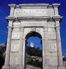
Ancona was badly damaged in World War II, but a few traces of its mediaeval past remain in the old town to the E of the Porto Commerciale. The Piazza del Plebiscito was once the town’s main square and contains a 15th century palazzo with a beautiful courtyard and the Baroque Chiesa di San Domenico with a famous painting of the Crucifixion by Titian. The remains of a 13th century city gate, the Porta San Pietro, is nearby. For history buffs, the Museo Archeologico Nazionale delle Marche contains an impressive collection of relics from the Iron Age up to the Byzantine period. The Romanesque cathedral of San Ciriaco past the archeological museum at the northern end of town was erected on the site of a former Roman temple. A short stroll to the west is the Arco di Traiano (Trajan’s arch), erected to commemorate the Roman emperor’s expansion of the harbour in 115 AD.
Grocery & Supply Stores
- Numerous provisions shops in the city, but some distance from the port.
Eateries
- Numerous restaurants in the city, but some distance from the port.
Internet/WiFi
None.
Laundry
None.
Motorbike & Car Rentals
- Numerous rental outlets in the town.
Garbage Disposal
Bins around the marina. Some around the Porto Commerciale.
Transportation
- Buses to all local destinations from the town.
- Railway station with connections to most destinations.
- Airport at Falconara, 11 kms away.
- Ferries to Greece (Patras, Igoumenitsa and Kerkyra), Croatia (Split, Zadar) and Turkey (Cesme)
Routes/Passages To/From
Popular passages/routes, timing, etc.
Cruiser's Friends
Contact details of "Cruiser's Friends" that can be contacted for local information or assistance.
Forum Discussions
List links to discussion threads on partnering forums. (see link for requirements)
External Links
Links to relevant websites.
References & Publications
Publications, Guides, etc.
Last Visited & Details Checked (and updated here)
Date of member's visit to this Port/Stop & this page's details validated:
- Data compiled from web research (please update if possible)--Athene of Lymington 19:27, 6 January 2011 (UTC)
Personal Notes
Personal experiences?
|
|---|
|
Names: |
| |
|---|
| | HOMEPAGE | Wiki Contents | Mediterranean | Italy | Taranto | |
.


