Kaprije
From CruisersWiki
m |
Istioploos (Talk | contribs) (Template) |
||
| (7 intermediate revisions not shown) | |||
| Line 1: | Line 1: | ||
| - | {{IsPartOf|Mediterranean|Adriatic Sea|Croatia}} | + | {{IsPartOf|Mediterranean|Adriatic Sea|Croatia|Northern Dalmatia}} |
{{TOC block}} | {{TOC block}} | ||
| + | |||
{{Infobox | {{Infobox | ||
| - | | lat=43.695307 |lon=15.701351 | + | | lat=43.695307 | lon=15.701351 |
| + | | name= Kaprije | ||
| zoom= 12 | | zoom= 12 | ||
| chartlet=y | | chartlet=y | ||
| image= KaprijeAerial.jpg | | image= KaprijeAerial.jpg | ||
| imagetext= Luka Kaprije (Kaprije harbour) from NW | | imagetext= Luka Kaprije (Kaprije harbour) from NW | ||
| + | | summary= '''Kaprije''' (Italian: ''Capri di Dalmazia'') is an island which lies off the mainland coast of [[Croatia]], seven miles W of the port of [[Šibenik]]. The islands of [[Kakan]] and [[Zmajan]] lie immediate W and E respectively. With a total area of only 2.7 square miles, the island supports a population of around 140, mostly centred on its single settlement – village of Kaprije. The economy of the island is based on olive and grape production and, presumably, capers, from which the island takes its name. Today, of course, tourism is also an important contributor. The island is also known by film buffs as it served as a setting for the Oscar-winning film, ''Mediterraneo''. Kaprije is commonly visited by sailors [https://www.zizoo.com/en/yacht-charter-sailing-routes/sibenik-to-kornati-and-krka-park on route from Šibenik]. Like many of the smaller Croatian islands, Kaprije is car-free. The island's main harbour is located at the head of a deep inlet on its W coast. | ||
| notes= | | notes= | ||
| news= | | news= | ||
}} | }} | ||
| - | |||
==Charts== | ==Charts== | ||
| - | + | ''See [[Northern Dalmatia#Charts|Northern Dalmatia]]''. | |
| - | + | ||
| - | + | ||
| - | + | ||
| - | + | ||
| - | + | ||
| - | + | ||
==Weather== | ==Weather== | ||
| - | + | ''See [[Croatia#Weather|Croatia]]''. | |
| - | + | ||
| - | + | ||
| - | + | ||
| - | + | ||
==Passages== | ==Passages== | ||
| Line 32: | Line 24: | ||
==Islands== | ==Islands== | ||
| - | |||
| - | |||
| - | |||
* [[Kakan]] | * [[Kakan]] | ||
* [[Zmajan]] | * [[Zmajan]] | ||
| Line 49: | Line 38: | ||
==Berthing== | ==Berthing== | ||
| - | There are two berthing options on the island, the harbour of Kaprije Town and | + | There are two berthing options on the island, [[#Luka Kaprije|Luka Kaprije]] the harbour of Kaprije Town and several [[#Anchorages|anchorages]]. |
| + | ===Ports=== | ||
{{Poi | {{Poi | ||
| - | | type= | + | | type= harbour |
| lat= 43.68733313128628 | lon= 15.707550631777648 | | lat= 43.68733313128628 | lon= 15.707550631777648 | ||
| zoom= 16 | | zoom= 16 | ||
| Line 59: | Line 49: | ||
| image= KaprijeJetty.jpg | imagetext= Yachts berthed at the jetty in the village of Kaprije | | image= KaprijeJetty.jpg | imagetext= Yachts berthed at the jetty in the village of Kaprije | ||
| imagewidth= | | imagewidth= | ||
| - | | text= The harbour is situated at the head of a half mile long inlet open NW. | + | | text= The harbour is situated at the head of a half mile long inlet open NW. At the head of the bay on the E side next to the town is a concrete jetty, the outer side of which is used by the ferries. |
| - | The inside is equipped with laid moorings for 10-12 yachts to berth bows or stern-to. | + | The inside is equipped with laid moorings for 10-12 yachts to berth bows or stern-to. Depths at the jetty are 5.0 - 6.0 metres. Shelter in the harbour is good in all except with moderate to strong NW winds. There are water and electricity posts on the jetty; water is available 0800-1200, ask for assistance otherwise. |
| - | For provisions in the village a boat can moor temporarily alongside on the outside of the jetty. This is also a landing place for ferries, so it's worth asking the harbourmaster's permission before securing your lines. | + | For provisions in the village, a boat can moor temporarily alongside on the outside of the jetty. This is also a landing place for ferries, so it's worth asking the harbourmaster's permission before securing your lines. |
}} | }} | ||
==Anchorages== | ==Anchorages== | ||
There are some good anchorages around the island. Just to name a few: | There are some good anchorages around the island. Just to name a few: | ||
| - | + | {{hold vertical}} | |
{{Poi | {{Poi | ||
| type= buoy | | type= buoy | ||
| Line 75: | Line 65: | ||
| altname= Kaprije Bay | | altname= Kaprije Bay | ||
| image=Kaprije - Blick über einen Teil der Bucht und des Ortes.JPG | imagetext=Buoy field in Kaprije | imagewidth= | | image=Kaprije - Blick über einen Teil der Bucht und des Ortes.JPG | imagetext=Buoy field in Kaprije | imagewidth= | ||
| - | | text= There are around 20 buoys laid in the bay in 3.0 - 5.0 meters. The per-night charge is HRK20/metre. | + | | text= There are around 20 buoys laid in the bay in 3.0 - 5.0 meters. The per-night charge is HRK20/metre. The buoys experience some chop in the prevailing NW sea breeze, but it dies down by evening. |
| - | Alternatively, it is possible to anchor in the bay opposite the village of Kaprije, ensuring that you are well clear of the ferry turning circle. Anchor in 6.0 - 8.0 metres. | + | Alternatively, it is possible to anchor in the bay opposite the village of '''Kaprije''', ensuring that you are well clear of the ferry turning circle. Anchor in 6.0 - 8.0 metres. The holding is good in sand and weed. |
| - | The anchorage is untenable | + | {{Warning}}The anchorage is untenable with strong NW winds. |
}} | }} | ||
| - | + | {{hold vertical}} | |
{{Poi | {{Poi | ||
| type= buoy | | type= buoy | ||
| Line 88: | Line 78: | ||
| name= U. Mala Nozdra | | name= U. Mala Nozdra | ||
| image= KaprijeMalaNozdra.jpg | imagetext= Anchorage of Mala Nozdra | imagewidth= | | image= KaprijeMalaNozdra.jpg | imagetext= Anchorage of Mala Nozdra | imagewidth= | ||
| - | | text= The anchorage of U. Mala Nozdra lies at the S end of Kiprije, facing two small islets, Misjak Veli and Misjak Mali, to the SE. | + | | text= The anchorage of U. Mala Nozdra lies at the S end of Kiprije, facing two small islets, {{mark|type=island|name=Misjak Veli|lat=43.67132|lon=15.73954|zoom=15}} and {{mark|type=island|name=Misjak Mali|lat=43.66958|lon=15.75877|zoom=15}}, to the SE. |
| + | |||
| + | {{Note}}In the approach that there are shoals to the NW of the tiny islet on the NW side of Misjak Veli. The anchorage offers good shelter in all but with SE winds. | ||
Both sides of the inlet are now subject to a [http://sibensko-kninska-zupanija.hr/upload/skupstina/2009/18/19%20ODLUKA%20O%20ODABIRU%20-NOZDRA%20MALA.pdf concession], with mooring buoys for which a charge is made. | Both sides of the inlet are now subject to a [http://sibensko-kninska-zupanija.hr/upload/skupstina/2009/18/19%20ODLUKA%20O%20ODABIRU%20-NOZDRA%20MALA.pdf concession], with mooring buoys for which a charge is made. | ||
| Line 124: | Line 116: | ||
| image= | | image= | ||
| imagetext= | | imagetext= | ||
| - | | text= At the NE side of the island S of the headland of Medoš. A few buoys are deployed there by a ''konoba''. They have a pontoon as well. | + | | text= At the NE side of the island S of the headland of Medoš. A few buoys are deployed there by a ''konoba''. They have a pontoon as well. |
| - | + | ||
| - | + | {{Note}} Take care of submarine cable there. | |
| + | }} | ||
| - | A couple of anchorages close to the Oštrica islet: | + | {{Poi| type=island|name=Oštrica islet|lat=43.69552|lon=15.71512|zoom=14 |
| + | |text=A couple of anchorages close to the Oštrica islet: | ||
{{mark | {{mark | ||
| type= anchorage | | type= anchorage | ||
| Line 147: | Line 140: | ||
| text= on the S of Oštrica | | text= on the S of Oštrica | ||
}}. There is a ''konoba'' is ashore just across the islet with a small jetty there suitable for dingies and motor boats only. | }}. There is a ''konoba'' is ashore just across the islet with a small jetty there suitable for dingies and motor boats only. | ||
| + | }} | ||
| - | == | + | ==Amenities== |
| - | + | {{tlist | |
| - | + | ||
| - | + | |header|Facilities | |
| - | + | ||
| - | ==== | + | |Water| {{mark | type= water |name= [[#Luka Kaprije|Luka Kaprije]]| text=on the jetty at the village}} |
| - | + | |Electricity| {{mark | type= electricity |name= [[#Luka Kaprije|Luka Kaprije]]| text=on the jetty at the village}} | |
| + | |Toilets| N/A (Not Available) | ||
| + | |Showers| N/A | ||
| + | |Laundry| N/A | ||
| + | |Garbage| Bins at the root of the jetty | ||
| - | + | |header|Supplies | |
| - | None | + | |Fuel| N/A |
| + | |Bottled gas| None | ||
| + | |Chandlers| None | ||
| - | + | |header|Services | |
| - | + | |Repairs| N/A | |
| + | |Internet| N/A | ||
| + | |Mobile connectivity| Fair | ||
| + | |Vehicle rentals| N/A | ||
| + | }} | ||
| - | ==== | + | ==Provisioning== |
| - | + | {{mark | type= provisions |name= [[#Luka Kaprije|Luka Kaprije]] ||text= there is a small grocery shop in the village—just at the root of the jetty.}} | |
| - | == | + | ==Eating out== |
| - | + | * [[#Luka Kaprije|Village of Kaprije]] | |
| - | + | : {{mark |name= ''Restoran Neptun''| type= eatingout | text=at the root of the jetty is good.}} | |
| - | + | : {{mark |name= | type= eatingout | text=several restaurants.}} | |
| - | === | + | * The Bays of [[#Mala Nozdra|Mala Nozdra]], [[#Zmorašnji Medoš|Zmorašnji Medoš]], and across the islet of [[#Oštrica islet|Oštrica]] (just over a hill from the village) |
| - | + | : {{mark |name= | type= eatingout | text= restaurant}} | |
| - | + | ||
| - | === | + | |
| - | + | ||
| - | + | ||
| - | == | + | |
| - | + | ||
| - | + | ||
| - | + | ||
| - | + | ||
| - | + | ||
| - | + | ||
| - | + | ||
| - | + | ||
| - | + | ||
| - | + | ||
| - | + | ||
| - | + | ||
| - | + | ||
| - | + | ||
==Transportation== | ==Transportation== | ||
| - | Ferries to [[ | + | Ferries to [[Šibenik]]. |
| - | + | ||
| - | + | ||
| - | + | ||
| - | + | ||
==Tourism== | ==Tourism== | ||
| - | The settlement of Kaprije Town is pleasant enough to explore and the landscape of the island is worth exploring, with its olive groves and small vineyards. The hill of Velika Glavica outside Kaprije Town is worth climbing for the views. | + | The settlement of '''Kaprije Town''' is pleasant enough to explore and the landscape of the island is worth exploring, with its olive groves and small vineyards. The hill of '''Velika Glavica''' outside Kaprije Town is worth climbing for the views. |
==Friends== | ==Friends== | ||
| Line 218: | Line 197: | ||
For other useful websites, ''see [[Croatia#Links|Croatia]]''. | For other useful websites, ''see [[Croatia#Links|Croatia]]''. | ||
| - | ==References | + | ==References== |
| - | ''See [[Croatia#References | + | ''See [[Croatia#References|Croatia]]''. |
| - | + | ||
| - | + | ||
{{Comments}} | {{Comments}} | ||
| + | * | ||
* | * | ||
Latest revision as of 21:42, 2 April 2019
| Kaprije
| |
| |
 Luka Kaprije (Kaprije harbour) from NW |
Kaprije (Italian: Capri di Dalmazia) is an island which lies off the mainland coast of Croatia, seven miles W of the port of Šibenik. The islands of Kakan and Zmajan lie immediate W and E respectively. With a total area of only 2.7 square miles, the island supports a population of around 140, mostly centred on its single settlement – village of Kaprije. The economy of the island is based on olive and grape production and, presumably, capers, from which the island takes its name. Today, of course, tourism is also an important contributor. The island is also known by film buffs as it served as a setting for the Oscar-winning film, Mediterraneo. Kaprije is commonly visited by sailors on route from Šibenik. Like many of the smaller Croatian islands, Kaprije is car-free. The island's main harbour is located at the head of a deep inlet on its W coast.
Charts
See Northern Dalmatia.
Weather
See Croatia.
Passages
See Croatia.
Islands
Communication
Add here VHF channel for coastguard, harbor masters. etc.
Also see World Cruiser's Nets
Berthing
There are two berthing options on the island, Luka Kaprije the harbour of Kaprije Town and several anchorages.
Ports

Luka Kaprije
The harbour is situated at the head of a half mile long inlet open NW. At the head of the bay on the E side next to the town is a concrete jetty, the outer side of which is used by the ferries.
The inside is equipped with laid moorings for 10-12 yachts to berth bows or stern-to. Depths at the jetty are 5.0 - 6.0 metres. Shelter in the harbour is good in all except with moderate to strong NW winds. There are water and electricity posts on the jetty; water is available 0800-1200, ask for assistance otherwise.
For provisions in the village, a boat can moor temporarily alongside on the outside of the jetty. This is also a landing place for ferries, so it's worth asking the harbourmaster's permission before securing your lines.Anchorages
There are some good anchorages around the island. Just to name a few:

Luka Kaprije anchorage
There are around 20 buoys laid in the bay in 3.0 - 5.0 meters. The per-night charge is HRK20/metre. The buoys experience some chop in the prevailing NW sea breeze, but it dies down by evening.
Alternatively, it is possible to anchor in the bay opposite the village of Kaprije, ensuring that you are well clear of the ferry turning circle. Anchor in 6.0 - 8.0 metres. The holding is good in sand and weed.
Warning: The anchorage is untenable with strong NW winds.
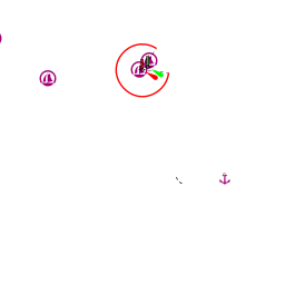
U. Mala Nozdra
The anchorage of U. Mala Nozdra lies at the S end of Kiprije, facing two small islets, ![]() Misjak Veli [[Kaprije#Misjak Veli|Misjak Veli]] 43°40.279'N, 015°44.372'E and
Misjak Veli [[Kaprije#Misjak Veli|Misjak Veli]] 43°40.279'N, 015°44.372'E and ![]() Misjak Mali [[Kaprije#Misjak Mali|Misjak Mali]] 43°40.175'N, 015°45.526'E , to the SE.
Misjak Mali [[Kaprije#Misjak Mali|Misjak Mali]] 43°40.175'N, 015°45.526'E , to the SE.
Note: In the approach that there are shoals to the NW of the tiny islet on the NW side of Misjak Veli. The anchorage offers good shelter in all but with SE winds.
Both sides of the inlet are now subject to a concession, with mooring buoys for which a charge is made.
Alternatively, there are also a few buoys provided by the two restaurants ashore, which are free if you eat there.
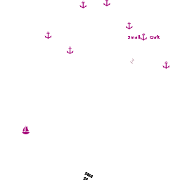
Otherwise anchor towards the head of the inlet in 5.0 - 6.0 metres. The holding is good in sand and weed.U. Remetič
Zmorašnji Medoš
At the NE side of the island S of the headland of Medoš. A few buoys are deployed there by a konoba. They have a pontoon as well.
Note: Take care of submarine cable there.Oštrica islet
A couple of anchorages close to the Oštrica islet:
Amenities
| Facilities | |
|---|---|
| Water | |
| Electricity | |
| Toilets | N/A (Not Available) |
| Showers | N/A |
| Laundry | N/A |
| Garbage | Bins at the root of the jetty |
| Supplies | |
| Fuel | N/A |
| Bottled gas | None |
| Chandlers | None |
| Services | |
| Repairs | N/A |
| Internet | N/A |
| Mobile connectivity | Fair |
| Vehicle rentals | N/A |
Provisioning
![]() Luka Kaprije [[Kaprije#Luka Kaprije|Luka Kaprije]] there is a small grocery shop in the village—just at the root of the jetty.
Luka Kaprije [[Kaprije#Luka Kaprije|Luka Kaprije]] there is a small grocery shop in the village—just at the root of the jetty.
Eating out
-
 Restoran Neptun [[Kaprije#Restoran Neptun|Restoran Neptun]] at the root of the jetty is good.
- [[Kaprije# | ]] several restaurants.
- The Bays of Mala Nozdra, Zmorašnji Medoš, and across the islet of Oštrica (just over a hill from the village)
- [[Kaprije# | ]] restaurant
Transportation
Ferries to Šibenik.
Tourism
The settlement of Kaprije Town is pleasant enough to explore and the landscape of the island is worth exploring, with its olive groves and small vineyards. The hill of Velika Glavica outside Kaprije Town is worth climbing for the views.
Friends
Contact details of "Cruiser's Friends" that can be contacted for local information or assistance.
Forums
List links to discussion threads on partnering forums. (see link for requirements)
Links
- Kaprije at the Wikipedia
- Sibenik area tourism
For other useful websites, see Croatia.
References
See Croatia.
Comments
We welcome users' contributions to the Wiki. Please click on Comments to view other users' comments, add your own personal experiences or recommend any changes to this page following your visit.
Verified by
Date of member's last visit to Kaprije and this page's details validated:
- June 2013 --Dimrub
- July 2015 -- Jürgen Coetsiers
- July 2016 --Athene of Lymington
| This is a usable page of the cruising guide. However, please contribute if you can to help it grow further. Click on Comments to add your personal notes on this page or to discuss its contents. Alternatively, if you feel confident to edit the page, click on the edit tab at the top and enter your changes directly. |
| |
|---|
|
Names: Athene of Lymington |