Fethiye
From CruisersWiki
Istioploos (Talk | contribs) (→Charts: Added charts) |
Istioploos (Talk | contribs) (Coords & Edits) |
||
| Line 1: | Line 1: | ||
==Fethiye (Port of entry)== | ==Fethiye (Port of entry)== | ||
| - | + | GPS: {{Coord|36|37.7|N|29|06|E|}} | |
| - | [[Image: | + | [[Image:Turkey_Fethyie_r.jpg|400px|thumb|center|Chart of the Fethyie Region<br/>''Click for larger view'']] |
| + | |||
===Background=== | ===Background=== | ||
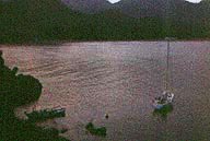
| - | + | [[Image:Fethiye1.jpg|200px|thumb|right|The Bay of Fethiye<br/>''Click for larger view'']] | |
| - | + | [http://en.wikipedia.org/wiki/Fethiye Fethiye], the ancient Telmessos, is a very pleasant town with a large esplanade. The town is surrounded by [http://en.wikipedia.org/wiki/Lycia Lycian] rock tombs carved on the rocks. There is also a medieval castle built by the Knights of Rhodes. In the middle of the town there is a Lycian [http://en.wikipedia.org/wiki/Sarcophagus sarcophagus tomb] in the shape of a small house. | |
| - | + | ||
| - | + | ||
| - | + | ||
===Charts=== | ===Charts=== | ||
| Line 28: | Line 26: | ||
===Approach and Navigation=== | ===Approach and Navigation=== | ||
| - | + | The approaches to Fethiye are straightforward. | |
| - | + | ||
| - | + | ||
| - | + | ||
===Marinas & Yacht Clubs=== | ===Marinas & Yacht Clubs=== | ||
| + | {| | ||
| + | |valign="top"|You can anchor off in the bay or moor in the marina. | ||
* Fethyie Marina - Go stern-to. The marina is very crowded but the bay is large. | * Fethyie Marina - Go stern-to. The marina is very crowded but the bay is large. | ||
* [[Göcek Marina]] | * [[Göcek Marina]] | ||
| Line 43: | Line 40: | ||
====Cape Batikkaya==== | ====Cape Batikkaya==== | ||
| - | There are a few anchorages at Cape Batikkaya just about 1 nM north of the town. | + | There are a few anchorages at Cape Batikkaya (GPS: {{Coord|36|38.2|N|29|06|E|}}, {{Coord|36|38.5|N|29|05.8|E|}}), and {{Coord|36|38.7|N|29|05.2|E|}} just about 1 nM north of the town. |
| + | |||
| + | |[[Image:Turkey_Fethyie_m.jpg|300px|thumb|right|Chart of the Bay of Fethiye - [http://mapserver.maptech.com/homepage/index.cfm?lat=36.628333&lon=29.1&scale=24000&zoom=50&type=1 Chartlet]<br/>''Click for larger view'']] | ||
| + | |} | ||
====Skopea Liman==== | ====Skopea Liman==== | ||
| - | + | {| | |
| - | The Skopea Liman gulf | + | |valign="top"|GPS: {{Coord|36|40.4|N|28|52.8|E|}} - [http://mapserver.maptech.com/homepage/index.cfm?lat=36.673333&lon=28.88&scale=24000&zoom=50&type=1 Chartlet] |
| + | The Skopea Liman gulf because of its proximity to the [[Göcek Marina]] and [[#Fethiye|Fethiye]] is very beautiful but also very crowded. There are many coves and anchorages if only one can find some room. | ||
| + | |||
| + | |[[Image:Skopea_Liman.jpg|200px|thumb|right|Skopea Liman<br/>''Click for larger view'']] | ||
| + | |} | ||
====Kizilkuyruk Koyu==== | ====Kizilkuyruk Koyu==== | ||
| - | + | {| | |
| - | + | |valign="top"|GPS: {{Coord|36|37.1|N|28|52.3|E|}} | |
| - | + | Kizilkuyruk Koyu is about 1 nM NNW of Ince Burun between [[Marmaris#Ekinçik_Liman|Ekinçik Liman]] and [[#Anchorages|Fethiye]]. It is a lovely cove but very crowded. In 1997 a small restaurant was continuously blasting the cove with disco music. Anchor at 8-12 m and take a line to the shore. | |
| + | |||
| + | [[Image:Lydae1.jpg|frame|center|Kizilkuyruk Koyu]] | ||
| + | |||
| + | |[[Image:Turkey_Fethiye_Kizilkuyruk_h.jpg|300px|thumb|center|Chart of Kizilkuyruk Koyu<br/>''Click for larger view'']] | ||
| + | |} | ||
====Ölu Deniz==== | ====Ölu Deniz==== | ||
| + | {| | ||
| + | |valign="top"|GPS: {{Coord|36|32.9|N|29|06.8|E|}} - [http://mapserver.maptech.com/homepage/index.cfm?lat=36.548333&lon=29.113333&scale=100000&zoom=100&type=0&icon=0&searchscope=dom&CFID=2448100&CFTOKEN=51416738&scriptfile=http://mapserver.maptech.com/homepage/index.cfm&latlontype=DMS Chartlet]<br/> | ||
[http://en.wikipedia.org/wiki/Ölüdeniz Ölu Deniz] is a completely land locked beautiful lagoon. It is overrun by tourists. Anchoring is prohibited. | [http://en.wikipedia.org/wiki/Ölüdeniz Ölu Deniz] is a completely land locked beautiful lagoon. It is overrun by tourists. Anchoring is prohibited. | ||
| + | |||
| + | |[[Image:Turkey_Oludeniz.jpg|thumb|200px|center|Aerial view of Ölu Deniz<br/>''Click for larger view'']] | ||
| + | |} | ||
===Offshore Islands=== | ===Offshore Islands=== | ||
| Line 63: | Line 77: | ||
====Baba Adasi==== | ====Baba Adasi==== | ||
{| | {| | ||
| - | |valign="top"|A small anchorage 10 nM W of Fethyie and few miles E of [[Marmaris#Ekinçik_Liman|Ekinçik Liman]]. Anchor at the S side of the island at 5-8 m with a shore line. Pleasant and isolated but only for good weather. | + | |valign="top"|GPS: {{Coord|36|41.5|N|28|41.7|E|}} - [http://mapserver.maptech.com/homepage/index.cfm?lat=36.691667&lon=28.695&scale=100000&zoom=100&type=0&icon=0&searchscope=dom&CFID=2448100&CFTOKEN=51416738&scriptfile=http://mapserver.maptech.com/homepage/index.cfm&latlontype=DMS Chartlet] |
| + | A small anchorage 10 nM W of Fethyie and few miles E of [[Marmaris#Ekinçik_Liman|Ekinçik Liman]]. Anchor at the S side of the island at 5-8 m with a shore line. Pleasant and isolated but only for good weather. | ||
|[[Image:Baba.jpg|frame|right|Baba Adasi]] | |[[Image:Baba.jpg|frame|right|Baba Adasi]] | ||
Revision as of 19:24, 3 March 2009
Fethiye (Port of entry)
GPS: 36°37.7′N, 29°06′E
Background
Fethiye, the ancient Telmessos, is a very pleasant town with a large esplanade. The town is surrounded by Lycian rock tombs carved on the rocks. There is also a medieval castle built by the Knights of Rhodes. In the middle of the town there is a Lycian sarcophagus tomb in the shape of a small house.
Charts
- BA 1886 Approaches to Fethiye Körfezi
- Imray-Tatra G36 South Coast of Turkey
- NIMA 54421 Kardeiga to Ilbiz Burnu
- Turkey 312Marmaris - Fethiye
- Turkey 313 Fethiye - Kaş
- Turkey 3122 Fethiye Körfezi
- Greek 452 Rhodos to Cattelorizo
Radio Nets
Also see Cruiser's Nets
Submit details of local radio Nets.
The approaches to Fethiye are straightforward.
Marinas & Yacht Clubs
You can anchor off in the bay or moor in the marina.
AnchoragesFethyieΑnchor off-shore at about 10 m in the bay. Cape BatikkayaThere are a few anchorages at Cape Batikkaya (GPS: 36°38.2′N, 29°06′E, 36°38.5′N, 29°05.8′E), and 36°38.7′N, 29°05.2′E just about 1 nM north of the town. |
Skopea Liman
| GPS: 36°40.4′N, 28°52.8′E - Chartlet
The Skopea Liman gulf because of its proximity to the Göcek Marina and Fethiye is very beautiful but also very crowded. There are many coves and anchorages if only one can find some room. |
Kizilkuyruk Koyu
| GPS: 36°37.1′N, 28°52.3′E
Kizilkuyruk Koyu is about 1 nM NNW of Ince Burun between Ekinçik Liman and Fethiye. It is a lovely cove but very crowded. In 1997 a small restaurant was continuously blasting the cove with disco music. Anchor at 8-12 m and take a line to the shore. |
Ölu Deniz
| GPS: 36°32.9′N, 29°06.8′E - Chartlet Ölu Deniz is a completely land locked beautiful lagoon. It is overrun by tourists. Anchoring is prohibited. |
Offshore Islands
Tersane Adasi
This is a private island. Not sure if anchoring is allowed.
Baba Adasi
| GPS: 36°41.5′N, 28°41.7′E - Chartlet
A small anchorage 10 nM W of Fethyie and few miles E of Ekinçik Liman. Anchor at the S side of the island at 5-8 m with a shore line. Pleasant and isolated but only for good weather. |
Routes/Passages To/From
Popular passages/routes, timing, etc.
Tourism & things to do ashore
Fethiye
The Museum is well worth a visit, they have a very exciting stele from the Letoön with an inscription shown in three languages: Greek, Aramaic, and Lycian. They also have a nice ethnographic section. It closes at 17:00.
From Fethiye one can take a number of inland excursions to places such as Ölu Deniz, Xanthos, and Patara. All of these places can also be visited from Kaş.
Kizilkuyruk Koyu
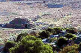
About a 30 minute walk up the hill is Lydae an archaeological site. The site, two Roman mausolea and some Byzantine foundations, is not very interesting but its setting is exquisite. There are several mud-brick domes which may be Moslem tombs but I am not so sure because goats have been using them for shelter.
Fuel, Water, & Electricity
At the Fethyie Marina
Laundry
Right across from the Fethyie Marina.
Grocery Stores
Many stores in town.
Eateries
There are many good restaurants in the town.
Motorbike & Car Rentals
There are several agencies in town.
Marine stores
Submit addresses and contact details of marine related businesses that are of interest to cruisers.
Repairs
Transportation
The Dalaman airport is nearby.
References & Publications
See Turkey.
Cruiser's Friends
Contact details of "Cruiser's Friends" that can be contacted for local information or assistance.
Forum Discussions
List links to discussion threads on the Cruiser Log Forum
External Links
- Fethiye (Wikipedia)
Personal Notes
Personal experiences?
Last Visited & Details Checked (and updated here)
Date of member's visit to this Port/Stop & this page's details validated:
- August 1997 --Istioploos 17:08, 6 June 2008 (MDT)
| |
|---|
| | HOMEPAGE | Wiki Contents | Mediterranean | Turkey | Fethiye | |
.


