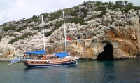
Kekova Roads
From CruisersWiki
m (Text replace - " <small>[''add 3 tildes (<nowiki>~~~</nowiki>) on the name line'']</small>" to "") |
Istioploos (Talk | contribs) (Added contributors & other material) |
||
| Line 12: | Line 12: | ||
! <center>[[image:Chart_icon.png]]</center> | ! <center>[[image:Chart_icon.png]]</center> | ||
| [http://mapserver.maptech.com/homepage/index.cfm?lat=36.173333&lon=29.84&scale=24000&zoom=50&type=1 Chartlet] | | [http://mapserver.maptech.com/homepage/index.cfm?lat=36.173333&lon=29.84&scale=24000&zoom=50&type=1 Chartlet] | ||
| - | | | + | |- |
| - | [[Image:KekovaRoads.jpg| | + | | colspan="2" style="text-align:center;" |[[Image:KekovaRoads.jpg|315px]] |
| + | |- | ||
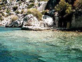
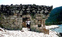
| + | | colspan="2" style="text-align:center;" |Entrance to Uçagiz from necropolis of Teimiussa<br />''Click for larger view'' | ||
| + | |} {{TOCleft}} | ||
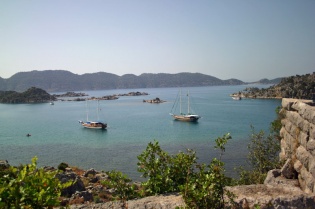
Kekova Roads is an enclosed bay protected by the 4 mile long [http://en.wikipedia.org/wiki/Kekova Kekova Island]. The Bay has several wonderful anchorages and an inner, completely land locked cove, [[#Uçagiz_Liman|Uçagiz Liman]], which is always calm. There are several submerged foundations on the NW side of Kekova Island near [[#Tersane|Tersane]], in [[#Kale_Köy|Kale Köy]], and at Asar Bay, a 30 minute walk from [[#Pölemos_Bükü|Pölemos Bükü]]. At the NE there is the beautiful [[#Gökkaya_Liman|Gökkaya Liman]] with many places to anchor. From there you could visit with your dinghy Demre and Myra, just 2 nM away. On the south side of Kekova Adasi there is the lovely and secluded [[#Karaloz_Liman|Karaloz Liman]]. | Kekova Roads is an enclosed bay protected by the 4 mile long [http://en.wikipedia.org/wiki/Kekova Kekova Island]. The Bay has several wonderful anchorages and an inner, completely land locked cove, [[#Uçagiz_Liman|Uçagiz Liman]], which is always calm. There are several submerged foundations on the NW side of Kekova Island near [[#Tersane|Tersane]], in [[#Kale_Köy|Kale Köy]], and at Asar Bay, a 30 minute walk from [[#Pölemos_Bükü|Pölemos Bükü]]. At the NE there is the beautiful [[#Gökkaya_Liman|Gökkaya Liman]] with many places to anchor. From there you could visit with your dinghy Demre and Myra, just 2 nM away. On the south side of Kekova Adasi there is the lovely and secluded [[#Karaloz_Liman|Karaloz Liman]]. | ||
| - | During the day all of the anchorages at Kekova Roads are crowded with gulets and day-trip boats but in the evening things do quieten down. | + | During the day all of the anchorages at Kekova Roads are crowded with gulets and day-trip boats but in the evening things do quieten down. In the absence of a major weather system bringing its own winds, the usual diurnal winds are light SE, which turn around at night to blow from NW. It is important to bear this in mind when selecting an anchoring spot, especially in [[#Uçagiz_Liman|Uçagiz Liman]], as yachts may well not be lying to their anchor when you arrive. |
| - | + | ||
| - | + | ||
==Charts== | ==Charts== | ||
| - | [[Image:Kekova_m.jpg| | + | [[Image:Kekova_m.jpg|310px|thumb|right|Kekova Roads Region <br />''Click to enlarge'']] |
| - | + | ||
;BA | ;BA | ||
:236 Hisarönü Körfesi to Taslik burnu | :236 Hisarönü Körfesi to Taslik burnu | ||
| Line 34: | Line 34: | ||
==Radio Nets== | ==Radio Nets== | ||
| - | ''Also see [[HF_Radio|Cruiser's Nets]]'' | + | ''Also see [[HF_Radio|Cruiser's Nets]]''. |
Submit details of local radio Nets. | Submit details of local radio Nets. | ||
==Local Weather== | ==Local Weather== | ||
| - | '' | + | There is an absence of a major weather system bringing its own winds, the usual diurnal winds are light SE, which turn around at night to blow from NW. |
| + | |||
| + | ''Also see [[Turkey#Turkey_Climate_&_Weather|Turkey]]''. | ||
==Approach and Navigation== | ==Approach and Navigation== | ||
| - | There are two approaches to Kekova Roads, from the east around Geyikova Burnu at the east end of Kekova Island and from the west between Kekova Island and the mainland. | + | There are two approaches to Kekova Roads, from the east around Geyikova Burnu at the east end of [[#Kekova_Adasi|Kekova Island]] and from the west between Kekova Island and the mainland. The eastern entrance presents few problems as long as you give the various islets in the approach a good clearance. However, there are dangerous reefs 200 metres SE of the village of [[#Kale_K.C3.B6y|Kale Köy]] (identifiable by its impressive Crusader castle). The reefs are marked with a south cardinal mark, which is lit at night. In the western approach, yachts may pass either side of a small group of rocky islets in the entrance, Karagol Adalari. The safer passage, especially on a first visit, is to the west of these islets, since there are dangerous, unmarked reefs 200 metres north of the eastern passage. A white-painted light structure on the northern shore bearing 356 degrees gives you safe entrance through the western passage. |
| - | The entrance to the inner cove and anchorages of Uçağiz is hard to spot, being surrounded by small rocky islets. | + | The entrance to the inner cove and anchorages of [[#U.C3.A7agiz_Liman|Uçağiz]] is hard to spot, being surrounded by small rocky islets. The village of Uçağiz on the north shore on a bearing of 340 degrees gives you safe passage into the anchorage. Once on the approach, a small inner islet will be seen, which should be left at least 100 metres to starboard as there are extensive shallow reefs all round it. |
| - | + | <font color="red">Warning: </font>Care must be taken when entering Kekova Roads form the Karaölor Adalari entrance (west), especially under sail, to avoid the many rocks near Karaölor and because there can be very violent gusts. | |
| + | <div style="clear: both;"></div> | ||
==Check-in facilities== | ==Check-in facilities== | ||
| Line 52: | Line 55: | ||
==Offshore Islands and Groups== | ==Offshore Islands and Groups== | ||
| + | ===Kekova Adasi=== | ||
The only island here is [http://www.hitit.co.uk/tosee/Kekova/index.html Kekova Adasi]. There are two anchorages on the island: | The only island here is [http://www.hitit.co.uk/tosee/Kekova/index.html Kekova Adasi]. There are two anchorages on the island: | ||
====Tersane==== | ====Tersane==== | ||
[[Image:Turkey_Kekova_Tersane_h.jpg|thumb|300px|right|Chart of Tersane<br />''Click to enlarge'']] | [[Image:Turkey_Kekova_Tersane_h.jpg|thumb|300px|right|Chart of Tersane<br />''Click to enlarge'']] | ||
| + | [[image:World_icon.png]] {{Coord|36|10.36|N|29|50.77|E|}}<br /> | ||
| + | Tersane or Xera is a tiny, well-sheltered cove on the NW side of [http://www.hitit.co.uk/tosee/Kekova/index.html Kekova Island]. If you can find room in this cove, which is packed with tripper boats during the season, you can anchor in 4-5 metres and take a line ashore to either side. The bottom is sand and rock and provides good holding. There are a couple of ropes tied through holes in the rocks on either side of the inlet which can be used to take a stern line. However, tripper boats come and go all day from around 0900 up until 2000 or later and, since the daytime wind tends to blow down the inlet, lay their anchors to the wind while their clients go for a quick splash. This means that if you have laid your chain across the inlet it will only be a matter of time before one of them snags your anchor. Effectively, this means that you need to arrive late and leave early - at least during the season. At its head, the cove is dominated by the collapsed arch of a Byzantine church. To the east of the cove, one can see many submerged ruins (Hellenistic, Roman, Byzantine). Snorkeling here, in the crystal-clear water, is definitely worth your while, despite the endless procession of day-trip boats with glass bottoms and loudspeakers. | ||
| - | + | Even if you cannot find room to anchor in Tersane, you could possibly visit it from [[#Kale_K.C3.B6y|Kale Köy]] or [[#U.C3.A7agiz_Liman|Uçağiz]] with the dinghy. | |
| - | + | ||
| - | + | ||
| - | Even if you cannot find room to anchor in Tersane, you could possibly visit it from Kale | + | |
=====Last Visited & Details Checked (and updated here)===== | =====Last Visited & Details Checked (and updated here)===== | ||
| Line 67: | Line 70: | ||
* June 2010 --[[User:Atheneoflymington|Athene of Lymington]] 17:27, 31 May 2010 (UTC) | * June 2010 --[[User:Atheneoflymington|Athene of Lymington]] 17:27, 31 May 2010 (UTC) | ||
| - | <div style="clear: both;"></div> | + | <div style="clear: both;">[[Image:Kekova2.jpg|frame|center|Submerged ruins in Kekova island]]</div> |
====Karaloz Liman==== | ====Karaloz Liman==== | ||
[[Image:Turkey_Kekova_Karaloz.jpg|thumb|300px|right|Chart of Karaloz Liman - [http://mapserver.maptech.com/homepage/index.cfm?lat=36.181667&lon=29.893333&scale=100000&zoom=100&type=0&icon=0&searchscope=dom&CFID=2448100&CFTOKEN=51416738&scriptfile=http://mapserver.maptech.com/homepage/index.cfm&latlontype=DMS Chartlet]<br />''Click to enlarge'']] | [[Image:Turkey_Kekova_Karaloz.jpg|thumb|300px|right|Chart of Karaloz Liman - [http://mapserver.maptech.com/homepage/index.cfm?lat=36.181667&lon=29.893333&scale=100000&zoom=100&type=0&icon=0&searchscope=dom&CFID=2448100&CFTOKEN=51416738&scriptfile=http://mapserver.maptech.com/homepage/index.cfm&latlontype=DMS Chartlet]<br />''Click to enlarge'']] | ||
| - | + | [[image:World_icon.png]] {{Coord|36|10.9|N|29|53.6|E|}}<br /> | |
| - | + | ||
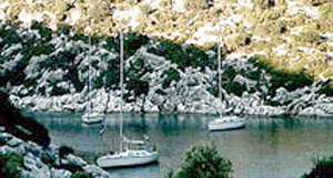
Karaloz Liman or Port Saint Stefano is a completely landlocked cove on the south of [http://www.hitit.co.uk/tosee/Kekova/index.html Kekova Adasi]. The cove is totally secluded and affords a wonderful anchorage, for several boats. The water is crystal-clear and the bottom is mud and weed with good holding. There can be, however, strong gusts so it is best to take a line ashore. | Karaloz Liman or Port Saint Stefano is a completely landlocked cove on the south of [http://www.hitit.co.uk/tosee/Kekova/index.html Kekova Adasi]. The cove is totally secluded and affords a wonderful anchorage, for several boats. The water is crystal-clear and the bottom is mud and weed with good holding. There can be, however, strong gusts so it is best to take a line ashore. | ||
| Line 80: | Line 82: | ||
* | * | ||
| - | <div style="clear: both;"> | + | <div style="clear: both;">[[Image:Karaloz2.jpg|frame|center|Karaloz Liman]]</div> |
| - | + | ||
| - | [[Image:Karaloz2.jpg|frame|center|Karaloz Liman]] | + | |
==Marinas & Yacht Clubs== | ==Marinas & Yacht Clubs== | ||
| Line 90: | Line 90: | ||
====Pölemos Bükü==== | ====Pölemos Bükü==== | ||
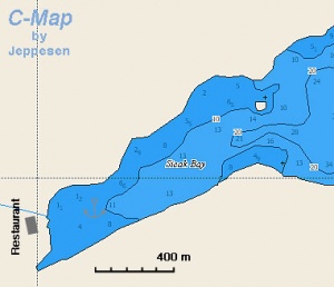
[[Image:Turkey_Kekova_Polemos_m.jpg|thumb|300px|right|Chart of Pölemos Bükü - [http://mapserver.maptech.com/homepage/index.cfm?lat=36.166667&lon=29.806667&scale=100000&zoom=100&type=0&icon=0&searchscope=dom&CFID=2448100&CFTOKEN=51416738&scriptfile=http://mapserver.maptech.com/homepage/index.cfm&latlontype=DMS Chartlet]<br />''Click to enlarge'']] | [[Image:Turkey_Kekova_Polemos_m.jpg|thumb|300px|right|Chart of Pölemos Bükü - [http://mapserver.maptech.com/homepage/index.cfm?lat=36.166667&lon=29.806667&scale=100000&zoom=100&type=0&icon=0&searchscope=dom&CFID=2448100&CFTOKEN=51416738&scriptfile=http://mapserver.maptech.com/homepage/index.cfm&latlontype=DMS Chartlet]<br />''Click to enlarge'']] | ||
| - | + | [[image:World_icon.png]] {{Coord|36|10|N|29|48.4|E|}}<br /> | |
| - | + | Pölemos Bükü is the westernmost anchorage of Kekova Roads. You can anchor in 5-10 metres near the shore. This is a very protected cove but subject to violent gusts that can easily reach 40 knots. It may be prudent to take a line ashore, as the bottom is soft mud and with the gusts the anchor may drag. There is a small restaurant at the end of the cove. About a 30 minute walk to the west, there is Asar Bay, the ancient [http://en.wikipedia.org/wiki/Aperlae Aperlae] whose ruins are fun to visit as they are totally deserted and quite extensive but it is hard going as the terrain is very rough. One can snorkel to see the underwater foundations. | |
| - | Pölemos Bükü is the westernmost anchorage of Kekova Roads. You can anchor in 5-10 metres near the shore. This is a very protected cove but subject to violent gusts that can easily reach 40 knots. It may be prudent to take a line ashore, as the bottom is soft mud and with the gusts the anchor may drag. There is a small restaurant at the end of the cove. About a 30 minute walk to the west, there is Asar Bay, the ancient Aperlae whose ruins are fun to visit as they are totally deserted and quite extensive but it is hard going as the terrain is very rough. One can snorkel to see the underwater foundations. | + | |
=====Last Visited & Details Checked (and updated here)===== | =====Last Visited & Details Checked (and updated here)===== | ||
| Line 106: | Line 105: | ||
====Uçagiz Liman==== | ====Uçagiz Liman==== | ||
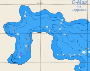
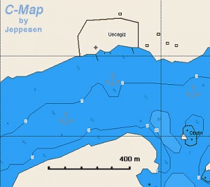
[[Image:Turkey_Kekova_Ucagiz_m.jpg|thumb|300px|right|Chart of Uçagiz Liman - [http://mapserver.maptech.com/homepage/index.cfm?lat=36.195&lon=29.848333&scale=100000&zoom=100&type=0&icon=0&searchscope=dom&CFID=2448100&CFTOKEN=51416738&scriptfile=http://mapserver.maptech.com/homepage/index.cfm&latlontype=DMS Chartlet]<br />''Click to enlarge'']] | [[Image:Turkey_Kekova_Ucagiz_m.jpg|thumb|300px|right|Chart of Uçagiz Liman - [http://mapserver.maptech.com/homepage/index.cfm?lat=36.195&lon=29.848333&scale=100000&zoom=100&type=0&icon=0&searchscope=dom&CFID=2448100&CFTOKEN=51416738&scriptfile=http://mapserver.maptech.com/homepage/index.cfm&latlontype=DMS Chartlet]<br />''Click to enlarge'']] | ||
| + | [[image:World_icon.png]] {{Coord|36|11.7|N|29|50.9|E|}}<br /> | ||
| + | Uçagiz Liman or Ölü Deniz or Tristomos is a land locked lagoon which is always calm, an excellent all around shelter. The water, however, is not clear but dirty. The bottom here is everywhere mud and reasonable holding, although some plough-type anchors will dig a furrow through it unless you let out plenty of chain. It is not unusual to need three or four attempts before your anchor holds. The best holding appears to be in the western arm of the inlet, to the west of the hamlet of Uçagiz, where the depths are 6-7 metres. One can also anchor in the eastern arm, although there is a slight chop here from the prevailing SW winds blowing in through the entrance. | ||
| - | + | A new T-jetty has just been completed off the hamlet, where, once fully commissioned, around 20 yachts will be able to berth stern or bows-to. There are at present (June 2010) just a few laid moorings, so it may be necessary to use your anchor. Depths off the jetty are around 4-5 metres. There are water and electricity points. Once the jetty is in commission, a charge will be made. There is a second jetty to the west, but this is for gulets only. | |
| - | + | ||
| + | There are a number of reportedly overpriced restaurants in the hamlet. To the east, accessible by a rather rocky path (wear sensible footwear) is the necropolis of the ancient Lycian town of Teimiussa, with numerous Lycian sarcophagi and a small acropolis on a rocky headland with excellent views out over Kekova Roads. | ||
=====Last Visited & Details Checked (and updated here)===== | =====Last Visited & Details Checked (and updated here)===== | ||
| Line 116: | Line 118: | ||
<center style="clear: both;"><gallery widths="200px" heights="160px" perrow="2"> | <center style="clear: both;"><gallery widths="200px" heights="160px" perrow="2"> | ||
| - | Image:UcagizEntrance.jpg|Entrance to Uçagiz from north | + | Image:UcagizEntrance.jpg|Entrance to Uçagiz from north<br />''Click for larger view'' |
| - | Image:UcagizPontoons.jpg|Uçagiz pontoons and western inlet | + | Image:UcagizPontoons.jpg|Uçagiz pontoons and western inlet<br />''Click for larger view'' |
| - | Image:LycianNecropolis.jpg|Lycian necropolis at Teimiussa | + | Image:LycianNecropolis.jpg|Lycian necropolis at Teimiussa<br />''Click for larger view'' |
| - | Image: UcagizWaterfront.jpg|Uçagiz waterfront | + | Image: UcagizWaterfront.jpg|Uçagiz waterfront<br />''Click for larger view'' |
</gallery></center> | </gallery></center> | ||
====Kale Köy==== | ====Kale Köy==== | ||
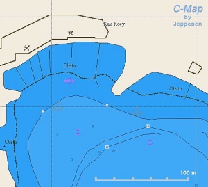
[[Image:Turkey_Kekova_Kalekoy_h.jpg|thumb|300px|right|Chart of Kale Köy<br />''Click to enlarge'']] | [[Image:Turkey_Kekova_Kalekoy_h.jpg|thumb|300px|right|Chart of Kale Köy<br />''Click to enlarge'']] | ||
| + | [[image:World_icon.png]] {{Coord|36|11.3|N|29|51.7|E|}}<br /> | ||
| + | [http://en.wikipedia.org/wiki/Kaleköy%2C_Kaş Kale Köy] the ancient Lycian town of Simena is a very picturesque location dominated by its Crusader castle, Lycian necropolis and submerged tombs protruding from the water. It needs to be approached with care because of the numerous reefs. The safest approach is on a course of 010°, heading for the castle, which avoids the rocky islets and their associated reefs to either side. The bottom is mud and weed over rock and does <font color="red">not</font> provide secure holding. It is better either to anchor inside [[#U.C3.A7agiz_Liman|Uçağiz Liman]] and visit Kale Köy with the dinghy or to berth alongside at one of the three 50-metre long pontoons provided by the restaurants. The pontoons belong to the ''Likya'', ''Hasan’s Roma'' and (confusingly) ''Hassan Deniz'' Restaurants. All can accommodate around 2/3 yachts either side of their pontoons, depending on size. Depths at the pontoons range from 4.5 metres at the root to 12 – 14 at the end. There are shallows about 20 metres to the west of the westernmost pontoon, which need to be avoided when berthing. All the restaurants offer water and electricity on the pontoon and WiFi into the bargain. Another smaller restaurant on the west side, ''Simena Restaurant'', has a small stub quay, which is shallow and only suitable for dinghies. | ||
| - | + | The medieval castle at the top of the village and the ancient theatre inside its walls are well worth the climb. The theatre is miniscule, just seven rows of seats. The necropolis of ancient Simena a few hundred yards to the east of the castle is also worth a visit. There are a number of intact Lycian tombs in an impressive setting overlooking Kekova Roads. The steep path up to the castle is lined with Turkish girls in costume selling scarves and cheap jewellery trinkets. Finally, if berthed at the pontoons, it is an 800 metre dinghy trip over to Kekova Island on a bearing of 130° to visit the impressive ruins of the ancient Lycian city on its north shore that was submerged in an earthquake. | |
| - | + | ||
| - | + | ||
| - | The medieval castle at the top of the village and the ancient theatre inside its walls are well worth the climb. The theatre is miniscule, just seven rows of seats. The necropolis of ancient Simena a few hundred yards to the east of the castle is also worth a visit. | + | |
Once the day tripper boats leave by around 1800, Kale Köy reverts to a charming Turkish fishing village, the children out to play after returning on the school boat, the men out fishing and the families sipping cay in the harbourside cafes and setting the world to rights. | Once the day tripper boats leave by around 1800, Kale Köy reverts to a charming Turkish fishing village, the children out to play after returning on the school boat, the men out fishing and the families sipping cay in the harbourside cafes and setting the world to rights. | ||
| Line 138: | Line 139: | ||
<center style="clear: both;"><gallery widths="200px" heights="160px" perrow="2"> | <center style="clear: both;"><gallery widths="200px" heights="160px" perrow="2"> | ||
| - | Image:KaleKoy.jpg|Kale Köy | + | Image:KaleKoy.jpg|Kale Köy<br />''Click for larger view'' |
| - | Image: KalePontoons.jpg|Kale Köy restaurant pontoons | + | Image: KalePontoons.jpg|Kale Köy restaurant pontoons<br />''Click for larger view'' |
| - | Image:KaleSarcophagus.jpg|Sunken saracophagus at Kale Köy | + | Image:KaleSarcophagus.jpg|Sunken saracophagus at Kale Köy<br />''Click for larger view'' |
| - | Image: SimenaNecropolis.jpg|Necropolis of ancient Simena | + | Image: SimenaNecropolis.jpg|Necropolis of ancient Simena<br />''Click for larger view'' |
</gallery></center> | </gallery></center> | ||
====Gökkaya Liman==== | ====Gökkaya Liman==== | ||
[[Image:Turkey_Kekova_Gokkaya_m.jpg|thumb|300px|right|Chart of Gökkaya Liman (the restaurants are no longer open) - [http://mapserver.maptech.com/homepage/index.cfm?lat=36.206667&lon=29.9&scale=100000&zoom=100&type=0&icon=0&searchscope=dom&CFID=2448100&CFTOKEN=51416738&scriptfile=http://mapserver.maptech.com/homepage/index.cfm&latlontype=DMS Chartlet]<br />''Click to enlarge'']] | [[Image:Turkey_Kekova_Gokkaya_m.jpg|thumb|300px|right|Chart of Gökkaya Liman (the restaurants are no longer open) - [http://mapserver.maptech.com/homepage/index.cfm?lat=36.206667&lon=29.9&scale=100000&zoom=100&type=0&icon=0&searchscope=dom&CFID=2448100&CFTOKEN=51416738&scriptfile=http://mapserver.maptech.com/homepage/index.cfm&latlontype=DMS Chartlet]<br />''Click to enlarge'']] | ||
| + | [[Image:GLView.jpg|thumb|300px|right| View over Gökkaya Liman<br />''Click for larger view'']] | ||
| + | [[image:World_icon.png]] {{Coord|36|12.4|N|29|54|E|}}<br /> | ||
| + | There are several sheltered anchorages, protected by a number of small islands, at this cove at the eastern end of Kekova Roads. The surroundings here are quite idyllic and – out of season - peaceful. Gökkaya Liman can be entered from S, SE or E. In the southern approach between Kisneli Adasi and the mainland there are good depths of 10-15 metres, although a reef extends for some 100 metres NE of the islet you pass in the approach. The approach from the SE between Kisneli and Ashil islets has depths of up to 30 metres and no dangers. When entering from either direction, however, beware of the reefs around the group of small rocky islets where the two approaches meet; there is an isolated underwater rock just west of this group with only 3.5 metres over it. The approach from E between Ashil islet and the mainland has depths of 8 – 20 metres and passes under overhead power lines with a clearance of at least 25 metres (unless your rig is exceptionally tall, it should not present problems; we watched a Beneteau 50 pass under without problems --[[User:Atheneoflymington|Athene of Lymington]] 15:42, 3 June 2010 (UTC)). | ||
| - | + | Once in the cove you can anchor anywhere there are suitable depths. The holding is good on mud and sand. Two of the most popular anchorages are in the narrow inlet running west from the centre of the cove, where you can anchor in 3.0 – 5.0 metres and take a line ashore, and in the NW corner where there are ruins ashore and a freshwater creek running into the anchorage. Anchor in 3.0 – 7.0 metres on mud and sand. One disadvantage of this anchorage is that day tripper boats from [[Andraki]] two miles to the east occasionally moor up here overnight during the season and arrive in the dark amidst much revving of engines and shouting. It is thus ''absolutely essential'' to use a good anchor light here if staying overnight. | |
| - | + | ||
| - | + | There are now no restaurants in the cove, the last one having closed in 2007, but there is a rustic bar, ''Smugglers Inn'', at the head of the narrow inlet, which will pick you up from your yacht if your onboard beer supplies are exhausted. Other than just appreciating the beautiful surroundings, it is fun to potter up the creek in the NW corner (beware of the underwater rock in the middle of the entrance), where a steady flow of fresh water from an inland spring keeps the cove cool. There is also a sea cave at the SE end of Ashil islet which you can enter in the dinghy and enjoy some respite from the baking summer heat. On the west side of Kisneli islet there are the ruins of what appears to have been a Byzantine church. Also, a section of the Lycian Way long-distance walking path runs along the west side of Gökkaya Liman and can be explored on foot if you take sensible shoes. Finally, it is possible to leave the boat here and visit [[Andraki]], the harbour of Demre and Myra, just 2 nM ENE. If you need directions, just follow the tripper boats when they leave the anchorage from 0800 onwards. | |
| - | + | ||
| - | + | ||
| - | + | ||
| - | There are now no restaurants in the cove, the last one having closed in 2007, but there is a rustic bar, Smugglers Inn, at the head of the narrow inlet, which will pick you up from your yacht if your onboard beer supplies are exhausted. | + | |
=====Last Visited & Details Checked (and updated here)===== | =====Last Visited & Details Checked (and updated here)===== | ||
| Line 162: | Line 161: | ||
<center style="clear: both;"><gallery caption="Gallery" widths="200px" heights="160px" perrow="2"> | <center style="clear: both;"><gallery caption="Gallery" widths="200px" heights="160px" perrow="2"> | ||
| - | Image:NWCove1.jpg|NW cove at 0730 | + | Image:NWCove1.jpg|NW cove at 0730<br />''Click for larger view'' |
| - | Image:NWCove2.jpg|NW cove at 0830 | + | Image:NWCove2.jpg|NW cove at 0830<br />''Click for larger view'' |
| - | Image:GLCave.jpg|Sea cave on Ashil islet | + | Image:GLCave.jpg|Sea cave on Ashil islet<br />''Click for larger view'' |
| - | Image:NWAnchorage.jpg|The NW anchorage at Gökkaya Liman | + | Image:NWAnchorage.jpg|The NW anchorage at Gökkaya Liman<br />''Click for larger view'' |
</gallery></center> | </gallery></center> | ||
| Line 184: | Line 183: | ||
==Tourism and Things to do Ashore== | ==Tourism and Things to do Ashore== | ||
| - | ===Tourism=== | + | ====Tourism==== |
''See notes on individual anchorages''. | ''See notes on individual anchorages''. | ||
| - | ===Eateries=== | + | ====Grocery Stores==== |
| + | Very limited. | ||
| + | |||
| + | ====Eateries==== | ||
* In [[#Pölemos_Bükü|Pölemos Bükü]] | * In [[#Pölemos_Bükü|Pölemos Bükü]] | ||
| - | * In [[#Kale_Köy|Kale Köy]] Likya Restaurant is family run and very friendly | + | * In [[#Kale_Köy|Kale Köy]] ''Likya Restaurant'' is family run and very friendly |
| - | ===Internet/WiFi=== | + | ====Internet/WiFi==== |
At restaurant pontoons in [[#Kale_Köy|Kale Köy]] (although rather unreliable). | At restaurant pontoons in [[#Kale_Köy|Kale Köy]] (although rather unreliable). | ||
| - | ===Laundry=== | + | ====Laundry==== |
Behind main square in [[#Uçagiz_Liman|Uçagiz]]. | Behind main square in [[#Uçagiz_Liman|Uçagiz]]. | ||
| - | ===Motorbike & Car Rentals=== | + | ====Motorbike & Car Rentals==== |
None. | None. | ||
| - | ===Garbage Disposal=== | + | ====Garbage Disposal==== |
Bins on waterfront at [[#Uçagiz_Liman|Uçagiz]]. | Bins on waterfront at [[#Uçagiz_Liman|Uçagiz]]. | ||
===Transportation=== | ===Transportation=== | ||
| - | + | ? | |
| - | + | ||
==Routes/Passages To/From== | ==Routes/Passages To/From== | ||
| Line 219: | Line 220: | ||
==External Links== | ==External Links== | ||
| - | + | * [http://en.wikipedia.org/wiki/Kekova Kekova Island] | |
| - | * | + | * [http://en.wikipedia.org/wiki/Aperlae Aperlae] |
| - | * | + | * [http://en.wikipedia.org/wiki/Kaleköy%2C_Kaş Kale Köy] |
==References & Publications== | ==References & Publications== | ||
| - | ''See [[Turkey#References_&_Publications|Turkey]]'' | + | ''See [[Turkey#References_&_Publications|Turkey]]'' |
| - | + | ||
| - | + | ||
| - | + | ||
| - | + | ||
==Personal Notes== | ==Personal Notes== | ||
* We spent two nights on the restaurant pontoons at Kale Koy and it was distressing to see the number of yachts that took advantage of the secure alongside moorings on them to visit the castle above the village and then push off without having the courtesy to take at least a drink or snack in the restaurant concerned. They are the only secure place to moor at Kale Koy, they are free to customers, but they won't be there much longer if people abuse them --[[User:Atheneoflymington|Athene of Lymington]] 09:46, 6 June 2010 (UTC). | * We spent two nights on the restaurant pontoons at Kale Koy and it was distressing to see the number of yachts that took advantage of the secure alongside moorings on them to visit the castle above the village and then push off without having the courtesy to take at least a drink or snack in the restaurant concerned. They are the only secure place to moor at Kale Koy, they are free to customers, but they won't be there much longer if people abuse them --[[User:Atheneoflymington|Athene of Lymington]] 09:46, 6 June 2010 (UTC). | ||
| + | |||
| + | ====Last Visited & Details Checked (and updated here)==== | ||
| + | ''See individual ports in this page''. | ||
| Line 237: | Line 237: | ||
| - | <br/> | + | <br /> |
{|id="mp-right" width="100%" cellpadding="2" cellspacing="1" style="vertical-align:top; background:#fff5ee; border:1px solid #fa8072;" | {|id="mp-right" width="100%" cellpadding="2" cellspacing="1" style="vertical-align:top; background:#fff5ee; border:1px solid #fa8072;" | ||
! <h2 id="mp-itn-h2" style="margin:0; background:#ffe4e1; font-size:120%; font-weight:bold; border:1px solid #fa8072; text-align:left; color:#000; padding:0.2em 0.4em;">[[image:SailorSmiley.gif]]Contributors to this page</h2> | ! <h2 id="mp-itn-h2" style="margin:0; background:#ffe4e1; font-size:120%; font-weight:bold; border:1px solid #fa8072; text-align:left; color:#000; padding:0.2em 0.4em;">[[image:SailorSmiley.gif]]Contributors to this page</h2> | ||
|- | |- | ||
|style="color:#000;"|<small> | |style="color:#000;"|<small> | ||
| - | '''Names''': | + | '''Names''': [[User:Istioploos|Istioploos]], [[User:Atheneoflymington|Athene of Lymington]] |
</small> | </small> | ||
|} | |} | ||
| Line 253: | Line 253: | ||
| - | [[Category: | + | |
| - | + | [[Category:Anchorages - Turkey]] [[Category:Islands - Turkey]] | |
| - | + | ||
Revision as of 15:23, 12 January 2012
Kekova Roads
| | |
| | 36°10.4′N, 29°50.4′E |
|---|---|
| | Photos |
| | Chartlet |
| |
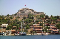
| Entrance to Uçagiz from necropolis of Teimiussa Click for larger view | |
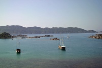
Kekova Roads is an enclosed bay protected by the 4 mile long Kekova Island. The Bay has several wonderful anchorages and an inner, completely land locked cove, Uçagiz Liman, which is always calm. There are several submerged foundations on the NW side of Kekova Island near Tersane, in Kale Köy, and at Asar Bay, a 30 minute walk from Pölemos Bükü. At the NE there is the beautiful Gökkaya Liman with many places to anchor. From there you could visit with your dinghy Demre and Myra, just 2 nM away. On the south side of Kekova Adasi there is the lovely and secluded Karaloz Liman.
During the day all of the anchorages at Kekova Roads are crowded with gulets and day-trip boats but in the evening things do quieten down. In the absence of a major weather system bringing its own winds, the usual diurnal winds are light SE, which turn around at night to blow from NW. It is important to bear this in mind when selecting an anchoring spot, especially in Uçagiz Liman, as yachts may well not be lying to their anchor when you arrive.
Charts
- BA
- 236 Hisarönü Körfesi to Taslik burnu
- Imray-Tetra
- G40 Kas to Antalya
- NIMA
- 54421 Kadiga to Ilbiz Burnu
- 54420 Isakandil Burnu to Didarde Burnu
- Turkey
- 321 Kaş - Çavuş Burnu
Radio Nets
Also see Cruiser's Nets.
Submit details of local radio Nets.
Local Weather
There is an absence of a major weather system bringing its own winds, the usual diurnal winds are light SE, which turn around at night to blow from NW.
Also see Turkey.
There are two approaches to Kekova Roads, from the east around Geyikova Burnu at the east end of Kekova Island and from the west between Kekova Island and the mainland. The eastern entrance presents few problems as long as you give the various islets in the approach a good clearance. However, there are dangerous reefs 200 metres SE of the village of Kale Köy (identifiable by its impressive Crusader castle). The reefs are marked with a south cardinal mark, which is lit at night. In the western approach, yachts may pass either side of a small group of rocky islets in the entrance, Karagol Adalari. The safer passage, especially on a first visit, is to the west of these islets, since there are dangerous, unmarked reefs 200 metres north of the eastern passage. A white-painted light structure on the northern shore bearing 356 degrees gives you safe entrance through the western passage.
The entrance to the inner cove and anchorages of Uçağiz is hard to spot, being surrounded by small rocky islets. The village of Uçağiz on the north shore on a bearing of 340 degrees gives you safe passage into the anchorage. Once on the approach, a small inner islet will be seen, which should be left at least 100 metres to starboard as there are extensive shallow reefs all round it.
Warning: Care must be taken when entering Kekova Roads form the Karaölor Adalari entrance (west), especially under sail, to avoid the many rocks near Karaölor and because there can be very violent gusts.
Check-in facilities
None.
Offshore Islands and Groups
Kekova Adasi
The only island here is Kekova Adasi. There are two anchorages on the island:
Tersane
![]() 36°10.36′N, 29°50.77′E
36°10.36′N, 29°50.77′E
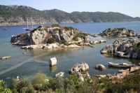
Tersane or Xera is a tiny, well-sheltered cove on the NW side of Kekova Island. If you can find room in this cove, which is packed with tripper boats during the season, you can anchor in 4-5 metres and take a line ashore to either side. The bottom is sand and rock and provides good holding. There are a couple of ropes tied through holes in the rocks on either side of the inlet which can be used to take a stern line. However, tripper boats come and go all day from around 0900 up until 2000 or later and, since the daytime wind tends to blow down the inlet, lay their anchors to the wind while their clients go for a quick splash. This means that if you have laid your chain across the inlet it will only be a matter of time before one of them snags your anchor. Effectively, this means that you need to arrive late and leave early - at least during the season. At its head, the cove is dominated by the collapsed arch of a Byzantine church. To the east of the cove, one can see many submerged ruins (Hellenistic, Roman, Byzantine). Snorkeling here, in the crystal-clear water, is definitely worth your while, despite the endless procession of day-trip boats with glass bottoms and loudspeakers.
Even if you cannot find room to anchor in Tersane, you could possibly visit it from Kale Köy or Uçağiz with the dinghy.
Last Visited & Details Checked (and updated here)
Date of member's visit to this Port/Stop & this page's details validated:
- August, 1997 --Istioploos

- June 2010 --Athene of Lymington 17:27, 31 May 2010 (UTC)
Karaloz Liman
![]() 36°10.9′N, 29°53.6′E
36°10.9′N, 29°53.6′E
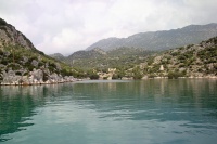
Karaloz Liman or Port Saint Stefano is a completely landlocked cove on the south of Kekova Adasi. The cove is totally secluded and affords a wonderful anchorage, for several boats. The water is crystal-clear and the bottom is mud and weed with good holding. There can be, however, strong gusts so it is best to take a line ashore.
Last Visited & Details Checked (and updated here)
Date of member's visit to this Port/Stop & this page's details validated:
- August, 1997 --Istioploos

Marinas & Yacht Clubs
None.
Anchorages
Pölemos Bükü
![]() 36°10′N, 29°48.4′E
36°10′N, 29°48.4′E
Pölemos Bükü is the westernmost anchorage of Kekova Roads. You can anchor in 5-10 metres near the shore. This is a very protected cove but subject to violent gusts that can easily reach 40 knots. It may be prudent to take a line ashore, as the bottom is soft mud and with the gusts the anchor may drag. There is a small restaurant at the end of the cove. About a 30 minute walk to the west, there is Asar Bay, the ancient Aperlae whose ruins are fun to visit as they are totally deserted and quite extensive but it is hard going as the terrain is very rough. One can snorkel to see the underwater foundations.
Last Visited & Details Checked (and updated here)
Date of member's visit to this Port/Stop & this page's details validated:
- August, 1997 --Istioploos

Uçagiz Liman
![]() 36°11.7′N, 29°50.9′E
36°11.7′N, 29°50.9′E
Uçagiz Liman or Ölü Deniz or Tristomos is a land locked lagoon which is always calm, an excellent all around shelter. The water, however, is not clear but dirty. The bottom here is everywhere mud and reasonable holding, although some plough-type anchors will dig a furrow through it unless you let out plenty of chain. It is not unusual to need three or four attempts before your anchor holds. The best holding appears to be in the western arm of the inlet, to the west of the hamlet of Uçagiz, where the depths are 6-7 metres. One can also anchor in the eastern arm, although there is a slight chop here from the prevailing SW winds blowing in through the entrance.
A new T-jetty has just been completed off the hamlet, where, once fully commissioned, around 20 yachts will be able to berth stern or bows-to. There are at present (June 2010) just a few laid moorings, so it may be necessary to use your anchor. Depths off the jetty are around 4-5 metres. There are water and electricity points. Once the jetty is in commission, a charge will be made. There is a second jetty to the west, but this is for gulets only.
There are a number of reportedly overpriced restaurants in the hamlet. To the east, accessible by a rather rocky path (wear sensible footwear) is the necropolis of the ancient Lycian town of Teimiussa, with numerous Lycian sarcophagi and a small acropolis on a rocky headland with excellent views out over Kekova Roads.
Last Visited & Details Checked (and updated here)
Date of member's visit to this Port/Stop & this page's details validated:
- August, 1997 --Istioploos

- June 2010 --Athene of Lymington 17:27, 31 May 2010 (UTC)
Kale Köy
![]() 36°11.3′N, 29°51.7′E
36°11.3′N, 29°51.7′E
Kale Köy the ancient Lycian town of Simena is a very picturesque location dominated by its Crusader castle, Lycian necropolis and submerged tombs protruding from the water. It needs to be approached with care because of the numerous reefs. The safest approach is on a course of 010°, heading for the castle, which avoids the rocky islets and their associated reefs to either side. The bottom is mud and weed over rock and does not provide secure holding. It is better either to anchor inside Uçağiz Liman and visit Kale Köy with the dinghy or to berth alongside at one of the three 50-metre long pontoons provided by the restaurants. The pontoons belong to the Likya, Hasan’s Roma and (confusingly) Hassan Deniz Restaurants. All can accommodate around 2/3 yachts either side of their pontoons, depending on size. Depths at the pontoons range from 4.5 metres at the root to 12 – 14 at the end. There are shallows about 20 metres to the west of the westernmost pontoon, which need to be avoided when berthing. All the restaurants offer water and electricity on the pontoon and WiFi into the bargain. Another smaller restaurant on the west side, Simena Restaurant, has a small stub quay, which is shallow and only suitable for dinghies.
The medieval castle at the top of the village and the ancient theatre inside its walls are well worth the climb. The theatre is miniscule, just seven rows of seats. The necropolis of ancient Simena a few hundred yards to the east of the castle is also worth a visit. There are a number of intact Lycian tombs in an impressive setting overlooking Kekova Roads. The steep path up to the castle is lined with Turkish girls in costume selling scarves and cheap jewellery trinkets. Finally, if berthed at the pontoons, it is an 800 metre dinghy trip over to Kekova Island on a bearing of 130° to visit the impressive ruins of the ancient Lycian city on its north shore that was submerged in an earthquake.
Once the day tripper boats leave by around 1800, Kale Köy reverts to a charming Turkish fishing village, the children out to play after returning on the school boat, the men out fishing and the families sipping cay in the harbourside cafes and setting the world to rights.
Last Visited & Details Checked (and updated here)
Date of member's visit to this Port/Stop & this page's details validated:
- August, 1997 --Istioploos

- June 2010 --Athene of Lymington 17:27, 31 May 2010 (UTC)
Gökkaya Liman
![]() 36°12.4′N, 29°54′E
36°12.4′N, 29°54′E
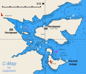
There are several sheltered anchorages, protected by a number of small islands, at this cove at the eastern end of Kekova Roads. The surroundings here are quite idyllic and – out of season - peaceful. Gökkaya Liman can be entered from S, SE or E. In the southern approach between Kisneli Adasi and the mainland there are good depths of 10-15 metres, although a reef extends for some 100 metres NE of the islet you pass in the approach. The approach from the SE between Kisneli and Ashil islets has depths of up to 30 metres and no dangers. When entering from either direction, however, beware of the reefs around the group of small rocky islets where the two approaches meet; there is an isolated underwater rock just west of this group with only 3.5 metres over it. The approach from E between Ashil islet and the mainland has depths of 8 – 20 metres and passes under overhead power lines with a clearance of at least 25 metres (unless your rig is exceptionally tall, it should not present problems; we watched a Beneteau 50 pass under without problems --Athene of Lymington 15:42, 3 June 2010 (UTC)).
Once in the cove you can anchor anywhere there are suitable depths. The holding is good on mud and sand. Two of the most popular anchorages are in the narrow inlet running west from the centre of the cove, where you can anchor in 3.0 – 5.0 metres and take a line ashore, and in the NW corner where there are ruins ashore and a freshwater creek running into the anchorage. Anchor in 3.0 – 7.0 metres on mud and sand. One disadvantage of this anchorage is that day tripper boats from Andraki two miles to the east occasionally moor up here overnight during the season and arrive in the dark amidst much revving of engines and shouting. It is thus absolutely essential to use a good anchor light here if staying overnight.
There are now no restaurants in the cove, the last one having closed in 2007, but there is a rustic bar, Smugglers Inn, at the head of the narrow inlet, which will pick you up from your yacht if your onboard beer supplies are exhausted. Other than just appreciating the beautiful surroundings, it is fun to potter up the creek in the NW corner (beware of the underwater rock in the middle of the entrance), where a steady flow of fresh water from an inland spring keeps the cove cool. There is also a sea cave at the SE end of Ashil islet which you can enter in the dinghy and enjoy some respite from the baking summer heat. On the west side of Kisneli islet there are the ruins of what appears to have been a Byzantine church. Also, a section of the Lycian Way long-distance walking path runs along the west side of Gökkaya Liman and can be explored on foot if you take sensible shoes. Finally, it is possible to leave the boat here and visit Andraki, the harbour of Demre and Myra, just 2 nM ENE. If you need directions, just follow the tripper boats when they leave the anchorage from 0800 onwards.
Last Visited & Details Checked (and updated here)
Date of member's visit to this Port/Stop & this page's details validated:
- August, 1997 --Istioploos

- June 2010 --Athene of Lymington 15:42, 3 June 2010 (UTC)
Yacht Repairs and Services
Marine Stores
None.
Repairs/Yards
None.
Fuel, Water, & Electricity
- Fuel
- N/A (Not Available)
- Water
- On pontoons at Uçagiz and Kale Köy
- Electricity
- On pontoons at Uçagiz and Kale Köy
Tourism and Things to do Ashore
Tourism
See notes on individual anchorages.
Grocery Stores
Very limited.
Eateries
- In Pölemos Bükü
- In Kale Köy Likya Restaurant is family run and very friendly
Internet/WiFi
At restaurant pontoons in Kale Köy (although rather unreliable).
Laundry
Behind main square in Uçagiz.
Motorbike & Car Rentals
None.
Garbage Disposal
Bins on waterfront at Uçagiz.
Transportation
?
Routes/Passages To/From
See Aegean.
Cruiser's Friends
Contact details of "Cruiser's Friends" that can be contacted for local information or assistance.
Forum Discussions
List links to discussion threads on partnering forums. (see link for requirements)
External Links
References & Publications
See Turkey
Personal Notes
- We spent two nights on the restaurant pontoons at Kale Koy and it was distressing to see the number of yachts that took advantage of the secure alongside moorings on them to visit the castle above the village and then push off without having the courtesy to take at least a drink or snack in the restaurant concerned. They are the only secure place to moor at Kale Koy, they are free to customers, but they won't be there much longer if people abuse them --Athene of Lymington 09:46, 6 June 2010 (UTC).
Last Visited & Details Checked (and updated here)
See individual ports in this page.
|
|---|
|
Names: Istioploos, Athene of Lymington |
| |
|---|
| | HOMEPAGE | Wiki Contents | Mediterranean | Turkey | Kekova Roads | |


