Kalkan
From CruisersWiki
Kalkan
Click for larger view
Background
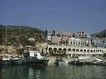
Kalkan (Greek Kalamaki - Καλαμάκι)[36° 16' N 029° 25' E] looks very much made up with several large hotels and older houses jazzed up in many pastel colors. It is a pleasant if crowded small marina just 14 nM west of Kas.
Charts
BA 236 Hisarönü Körfesi to Taslik burnu
Imray-Tetra G36 Marmaris to Kekova Adasi
NIMA 54421 Kadiga to Ilbiz Burnu
Radio Nets
Also see Cruiser's Nets
Submit details of local radio Nets.
Details?
Check-in facilities
Submit details about facilities for checking in - where to dock, etc.
Anchorages
Yesilköy Liman
Yesilköy is pleasant anchorage just 2 nM west of Kalkan with very clear water. The bottom is rocky and very hard to anchor. It is better to anchor at the NE corner at about 5-10 m and take a line ashore. Many gullets.
Routes/Passages To/From
Popular passages/routes, timing, etc.
Tourism & things to do ashore
List places of interest, tours, eateries, etc.
Marine stores
Submit addresses and contact details of marine related businesses that are of interest to cruisers.
References & Publications
See Turkey.
Cruiser's Friends
Contact details of "Cruiser's Friends" that can be contacted for local information or assistance.
Forum Discussions
List links to discussion threads on the Cruiser Log Forum
External Links
- Kalkan (Wikipedia)
Personal Notes
Personal experiences?
.
