Aeolian Coast/imagemap
From CruisersWiki
(Difference between revisions)
Istioploos (Talk | contribs) (New) |
Istioploos (Talk | contribs) (Port of entry) |
||
| (2 intermediate revisions not shown) | |||
| Line 1: | Line 1: | ||
| + | <center>{{infobox coordblock | ||
| + | | lat= 39.10875|lon=26.71326 |zoom=8 | ||
| + | | type=waypoint | ||
| + | }}{{PEntry there}}</center> | ||
| + | |||
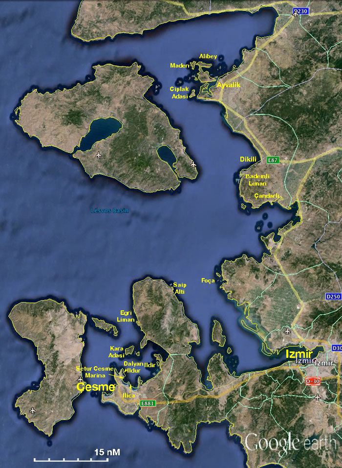
<imagemap> | <imagemap> | ||
Image:TurkeyAeolian.jpg|frame|center|The Turkish Aeolian Coast - <em>For details click on a name or an area</em> | Image:TurkeyAeolian.jpg|frame|center|The Turkish Aeolian Coast - <em>For details click on a name or an area</em> | ||
Latest revision as of 18:04, 25 February 2017

The Turkish Aeolian Coast - For details click on a name or an area