Biograd na Moru
From CruisersWiki
(Created page with "==Biograd, Croatia== {| class="infobox bordered" style="width: 28em; text-align: left; font-size: 90%;" |- | colspan="2" style="text-align:center;" | [[Image:imagename.jpg|330px|...") |
Istioploos (Talk | contribs) m (Minor) |
||
| (55 intermediate revisions not shown) | |||
| Line 1: | Line 1: | ||
| - | + | {{IsPartOf|Mediterranean|Adriatic Sea|Croatia|Northern Dalmatia}} | |
| - | { | + | {{TOC block}} |
| - | + | ||
| - | + | ||
| - | + | ||
| - | + | ||
| - | | | + | |
| - | + | ||
| - | | | + | |
| - | + | ||
| - | + | ||
| - | + | ||
| - | + | ||
| - | + | ||
| - | + | ||
| - | + | ||
| - | + | ||
| - | + | ||
| - | + | ||
| - | + | ||
| - | + | ||
| - | + | ||
| - | + | ||
| - | + | ||
| - | + | ||
| - | + | ||
| - | + | ||
| - | + | ||
| - | + | ||
| - | + | ||
| - | + | ||
| - | + | ||
| - | + | ||
| - | + | {{Infobox | lat=43.938| lon=15.43817 | |
| + | | name= Biograd na Moru | ||
| + | | zoom= 14 | ||
| + | | chartlet=y | ||
| + | | image= Biograd.jpg | ||
| + | | imagetext= Biograd harbour from NW | ||
| + | | summary= The town of '''Biograd''' (or, to give it its full name [[Biograd na Moru]]) lies on the Adriatic coast of [[Croatia]], approximately 15 miles SE of [[Zadar]] and opposite the southern end of the island of [[Pašman]]. The town’s main claim to fame is as the former capital of the mediaeval Kingdom of the Croats, which lasted from 925 to 1102. The town has two large marinas, [[Marina Kornati]] and [[Marina Sangulin]], which between them offer a total of over 1,000 berths. | ||
| + | | notes= | ||
| + | | news= | ||
| + | }} | ||
| - | + | ==Charts== | |
| - | + | ''See [[Northern Dalmatia#Charts|Northern Dalmatia]]''. | |
| - | + | ||
| - | + | ||
| - | + | ==Weather== | |
| + | ''See [[Croatia#Weather|Croatia]]''. | ||
| - | == | + | ==Passages== |
| - | + | ''See [[Croatia#Passages|Croatia]]''. | |
| - | + | ==Islands== | |
| - | + | {{dest legend|m|h|a|i}} | |
| - | + | * {{dest| Ugljan |m|h|a|i}} | |
| - | + | * {{dest| Pašman |h|a|i}} | |
| - | + | * {{dest| Kornati archipelago |m|a|i}} | |
| - | + | ||
| - | + | ||
| - | == | + | ==Communication== |
| - | + | {{Green|Add here VHF channel for the coastguard, harbor masters. etc.}} | |
| + | * | ||
* | * | ||
| - | + | ''Also see [[HF_Radio|Cruiser's Nets]]'' | |
| - | + | ||
| - | == | + | ==Navigation== |
| - | + | '''Biograd''' is approached either from NW along the channel separating the mainland from the islands of [[Ugljan]] and Pašman or from the S around the southern end of the island of Pašman. There are no dangers in the approach from NW other than the numerous islands in the '''Pasmanski Kanal'''. | |
| - | == | + | {{Danger}}In the approach from the S, note that the island of {{mark|type=danger|name=Sv. Katerina|lat=43.93284|lon=15.43062|zoom=15}} has shoals extending half a mile off its eastern coast. Also, a green marker buoy indicates a shoal patch 200 metres SW of the entrance to the marinas. |
| - | + | ||
| - | + | ||
| - | + | {{Note}}Take care of ferries shuttling between Biograd and the island of Pašman. | |
| - | + | ||
| - | + | Both marinas are situated in the large harbour on the N side of the peninsula on which the town sits, which is entered from WNW between two long breakwaters. | |
| - | + | ||
| - | + | ||
| - | == | + | ==Berthing== |
| - | + | There are two principal options for a visiting yacht, the [[Marina Kornati]] and [[Marina Sangulin]]. | |
| - | + | ||
| - | + | ||
| - | === | + | ===Marinas & Yacht Clubs=== |
| - | * | + | * [[Marina Kornati]] -- occupies the outer part of the harbour |
| + | * [[Marina Sangulin]] -- in the inner part of the harbour | ||
| + | * [http://www.marinakornati.com/en/biograd-yacht-club Biograd Yacht Club] -- is a part of the ''Marina Kornati'' | ||
| + | * [http://www.marinakornati.com/en/the-hotel-marina Hotel Marina] -- is a branch of the ''Marina Kornati''. It is located outside the harbour around half a mile to the SE at the ''Hotel Kornati''. In the marina there are 120 berths is for motor boats only. Max. length 8.5m, min. depth 2.5 m. Water and electricity are on the berths. Services are the Marina Kornati. | ||
| - | ==== | + | ===Other options=== |
| - | + | {{poi | lat= 43.96092737261266| lon= 15.420957101835967| zoom= 16 | |
| - | + | | type=harbour | |
| - | + | | name=Sv. Filip I Jakov | |
| - | + | | text=The hamlet of Sv. Filip I Jakov lies just over 1.5 miles NW of Biograd. The small and shallow harbour here is usually filled with local boats, but it is possible in settled weather to go alongside or stern/bows-to the outer side of the breakwater. Shelter here is poor with any strong winds and untenable in winds from NW round to SE. Depths at the breakwater are 3.0 metres. | |
| - | + | }} | |
| - | + | ||
| - | == | + | {{poi | lat= 43.9672713186267| lon= 15.40489971613233| zoom= 16 |
| - | = | + | | type= harbour |
| - | + | | name=Turanj | |
| - | + | | text=The hamlet of Turanj lies half a mile NW of Sv. Filip I Jakov. A small yacht may be able to find a space in one of the two tiny basins here but depths are little more than 2.0 metres. Shelter here is also poor with any strong winds and untenable in winds from NW round to SE. | |
| + | }} | ||
| - | ==== | + | ==Anchorages== |
| - | + | {{poi | lat= 43.929468940767904| lon= 15.450084974923543| zoom= 17 | |
| + | | type=anchorage | ||
| + | | name=U. Solina | ||
| + | | text=Uvala Solina is a small bay a mile SE of the main harbour of Biograd. It is a useful and attractive anchorage off a popular beach, but only in settled weather. The bay is completely open to winds from W round to S. Anchor off in 3.0 - 4.0 metres. The holding is good in sand. | ||
| + | }} | ||
| - | |||
| - | |||
| - | == | + | ==Amenities== |
| - | + | {{tlist | |
| - | + | |header|Facilities | |
| - | + | ||
| - | ==== | + | |Water| {{mark | type= water |name= [[Marina Kornati]] | lat= 43.94191|lon=15.44111 | zoom=16 |text= on each on berth}} |
| - | + | {{mark | type= water |name= [[Marina Sangulin]]| lat= 43.94029|lon=15.44339 | zoom=16 |text= on each on berth}} | |
| + | |Electricity| {{mark | type= electricity |name= [[Marina Kornati]] | lat= 43.94191|lon=15.44111 | zoom=16 |text= on each on berth}} | ||
| + | {{mark | type= electricity |name= [[Marina Sangulin]]| lat= 43.94029|lon=15.44339 | zoom=16 |text= on each on berth}} | ||
| + | |Toilets| In the marinas | ||
| + | |Showers| In the marinas | ||
| + | |Laundry| Near [[Marina Kornati]] & [[Marina Sangulin]] | ||
| + | |Garbage| In the marinas | ||
| - | ==== | + | |header|Supplies |
| - | + | |Fuel| {{mark |name= INA fuel station | type= fuel | lat=43.93884|lon=15.43963 |zoom=17|text= close to the ferry pier.}} | |
| + | |Bottled gas| None | ||
| + | |Chandlers| None | ||
| - | ==== | + | |header|Services |
| - | + | |Repairs| {{mark | type= service |name= [[Marina Kornati]] | lat= 43.94191|lon=15.44111 | zoom=16 |text= Engine, electrical and electronic repairs. Wood and fiberglass hull repairs. Osmosis treatment and paint works}} | |
| - | + | {{mark | type= service |name= [[Marina Sangulin]]| lat= 43.94029|lon=15.44339 | zoom=16 |text= very limited}} | |
| + | |Internet| WiFi In [[Marina Sangulin]] | ||
| + | |Mobile connectivity| Good | ||
| + | |Vehicle rentals| Car rental outlets in the town | ||
| + | }} | ||
| - | == | + | ==Provisioning== |
| - | + | {{mark |lat=43.94124|lon=15.44578|type=provisions|name=Konzum|text= mid-sized supermarket just E of the harbour}} | |
| - | + | ||
| + | {{mark | type= provisions |name= [[Marina Kornati]] | lat= 43.94191|lon=15.44111 | zoom=16 |text= minimarket}} | ||
| + | |||
| + | {{mark | type= provisions |name= Plodine| |lat=43.94244|lon=15.45564 |text= is located further E (approx. 1 Km) at the intersection with the D8 highway}} | ||
| + | |||
| + | {{mark | type= provisions |name=Old Town |text=smaller grocery shops in the old town}} | ||
| + | |||
| + | ==Eating out== | ||
| + | {{mark | type= eatingout |name= [[Marina Kornati]] | lat= 43.94191|lon=15.44111 | zoom=16 |text= restaurant & café/bar}} | ||
| - | == | + | {{mark | type= eatingout |name=Old Town |text=Numerous bars and restaurants}} |
| + | |||
| + | ==Transportation== | ||
| + | * Buses to [[Zadar]], [[Sibenik]], [[Split]], and local destinations | ||
| + | * Airports in [[Zadar]] (25 Km), [[Split]] | ||
| + | * Ferries to [[Tkon]] on the island of [[Pašman]] | ||
| + | |||
| + | ==Tourism== | ||
| + | Biograd is characterised by its picturesque soft sand and pebble beaches, shaded pine forest and brilliantly coloured waters. Legend has it that God, after creating the world, dropped all of the remaining beauty from his hand in the middle of the Adriatic Sea where Biograd is located. Today the town is a popular holiday resort and ferry port and a good base for cruising the Kornati Islands 12 miles SW. It also contains several old churches dating from the 11th through to the 17th century. | ||
| + | |||
| + | In addition to being a great starting point for a trip to the Kornati Islands, Biograd is also a popular meeting place for sailors who train and compete in one of Biograd’s numerous sailing events. Even in the winter racers compete from Biograd, thus making the coastal city a popular meeting point for sailors. In autumn, the Biograd Boat Show is held, Central Europe’s largest boating expo. | ||
| + | |||
| + | ==Friends== | ||
Contact details of "Cruiser's Friends" that can be contacted for local information or assistance. | Contact details of "Cruiser's Friends" that can be contacted for local information or assistance. | ||
* | * | ||
| - | == | + | ==Forums== |
| - | List links to discussion threads on [[Cruising Forums|partnering forums]]. (see link for requirements) | + | List links to discussion threads on [[Cruising Forums|partnering forums]]. (''see link for requirements'') |
| - | * | + | * |
| + | * | ||
| - | == | + | ==Links== |
| - | + | * {{wikipedia|Biograd_na_Moru}} | |
| - | * | + | * {{Wikivoyage}} |
| + | * [http://www.noonsite.com/Countries/Croatia/Biograd-na-Moru Noonsite] | ||
| + | * [http://www.biograd.info/en/ Biograd Info] | ||
| - | + | ''For other useful websites, see [[Croatia#Links|Croatia]]''. | |
| - | + | ||
| - | + | ||
| - | == | + | ==References== |
| - | + | ''See [[Croatia#References|Croatia]]''. | |
| + | |||
| + | {{Comments}} | ||
| + | * | ||
* | * | ||
| - | + | {{Verified by}} | |
| - | + | * June 2016--[[User:Atheneoflymington|Athene of Lymington]] | |
| - | * | + | * |
| - | + | ||
| - | + | ||
| - | + | ||
| + | {{Green|If you provide a lot of info and this page is almost complete, change <nowiki>{{Page outline}} to {{Page useable}}</nowiki>.}} | ||
| - | + | {{Page outline}} | |
| - | { | + | |
| - | + | ||
| - | + | ||
| - | + | ||
| - | + | ||
| - | + | ||
| - | + | ||
| - | + | ||
| - | { | + | |
| - | + | ||
| - | + | ||
| - | + | ||
| - | + | ||
| + | {{Contributors|[[User:Haiqu|Haiqu]], [[User:Atheneoflymington|Athene of Lymington]]}} | ||
| - | [[Category:Ports - Croatia]] | + | [[Category:Ports - Croatia]] [[Category:Anchorages - Croatia]] |
Latest revision as of 21:09, 25 March 2019
| Biograd na Moru
| |
| |
 Biograd harbour from NW |
The town of Biograd (or, to give it its full name Biograd na Moru) lies on the Adriatic coast of Croatia, approximately 15 miles SE of Zadar and opposite the southern end of the island of Pašman. The town’s main claim to fame is as the former capital of the mediaeval Kingdom of the Croats, which lasted from 925 to 1102. The town has two large marinas, Marina Kornati and Marina Sangulin, which between them offer a total of over 1,000 berths.
Charts
See Northern Dalmatia.
Weather
See Croatia.
Passages
See Croatia.
Islands
Communication
Add here VHF channel for the coastguard, harbor masters. etc.
Also see Cruiser's Nets
Biograd is approached either from NW along the channel separating the mainland from the islands of Ugljan and Pašman or from the S around the southern end of the island of Pašman. There are no dangers in the approach from NW other than the numerous islands in the Pasmanski Kanal.
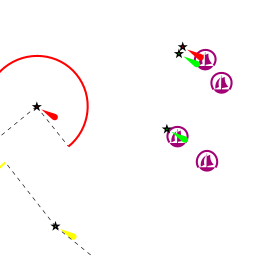
Danger: In the approach from the S, note that the island of ![]() Sv. Katerina [[Biograd na Moru#Sv. Katerina|Sv. Katerina]] 43°55.970'N, 015°25.837'E has shoals extending half a mile off its eastern coast. Also, a green marker buoy indicates a shoal patch 200 metres SW of the entrance to the marinas.
Sv. Katerina [[Biograd na Moru#Sv. Katerina|Sv. Katerina]] 43°55.970'N, 015°25.837'E has shoals extending half a mile off its eastern coast. Also, a green marker buoy indicates a shoal patch 200 metres SW of the entrance to the marinas.
Note: Take care of ferries shuttling between Biograd and the island of Pašman.
Both marinas are situated in the large harbour on the N side of the peninsula on which the town sits, which is entered from WNW between two long breakwaters.
Berthing
There are two principal options for a visiting yacht, the Marina Kornati and Marina Sangulin.
Marinas & Yacht Clubs
- Marina Kornati -- occupies the outer part of the harbour
- Marina Sangulin -- in the inner part of the harbour
- Biograd Yacht Club -- is a part of the Marina Kornati
- Hotel Marina -- is a branch of the Marina Kornati. It is located outside the harbour around half a mile to the SE at the Hotel Kornati. In the marina there are 120 berths is for motor boats only. Max. length 8.5m, min. depth 2.5 m. Water and electricity are on the berths. Services are the Marina Kornati.
Other options
Sv. Filip I Jakov
Turanj
Anchorages
U. Solina
Amenities
| Facilities | |
|---|---|
| Water |
|
| Electricity |
|
| Toilets | In the marinas |
| Showers | In the marinas |
| Laundry | Near Marina Kornati & Marina Sangulin |
| Garbage | In the marinas |
| Supplies | |
| Fuel | |
| Bottled gas | None |
| Chandlers | None |
| Services | |
| Repairs |
|
| Internet | WiFi In Marina Sangulin |
| Mobile connectivity | Good |
| Vehicle rentals | Car rental outlets in the town |
Provisioning
![]() Konzum [[Biograd na Moru#Konzum|Konzum]] 43°56.474'N, 015°26.747'E mid-sized supermarket just E of the harbour
Konzum [[Biograd na Moru#Konzum|Konzum]] 43°56.474'N, 015°26.747'E mid-sized supermarket just E of the harbour
![]() Marina Kornati [[Biograd na Moru#Marina Kornati|Marina Kornati]] 43°56.515'N, 015°26.467'E minimarket
Marina Kornati [[Biograd na Moru#Marina Kornati|Marina Kornati]] 43°56.515'N, 015°26.467'E minimarket
![]() Plodine [[Biograd na Moru#Plodine|Plodine]] 43°56.546'N, 015°27.338'E is located further E (approx. 1 Km) at the intersection with the D8 highway
Plodine [[Biograd na Moru#Plodine|Plodine]] 43°56.546'N, 015°27.338'E is located further E (approx. 1 Km) at the intersection with the D8 highway
![]() Old Town [[Biograd na Moru#Old Town|Old Town]] smaller grocery shops in the old town
Old Town [[Biograd na Moru#Old Town|Old Town]] smaller grocery shops in the old town
Eating out
![]() Marina Kornati [[Biograd na Moru#Marina Kornati|Marina Kornati]] 43°56.515'N, 015°26.467'E restaurant & café/bar
Marina Kornati [[Biograd na Moru#Marina Kornati|Marina Kornati]] 43°56.515'N, 015°26.467'E restaurant & café/bar
![]() Old Town [[Biograd na Moru#Old Town|Old Town]] Numerous bars and restaurants
Old Town [[Biograd na Moru#Old Town|Old Town]] Numerous bars and restaurants
Transportation
- Buses to Zadar, Sibenik, Split, and local destinations
- Airports in Zadar (25 Km), Split
- Ferries to Tkon on the island of Pašman
Tourism
Biograd is characterised by its picturesque soft sand and pebble beaches, shaded pine forest and brilliantly coloured waters. Legend has it that God, after creating the world, dropped all of the remaining beauty from his hand in the middle of the Adriatic Sea where Biograd is located. Today the town is a popular holiday resort and ferry port and a good base for cruising the Kornati Islands 12 miles SW. It also contains several old churches dating from the 11th through to the 17th century.
In addition to being a great starting point for a trip to the Kornati Islands, Biograd is also a popular meeting place for sailors who train and compete in one of Biograd’s numerous sailing events. Even in the winter racers compete from Biograd, thus making the coastal city a popular meeting point for sailors. In autumn, the Biograd Boat Show is held, Central Europe’s largest boating expo.
Friends
Contact details of "Cruiser's Friends" that can be contacted for local information or assistance.
Forums
List links to discussion threads on partnering forums. (see link for requirements)
Links
- Biograd na Moru at the Wikipedia
- Biograd na Moru at the Wikivoyage
- Noonsite
- Biograd Info
For other useful websites, see Croatia.
References
See Croatia.
Comments
We welcome users' contributions to the Wiki. Please click on Comments to view other users' comments, add your own personal experiences or recommend any changes to this page following your visit.
Verified by
Date of member's last visit to Biograd na Moru and this page's details validated:
- June 2016--Athene of Lymington
If you provide a lot of info and this page is almost complete, change {{Page outline}} to {{Page useable}}.
| This page has an outline in place but needs completing. Please contribute if you can to help it grow further. Click on Comments to suggest further content or alternatively, if you feel confident to edit this page, click on the edit tab at the top and enter your changes directly. |
| |
|---|
|
Names: Haiqu, Athene of Lymington |