Cyclades/imagemap
From CruisersWiki
(Difference between revisions)
Istioploos (Talk | contribs) (Port of entry) |
Istioploos (Talk | contribs) (Template) |
||
| Line 2: | Line 2: | ||
| lat= 37.19971|lon=25.11749|zoom=9 | | lat= 37.19971|lon=25.11749|zoom=9 | ||
| type=waypoint | | type=waypoint | ||
| - | }}{{ | + | }}{{PEntry there}} |
</center> | </center> | ||
Latest revision as of 14:55, 20 September 2016
There are Port(s) of Entry here
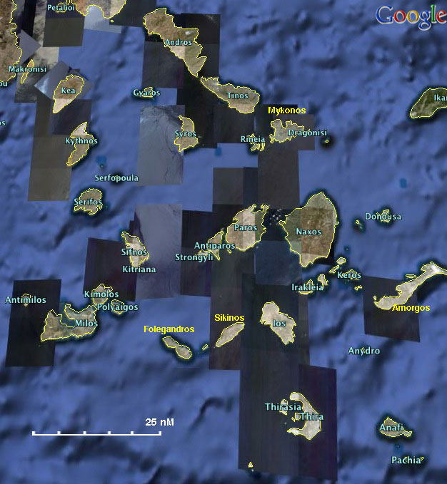

Satellite view of the Cyclades - For details click on a name or an area