Drvenik Veli
From CruisersWiki
| Drvenik Veli
| |
| |
 Yachts on Drvenik jetty |
Drvenik Veli is an island which lies two miles off the mainland coast of Croatia six miles SW of the harbour of Trogir and 14 miles WSW of the port of Split. A mile to the W is the smaller island of Drvenik Mali, which has only rather exposed day anchorages. With a population of only 168, the island survives on fishing, simple agriculture and, increasingly, tourism. The island has just one harbour on its NW side and two anchorages on its SW and E coasts respectively. The harbour is sheltered in all conditions, although strong NW winds send in a swell. There are plans to construct a small 140-berth marina in the harbour, but progress appears to have stalled.
Charts
| British Admiralty | 2712, 2774 |
|---|---|
| Croatian | MK16 |
| Imray | M26 (Split to Dubrovnik) |
Weather
Diurnal winds among the islands are mostly moderate during the summer months, predominantly from NW and rarely exceeding force 4/5, although gusting is common in narrow channels between islands and on the lee side of headlands. At night, katabatic winds off the mountains affect some of the islands close to the mainland coast. During early spring and (especially) autumn conditions can be more unsettled, occasionally accompanied by violent thunderstorms - luckily of short duration - with winds of 30-35 knots or more and vicious, steep seas. In the winter the sudden, violent N wind off the mountains, the bora, is much to be feared, especially along the coast from Rijeka down to Zadar, although its effects can be felt as far south as Split.
Equally prevalent in winter - although not uncommon in summer - is the scirocco, a S/SE wind that blows up from North Africa, usually in advance of a depression moving E across the Mediterranean. Unlike the bora, the scirocco only occasionally exceeds gale force, but is still a phenomenon to be wary of, especially if on a lee coast.
For sources of weather forecasting, see Croatia.
Passages
See Croatia.
Islands
Communication
Add here VHF channel for coastguard, harbor masters. etc.
Also see World Cruiser's Nets
Add any navigation notes such approaches, dangers etc here. If this section does not apply remove it.
Entrance
Split is the nearest all-year round port of entry. During the summer, Hvar and, if arriving from N, Primosten on the mainland are also ports of entry.
Berthing
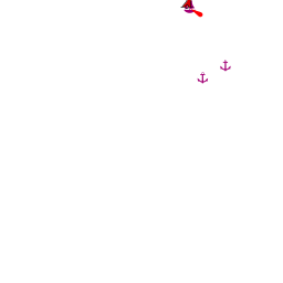
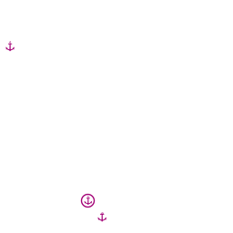
There are three berthing options on the island, the harbour of Luka Drvenik and the anchorages of U. Mala Luka and U. Krknjas (see below for details)
Luka Drvenik
The approach to Luka Drvenik is free of dangers. Note, however, the islet, O. Malta, in the channel between Drvenik Veli and Drvenik Mali islands, one mile due W of the entrance to the inlet. Depths are considerable in the outer part of the inlet, with over 15 metres at the harbour entrance. Visiting yachts usually berth on the inside of the breakwater extending from the N side of the inlet. There is space here for 10-15 yachts in depths of 5.0 - 8.0 metres, using their anchors to go bows or stern-to. However, you will be dropping your anchor in 12-15 metres, so this option is only good in settled weather and if you have plenty of anchor scope. Due to the depth and holding, some yachts moor alongside the breakwater, in which case there is room for only about five yachts. A charge is made for mooring.
Alternatively, anchor in the bight at the S end of the inlet, opposite the village. Depths here are 6.0 - 8.0 metres and the holding is good in sand and mud. However, there are reportedly underwater obstructions, probably from the buoys which were previously installed here, and it is wise to use a tripping line on your anchor if mooring in this bight. Most of the quay here is filled with small craft moorings, and the part with tyre fenders is used by the ferry twice daily.
Plans were under way to convert the harbour into a 140-berth marina, Marina Zirona, but little progress has been made and the plan apears abandoned as of 2015.Anchorages

There are two good anchorages on Drvenik Veli island, U. Mala Luka on the NW coast and U. Krknjas on the E coast.
U. Mala Luka
U. Krknjas
Amenities
| Facilities | |
|---|---|
| Water | None |
| Electricity | None |
| Toilets | None |
| Showers | None |
| Laundry | None |
| Garbage | Luka Drvenik - bins close to the harbour. |
| Supplies | |
| Fuel | None |
| Bottled gas | None |
| Chandlers | None |
| Services | |
| Repairs | None |
| Internet | |
| Mobile connectivity | |
| Vehicle rentals | None |
| Health | |
Provisioning
Small grocery store only at the Luka Drvenik
Eating out
Luka Drvenik - a couple of restaurants in the village
Transportation
Daily ferries to Split on mainland.
Tourism
Very little. It’s a place to chill out.
Friends
Contact details of "Cruiser's Friends" that can be contacted for local information or assistance.
Forums
List links to discussion threads on partnering forums. (see link for requirements)
Links
- Drvenik Veli at the Wikipedia
For other useful websites, see Croatia.
References & Publications
See Croatia.
Comments
We welcome users' contributions to the Wiki. Please click on Comments to view other users' comments, add your own personal experiences or recommend any changes to this page following your visit.
Verified by
Date of member's last visit to Drvenik Veli and this page's details validated:
- July 2015 --Athene of Lymington
| This is a usable page of the cruising guide. However, please contribute if you can to help it grow further. Click on Comments to add your personal notes on this page or to discuss its contents. Alternatively, if you feel confident to edit the page, click on the edit tab at the top and enter your changes directly. |
| |
|---|
|
Names: Lighthouse, Athene of Lymington |