Erdek
From CruisersWiki
Erdek Harbour
| | |
| | 40°23.6′N, 27°47.4′E |
|---|---|
| | Photo gallery |
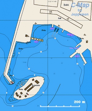
| | Local chartlet |
Background
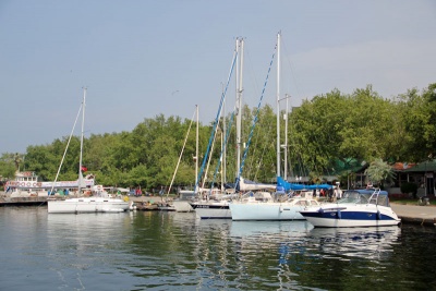
Erdek is a pleasant resort town, popular with Turkish tourists and weekenders from Istanbul, in the gulf of the same name on the south side of the Sea of Marmara. Lying under the SW corner of the Kapidag Peninsula, an oval-shaped mountainous peninsula which defines the eastern side of the gulf, its harbour offers the best shelter in this part of the Sea of Marmara. The harbour is busy with fishing boats and ferries but does have a section of quay reserved for yachts, with space for around 10-12 yachts on anchor moor. Water and electricity are available on the quay and restaurants and shops are nearby.
Charts
- Turkey
- 2941 Erdek, Erdek Port
See also Marmara Sea
Radio Nets
Also see Cruiser's Nets
Submit details of local radio Nets.
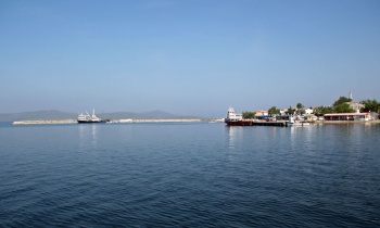
The harbour lies a mile N of the small island of Tavsan Adasi. The most conspicuous feature on the approach is the long breakwater that protects the harbour from the W and terminates just short of a low, tree-clad island. The harbour is entered from SE, leaving this island well to port as there are shallows off its SW end. Note: with anything E in the wind, fresh to strong SE winds will be experienced across the narrow neck of the peninsula, extending from around two miles offshore up to the harbour entrance. Once inside, you are shielded from the worst of the wind. The yacht quay is at the N end of the harbour, past the ferry berth and a couple of floating restaurants. Shelter here is excellent from the prevailing NE winds, but the harbour becomes very uncomfortable in strong S winds and in a gale from this direction would probably be untenable.
Routes/Passages To/From
Erdek is a useful port of call for a yacht cruising the southern shore of the Sea of Marmara between the Dardanelles and Istanbul. It also a good base for a cruise to the islands of Marmara, Avsa and Pasalimani a few miles NW.
Anchorages
There are two alternative anchorages N of Erdek that might be considered in settled weather.
Ocaklar Bay ![]() 40°26.38′N, 27°44.84′E lies three miles NNW of Erdek on the west side of the Kapidag Peninsula. A wide sandy bay with a small settlement in the SE corner, it is a useful anchorage in the prevailing N/NE winds but completely open W and S. Anchor off the settlement clear of the small craft moorings in 5.0 – 8.0 metres. The holding is good in sand.
40°26.38′N, 27°44.84′E lies three miles NNW of Erdek on the west side of the Kapidag Peninsula. A wide sandy bay with a small settlement in the SE corner, it is a useful anchorage in the prevailing N/NE winds but completely open W and S. Anchor off the settlement clear of the small craft moorings in 5.0 – 8.0 metres. The holding is good in sand.
Narlikoy ![]() 40°28.15′N, 27°41.46′E is situated six miles NW of Erdek opposite the island of Pasalimani in the Marmara Islands. A new breakwater extends WSW from the NW end of the bay, giving good shelter from the prevailing N/NE winds in the bay to its east. Anchor off the village in 5.0 – 7.0 metres. The holding is good in sand and weed, but make sure your anchor is through the weed before hitting the Efes. A ferry runs from here to Pasalimani island.
40°28.15′N, 27°41.46′E is situated six miles NW of Erdek opposite the island of Pasalimani in the Marmara Islands. A new breakwater extends WSW from the NW end of the bay, giving good shelter from the prevailing N/NE winds in the bay to its east. Anchor off the village in 5.0 – 7.0 metres. The holding is good in sand and weed, but make sure your anchor is through the weed before hitting the Efes. A ferry runs from here to Pasalimani island.
Tourism & things to do ashore
The main attraction for most visitors to Erdek is the long town beach to the N of the harbour. The tree-lined waterfront of the harbour itself is also crammed with restaurants and tea rooms, which are invariably filled to capacity with local tourists. At the SE end of the harbour is a small park with some interesting marble sculptures from the ancient city of Cyzicus, once a flourishing settlement as important as Pergamum and Troy, including a lovely carved sarcophagus.
Fuel, Water, & Electricity
- Fuel – delivered to the quay by truck from nearby petrol station
- Water - On the quay
- Electricity - On the quay (a man comes to unlock the cabinet around 1800).
Laundry
Grocery & Supply Stores
- Dia discount supermarket 200 metres NE of the quay.
- Minimarket opposite Nehir tea rooms.
- Butchers, bakery and patisserie in square 400 metres inland from the quay.
Eateries
Numerous bars, restaurants and tea houses all along the waterfront. Kafka’s Pub is a useful tip for a simple, good value pub-type meal and sometimes has live music from a small, four-man Turkish band. Aspava Cafe, with its dark wooden benches and white upholstery giving it the feel of a yacht club bar, is also good value.
Internet/WiFi
In several of the cafés and tea rooms. Nehir tea rooms has a good strong signal.
Motorbike & Car Rentals
Marine stores
None.
Repairs
None.
Transportation
Transportation to mainland or other countries, etc.
References & Publications
See Turkey.
Cruiser's Friends
Contact details of "Cruiser's Friends" that can be contacted for local information or assistance.
Forum Discussions
List links to discussion threads on partnering forums. (see link for requirements)
External Links
- Erdek (Wikipedia)
Personal Notes
Personal experiences?
- Mooring charges (May 2011) for a typical 13 metre yacht: YTL 30 per night, including water and electricity.--Athene of Lymington 10:33, 19 May 2011 (BST)
Last Visited & Details Checked (and updated here)
Date of member's visit to this Port/Stop & this page's details validated:
- August 1999 --Istioploos

- May 2011 --Athene of Lymington 10:21, 19 May 2011 (BST)
|
|---|
|
Names: |
| |
|---|
| | HOMEPAGE | Wiki Contents | Mediterranean | Turkey | Marmara Sea | Erdek | |


