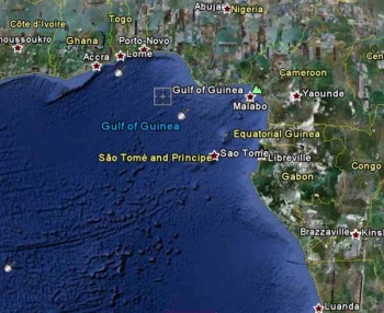
Gulf of Guinea
From CruisersWiki
m |
|||
| Line 29: | Line 29: | ||
[[Lome]]<br> | [[Lome]]<br> | ||
[[Porto-Novo]]<br> | [[Porto-Novo]]<br> | ||
| - | [[ | + | [[Malabo]]<br> |
[[Sao Tome]]<br> | [[Sao Tome]]<br> | ||
| + | [[Libreville]]<br> | ||
[[Luanda]]<br> | [[Luanda]]<br> | ||
|} | |} | ||
Revision as of 11:34, 30 May 2011
Gulf of Guinea Cruising Guide
An online cruising guide for yachts that are sailing around the Gulf of Guinea
|
The standard Lorem Ipsum passage, used since the 1500s
"Lorem ipsum dolor sit amet, consectetur adipisicing elit, sed do eiusmod tempor incididunt ut labore et dolore magna aliqua. Ut enim ad minim veniam, quis nostrud exercitation ullamco laboris nisi ut aliquip ex ea commodo consequat. Duis aute irure dolor in reprehenderit in voluptate velit esse cillum dolore eu fugiat nulla pariatur. Excepteur sint occaecat cupidatat non proident, sunt in culpa qui officia deserunt mollit anim id est laborum." Section 1.10.32 of "de Finibus Bonorum et Malorum", written by Cicero in 45 BC
| Countries and Islands in the Gulf of Guinea | Countries and Islands (cont) | Ports in the Gulf of Guinea |
|---|---|---|
| Angola Democratic Republic of the Congo | Equatorial Guinea | Accra |
Gulf of Guinea Weather Information
General weather conditions in the region
Sources for weather information:
The following forecasters' websites are those that specifically provide Cruisers with weather related to daily activities and journeys - also provision has been made to cover Tropical Storms. As with many web-sites of this type - it may be necessary to navigate the site to acquire specific information. In addition, updates will be required to correct frequent changes to the URLS.
Regional Radio Nets
- Mediteranian Maritime Mobile Net. Med. 7.085Mhz @ 0700hrs zulu
- U.K. M/M Net. U.K. Covers UK waters, Med & Atlantic. 14.303+/- QRMhz @ 0800hrs zulu & 1800hrs zulu
- Maritime Mobile Service Net. Covers the Atlantic from Cape Town to Greenland, the Eastern Pacific and the Gulf of Mexico. 14.300Mhz @ 1700hrs zulu till 0200hrs zulu during winter and during the summer from 1600 hrs z to 0200hrs zulu
Also see World Cruiser's Nets
References
Books, Guides, etc.
Forum Discussions
List links to discussion threads on partnering forums. (see link for requirements).
External Links
Personal Notes
Personal experiences?
| |
|---|
| | HOMEPAGE | WIKI CONTENTS | South Atlantic | Africa | Middle Africa | Gulf of Guinea | |
