Helgoland
From CruisersWiki
(→External Links) |
m (Text replace - "#References & Publications|" to "#References|") |
||
| (43 intermediate revisions not shown) | |||
| Line 1: | Line 1: | ||
| - | + | {{IsPartOf|North Atlantic|North Sea|Germany|Frisian Islands}} | |
| - | + | {{TOC block}} | |
| - | + | ||
| - | + | ||
| - | + | {{infobox port | |
| + | | lat= 54.1825 | lon= 7.88517 | ||
| + | | name= Helgoland | ||
| + | | portofentry= y | ||
| + | | zoom=13 | ||
| + | | chartlet = y | ||
| + | | image= Helgoland 1.jpg | ||
| + | | imagetext= Heligoland | ||
| + | | summary= | ||
| + | | notes= | ||
| + | | news= | ||
| + | }} | ||
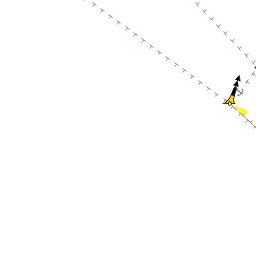
| + | {{Image right| Helgoland 2.jpg| Heligoland Harbour }} | ||
| - | The main island has a good harbour, a former naval base, and is frequented mostly by sailing yachts on the way from the English Channel | + | Heligoland (German: Helgoland) is a small German archipelago with its characteristic red cliff line, (61 meter high), located in the Heligoland Bight (part of the German Bight) in the south-eastern corner of the North Sea, approximately four hours sailing time from [[Cuxhaven]] (35 nm) at the mouth of the River Elbe. Heligoland consists of two islands: main island (Hauptinsel) to the west and the Dune (Düne) to the east. Heligoland is now a holiday resort and enjoys a tax-exempt status, as it is part of the EU but excluded from the EU VAT area and customs union, and consequently, much of the economy is founded on sales of cigarettes, alcoholic beverages and perfumes to tourists who visit the islands, but also tax-free Diesel for ships. |
| + | |||
| + | The main island has a good harbour, a former naval base, and is frequented mostly by sailing yachts on the way from the [[English Channel]] or Netherlands to the River Elbe up to [[Hamburg, Germany]] or on the way to the Baltic Sea by using the [[Kiel Canal]] (German: Nord-Ostsee-Kanal, NOK). | ||
Heligoland is located 30 nm north off the German coastline and as most of the harbours along the East Frisian and North Frisian coast are located 'behind' the islands, they can only be reached by passing through the Seegaten between the islands. These Gatts should not be entered at night and it is dangerous to enter under fresh- to strong onshore winds and it is even impossible to do so under stormy conditions. Therefore, Heligoland is the best and safest harbour for a stopover. | Heligoland is located 30 nm north off the German coastline and as most of the harbours along the East Frisian and North Frisian coast are located 'behind' the islands, they can only be reached by passing through the Seegaten between the islands. These Gatts should not be entered at night and it is dangerous to enter under fresh- to strong onshore winds and it is even impossible to do so under stormy conditions. Therefore, Heligoland is the best and safest harbour for a stopover. | ||
Yachts should pass the Outer Harbour to go into the South-Harbour. | Yachts should pass the Outer Harbour to go into the South-Harbour. | ||
| Line 13: | Line 25: | ||
Also, there is a search and rescue (SAR) base of the DGzRS, the Deutsche Gesellschaft zur Rettung Schiffbrüchiger ("German Maritime Search and Rescue Service") on Heligoland. | Also, there is a search and rescue (SAR) base of the DGzRS, the Deutsche Gesellschaft zur Rettung Schiffbrüchiger ("German Maritime Search and Rescue Service") on Heligoland. | ||
| - | == | + | ==Charts== |
| + | ''See [[Germany#Charts|Germany]]''. | ||
| - | + | ==Weather== | |
| - | + | ''See [[Germany#Weather|Germany]]''. | |
| - | + | Sources for Weather forecasts: | |
| - | + | * Weatherstation: Tel 0049 4725-606 Helgoland Weather | |
| - | [ | + | * [http://www.wetter.info/wetter-deutschland/schleswig-holstein/wetter-helgoland/17759182/ Local Weather Helgoland] |
| + | * | ||
| + | ==Passages== | ||
| + | ''See [[Germany#Passages|Germany]]''. | ||
| - | + | ==Islands== | |
| - | + | The dune (Düne), o,5 nm north-east, with sandy beaches, camping area, airflied and restaurant. Ferry service from main island (Hauptinsel) is available at north harbour. | |
| - | == | + | ==Communication== |
| - | ''Harbour Master Bundeshafen: Tel 0049 4725-504, UHF-Radio Channel 67, Call "Helgoland Port". | + | * ''Harbour Master Bundeshafen: Tel 0049 4725-504, UHF-Radio Channel 67, Call "Helgoland Port". |
| - | + | * '''MEZ 9:45 and MEZ 19:45 (Central European Time, CET) Weather Information:''' | |
| - | '''MEZ 9:45 and MEZ 19:45 (Central European Time, CET) Weather Information:''' | + | : Küstenfunkstellen (Shipradio) DP07 Seefunk: |
| - | Küstenfunkstellen (Shipradio) DP07 Seefunk: | + | : Hamburg Radio Channel 27 und 83, Elbe-Weser Radio Channel 24 und 01, |
| - | Hamburg Radio Channel 27 und 83, Elbe-Weser Radio Channel 24 und 01, | + | : Helgoland Radio Channel 88, Nordfriesland Radio Channel 26, |
| - | Helgoland Radio Channel 88, Nordfriesland Radio Channel 26, | + | : Borkum Radio Channel 28 und 61 |
| - | Borkum Radio Channel 28 und 61 | + | |
* | * | ||
| - | == | + | ==Navigation== |
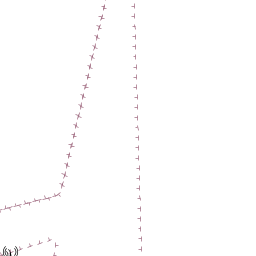
| - | + | {{Image right| Helgo.jpg| Heligoland Approach }} | |
| + | The German Bight around Helgoland is a heavy commercial traffic area, coming in from the south western North Sea with destinations in the River Jade, Weser or Elbe, continuing through the Kiel Kanal at Brunsbüttel or to Europe's second biggest Port of [[Hamburg, Germany]]. | ||
| - | + | To safely manage the dence traffic a huge system of Traffic Separation Schemes (TSS) has been installed, starting with the TSS Dover Strait continuing in the Southern North Sea off the coast of Belgium and the Netherlands and splitting off into at about 54°05'N, 004°20'E to the TSS German Bight Western Approach. At the eastern end the TSS German Bight Western Approach and the TSS Tershelling-German Bight merge into the TSS Jade Approach and the TSS Elbe Approach. | |
| - | + | It is strongly recommended to avoid these areas wherever possible – the crossing of all TSS has to be done according to Rule 10 ( c ) of the International Regulations for Preventing Collisions at Sea (IRPCS): on a heading as nearly as practicable at right angles to the general direction of traffic flow. You must keep in mind the wind and tidal impact and as the TSS in the German Bight are under constant radar surveillance it is more strongly advised to even keep a reasonable course by using the motor, if the ground speed falls below 3 knots or this course cannot be obtained. | |
| - | + | ||
| - | ==== | + | ==Entrance== |
| - | + | [[{{PAGENAME}}]] is a port of entry for Germany. For details ''see [[Germany#Entrance|Entrance: Germany]]''. | |
| - | + | ||
| - | + | ||
| - | + | The Customs office is the in south-harbour. | |
| - | + | ||
| - | + | ||
| - | + | ||
| - | + | ||
| - | ==== | + | ====EU Vessels & EU Nationals==== |
| - | + | For European Union members, EU regulations apply. Vessels arriving from another EU country do not need to clear customs. Vessels registered in countries falling under the Schengen Agreement, (i.e. vessels from Spain or Italy) do not need to clear immigration. | |
| - | + | ||
| - | + | ||
| - | + | ||
| - | == | + | ====Non-EU Vessels (incl. EU vessels with non-EU nationals aboard)==== |
| - | + | The skipper must report to customs with the ship's registration papers and passports and sometimes the customs officials will visit the boat on arrival. The Customs officials may also sometimes inspect yachts. The port captain must be contacted immediately on arrival in the marina and he will usually notify Customs. If not, the skipper must phone Customs. | |
| - | + | ||
| - | + | ||
| - | + | ==Berthing== | |
| - | + | ===Ports=== | |
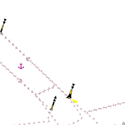
| + | {{Image right| Helgoland 3.jpg| Heligoland Harbour }} | ||
| + | There are two ports: North and South Harbor. Both have marinas. | ||
| - | + | ===Marinas & Yacht Clubs=== | |
| - | + | ====South Harbour==== | |
| + | Watersportclub Helgoland: Tel +49 4725-585. | ||
| - | ==== | + | ====North Harbour==== |
| - | + | Deserved for private motor yachts | |
| - | + | ||
| - | + | ||
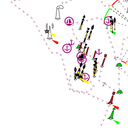
| - | == | + | ==Anchorages== |
| - | + | {{GreenText|List anchorages. If there is more then 2 paragraphs for a given anchorage, create a dedicated page for it ([[Template:Port|Port/Stop Template]]) We use headings for these so that other pages can link to them. Remove if not applicable..}} | |
* | * | ||
| + | * | ||
| - | ==== | + | ==Amenities== |
| - | + | {{tlist | |
| - | + | ||
| - | + | |header|Facilities | |
| - | + | ||
| - | + | ||
| - | + | |Water| In the Marina Restaurant South-Harbour | |
| - | Marina Restaurant | + | |Electricity| In the Marina Restaurant South-Harbour |
| + | |Toilets| WC in the Marina Restaurant South-Harbour | ||
| + | |Showers| In the Marina Restaurant South-Harbour} | ||
| + | |Laundry| {{MagentaText|?}} | ||
| + | |Garbage| {{MagentaText|?}} | ||
| - | + | |header|Supplies | |
| - | + | |Fuel| Fuel station is in the 'Binnenharbour' | |
| + | |Bottled gas| {{MagentaText|?}} | ||
| + | |Chandlers| The company and traditional family [http://www.rickmers-online.de/ Rickmers] operates the fuel-station and a hugh marine-store at 'Binnenhafen'. On their homepage you will find pictures of the station and prices and openings. Because the tidal ranges of up to 3 meters, it is difficult for deepgoing yachts to use the 'Binnenhafen' during low tide. After mooring at the station, you can call for the service. | ||
| - | == | + | |header|Services |
| - | + | |Repairs| {{MagentaText|?}} | |
| - | + | |Internet| {{MagentaText|?}} | |
| + | |Mobile connectivity| {{MagentaText|?}} | ||
| + | |Vehicle rentals| '''No''' cars, bikes and bicyles are allowed on the island | ||
| + | }} | ||
| + | |||
| + | ==Provisioning== | ||
| + | {{Green|Give the names and locations of supermarkets, grocery stores, bakeries, etc.}} | ||
| - | ==== | + | ==Eating out== |
| + | {{Green|Give the name of recommended restaurant, tavernas, pastry stores, etc.}} | ||
| + | |||
| + | ==Transportation== | ||
| + | {{GreenText|List transportation (local and/or international.)}} | ||
| + | * | ||
* | * | ||
| - | ==== | + | ==Tourism== |
| - | + | {{Image right| Falk 1.jpg| Helgoland, Lange Anna, G.Falk }} | |
| + | {{Image right| Falk 2.jpg| Lange Anna, G.Falk }} | ||
| + | {{Image right| Falk 3.jpg| View from dune, G.Falk }} | ||
| + | {{Image right| Falk 4.jpg| At the dune beach, G.Falk }} | ||
| - | ==== | + | ====History==== |
| - | + | {{Green|Give a short history of the port.}} | |
| - | + | ||
| - | == | + | ====Places to Visit==== |
| - | + | The island of Heligoland is a geological oddity; the presence of the main island's characteristic red sedimentary rock in the middle of the German Bight is unusual. It is the only such formation of cliffs along the continental coast of the North Sea. Outstanding is the single red rock in the north, namend 'Lange Anna'. The Lange Anna ("Long Anna" or "Tall Anna") which is a free standing rock column (or stack), 47 metres (154 ft) high and weighing about 25,000 tons. | |
| - | + | ||
| - | == | + | ==Friends== |
Contact details of "Cruiser's Friends" that can be contacted for local information or assistance. | Contact details of "Cruiser's Friends" that can be contacted for local information or assistance. | ||
* | * | ||
| - | == | + | ==Forums== |
| - | List links to discussion threads on [[Cruising Forums|partnering forums]]. (see link for requirements) | + | List links to discussion threads on [[Cruising Forums|partnering forums]]. (''see link for requirements'') |
| - | + | * | |
| - | + | ||
| - | * | + | |
| - | == | + | ==Links== |
| - | * http://www.helgoland.de | + | * {{wikipedia|Heligoland}} |
| + | * {{Wikivoyage}} | ||
| + | * [http://www.helgoland.de Heligoland] | ||
* [http://www.rickmers-online.de/ Rickmers] | * [http://www.rickmers-online.de/ Rickmers] | ||
* [http://de.wikipedia.org/wiki/Helgoland Helgoland (Wikipedia DE)] | * [http://de.wikipedia.org/wiki/Helgoland Helgoland (Wikipedia DE)] | ||
| Line 131: | Line 152: | ||
* | * | ||
* | * | ||
| - | |||
| - | == | + | ==References== |
| - | + | ''See [[Germany#References|Germany]]''. | |
| - | + | ||
| - | + | {{Comments}} | |
| - | + | * Visited several times on trips from Hamburg and Bremen to Netherland, last 2010, --[[User:Blome|Blome]] 22:14, 8 May 2012 (BST) | |
* | * | ||
| - | + | {{Verified by}} | |
| - | + | * June 2010, edited May 2012--[[User:Blome|Blome]] 09:05, 11 May 2012 (BST) | |
* | * | ||
* | * | ||
| - | {{ | + | {{Page useable}} |
| - | + | {{Contributors|[[User:Lighthouse|Lighthouse]], [[User:Blome|Blome]] }} | |
| - | {| | + | |
| - | + | ||
| - | + | ||
| - | + | ||
| - | + | ||
| - | + | ||
| - | + | ||
| - | + | ||
| - | + | ||
| - | + | ||
| - | + | ||
| - | + | ||
| - | + | ||
| - | [[Category: | + | [[Category:Ports - Germany]] [[Category:Islands - Germany]] [[Category:Marinas - Germany]] |
Latest revision as of 07:46, 21 August 2018
| Helgoland Port of Entry
| |
| |
 Heligoland |

Heligoland (German: Helgoland) is a small German archipelago with its characteristic red cliff line, (61 meter high), located in the Heligoland Bight (part of the German Bight) in the south-eastern corner of the North Sea, approximately four hours sailing time from Cuxhaven (35 nm) at the mouth of the River Elbe. Heligoland consists of two islands: main island (Hauptinsel) to the west and the Dune (Düne) to the east. Heligoland is now a holiday resort and enjoys a tax-exempt status, as it is part of the EU but excluded from the EU VAT area and customs union, and consequently, much of the economy is founded on sales of cigarettes, alcoholic beverages and perfumes to tourists who visit the islands, but also tax-free Diesel for ships.
The main island has a good harbour, a former naval base, and is frequented mostly by sailing yachts on the way from the English Channel or Netherlands to the River Elbe up to Hamburg, Germany or on the way to the Baltic Sea by using the Kiel Canal (German: Nord-Ostsee-Kanal, NOK). Heligoland is located 30 nm north off the German coastline and as most of the harbours along the East Frisian and North Frisian coast are located 'behind' the islands, they can only be reached by passing through the Seegaten between the islands. These Gatts should not be entered at night and it is dangerous to enter under fresh- to strong onshore winds and it is even impossible to do so under stormy conditions. Therefore, Heligoland is the best and safest harbour for a stopover. Yachts should pass the Outer Harbour to go into the South-Harbour. Fuel/Diesel you can get in the Binnenhafen.
Also, there is a search and rescue (SAR) base of the DGzRS, the Deutsche Gesellschaft zur Rettung Schiffbrüchiger ("German Maritime Search and Rescue Service") on Heligoland.
Charts
See Germany.
Weather
See Germany.
Sources for Weather forecasts:
- Weatherstation: Tel 0049 4725-606 Helgoland Weather
- Local Weather Helgoland
Passages
See Germany.
Islands
The dune (Düne), o,5 nm north-east, with sandy beaches, camping area, airflied and restaurant. Ferry service from main island (Hauptinsel) is available at north harbour.
Communication
- Harbour Master Bundeshafen: Tel 0049 4725-504, UHF-Radio Channel 67, Call "Helgoland Port".
- MEZ 9:45 and MEZ 19:45 (Central European Time, CET) Weather Information:
- Küstenfunkstellen (Shipradio) DP07 Seefunk:
- Hamburg Radio Channel 27 und 83, Elbe-Weser Radio Channel 24 und 01,
- Helgoland Radio Channel 88, Nordfriesland Radio Channel 26,
- Borkum Radio Channel 28 und 61

The German Bight around Helgoland is a heavy commercial traffic area, coming in from the south western North Sea with destinations in the River Jade, Weser or Elbe, continuing through the Kiel Kanal at Brunsbüttel or to Europe's second biggest Port of Hamburg, Germany.
To safely manage the dence traffic a huge system of Traffic Separation Schemes (TSS) has been installed, starting with the TSS Dover Strait continuing in the Southern North Sea off the coast of Belgium and the Netherlands and splitting off into at about 54°05'N, 004°20'E to the TSS German Bight Western Approach. At the eastern end the TSS German Bight Western Approach and the TSS Tershelling-German Bight merge into the TSS Jade Approach and the TSS Elbe Approach.
It is strongly recommended to avoid these areas wherever possible – the crossing of all TSS has to be done according to Rule 10 ( c ) of the International Regulations for Preventing Collisions at Sea (IRPCS): on a heading as nearly as practicable at right angles to the general direction of traffic flow. You must keep in mind the wind and tidal impact and as the TSS in the German Bight are under constant radar surveillance it is more strongly advised to even keep a reasonable course by using the motor, if the ground speed falls below 3 knots or this course cannot be obtained.
Entrance
Helgoland is a port of entry for Germany. For details see Entrance: Germany.
The Customs office is the in south-harbour.
EU Vessels & EU Nationals
For European Union members, EU regulations apply. Vessels arriving from another EU country do not need to clear customs. Vessels registered in countries falling under the Schengen Agreement, (i.e. vessels from Spain or Italy) do not need to clear immigration.
Non-EU Vessels (incl. EU vessels with non-EU nationals aboard)
The skipper must report to customs with the ship's registration papers and passports and sometimes the customs officials will visit the boat on arrival. The Customs officials may also sometimes inspect yachts. The port captain must be contacted immediately on arrival in the marina and he will usually notify Customs. If not, the skipper must phone Customs.
Berthing
Ports

There are two ports: North and South Harbor. Both have marinas.
Marinas & Yacht Clubs
South Harbour
Watersportclub Helgoland: Tel +49 4725-585.
North Harbour
Deserved for private motor yachts
Anchorages
List anchorages. If there is more then 2 paragraphs for a given anchorage, create a dedicated page for it (Port/Stop Template) We use headings for these so that other pages can link to them. Remove if not applicable..
Amenities
| Facilities | |
|---|---|
| Water | In the Marina Restaurant South-Harbour |
| Electricity | In the Marina Restaurant South-Harbour |
| Toilets | WC in the Marina Restaurant South-Harbour |
| Showers | In the Marina Restaurant South-Harbour} |
| Laundry | ? |
| Garbage | ? |
| Supplies | |
| Fuel | Fuel station is in the 'Binnenharbour' |
| Bottled gas | ? |
| Chandlers | The company and traditional family Rickmers operates the fuel-station and a hugh marine-store at 'Binnenhafen'. On their homepage you will find pictures of the station and prices and openings. Because the tidal ranges of up to 3 meters, it is difficult for deepgoing yachts to use the 'Binnenhafen' during low tide. After mooring at the station, you can call for the service. |
| Services | |
| Repairs | ? |
| Internet | ? |
| Mobile connectivity | ? |
| Vehicle rentals | No cars, bikes and bicyles are allowed on the island |
Provisioning
Give the names and locations of supermarkets, grocery stores, bakeries, etc.
Eating out
Give the name of recommended restaurant, tavernas, pastry stores, etc.
Transportation
List transportation (local and/or international.)
Tourism


History
Give a short history of the port.
Places to Visit
The island of Heligoland is a geological oddity; the presence of the main island's characteristic red sedimentary rock in the middle of the German Bight is unusual. It is the only such formation of cliffs along the continental coast of the North Sea. Outstanding is the single red rock in the north, namend 'Lange Anna'. The Lange Anna ("Long Anna" or "Tall Anna") which is a free standing rock column (or stack), 47 metres (154 ft) high and weighing about 25,000 tons.
Friends
Contact details of "Cruiser's Friends" that can be contacted for local information or assistance.
Forums
List links to discussion threads on partnering forums. (see link for requirements)
Links
- Helgoland at the Wikipedia
- Helgoland at the Wikivoyage
- Heligoland
- Rickmers
- Helgoland (Wikipedia DE)
- Hafen Helgoland (WSV)
- Wassersportclub Helgoland
References
See Germany.
Comments
We welcome users' contributions to the Wiki. Please click on Comments to view other users' comments, add your own personal experiences or recommend any changes to this page following your visit.
- Visited several times on trips from Hamburg and Bremen to Netherland, last 2010, --Blome 22:14, 8 May 2012 (BST)
Verified by
Date of member's last visit to Helgoland and this page's details validated:
- June 2010, edited May 2012--Blome 09:05, 11 May 2012 (BST)
| This is a usable page of the cruising guide. However, please contribute if you can to help it grow further. Click on Comments to add your personal notes on this page or to discuss its contents. Alternatively, if you feel confident to edit the page, click on the edit tab at the top and enter your changes directly. |
| |
|---|
|
Names: Lighthouse, Blome |