Hilo
From CruisersWiki
Hilo (Port of entry)
| | |
| | 19°42.33′N, 155°05.15′W |
|---|---|
| | Photo gallery |
| | Local chartlet |
Hilo, on the island of Hawaii (called "Big Island" to avoid confusion), is a popular first stop in the islands as it's the most upwind of the islands - allowing downwind passages to the rest of the islands - and is an easy landfall from the US.
Hilo is a coastal town in the State of Hawaiʻi. It is the largest settlement on the island of Hawaiʻi, and the second largest settlement in the state. The population was 40,759 at the 2000 census.
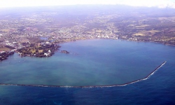
Hilo is the county seat of Hawaiʻi County, Hawaiʻi, and is situated in the South Hilo District. The town overlooks Hilo Bay, and is near two shield volcanoes, Mauna Loa, considered active, and Mauna Kea, a dormant volcano upon which some of the best ground-based astronomical observatories are placed.
Hilo is home to the University of Hawaiʻi at Hilo, as well as the Merrie Monarch Festival, a week-long celebration of ancient and modern hula, which takes place annually after Easter. It is also home to the Mauna Loa Macadamia Nut Corporation, one of the world's leading producers of macadamia nuts. It is served by Hilo International Airport.
Hilo is located at 19°42′20″N, 155°5′9″W, the southernmost city in the United States.
Hilo's location on the eastern side of the island of Hawaiʻi (windward relative to the trade winds) makes it the wettest city in the United States and one of the wettest cities in the world. An average of 127.77 inches (3245 mm) of rain falls on Hilo (airport) annually (between 1949 and 2007). At some other weather stations in Hilo the annual rainfall is above 200 inches.
Its location on the shore of the funnel-shaped Hilo Bay also makes it vulnerable to tsunamis.
Submit details about the sailing/cruising in the area, etc.
Charts
Submit the chart details that are required for safe navigation.
Radio Nets
Also see Cruiser's Nets
Weather
Local weather conditions?
Sources for Weather forecasts:
As you approach Hilo Harbor Basin you'll see the large seawall that you have to leave to port and then duck in behind. You can follow the seawall all the way into Radio Bay. Don't approach the cruise ship too closely - just continue straight down the seawall passing the cruise ship dock and then cutting to starboard to get back into the basin. You'll see the Coast Guard station nestled against the back side of the cruise ship dock and left of that is the seawall where you can stern tie - or just anchor in the basin. University of Hawaii keeps a large cat at the seawall, too, but between that berth on the far left and the CG berth to far right about 8 boats can be accommodated. There's a Hawaiian Canoe club and a small public beach to left.
When you dinghy over to the seawall and climb up the 8 foot ladders you'll find the lavatory building to the left. Although there are two toilets and a shower in each of the two rooms, the tradition seemed to be to let each person finish before another entered. Since the women's shower wasn't working well families were sharing the bathrooms as well. But with only a few people resident it wasn't a problem. There is also a bookcase of free books - contribute any you're done with and take what you need. Under the overhang you can also dry out laundry. It rains frequently (and briefly) so you'll want to hang it here.
Crossing the parking lot to the right from the seawall you'll come to the temporary buildings housing the harbormaster where you can pay for your accommodation and get the lavatory key. If you continue walking in that direction you'll come to the security gates. Tell them your boat name and smile and they'll treat you very nicely. Continuing through the gates, simply cross the highway to get to the convenience store and bar. Unfortunately the laundry mentioned in cruising guides has now closed (2008).
Check-in facilities
Submit details about facilities for checking in - where to dock, etc.
Marinas & Yacht Clubs
Submit Marina details.
Anchorages
List details of all safe anchorages in the area.
Tourism & things to do ashore
List places of interest, tours, etc.
Fuel, Water, & Electricity
Laundry
Grocery & Supply Stores
Eateries
Internet/WiFi
Available?
Motorbike & Car Rentals
Marine Stores & Facilities
Submit addresses and contact details of marine related businesses that are of interest to cruisers.
Repairs
Garbage Disposal
?
Transportation
Transportation (local and/or international)
Routes/Passages To/From
Popular passages/routes, timing, etc.
References & Publications
Publications, Guides, etc.
Cruiser's Friends
Contact details of "Cruiser's Friends" that can be contacted for local information or assistance.
Forum Discussions
List links to discussion threads on partnering forums. (see link for requirements)
External Links
Links to relevant websites.
Personal Notes
Personal experiences?
Last Visited & Details Checked (and updated here)
Date of member's visit to this Port/Stop & this page's details validated:
| |
|---|
| | HOMEPAGE | Wiki Contents | North & Central Pacific | Hawaii | Hawaii, Big Island | Hilo | |
.
