Ionian Sea/imagemap
From CruisersWiki
(Difference between revisions)
Istioploos (Talk | contribs) m (Protected "Ionian Sea/imagemap" ([edit=sysop] (indefinite) [move=sysop] (indefinite))) |
Istioploos (Talk | contribs) (Coords) |
||
| Line 1: | Line 1: | ||
| + | <center>{{infobox coordblock | ||
| + | | lat=38.29856 |lon=19.9292 |zoom=7 | ||
| + | | type=waypoint | ||
| + | }}</center> | ||
<imagemap> | <imagemap> | ||
| + | |||
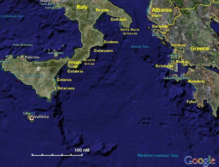
Image:Ionian_Sea.jpg|frame|center|<center>The Ionian Sea Cruising Region- <em>For details click on a name or an area</em></center> | Image:Ionian_Sea.jpg|frame|center|<center>The Ionian Sea Cruising Region- <em>For details click on a name or an area</em></center> | ||
rect 485 19 554 44 [[Albania]] | rect 485 19 554 44 [[Albania]] | ||
Revision as of 12:42, 14 May 2016