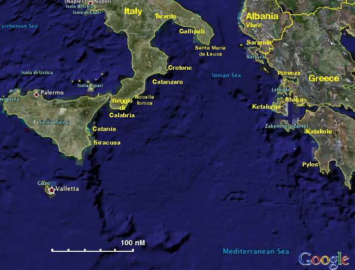
Ionian Sea/imagemap

From CruisersWiki

(Difference between revisions)
Jump to: navigation, search
(Coords)
(Port of entry)
 
Line 2: Line 2:
| lat=38.29856 |lon=19.9292 |zoom=7
| lat=38.29856 |lon=19.9292 |zoom=7
| type=waypoint
| type=waypoint
-
}}</center>
+
}}{{PEntry there}}</center>
 +
 
<imagemap>
<imagemap>

Latest revision as of 02:50, 25 February 2017

38°17.914'N, 019°55.752'E Chart icon.png
There are Port(s) of Entry here
AlbaniaSarandëVlorëGreeceCorfu or KerkyraPrevezaLefkas or LefkadaKefaloniaIthaca or IthakeZakinthos or Zakynthos or ZanteKatakoloPylosItalySiracusaCataniaReggio di CalabriaRocella IonicaCatanzaroCrotoneTarantoGallipoliSanta Maria de Leuca
About this image
The Ionian Sea Cruising Region- For details click on a name or an area
Personal tools
advertisement
Friends of Cruisers Wiki