Kota Kinabalu
From CruisersWiki
Lighthouse (Talk | contribs) |
Lighthouse (Talk | contribs) |
||
| Line 1: | Line 1: | ||
==Kota Kinabalu== | ==Kota Kinabalu== | ||
| - | <googlemap lat="5.996485" lon="116.073303" zoom="11">5.969168, 116.07605, Kota Kinabalu</googlemap> | + | {| class="infobox bordered" style="width: 27em; text-align: left; font-size: 90%;" |
| + | |- | ||
| + | | colspan="2" style="text-align:center;" | <googlemap lat="5.996485" lon="116.073303" zoom="11">5.969168, 116.07605, Kota Kinabalu</googlemap> | ||
| + | |} | ||
| + | |||
[[Image:imagename.jpg|300px|thumb|right|Caption]] | [[Image:imagename.jpg|300px|thumb|right|Caption]] | ||
| Line 11: | Line 15: | ||
===Radio Nets=== | ===Radio Nets=== | ||
Submit details of local radio Nets. | Submit details of local radio Nets. | ||
| - | |||
| - | |||
| - | |||
===Check-in facilities/Ports of Entry=== | ===Check-in facilities/Ports of Entry=== | ||
| Line 20: | Line 21: | ||
* | * | ||
| - | === | + | ===Setura Harbour and Marina=== |
| - | + | ||
| - | + | ||
| - | + | ||
| - | + | ||
| - | + | ||
| - | + | ||
| - | + | ||
| - | + | ||
| - | + | ||
| - | + | ||
| - | + | ||
| - | + | ||
| - | + | ||
| - | + | ||
| - | + | ||
| - | + | ||
| - | + | ||
| - | + | ||
| - | + | ||
| - | + | ||
| - | + | ||
| - | + | ||
| - | + | ||
| - | + | ||
| - | + | ||
| - | + | ||
| - | + | ||
| - | + | ||
| - | + | ||
| - | + | ||
| - | + | ||
| - | + | ||
| - | + | ||
| - | + | ||
| - | + | ||
| - | + | ||
| - | + | ||
| - | + | ||
| - | + | ||
| - | + | ||
| - | + | ||
| - | + | ||
| - | + | ||
| - | + | ||
| - | + | ||
| - | + | ||
| - | + | ||
| - | + | ||
| - | + | ||
| - | + | ||
| - | + | ||
| - | + | ||
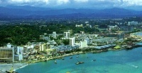
<center><gallery caption="Kota Kinabalu" widths="200px" heights="120px" perrow="4"> | <center><gallery caption="Kota Kinabalu" widths="200px" heights="120px" perrow="4"> | ||
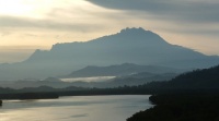
Image:Mount Kinabalu.jpg|Mount Kina Balu | Image:Mount Kinabalu.jpg|Mount Kina Balu | ||
| Line 79: | Line 28: | ||
</gallery></center> | </gallery></center> | ||
| - | How to navigate into Sutera | + | ====How to navigate into Sutera==== |
| - | + | ||
If coming from the South - go to waypoint 1. @ 5° 59' North x 115° 59' East; then go to Waypoint 2. @ 5° 59' North x 116° 00' East, then head for the Marina breakwater and enter from the north side. | If coming from the South - go to waypoint 1. @ 5° 59' North x 115° 59' East; then go to Waypoint 2. @ 5° 59' North x 116° 00' East, then head for the Marina breakwater and enter from the north side. | ||
| Line 87: | Line 35: | ||
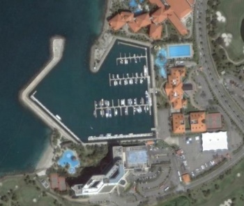
[[Image:Sutera Marina Sat Image.jpg|thumb|350px|right|Setura Marina ''Click for larger view'']] | [[Image:Sutera Marina Sat Image.jpg|thumb|350px|right|Setura Marina ''Click for larger view'']] | ||
| - | Below is the instructions how to navigate the final approach | + | ====Below is the instructions how to navigate the final approach==== |
| - | + | ||
Come in on a heading of 090°T, keeping Tanjung Waking a ½ mile to port. When at Tanjung Wakong, turn towards Sutera Harbour Resort, course 128°T. ''Note:'' This approach is using Admiralty Chart #3626. However, the most recent chart does not indicate Sutera Harbour Resort's location. Furthermore,the charted depth outside the Marina is no longer accurate, as the Marina channel has been dredged and expanded. The average dept at lowest astronomical tide (LAT) is 5 meters inside the basin and outside the breakwater is more than 7 metres. | Come in on a heading of 090°T, keeping Tanjung Waking a ½ mile to port. When at Tanjung Wakong, turn towards Sutera Harbour Resort, course 128°T. ''Note:'' This approach is using Admiralty Chart #3626. However, the most recent chart does not indicate Sutera Harbour Resort's location. Furthermore,the charted depth outside the Marina is no longer accurate, as the Marina channel has been dredged and expanded. The average dept at lowest astronomical tide (LAT) is 5 meters inside the basin and outside the breakwater is more than 7 metres. | ||
| Line 103: | Line 50: | ||
|} | |} | ||
| - | Location | + | ====Location==== |
| - | + | ||
Located in the South China Sea on the northern tip of the island of Borneo, Sabah is easily accessible by sea and air. The international airport, 5 minutes from Sutera Harbour Resort, has flights departing to countless major cities throughout the Asian region via links with Kuala Lumpur and Singapore, and an increasing amount of direct flights to the island. | Located in the South China Sea on the northern tip of the island of Borneo, Sabah is easily accessible by sea and air. The international airport, 5 minutes from Sutera Harbour Resort, has flights departing to countless major cities throughout the Asian region via links with Kuala Lumpur and Singapore, and an increasing amount of direct flights to the island. | ||
| - | Communication Channel & Contact V H F 16 calling. 71 working | + | ====Communication Channel & Contact==== |
| + | V H F 16 calling. 71 working | ||
{| class="prettytable" | {| class="prettytable" | ||
| Line 123: | Line 70: | ||
|} | |} | ||
| - | Facilities & | + | ====Facilities & Services==== |
| + | * 24-hour security | ||
* Shower Room & Private Locker | * Shower Room & Private Locker | ||
* Pump out station for black water discharge | * Pump out station for black water discharge | ||
| Line 134: | Line 82: | ||
* Boat hull cleaning | * Boat hull cleaning | ||
| - | Arrival Requirements | + | ====Arrival Requirements==== |
| - | + | ||
All visiting vessels are required to do port clearance before their crew is allowed ashore. Proceed to the Marine Department located in Sepanggar Bay and take the following documents: | All visiting vessels are required to do port clearance before their crew is allowed ashore. Proceed to the Marine Department located in Sepanggar Bay and take the following documents: | ||
* Ship registration certificate | * Ship registration certificate | ||
| Line 146: | Line 93: | ||
* '''Marine Department (Check-in & Check-out)''' - Jabatan Laut SabahNombor 2, Kompleks Jabatan LautTeluk SalutSepangarPh: +60 88 401 111 | * '''Marine Department (Check-in & Check-out)''' - Jabatan Laut SabahNombor 2, Kompleks Jabatan LautTeluk SalutSepangarPh: +60 88 401 111 | ||
* '''Immigration Department (Check-in & Check-out)''' - Sabah Port Authority Building - Next gate to the security entrance, Ground Floor,Ph: +60 88 280 740 | * '''Immigration Department (Check-in & Check-out)''' - Sabah Port Authority Building - Next gate to the security entrance, Ground Floor,Ph: +60 88 280 740 | ||
| + | |||
| + | |||
| + | ===Anchorages=== | ||
| + | List details of all safe anchorages in the area. | ||
| + | * | ||
| + | * | ||
| + | * | ||
| + | |||
| + | ===Tourism & things to do ashore=== | ||
| + | List places of interest, tours, eateries, etc. | ||
| + | |||
| + | ===Marine stores=== | ||
| + | Submit addresses and contact details of marine related businesses that are of interest to cruisers. | ||
| + | |||
| + | ===Offshore Islands=== | ||
| + | List Islands | ||
| + | * | ||
| + | * | ||
| + | |||
| + | ===Routes to/from=== | ||
| + | Popular routes, timing, etc. | ||
| + | |||
| + | ===References & Publications=== | ||
| + | Publications, etc. | ||
| + | * | ||
| + | * | ||
| + | * | ||
| + | |||
| + | ===Cruiser's Friends=== | ||
| + | Contact details of "Cruiser's Friends" that can be contacted for local information or assistance. | ||
| + | * | ||
| + | |||
| + | ===Forum Discussions=== | ||
| + | List links to discussion threads on the Cruiser Log Forum | ||
| + | * | ||
| + | * | ||
| + | * | ||
| + | |||
| + | ===External Links=== | ||
| + | Links to relevant websites. | ||
| + | * | ||
| + | * | ||
| + | * | ||
| + | |||
| + | ===Personal Notes=== | ||
| + | Personal experiences? | ||
| + | * | ||
| + | |||
| + | |||
| + | {{Guide1}} | ||
| + | |||
| + | |||
| + | <center>[[Malaysia|BACK]]</center> | ||
| + | |||
| + | . | ||
| + | |||
| + | |||
| + | '''KOTA KINABALU - SABAH - MALAYSIA - BORNIO''' | ||
| + | |||
| + | '''SUTERA HARBOUR & MARINA''' | ||
Revision as of 11:06, 14 September 2008
Kota Kinabalu
Background
Historic details & submit details about the sailing/cruising in the area, etc.
Charts
Submit the chart details that are required for safe navigation.
Radio Nets
Submit details of local radio Nets.
Check-in facilities/Ports of Entry
Submit details about facilities for checking in.
Setura Harbour and Marina
If coming from the South - go to waypoint 1. @ 5° 59' North x 115° 59' East; then go to Waypoint 2. @ 5° 59' North x 116° 00' East, then head for the Marina breakwater and enter from the north side.
If coming from the North keep west of Gaya Island until south of it - then go to the above waypoints.
Come in on a heading of 090°T, keeping Tanjung Waking a ½ mile to port. When at Tanjung Wakong, turn towards Sutera Harbour Resort, course 128°T. Note: This approach is using Admiralty Chart #3626. However, the most recent chart does not indicate Sutera Harbour Resort's location. Furthermore,the charted depth outside the Marina is no longer accurate, as the Marina channel has been dredged and expanded. The average dept at lowest astronomical tide (LAT) is 5 meters inside the basin and outside the breakwater is more than 7 metres.
Latitude & Longtitude
| Lat | 5°58'.05 N | Latitude - 05 degrees 58.05 minutes North |
| Long | 116°03'.40 E | Latitude 116 degrees 03.40 minutes East |
Location
Located in the South China Sea on the northern tip of the island of Borneo, Sabah is easily accessible by sea and air. The international airport, 5 minutes from Sutera Harbour Resort, has flights departing to countless major cities throughout the Asian region via links with Kuala Lumpur and Singapore, and an increasing amount of direct flights to the island.
Communication Channel & Contact
V H F 16 calling. 71 working
| Callsign: | 'SUTERA HARBOUR MARINA' |
| Telephone: | +60 88 308 127 / 308 128 |
| Fax: | +60 88 252 211 |
| Email: | [email protected] |
Facilities & Services
- 24-hour security
- Shower Room & Private Locker
- Pump out station for black water discharge
- Facility for waste oil
- Fuel (unleaded petrol and diesel
- Lubricant
- Minor hull & engine repairs and maintenance
- Major hull & engine repairs and maintenance (In-house contractor can recommend repair sites)
- Boat hull washing
- Boat hull cleaning
Arrival Requirements
All visiting vessels are required to do port clearance before their crew is allowed ashore. Proceed to the Marine Department located in Sepanggar Bay and take the following documents:
- Ship registration certificate
- Crew List
- Passenger List - if any
- Last port clearance certificate
- Master is required to fill in the MSS 1 form
On completion, proceed to the immigration and custom office for further clearance. Do not forget to take along passports for stamping.
- Marine Department (Check-in & Check-out) - Jabatan Laut SabahNombor 2, Kompleks Jabatan LautTeluk SalutSepangarPh: +60 88 401 111
- Immigration Department (Check-in & Check-out) - Sabah Port Authority Building - Next gate to the security entrance, Ground Floor,Ph: +60 88 280 740
Anchorages
List details of all safe anchorages in the area.
Tourism & things to do ashore
List places of interest, tours, eateries, etc.
Marine stores
Submit addresses and contact details of marine related businesses that are of interest to cruisers.
Offshore Islands
List Islands
Routes to/from
Popular routes, timing, etc.
References & Publications
Publications, etc.
Cruiser's Friends
Contact details of "Cruiser's Friends" that can be contacted for local information or assistance.
Forum Discussions
List links to discussion threads on the Cruiser Log Forum
External Links
Links to relevant websites.
Personal Notes
Personal experiences?
.
KOTA KINABALU - SABAH - MALAYSIA - BORNIO
SUTERA HARBOUR & MARINA


